We recently returned from a trip to Switzerland where we did a lot of hiking in the central and eastern Alps. I plan to post a longer writeup of the trip with a full set of images but thought I would start with this one.
This was taken at Lej Muragl after stormy weather on the previous day had brought rain and snow to the area. The panorama is a compilation of about a dozen images and covers about 270° from the northwest on the left edge though east in the center where the low pass is located to the southwest on the right edge.
Lej Muragl in the eastern Swiss Alps.
We encountered only two other hikers on the walk to the lake. The experience of walking though an early season snowfall (well, maybe not so early for this area) without crowds was truly wonderful.
Zion Narrows: It’s a trip we have thought about for several years. So when a friend indicated she wanted to do the Narrows this spring, we agreed to join her and plan a trip.
There are two different ways to hike Zion Narrows. The easiest and the one done by probably 99%+ of visitors to Zion National Park is to walk upstream from the Temple of Sinawava—the last stop on the summer shuttle bus. The other is much harder and is a full-day commitment. It requires a long drive to the upper end of the canyon followed by a 16-mile hike down through the canyon. Wading through water is required most of the way—and a few swims are also possible.
The full-day trip requires a permit. We decided that early June would be the best time because water levels have diminished from the high water of spring, water temperatures have slowly increased, days are long and hot, and the summer thunderstorm season has not started. This last point is an important one because this is not a good place to be if it begins to rain hard. Flash floods are possible and there are sections of the walk where no high ground is possible.
So we obtained a reservation for our permit—to be picked up the day before the hike.
But something strange happened to the weather this spring. Instead of the normally hot and dry months of May and June, we had rain and cool temperatures. And then there were the unseasonably strong and early hurricanes in the eastern Pacific this year. Hurricane Blanca, in particular, caused problems because it sent a substantial surge of tropical moisture northward. So what should have been a warm and dry June became a cool and wet June.
A Flash Flood Watch was issued for several days across southwestern Utah because conditions suggested that floods were possible. We declined the permit. Instead, we went hiking and did the Observation Point Trail.
The many switchbacks of Observation Point Trail.Looking down on Angels Landing from Observation Point.Near the top of Observation Point.Slot canyon along the Observation Point Trail.
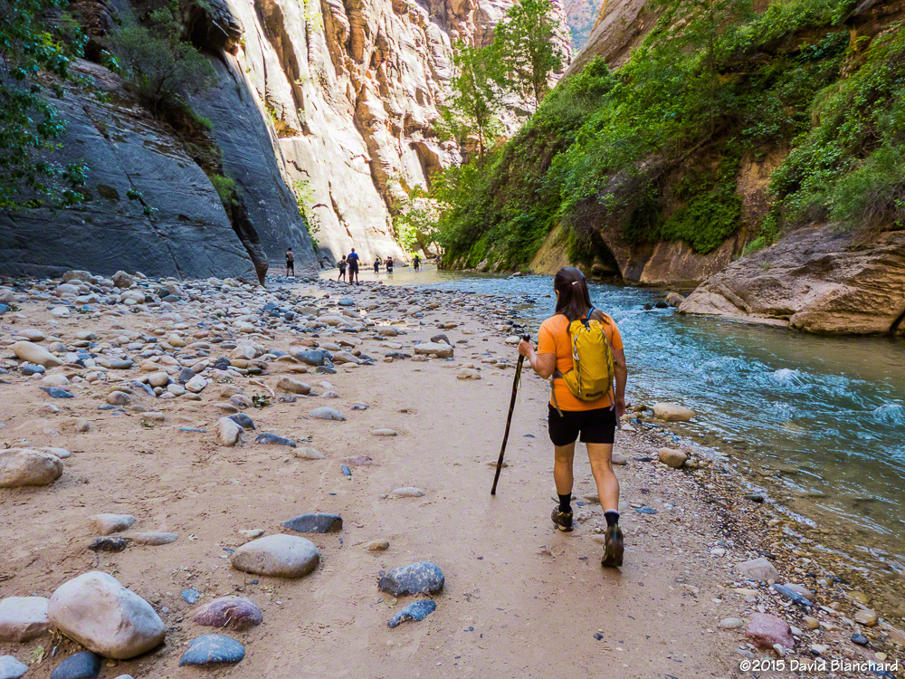
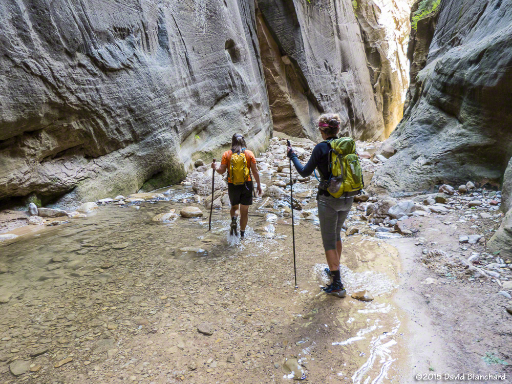
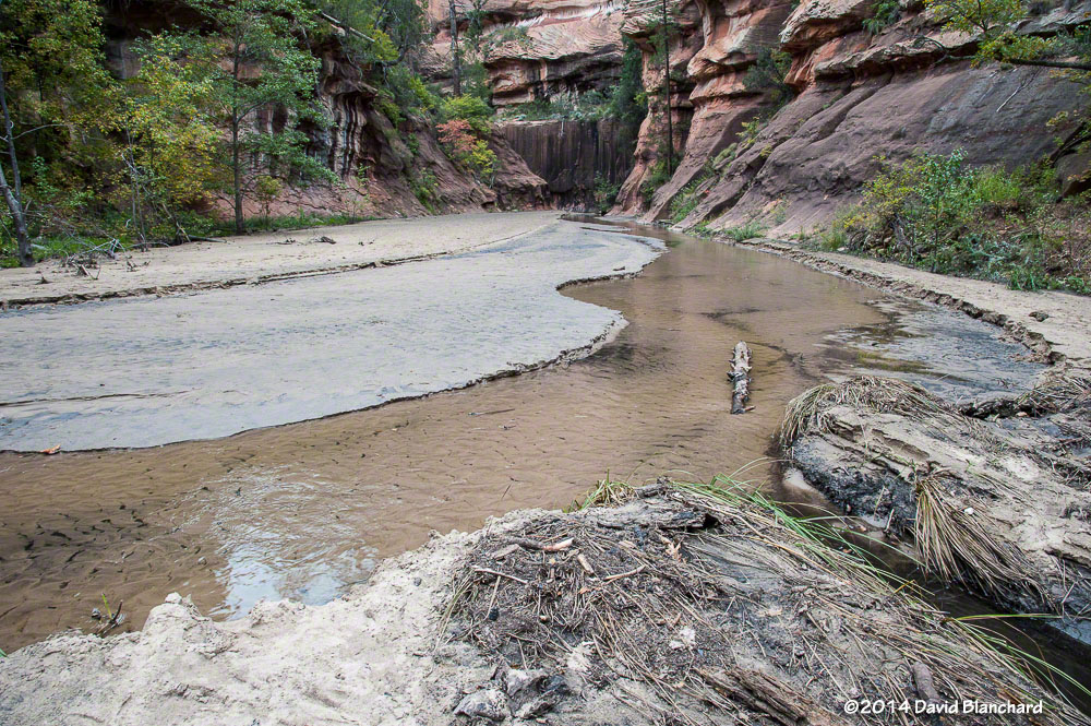
The next day, we decided to do the out-and-back version of Zion Narrows since this required far less time and commitment and provided some safety escape routes. At the beginning of the trail the Park Service had posted a sign indicating that a Flash Flood Watch was in effect and that flooding was possible. This didn’t seem to deter the folks intent on hiking up the river. I wonder how many of these visitors actually understood the situation? I certainly did. We would minimize the risk by starting and ending early before thunderstorms developed and we would minimize how far upstream we would travel so that we could stay in the wider and—hopefully—safer stretches of the canyon.
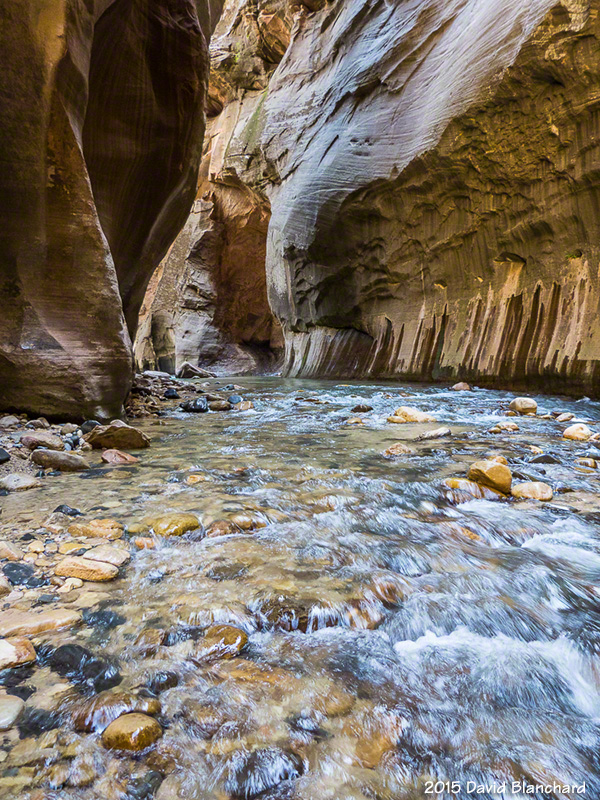
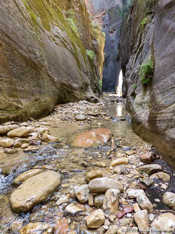
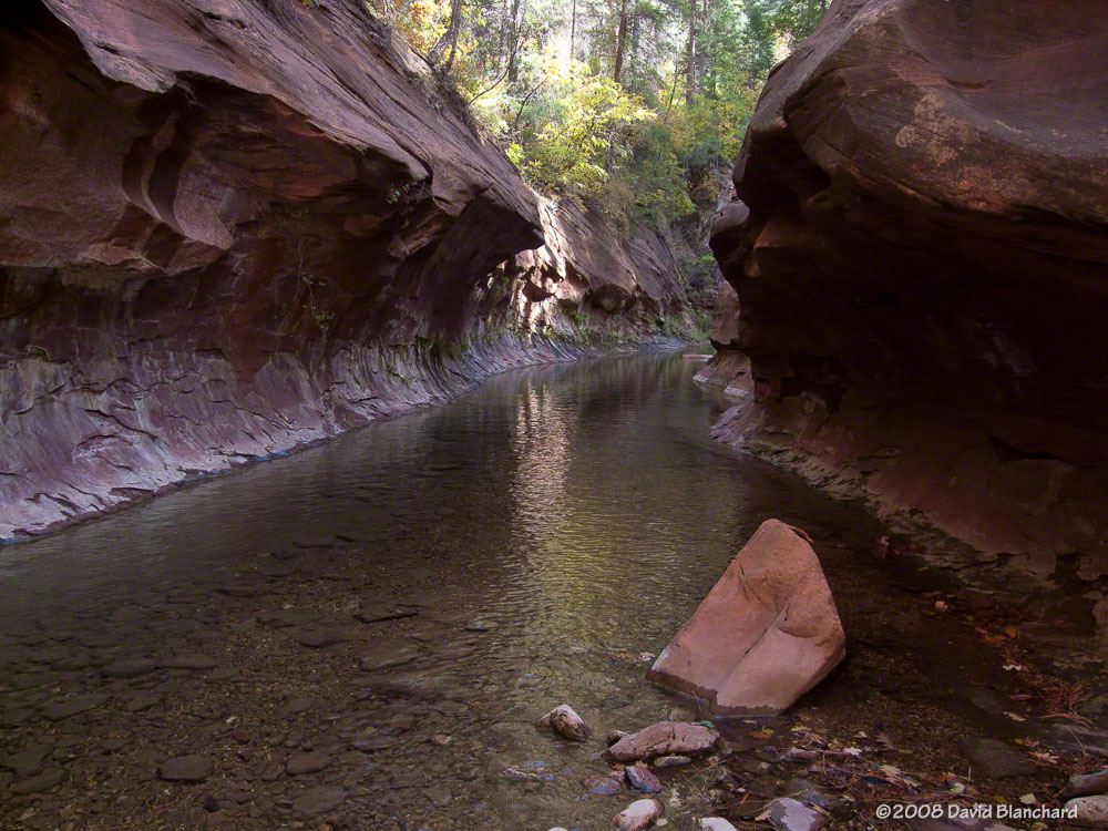
The beginning of the Zion river walk.The walls close in on the river……and a small rock and sand beach appears alongside the river.Deeper into the canyon…
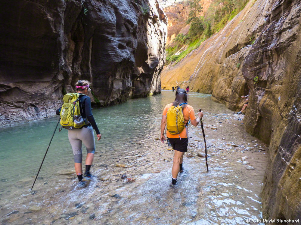
And so we set off under mostly sunny skies and warm temperatures. The water was cool but we had brought along neoprene socks and these did a fine job keeping our feet warm. After a few miles, we reached Orderville Canyon, a fine side canyon to explore. The water was shallower here with far less current making for easier travel. Until, that is, we reached some of the deep pools that required some swimming. So—we swam. Not too much farther upstream we were blocked from easy travel. We might have been able to bypass the rocks and logs at this point but with the weather situation looming we were content to let this be our turn-around point.
The beginning stretch of Orderville Canyon.Around this bend was our first deep water and swim.The return trip down Orderville Canyon.
And, sure enough, on the way back, it began to rain. Not much, not long, but enough to be glad we were heading back downstream.
Flood gage for the Paria River.
Oh, one more thing. While no flash floods occurred in Zion National Park that day, a large flash flood did occur not too far away along the Paria River, another popular canyon hike. Water levels rose from 8 cubic feet per second (cfs) to over 1000 cfs in less than an hour.
With autumn winding down and winter just around the corner in northern Arizona, it was our last chance to attempt a Rim-to-Rim-to-Rim (R2R2R) hike across the Grand Canyon. Several years ago we tried the R2R2R but strong winds drove us back as we neared the North Rim. Although we were only about 3-1/2 miles from the finish, it was the prudent thing to do. Later that year, we tried again but a problem with my iliotibial band turned us around after only a few miles and we settled for a shorter hike.
Jump forward a few years and the knee issues have gone into remission. With fine weather expected and the moon just a few days past full it was time to try again.
We left the South Rim on the South Kaibab Trail (elevation 7260′) at midnight with a temperature in the low 40’s and 20–30 mph winds. Hats, gloves, and vests/parkas were required for this initial descent. At times, the wind was so fierce that we wondered if we should continue. By the time we had descended to Cedar Ridge (6060′) the wind had diminished enough to allow us to shed some of the excess gear.
With the bright moon high overhead and headlamps we were able to easily travel downhill. Traveling in the dark with a bright moon and no other hikers around is an amazing experience. It’s so quiet! We traveled quickly and arrived at the Colorado River (2480′) at 3:30 a.m. Temperatures were in the low 60’s and we took a long food and water break at Phantom Ranch before starting up the North Kaibab Trail through Bright Angel Canyon.
First light high on the canyon walls.
A short distance up stream from Phantom Ranch is “The Box.” Traveling through The Box can be the hottest part of the hike with its high and close walls of granite but it was still dark and pleasantly cool as we traversed this section of Bright Angel Canyon. The last time we were here, spring snow melt had resulted in so much water rushing down the creek that boulders were constantly moving, grinding, and crashing into each other underwater resulting in a raucous cacophony of sound. Not tonight; the gentle flow of water resulted in a delightful sound that was mesmerizing in the dark.
North Kaibab Trail in Roaring Springs Canyon.
We arrived at Cottonwood campground (4080′), about 8 miles from Phantom Ranch, shortly after sunrise. We learned that the water had already been shut off for the season which meant there might not be any drinking water available uphill from here. Luckily, water was still running at the Roaring Springs Pumphouse Residence (~5200′) and we refilled here.
Supai Bridge on the North Kaibab Trail in Roaring Springs Canyon.
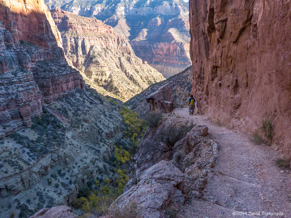
From Phantom Ranch to Roaring Springs Residence the North Kaibab Trail is a gentle uphill climb. The trail leaves Bright Angel Canyon just past the Residence and ascends Roaring Springs Canyon which is a much steeper section of trail. The trail is narrow and perched on a nearly vertical wall with steep drops to the side. It can be very intimidating.
Supai Bridge in Roaring Springs Canyon as seen from North Kaibab Trail.
The trail crosses the narrow canyon at Supai Bridge and begins a series of steep switchbacks to the top. Along the way, you pass through Supai Tunnel (6800′). Not surprisingly, the water here had been turned off for the season. We arrived at the North Rim (8240′) at 12:15 p.m., where we had a leisurely lunch. Already very tired from the long climb, we now had to reverse and do it in the opposite direction.
Coconino Overlook on the North Kaibab Trail.
As we descended Roaring Springs Canyon we stopped often to take photographs as the light was much better in the afternoon than it had been in the morning. The trees in the bottom of the canyon were still showing autumn colors and the narrowness of the trail as it hugged the canyon cliff was much more impressive. We stopped again at the Residence to refill our water bottles, drink, eat, and rest.
Narrow trail and steep cliffs in Roaring Springs Canyon.
Darkness descended upon us down canyon from Cottonwood Campground and, once again, we traversed The Box in the cool darkness, arriving at Phantom Ranch at 8 p.m. Many campers were hanging around waiting for the cantina to re-open so they could visit the bar. I was definitely interested in a beer but thought better of it. Instead, I lay down on the picnic bench to rest and, not too surprisingly, fell asleep, awakening around 9 p.m.
Narrow trail, steep cliffs, and autumn colors on the trees in Roaring Springs Canyon.
After drinking lots of water, consuming as many calories as we could, and filling our water bottles, we departed Phantom Ranch around 9:30 p.m. and began the long and steep climb back up South Kaibab Trail. Clouds during the evening prevented us from getting any useful moon light so we were on headlamp lighting only. Once again, winds became strong and gusty as we ascended and we donned the warmer clothing.
Finally, at 3:15 a.m., we arrived at the South Rim. It had taken us 27 hours and my goal had been 24 hours. Although I was slightly disappointed at how slow we had traveled I was very happy that my third attempt at R2R2R had been successful. Total: 42 miles and 10,540 feet of ascent.
The Slide Fire started on May 20, 2014, and was fully contained 16 days later. In the aftermath of the fire, Coconino National Forest closed much of Oak Creek Canyon for safety reasons. Four months later, on October 1, the restrictions were lifted and recreational activities resumed.
We wondered how much—or how little—of West Fork Oak Creek (WFOC) had burned. There had been some information during and just after the fire indicating that in the lower section of the canyon there was only light to moderate burn severity and only over a small percentage of the canyon. Farther up in the headwaters there had been widespread low intensity burns.
Typical burn scar seen in the lower reaches of West Fork.
So, finally, we hiked up WFOC to see for ourselves. The information was essentially correct and only small portions had burned and at low intensity. The canyon had survived. But there was still significant damage. Because of the burned areas farther up canyon, heavy rains this summer caused a lot of soil and ash to wash into the creek and flow downstream.
The creek channel was filled with silt and black ash. Where once the creek bottom had been smooth sandstone it now had several feet of silt and ash with deep channels carved through the silt.
This will slowly evolve back to its original state as winter rains and summer thunderstorms over the coming years flush out the silt and ash.
On a brighter note, we did see a late crop of ripening berries along the creek. Tasty!
A late season crop of ripening blackberries along West Fork.
One of the most significant changes occurred at the end of the West Fork Trail. The trail ends around 3.3 miles from the trail head where the canyon narrows and deep water is found from edge to edge. To travel farther upstream requires wading through water that is thigh deep in places. Most hikers turn back at this point; a few hardy hikers accept the challenge of water and no trail and continue upstream for many miles.
End of West Fork Trail in 2012 with water-filled channel.End of West Fork Trail in 2008 with water-filled channel.End of West Fork Trail in 2014 with silt-filled channel.
That has changed now as silt fills the slot canyon and a firm trail now exists where it once was only water.
Here are additional before and after images of West Fork Oak Creek.
This is the first large pool most hikers see as they travel up West Fork Trail (2011).This is the same pool in 2014. Ash and mud line the banks.
Several miles up the canyon the walls of the canyon close in again and water is found from edge to edge.
A wide and shallow pool stretches from wall to wall in this section of West Fork (2009).The same section is now filled with silt and ash with a narrow channel carved in the debris.This is the same pool as above but viewed from downstream (2010).The once-sparkling pool of water is now filled with silt and ash (2014).
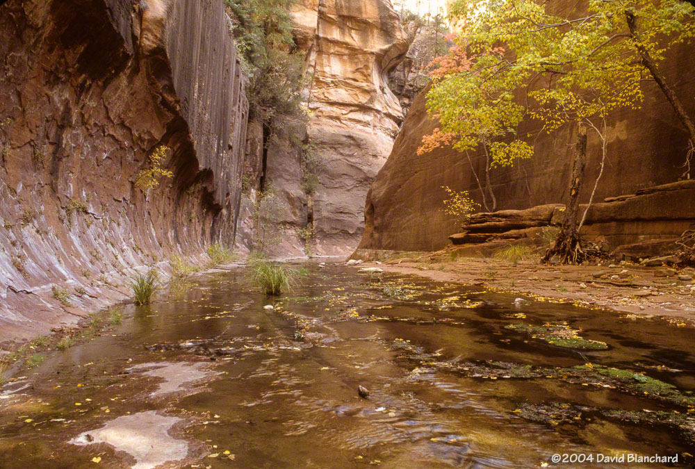
Just upstream and around the corner from this pool likes another narrow portion of the canyon with this large and smooth sandstone wall with trees. The sandstone floor of the creek bed has been filled with silt but the trees remain safe above the water and silt.
Narrow “slot canyon” with trees (2004).Silt and ash now cover the creek bed (2014).
Fire is an essential part of the ecosystem in northern Arizona and the Slide Fire may have done more good than harm since much of the burn severity was low or moderate. The fire removed a lot of fuels on the forest floor and have provided nutrients for the future of the forest. In the short term the silt and ash have filled many pools and covered the sandstone floor of the creek bed but these are not long-term harms. In time, the canyon will return to what it was before.
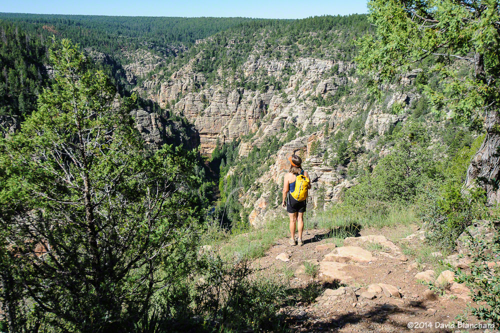
Earlier this year we hiked through the upper reaches of West Clear Creek canyon. After driving as far as possible on rough forest roads, we hiked the remainder of the distance to the Tramway trail head. From here, it was a steep descent from the canyon rim to the canyon floor.
The start of the steep descent into West Clear Creek.
We hiked downstream for a few hours then turned around and headed upstream, passing our original descent trail, and exiting the canyon using the Maxwell Trail.
One location in the canyon was especially wonderful. First, there was a short and narrow side canyon with vertical walls that lent a sense of isolation from the rest of the canyon and world. Second, we found a peach tree with small peaches. How this tree came to be in this canyon is unknown but the most likely explanation is someone ate a peach and tossed the pit—and it grew in this most unlikely of places.
On that trip I carried a small camera that was unable to do justice to the amazing side canyon. So on this return trip I carried a different camera along with a tripod so I could attempt to get some better images. And we were also interested in the peach tree.
A peach tree deep within West Clear Creek canyon.
The tree had many peaches and the branches were weighted down as a result. I grabbed a peach and bit into it—and was surprised that it was dry and hard. Not juicy at all. And no real taste or flavor. But, you know what? You can’t tell that from the photographs. They look wonderful, don’t they?
[Edit: 09/10/2014. We took one peach home with us and allowed it to ripen in a paper bag for several days. The result was juicy and delicious!]
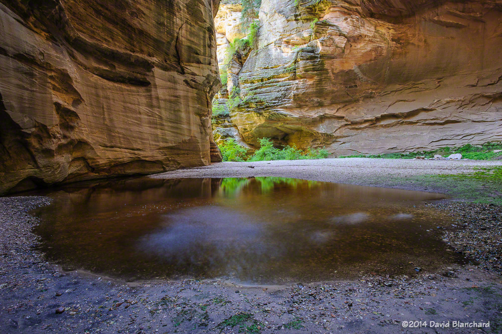
A small stream trickles down the steep walls on the side canyon.Side canyon in West Clear Creek.Water splashes into a small pool in a side canyon in West Clear Creek.
When we visited the side canyon earlier this year it was dry. Now, however, an above normal rainfall this summer has produced a small stream of water that cascades over the edge and into a small pool of water. Here are some of the images taken that day.