A visit to West Fork Oak Creek after the Slide Fire

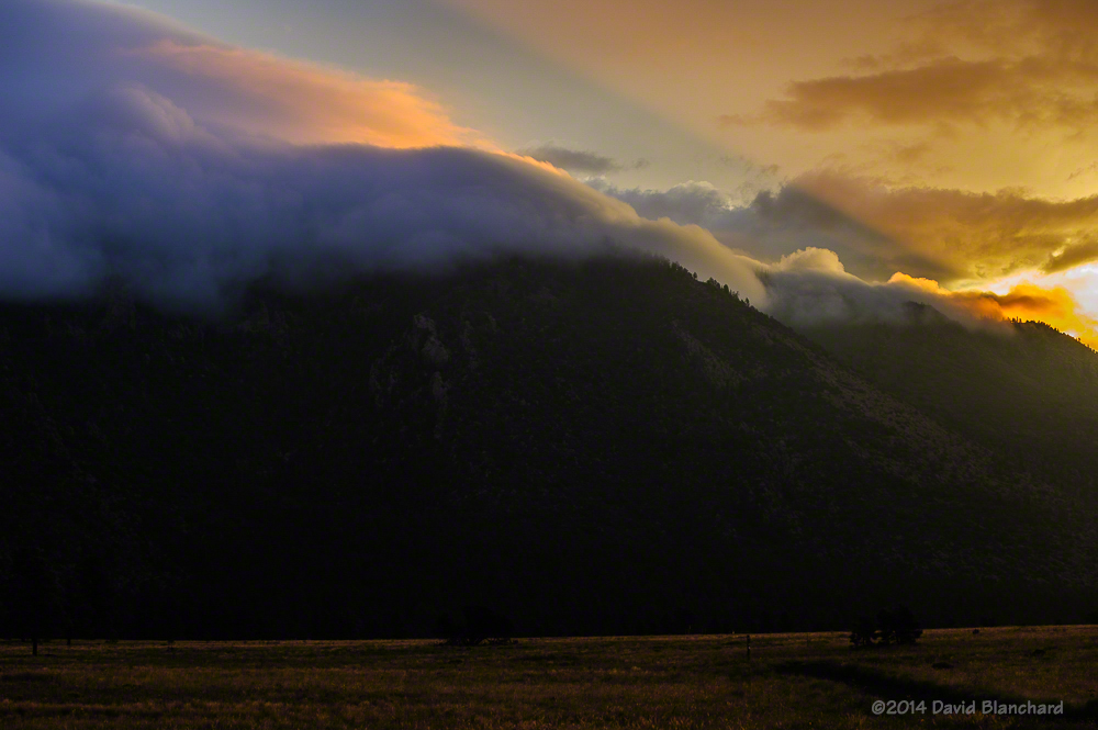
The Slide Fire started on May 20, 2014, and was fully contained 16 days later. In the aftermath of the fire, Coconino National Forest closed much of Oak Creek Canyon for safety reasons. Four months later, on October 1, the restrictions were lifted and recreational activities resumed.

We wondered how much—or how little—of West Fork Oak Creek (WFOC) had burned. There had been some information during and just after the fire indicating that in the lower section of the canyon there was only light to moderate burn severity and only over a small percentage of the canyon. Farther up in the headwaters there had been widespread low intensity burns.

Typical burn scar seen in the lower reaches of West Fork.

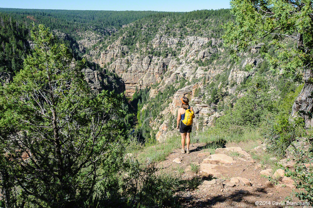
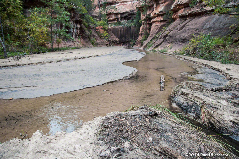
So, finally, we hiked up WFOC to see for ourselves. The information was essentially correct and only small portions had burned and at low intensity. The canyon had survived. But there was still significant damage. Because of the burned areas farther up canyon, heavy rains this summer caused a lot of soil and ash to wash into the creek and flow downstream.

The creek channel was filled with silt and black ash. Where once the creek bottom had been smooth sandstone it now had several feet of silt and ash with deep channels carved through the silt.

This will slowly evolve back to its original state as winter rains and summer thunderstorms over the coming years flush out the silt and ash.

On a brighter note, we did see a late crop of ripening berries along the creek. Tasty!

A late season crop of ripening blackberries along West Fork.

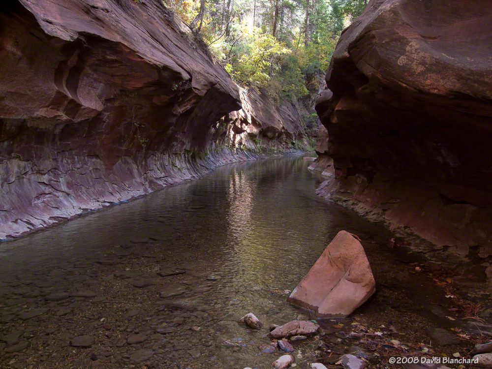
One of the most significant changes occurred at the end of the West Fork Trail. The trail ends around 3.3 miles from the trail head where the canyon narrows and deep water is found from edge to edge. To travel farther upstream requires wading through water that is thigh deep in places. Most hikers turn back at this point; a few hardy hikers accept the challenge of water and no trail and continue upstream for many miles.

End of West Fork Trail in 2012 with water-filled channel.
End of West Fork Trail in 2008 with water-filled channel.
End of West Fork Trail in 2014 with silt-filled channel.

That has changed now as silt fills the slot canyon and a firm trail now exists where it once was only water.

Here are additional before and after images of West Fork Oak Creek.

This is the first large pool most hikers see as they travel up West Fork Trail (2011).
This is the same pool in 2014. Ash and mud line the banks.

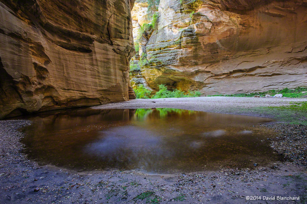
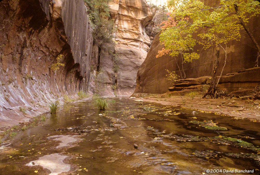
Several miles up the canyon the walls of the canyon close in again and water is found from edge to edge.

A wide and shallow pool stretches from wall to wall in this section of West Fork (2009).
The same section is now filled with silt and ash with a narrow channel carved in the debris.
This is the same pool as above but viewed from downstream (2010).
The once-sparkling pool of water is now filled with silt and ash (2014).

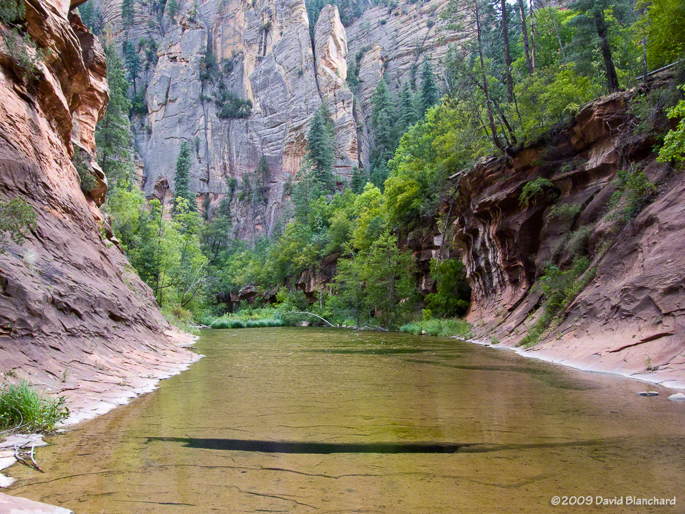
Just upstream and around the corner from this pool likes another narrow portion of the canyon with this large and smooth sandstone wall with trees. The sandstone floor of the creek bed has been filled with silt but the trees remain safe above the water and silt.

Narrow "slot canyon" with trees (2004).
Narrow “slot canyon” with trees (2004).
Silt and ash now cover the creek bed (2014).

Fire is an essential part of the ecosystem in northern Arizona and the Slide Fire may have done more good than harm since much of the burn severity was low or moderate. The fire removed a lot of fuels on the forest floor and have provided nutrients for the future of the forest. In the short term the silt and ash have filled many pools and covered the sandstone floor of the creek bed but these are not long-term harms. In time, the canyon will return to what it was before.


Rainbows and lightning in the Arizona Desert

Over the weekend tropical moisture and an area of low pressure interacted to produce showers and thunderstorms—and even a few severe thunderstorms—across northern Arizona. A quick look at satellite and radar data convinced me it was worthwhile to drive down the hill from Flagstaff to Sedona to capture some lightning photos.

A rainbow arcs across the skies of Sedona and in front of Cathedral Rock.

Light rain began to fall as I approached my first photo location and a horizon-to-horizon rainbow appeared. As I arrived, the southern end was quickly fading while overhead and to the north the rainbow remained brilliant. And, then, for just a brief moment, the southern end brightened again and a swath of color painted itself across Cathedral Rock. In another moment it was gone. Note, also, that there is a supernumerary rainbow visible in a portion of the bow. Supernumeraries are the closely spaced greenish purple arcs on the inner side of the primary bow.

Lightning and sunset colors over the Verde Valley.

As these storms moved to the northwest it was time to reposition and hope for some lightning. The first image shows a thunderstorm moving across the Verde Valley and the storm is lit up from below by the lights in the town of Cottonwood. Sunset colors are still faintly visible in the west and stars can also be seen. This was followed by a bolt with numerous downward stepped leaders and a brilliant return stroke.

Lightning bolt with numerous branches.

Not too bad!

A Peach of a Canyon

Earlier this year we hiked through the upper reaches of West Clear Creek canyon. After driving as far as possible on rough forest roads, we hiked the remainder of the distance to the Tramway trail head. From here, it was a steep descent from the canyon rim to the canyon floor.

The start of the steep descent into West Clear Creek.

We hiked downstream for a few hours then turned around and headed upstream, passing our original descent trail, and exiting the canyon using the Maxwell Trail.

One location in the canyon was especially wonderful. First, there was a short and narrow side canyon with vertical walls that lent a sense of isolation from the rest of the canyon and world. Second, we found a peach tree with small peaches. How this tree came to be in this canyon is unknown but the most likely explanation is someone ate a peach and tossed the pit—and it grew in this most unlikely of places.

On that trip I carried a small camera that was unable to do justice to the amazing side canyon. So on this return trip I carried a different camera along with a tripod so I could attempt to get some better images. And we were also interested in the peach tree.

A peach tree deep within West Clear Creek canyon.

The tree had many peaches and the branches were weighted down as a result. I grabbed a peach and bit into it—and was surprised that it was dry and hard. Not juicy at all. And no real taste or flavor. But, you know what? You can’t tell that from the photographs. They look wonderful, don’t they?

[Edit: 09/10/2014. We took one peach home with us and allowed it to ripen in a paper bag for several days. The result was juicy and delicious!]

A small stream trickles down the steep walls on the side canyon.
Side canyon in West Clear Creek.
Water splashes into a small pool in a side canyon in West Clear Creek.

When we visited the side canyon earlier this year it was dry. Now, however, an above normal rainfall this summer has produced a small stream of water that cascades over the edge and into a small pool of water. Here are some of the images taken that day.

Another planetary conjunction

Another planetary conjunction occurred yesterday (31 Aug 2014) with the close placement of Mars, Saturn, and the Moon in the evening sky. It’s only been a few weeks since the planetary conjunction of Venus and Jupiter in the morning sky so we’ve had an interesting few weeks for sky watching.

Mars and Saturn were joined by the crescent Moon to form a triangle in the evening sky. Using “The Photographers Ephemeris” I was able to determine that I could get a photograph of the triplet as they hung in the sky above Cathedral Rock in Sedona, Arizona. But if only it were that easy. After arriving at my predetermined spot I still had to move around to get a good setup. A bit of travel southward along the Templeton Trail…followed by some climbing up…then down…then back to the north…and finally I get a few minutes where they lined up with the spires of Cathedral Rock. Whew!

Conjunction of Mars, Saturn, and the crescent Moon.

With that done, I retreated back down to the parking lot before it got too dark and spent another few hours photographing the Milky Way as it lined up with Cathedral Rock.

Milky Way and Cathedral Rock.

Early morning clouds across Mount Elden

Earlier in the morning I was shooting images of the conjunction of the planets Venus and Jupiter. I had noticed that there were early morning clouds draped across Mount Elden. I wasn’t ready to put the camera away yet so I headed over to Buffalo Park so that I could get a better view of the clouds, mountain, and the quickly changing light as the sun began to rise. I was rewarded with this image of the clouds obscuring the peak of the mountain while rays of light were intersecting the clouds at different points with amazing colors.


Early morning clouds on Mount Elden.