Late September Storms in Flagstaff and Sedona

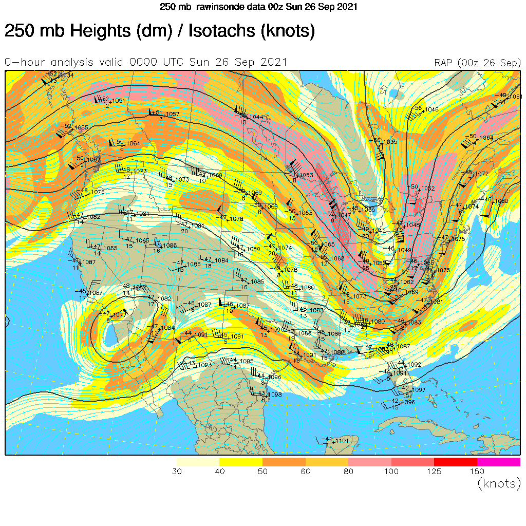
Late September provided a chance to photograph storms associated with the passage of an upper-level trough crossing the southwest. Ahead of the trough would be moderate-to-strong upper level winds along with deep-layer shear. So there was a possibility of a few strong thunderstorms that might develop supercellular characteristics. As well, there would likely be a line of storms that formed on the surface cold front pushing southeastward across the state.

Shelf cloud associated with an outflow boundary from a cluster of thunderstorms moving over the San Francisco Peaks.

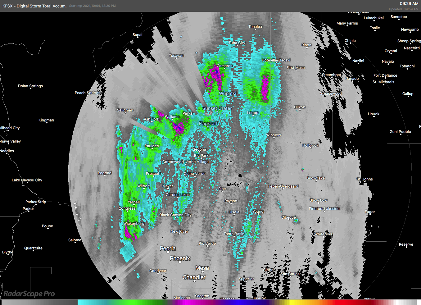
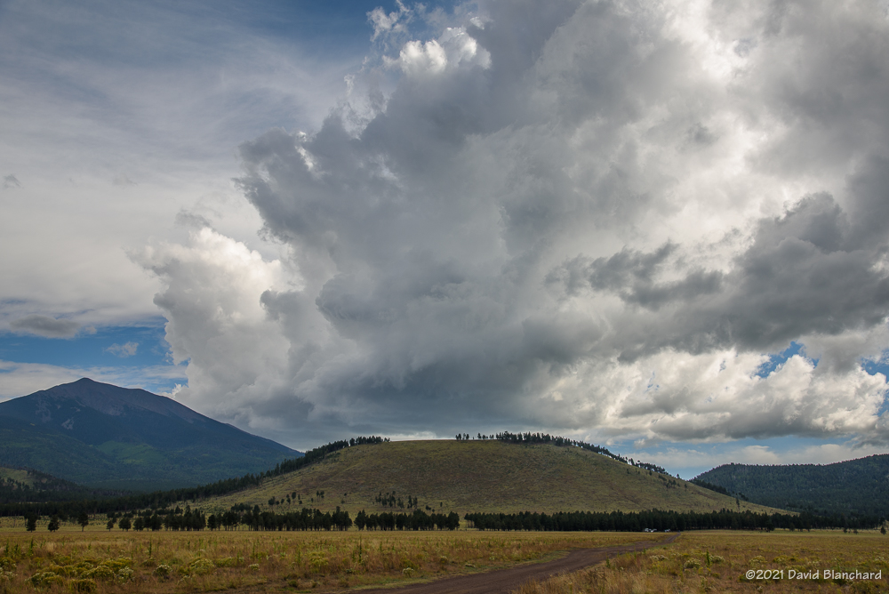
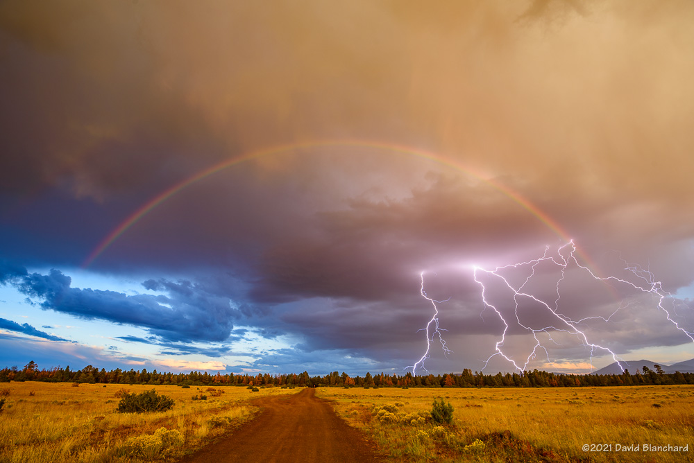
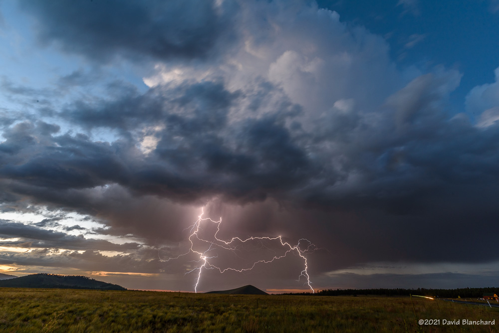
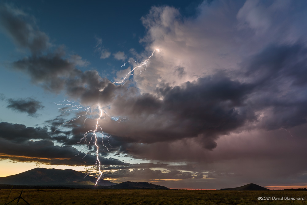
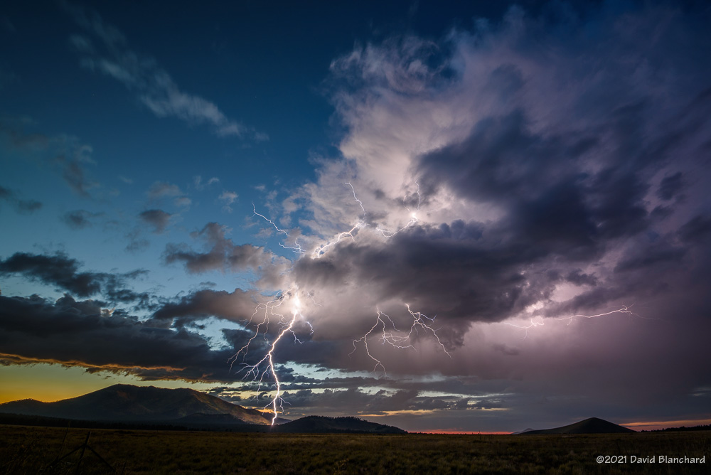
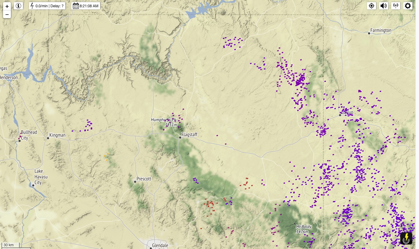
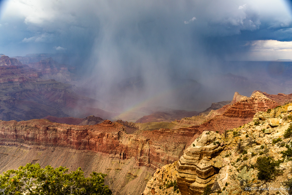
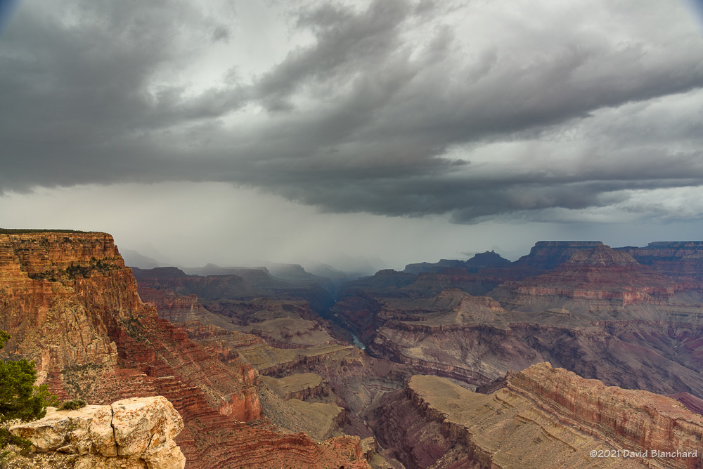
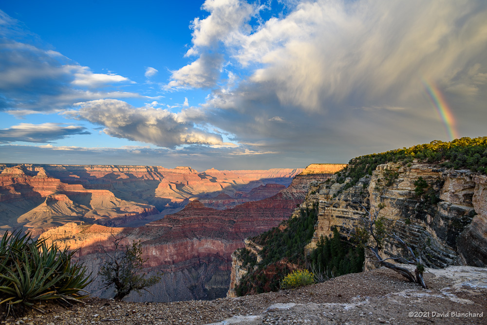
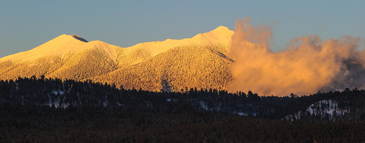
The plan was to head north to Cameron, Arizona, then slowly work back to the south as the line of storms moved across the area. I went to Cameron but the storms to the west and northwest were already weakening while storms farther to the southwest were strengthening. So — back south I went with stops at Wupatki NM and Sunset Crater NM while watching the storms. A cluster of storms developed north of the San Francisco Peaks and eventually pushed a strong outflow across the mountains. The leading edge of this outflow had an interesting cloud structure and was briefly very photogenic.

Sunset colors on the clouds at Fort Tuthill County Park.

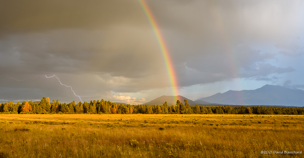
After a few photos, I continued moving across Flagstaff on my way home. Suddenly, the sun dropped low enough to get below the clouds and for a few minutes there was great sunset light on the bottom of the clouds. I shot a few photos at Fort Tuthill County Park with the undersides of the clouds full of sunset colors. And, then just a few minutes later it was over and the light was gone.

So I could have just stayed at home and gone out shooting at the last minute of daylight.

Late afternoon sun lights up a distant thunderstorm and the Red Rocks of Sedona.
The setting sun and crepuscular rays.

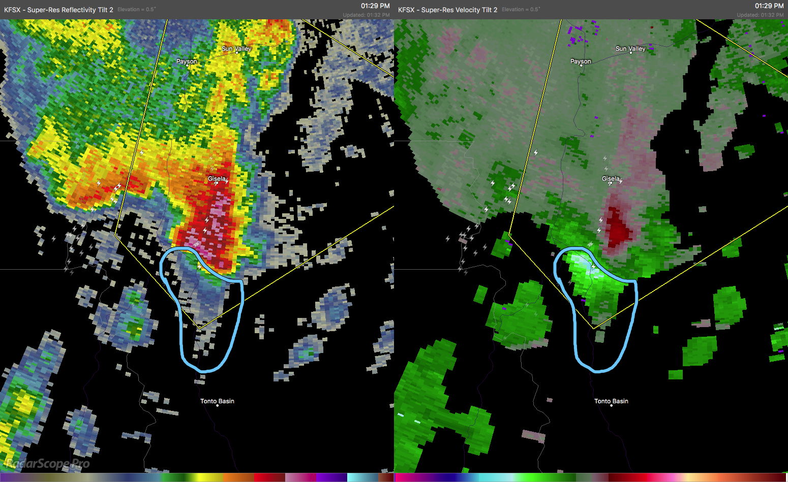
The next day showed potential for a few interesting storms south of Flagstaff. I headed to Sedona and spent a few hours photographing storms.

The setting sun with crepuscalur rays was pretty nice.

Edit: corrected typo in photo caption.


Thunderstorms and Tornadoes in Arizona

A potent weather system moved across Arizona on Tuesday, October 5, 2021, and produced a variety of weather including tornadoes, large hail, heavy rain, and flooding. This system was well forecasted and the various models did a very good job depicting the possibilities.

Radar-estimated rainfall amounts across Arizona on Tuesday morning.

Areas of moderate rain moved across Arizona in the pre-dawn hours with many locations receiving more and one inch of rain by sunrise.

There had been some expectations that the severe weather would commence before sunrise owing to the favorable vertical wind profiles. Both the low-level shear and deep-layer shear supported organized thunderstorms with the possibilities of rotating supercells and even tornadoes. That scenario did not manifest probably because the widespread overnight rain cooled the boundary layer enough to inhibit strong thunderstorm development.

The forecast models also suggested a second period of severe weather was possible in the afternoon as temperatures warmed and buoyant instability increased across the area.

Severe thunderstorm with a Three-Body Scatter Signature (TBSS; also known as a "hail spike").
Severe thunderstorm with a Three-Body Scatter Signature (TBSS; also known as a “hail spike”).
Severe thunderstorm with a hook echo (left) and strong velocity couplet (right). The box indicates that a Severe Thunderstorm Warning is in effect for this storm.
Severe thunderstorm continues to show a hook echo (left); on the right is Correlation Coefficient where low values may indicate tornadic debris. The warning has been upgraded to a Tornado Warning.

Strong thunderstorms developed across the desert regions of central and southern Arizona in the afternoon. These moved quickly to the northeast and into the higher terrain of the Mogollon Rim and Tonto Rim. At least two of these thunderstorms began to acquire supercellular characteristics and began to show rotation signatures in the Dopper radar data. By mid afternoon, one storm had developed a well-defined hook echo and velocity couplet. This storm was already producing strong winds and hail and a Severe Thunderstorm Warning (SVR) was already in effect. As the rotation rapidly intensified, the SVR was replaced with a Tornado Warning (TOR). Polarimetric Dopper radar data indicated low values of Correlation Coefficient (CC). This often accompanies tornadic debris lofted into the air. This was clearly a dangerous storm and the TOR was justified.

Multi-Radar Multi-Sensor (MRMS) depiction of large hail swaths.
MRMS rotation tracks associated with the tornado.

Eventually, the rotation weakened but the storm was still producing large hail as it moved northeastwards. Other storms also produced large hail. The Multiple Radar Multiple Sensors (MRMS) data shows these long swaths of large hail across portions of Arizona.

Forecasters from the National Weather Service offices in Arizona did a great job of anticipating this severe weather event and issuing timely warnings.

Lightning and Rainbows

Twilight lightning over Kendrick Park. The north flanks of Kendrick Peak are illuminated by the bolt.

We are in the midst of the “Transition Season” where the summer monsoon pattern fades away and the mid-latitude westerlies and low pressure systems move across the area. Another of these events is in progress as a weak closed-low moves across the southwest bringing showers and thunderstorms to the area.

Thunderstorms begin to develop over the San Francisco Peaks.

Saturday afternoon we set out for the north side of the San Francisco Peaks hoping that thunderstorms would form over the higher terrain and then move northwestward across Kendrick Park. A few storms did form over the peaks and some of them were briefly photogenic but there was very little in the way of lightning. Eventually, approaching rain chased us from Kendrick Park to the northwest where we set up near Slate Mountain in a large meadow with good views of the peaks.

Distant lightning under the rainbow.
A multi-pronged lightning strike under the rainbow.
Twilight lightning over Kendrick Park.
Twilight lightning over Kendrick Park. The north flanks of Kendrick Peak are illuminated by the bolt.

These slow-moving storms continued to move towards the northwest and this time we got lightning and rainbows—and rainbows with lightning. As the sun dropped lower in the west the rainbow quickly faded and rain was again approaching our location. We retreated back to Kendrick Park—this time with the thunderstorms located to our northwest with light from the setting sun still illuminating some clouds. Lightning stikes were frequent and close enough to fill the field of view of the 17-mm focal length lens. Several of these lightning bolts struck the northern flanks of Kendrick Peak. About a half-hour after sunset it was over and the storms quickly dissipated.

Another fun day of storms and lightning.

250-mb height/winds at 0000 UTC 26 September 2021.
24-hour lightning plot with a lightning cluster near the San Francisco Peaks.

Grand Canyon Rainbows

A double rainbow with supernumaries appears above Grand Canyon.

With a weak short-wave trough and residual monsoon moisture moving across Arizona there were possibilities that this would be a “monsoon transition” event. The vertical wind shear was in place but instability was marginal. The end result was a general lack of supercells—but that didn’t mean that the convection wasn’t interesting.

Small rainbow segment over Unkar Delta in Grand Canyon.

Multiple waves of thunderstorms moved across Grand Canyon with the earliest storms appearing before noon. With each wave, there was rain with some lightning followed by clearing and even some rainbows.

A band of heavy rain moves across Grand Canyon.
Rain approaches Lipan Point.

The first rainbow occurred while the sun was high overhead resulting in the rainbow appearing almost directly below in the canyon. This rainbow did not have brilliant colors but being able to see a rainbow over the Unkar Delta was interesting.

A double rainbow with supernumaries appears above Grand Canyon.
A closer look at the rainbow inside Grand Canyon.

More showers…more rainbows. That was how the afternoon played out.

Clouds hug the rim of Grand Canyon.

Late in the day I relocated to Yavapai Point for sunset colors and hoped for another rainbow. A partial rainbow appeared over the South Rim—but the arch did not continue up and over across the canyon.

A rainbow segment appears just before sunset at Grand Canyon.

A fun day.

Monsoon Transition Season Is Here

It is now September and we are in the so-called “transition season” as the North American Monsoon weakens and stronger baroclinic weather systems begin to traverse the southwestern states. From a paper presented at the 23rd Severe Local Storms Conference (2006):

Outbreaks of severe thunderstorms in northern Arizona are most likely to occur during the transition between the moist, tropical environment of the warm-season North American Monsoon regime and the first incursions of mid-latitude baroclinic systems in September. The presence of copious tropical moisture, combined with increased convective instability and deep-layer shear, is supportive of long-lived supercells which are responsible for most of the severe weather.

Supercells are more common during the transition season than other times of the year in northern Arizona. Tornadoes—especially long-lived, damaging tornadoes—are more likely to occur during this brief period. This is from a paper presented at the 24th Severe Local Storms Conference (2008):

The results show that more than half of the tornado days occurred during the approach of a closed low from the eastern Pacific with northern Arizona located in the warm sector of the northeast quadrant of the low. The closed lows produced environments with deep-layer shear and low-level shear comparable to the 3rd and 4th quartiles of tornadic environments discussed by Rasmussen and Blanchard (1998) while instability was small and was comparable to or less than their 1st quartile. These interesting results suggest that shear may be the more important factor and that instability need only be sufficient to initiate and maintain convection long enough for the shear to act upon the updrafts.

While tornadoes in northern Arizona are more likely to occur during the transition season they are still uncommon (a notable exception was the October 2010 outbreak) and several years may pass without any tornado events. Supercells, on the other hand, are more common and at least a few can be expected each year during the transition.

Below are composite means of 500-mb geopotential height, 700-mb v-wind component, and surface Lifted Index for the tornado events.

Composite 500-mb height field for the 19 tornado event days.
Composite 700-mb v-component of the wind field.
Composite surface-based Lifted Index field.

Will we have a closed-low, transition-season type of event this year?

References

Blanchard, D. O., 2006: A cool season severe weather episode in northern Arizona. Preprints, 23rd Conference on Severe Local Storms, St. Louis, MO., Amer. Meteor. Soc.

Blanchard, D. O., 2008: Synoptic environments associated with tornadoes in northern Arizona. Preprints, 24th Conference on Severe Local Storms, Savannah, GA., Amer. Meteor. Soc.

Blanchard, D. O. 2013: Comparison of wind speed and forest damage associated with tornadoes in northern Arizona. Wea. Forecasting, 28, 408–417.