Monsoon–July 2023

A double rainbow arches above Wukoki Pueblo in Wupatki National Monument.

The North American Monsoon (NAM) has been slow to get started this year. A general rule of thumb is it gets going around the 4th of July and is considered late (but still normal) by mid-July. Likewise an early start can occur as early as mid June–as it did last year.

Composite image of late afternoon lightning strikes over the grasslands of Wupatki National Monument.
A segment of a rainbow over Wukoki Pueblo in Wupatki National Monument.
Several lightning clusters that occurred during twilight at Wupatki National Monument.

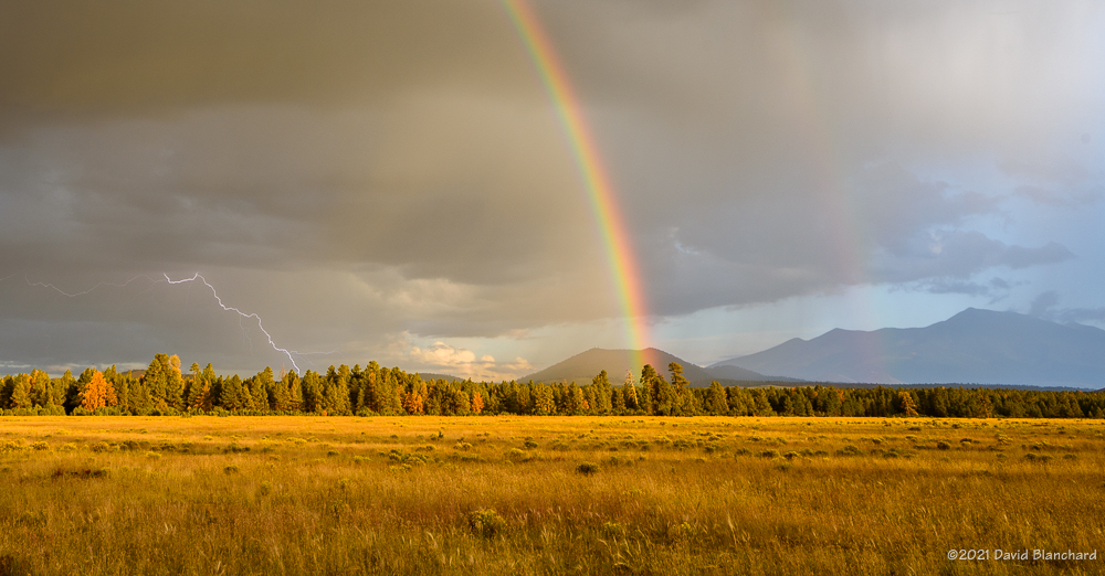
During the month of July the GFS weather forecast model consistently showed the NAM getting started “Real Soon Now.” But the target was always several days away. Finally, late in the month the rains arrived as an inverted trough (IVT; def. 2) moved across Arizona.

Lightning over the San Francisco Peaks with Marshall Lake in the foreground.
Lightning touches down deep in Grand Canyon.

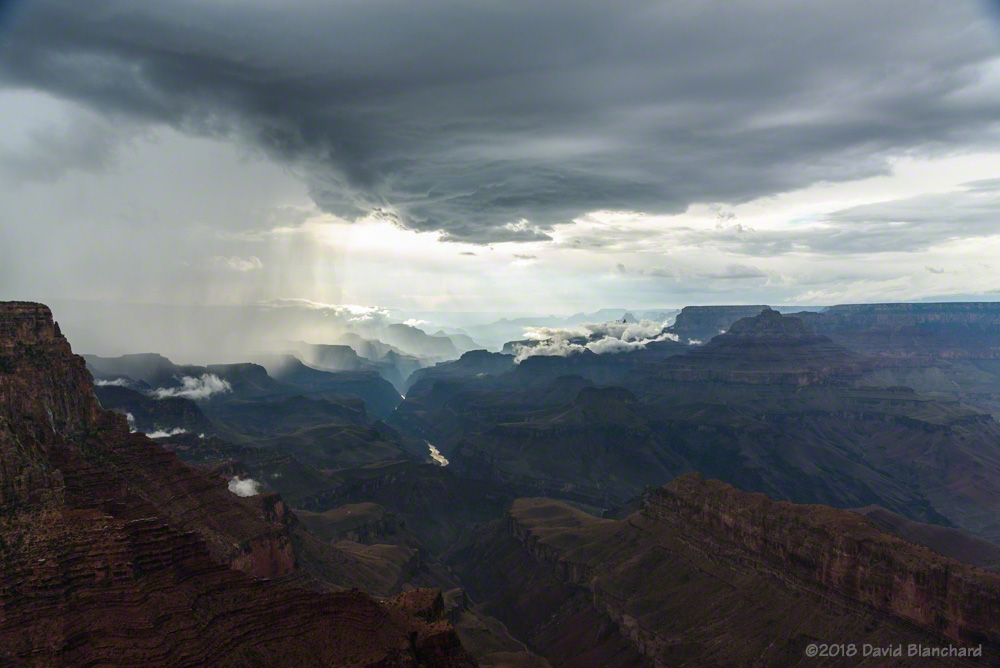
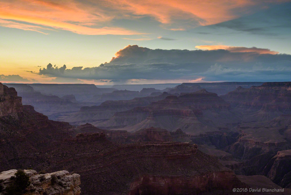
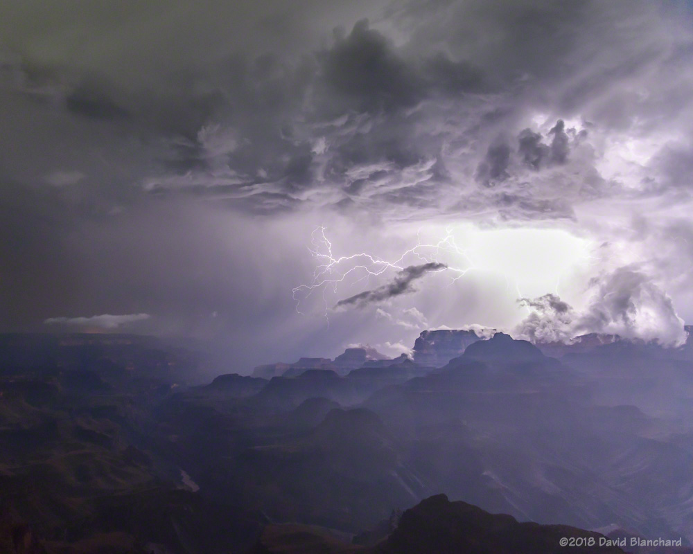
There have been some photogenic storms. A little over a week ago I traveled to the South Rim of Grand Canyon hoping to get some lightning. Although there were some flashes they were far away. On the other hand, the sunset was pretty good. A band of clouds just above the horizon effectively blocked the Sun at my location while beams of light were getting under the clouds and into the canyon farther to the west. The alternating beams of light and shadow were pretty nice.

Beams of light and shadow filter deep into Grand Canyon.

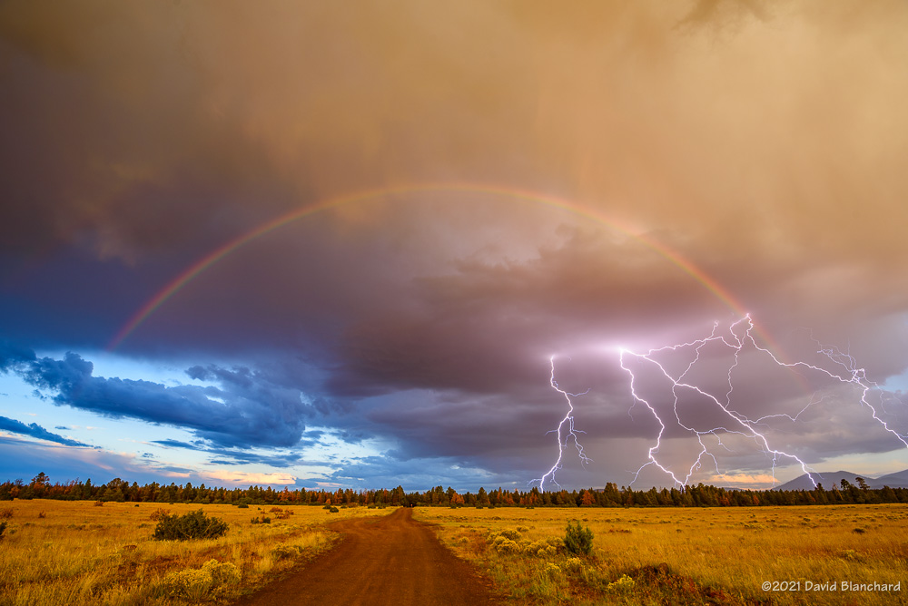
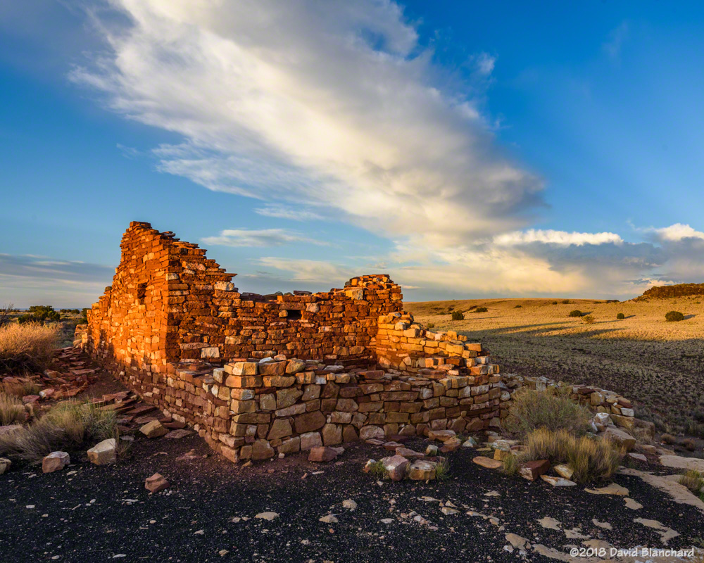
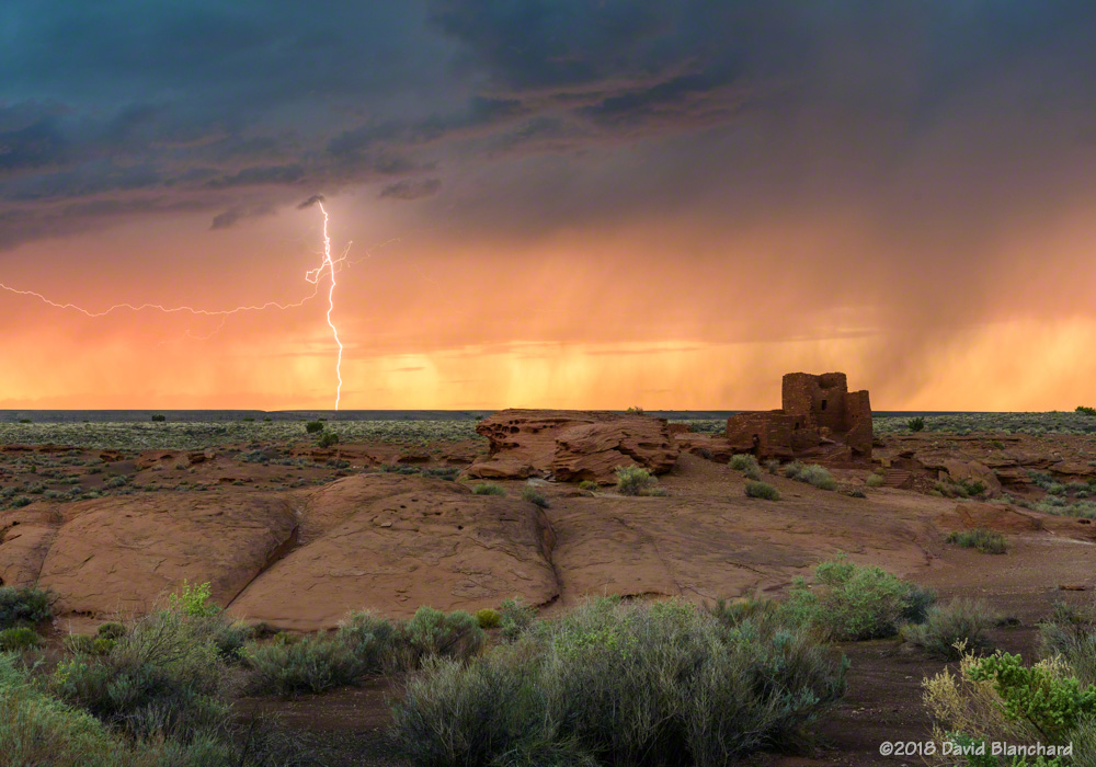
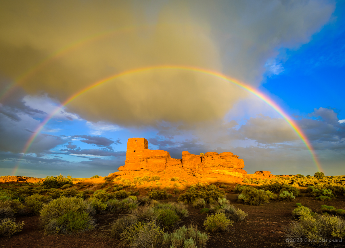
The following day I went to Wupatki National Monument in hopes of lightning and rainbows. There was a late afternoon storm that moved towards the Monument and produced a lot of lightning. As it got closer it weakened but was still dropping rain and a short time later a beautiful, full double rainbow appeared. All I needed to do was position myself so that I could get the rainbow arch to frame Wukoki Pueblo.

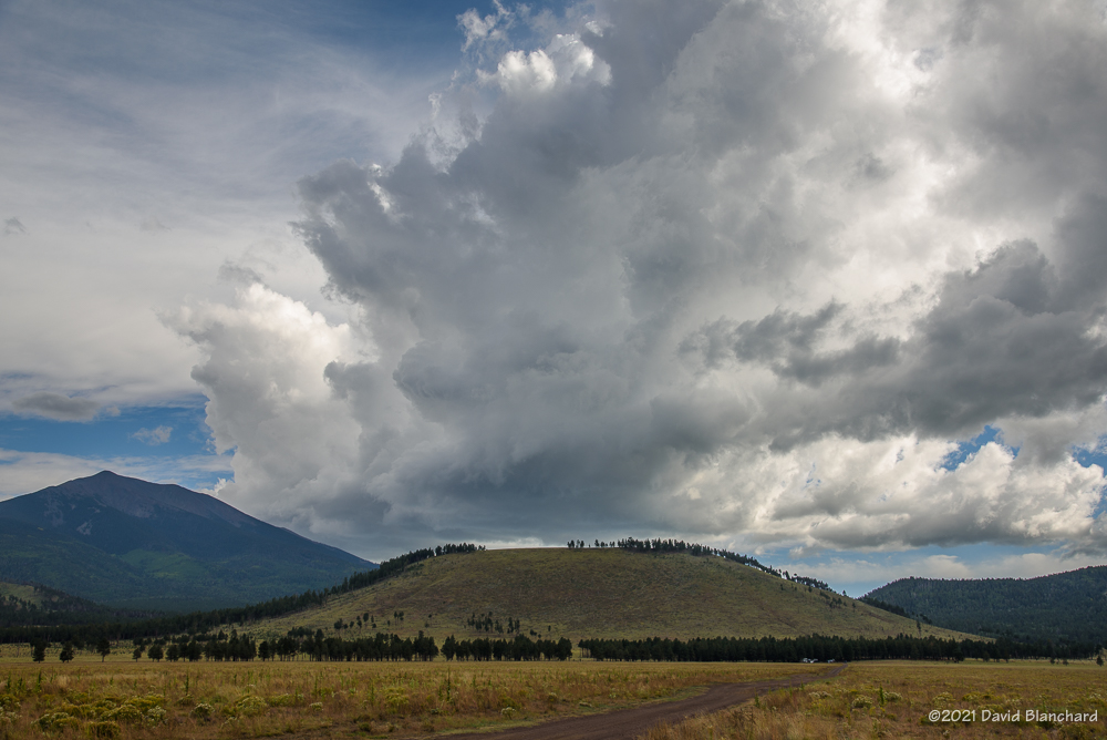
Time lapse of convection developing over the San Francisco Peaks with Marshall Lake in the foreground.

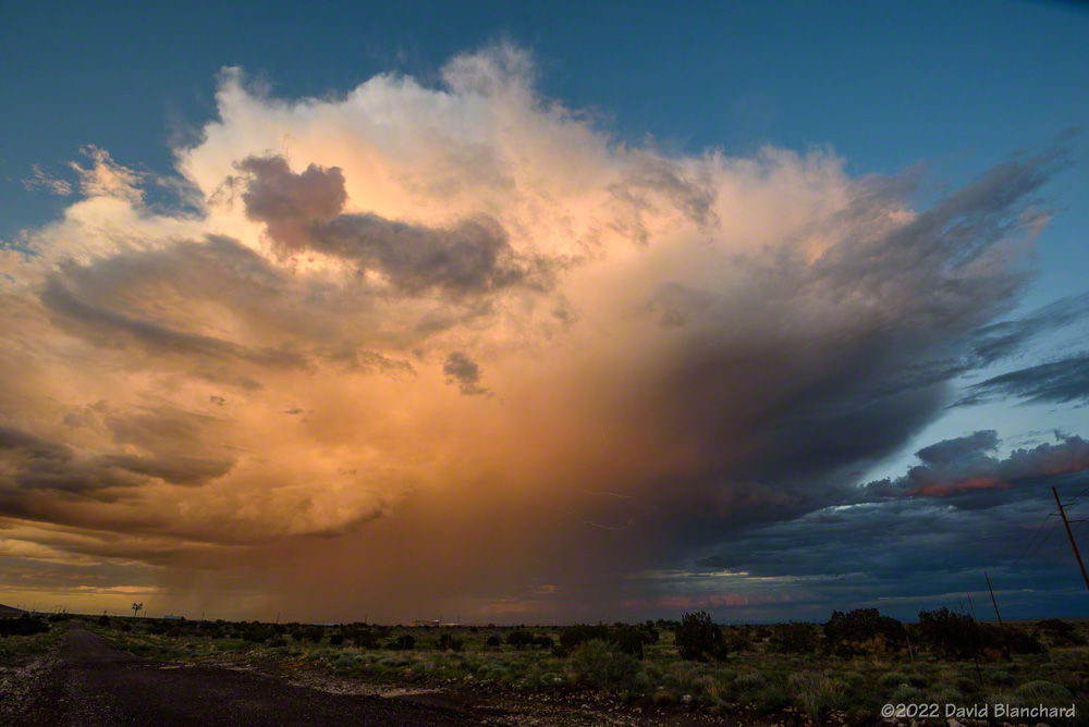
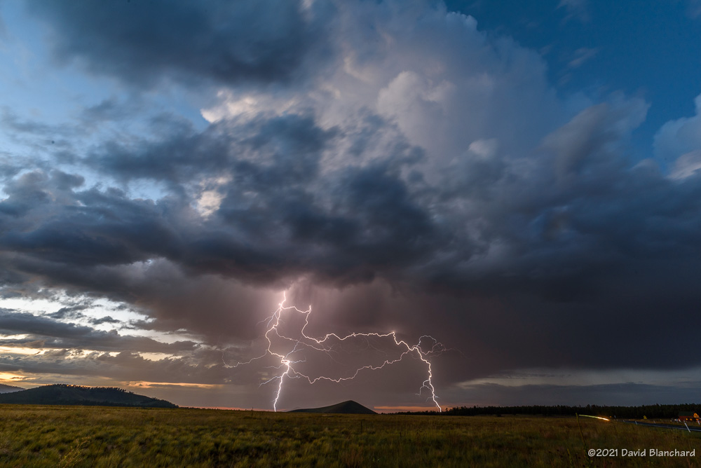
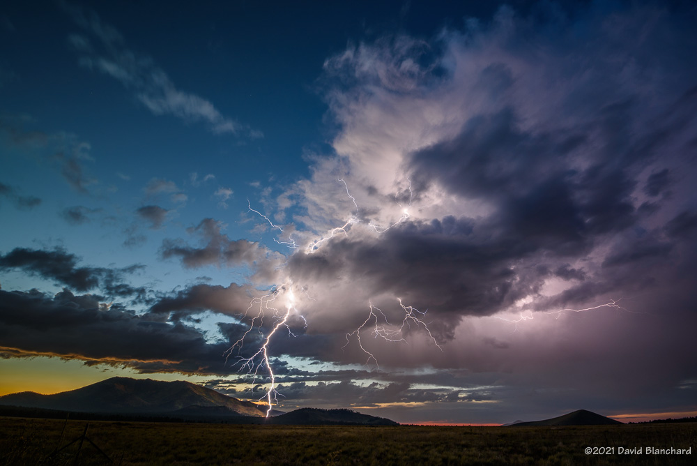
A new storm formed to my southeast as twilight came on and began to produce a lot of lightning. This was the 3rd act of the day and it was a good one.

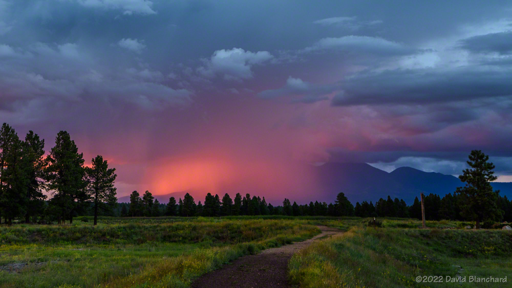
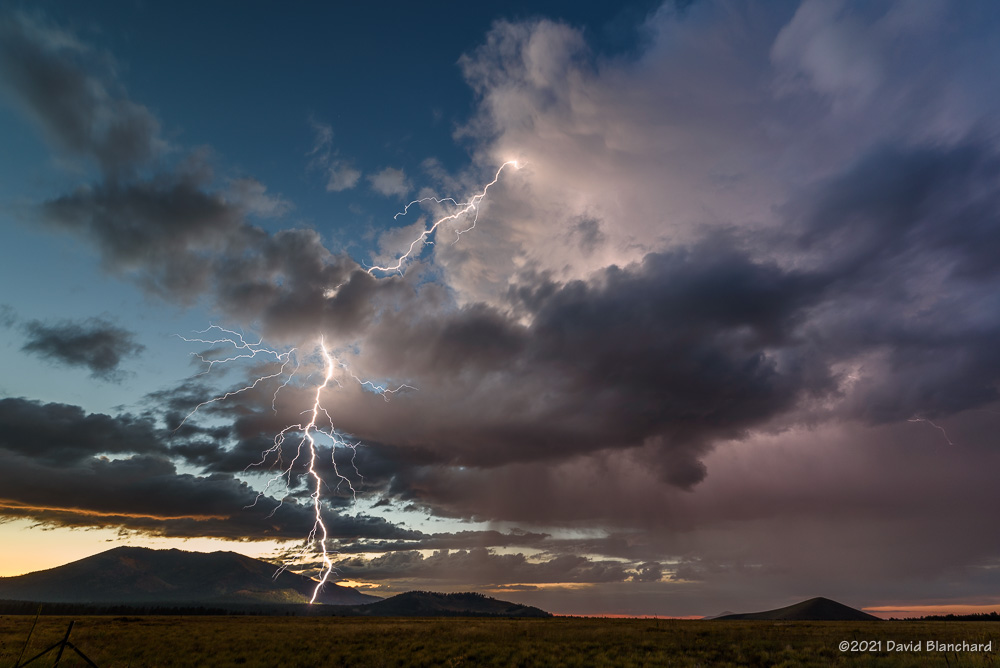
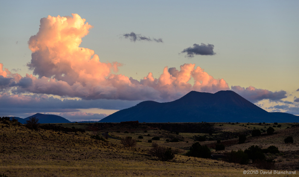
Later in the week I took a short drive to Marshall Lake near Flagstaff to time lapse the early stages of convection over the San Francisco Peaks–and with some reflections in the waters of the lake. A few lightning bolts landed near the peaks adding to the show.

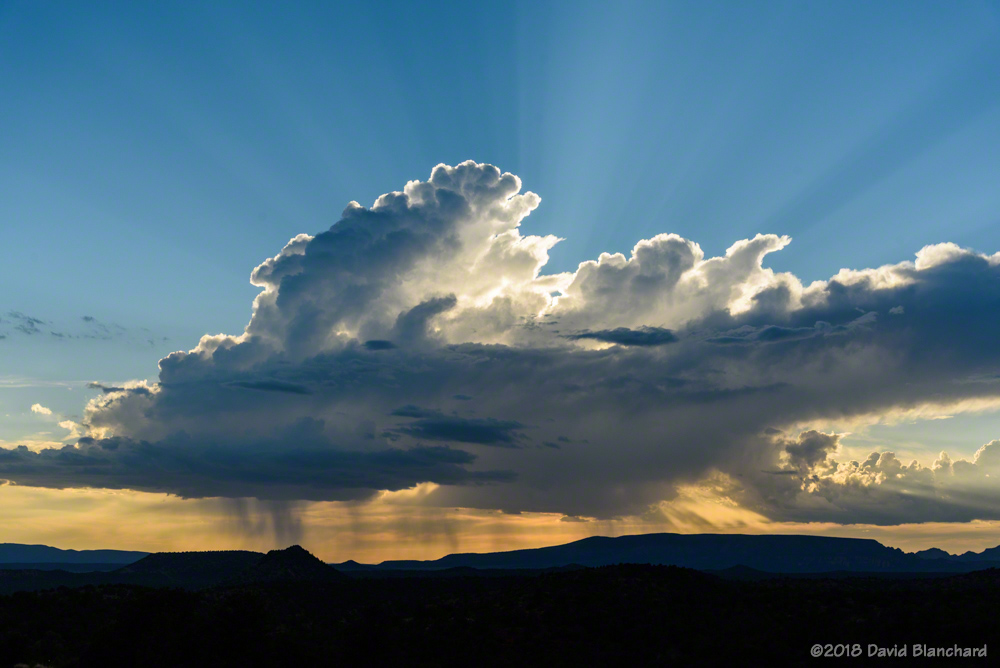
A few more trips to Grand Canyon rounded out the month.

And, now, the monsoon is on hiatus again.

Sunrise, Sunset, Rainbows, and Fog

The North American Monsoon continues to bring convective activity to much of northern Arizona on a daily basis. There have been plenty of opportunities for colorful sunrises and sunsets as well as rainbows and even some fog.

Light rain showers are illuminated by the rising sun over Anderson Mesa.
A partial rainbow appears right after sunrise over Mormon Mountain.
Early morning light on Upper Lake Mary.
Sunset colors illuminate a thunderstorm near Twin Arrows.
The setting sun briefly illuminates heavy rain falling on the San Francisco Peaks.
Light rain from a dissipating thunderstorm is illuminated by the setting sun.
The almost daily rainfall has resulted in many opportunities for morning fog.

The rainy season should continue for at least a few more weeks so there should be additional opportunities for colorful photographs.

Lightning and Rainbows

Twilight lightning over Kendrick Park. The north flanks of Kendrick Peak are illuminated by the bolt.

We are in the midst of the “Transition Season” where the summer monsoon pattern fades away and the mid-latitude westerlies and low pressure systems move across the area. Another of these events is in progress as a weak closed-low moves across the southwest bringing showers and thunderstorms to the area.

Thunderstorms begin to develop over the San Francisco Peaks.

Saturday afternoon we set out for the north side of the San Francisco Peaks hoping that thunderstorms would form over the higher terrain and then move northwestward across Kendrick Park. A few storms did form over the peaks and some of them were briefly photogenic but there was very little in the way of lightning. Eventually, approaching rain chased us from Kendrick Park to the northwest where we set up near Slate Mountain in a large meadow with good views of the peaks.

Distant lightning under the rainbow.
A multi-pronged lightning strike under the rainbow.
Twilight lightning over Kendrick Park.
Twilight lightning over Kendrick Park. The north flanks of Kendrick Peak are illuminated by the bolt.

These slow-moving storms continued to move towards the northwest and this time we got lightning and rainbows—and rainbows with lightning. As the sun dropped lower in the west the rainbow quickly faded and rain was again approaching our location. We retreated back to Kendrick Park—this time with the thunderstorms located to our northwest with light from the setting sun still illuminating some clouds. Lightning stikes were frequent and close enough to fill the field of view of the 17-mm focal length lens. Several of these lightning bolts struck the northern flanks of Kendrick Peak. About a half-hour after sunset it was over and the storms quickly dissipated.

Another fun day of storms and lightning.

250-mb height/winds at 0000 UTC 26 September 2021.
24-hour lightning plot with a lightning cluster near the San Francisco Peaks.

A Winter Rainbow in Flagstaff

Over the weekend we had an extended period of rain in the Flagstaff area. Normally we would see snow at this time of year—it is, after all, the middle of winter. Rainfall amounts were sufficient (1.35 inches at Flagstaff airport) to cause large increases in the flow of Oak Creek where gauges recorded a rise from ~2.4 feet (30 cfs) to 9.6 feet (6900 cfs). Other streams were running high as well.

A winter rainbow in Flagstaff.

I though it might be interesting to look at Lake Mary and Mormon Lake to see if lake levels were increasing as a result of the runoff. Indeed, they were, but not quite as much as I had hoped. Still, water rushing down Newman Canyon, a normally dry wash, into Upper Lake Mary was impressive.

Newman Canyon, a normally dry wash, is filled with runoff pouring into Upper Lake Mary.

Back in December 2004, we had a much bigger rain event. Lake Mary was frozen and the water rushing down the hillsides flowed across the top of the ice. The immense weight of the water caused the ice to break with thunderous booms. That is what I was hoping to experience. Didn’t happen because there was no ice this time.

Stream gauge for Oak Creek showing the rapid rise in stream flow.

My next stop was Mormon Lake. As I drove towards it the sun was able to break through the thinning clouds to my south. I took a quick look in the rear-view mirror to check for rainbows.

And, there it was. A winter rainbow in Flagstaff. Not rare, but certainly not common.


Arizona Monsoon Clouds — August 2018

The setting sun lights up rain curtains as a brilliant lightning bolt strikes behind Wukoki Pueblo in Wupatki National Monument.

A previous post displayed photographs of storms and weather that occurred during July of this year’s North American Monsoon. Here are photographs from August (plus the first day of September).

Cumulus and Cumulonimbus

A search for wildflowers and thunderstorms brought me to Rogers Lake west of Flagstaff. It’s a lake only ephemerally during springs with heavy snow runoff. But it makes a grand place for photographs when a wide-open vista is desired. Earlier convective storms were pushing an outflow boundary southward with new convection developing on the boundary.

Outflow boundary and convection over Rogers Lake with the San Francisco Peaks in the distance.
A distant cumulonimbus can be seen from the Doney Mountain Picnic Area near Wupatki National Monument.
Thunderstorms move across Grand Canyon with low clouds clinging to the higher points and buttes.

There was just enough vertical wind shear on this day to allow some storms to briefly exhibit supercell characteristics and deviate to the right—which brought this thunderstorm near the edge of the North Rim of Grand Canyon.

A strong thunderstorm over the North Rim of Grand Canyon is reflected in a small pool of water.
A weak, late afternoon thunderstorm is backlit by the setting sun.

Fog and Smoke

Sometimes the unexpected can be magical. When fog forms in Grand Canyon the visitors may be disappointed but there is the potential for amazing photographs.

A long-lived cluster of thunderstorms east of Grand Canyon pushed a cool, moist outflow into the canyon producing areas of fog near the South Rim.
More fog in Grand Canyon.

Smoke from the Obi Fire on the North Rim produced both amazing and dull conditions.

Smoke from the Obi Fire on the North Rim creates a colorful sunset.
Smoke from the Obi Fire fills Grand Canyon and reduces visibility.

Sunset and Full Moon

Sunset after the storms can be amazing. And if there is a nearly full moon, things can get very interersting.

A backlit thunderstorm at sunset over Grand Canyon.
Post-sunset colors illuminate the underside of a dissipating shower.
Dissipating cumulus clouds at sunset with O'Leary Peak in the distance.
Dissipating cumulus clouds at sunset with O’Leary Peak in the distance.
Dissipating showers are backlit by the setting sun.
The nearly full moon illuminates the inner canyon as twilight fades behind a distant thunderstorm.
A dissipating thunderstorm anvil cloud is seen above pueblo ruins in Wupatki National Monument at sunset.

Rainbows

A double rainbow above Cathedral Rock in Sedona.
A rainbow, dissipating anvil, thunderstorm, and towering cumulus.

Lightning

And lightning…

An amazing anvil bolt...and too close!
An amazing anvil bolt…and too close!
Lightning west of Sedona, Arizona.
Anvil bolt over Cathedral Rock. (It's out of focus--<u>you</u> try focusing in the dark!)
Anvil bolt over Cathedral Rock. (It’s out of focus–you try focusing in the dark!)
Lightning illuminates Grand Canyon at night.
Lightning strikes the Moenkopi Plateau (composite image).
Several bolts strike behind Wukoki Pueblo in Wupatki National Monument.
The setting sun lights up rain curtains as a brilliant lightning bolt strikes behind Wukoki Pueblo in Wupatki National Monument.

It’s early September and the summer monsoon pattern is beginning to fade away. Soon it will be time to start thinking about autumn colors on the peaks.