2005 Storm Chase Summary and Photographs

David Blanchard
Flagstaff Arizona

All photographs were shot on Fuji Provia 100f film. Camera equipment included a Nikon FM with three AI Nikkor lenses: 28mm f/2.8; 50mm f/1.8, and 80-200mm f/4.0-f/5.6. All slides were scanned with a Nikon LS-2000.

Although much of 2005 provided excellent chase opportunities and great synoptic scale weather patterns for supercells, there was a period in late May in which a large ridge developed over the central portion of the country. This ridge resulted in less than optimal shear and instability for supercells in most locations. The only place that was able to produce thunderstorms each day with at least a chance of supercells was the High Plains of eastern Colorado and New Mexico. And as luck would have it, my previously scheduled period for storm chasing fell during this period of atmospheric ridging. Despite suboptimal conditions, I still managed to see some interesting storms and to get some great photographs.

22 May 2005
Sunset in New Mexico

Sunset near Fort Union, New Mexico.

Sunset near Fort Union, New Mexico.

I started the day in my hometown of Flagstaff, Arizona, and began the drive eastward with hopes of storms, severe weather, tornadoes and -- most of all -- great photographs.

I got my first set of photographs on Interstate 25 north of Fort Union, New Mexico, as the sun set on some weak storms developing over the higher terrain. The sunset colors were quite impressive.

Overnight was spent in Raton, New Mexico.


23 May 2005
Cumulonimbus Mammatus

Cumulonimbus mammatus southwest of Limon, Colorado.

After a quick check of data this morning, I selected an initial target of Limon, Colorado. From Limon, it's possible to get good roads north, east, southeast, south, southwest, west, and northwest.

As I left Colorado Springs and drove towards Limon, thunderstorms began to develop over the higher terrain of the Palmer Divide. The best photographs of the day were of these CBMam -- cumulonimbus mammatus -- taken southwest of Limon.

From Limon, I travelled east to Siebert, north to Anton, then east to Idalia. There were severe thunderstorms in every direction but because of all the intervening clouds, there was nothing particularly photogenic and I took no photographs.

I spent the night in Burlington, Colorado, along with many other chasers.


24 May 2005
Wave clouds in the morning sky

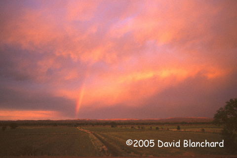
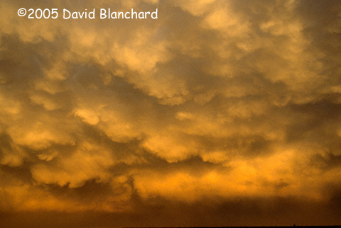
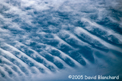
Wave clouds observed on a beautiful Colorado morning.

Supercell with a circulation

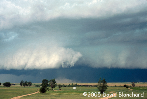
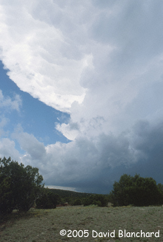
Supercell near Akron, Colorado, with a gust front vortex.

Kiowa County Supercell

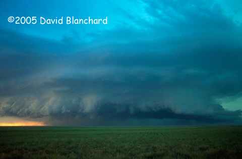
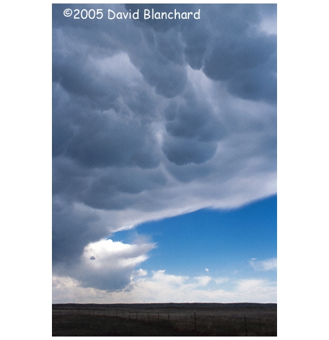
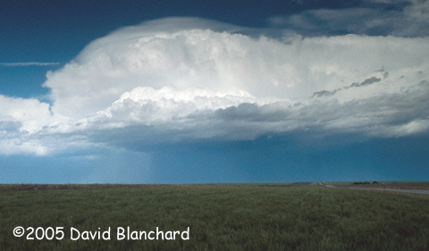
Kiowa County supercell (3 second exposure).

In the morning, I was able to team up with other chasers, including Matt Crowther and Betsy Abrams, John Monteverdi, and John Moore.

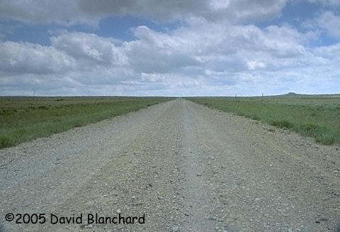
All agreed that the best target area was not too far to our north so we drove north to Wray, then west to Yuma and checked new data at the library. Storms were already in progress north of the South Platte River and we only had to wait until these moved southeastard and crossed the river into the better road network.

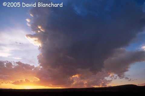
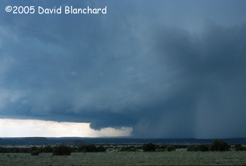
As the storms moved towards Akron, a broad but weak circulation developed on the leading edge of the storm outflow. It did not have the characteristic look of a gust-front vortex but, rather, looked more significant. Could this be a front flank mesocyclone along the leading edge of the gust front? Its broad scale and longer-than-typical lifetime of a "gustnado" along with rotation in the cloud above leaves us pondering what, exactly, did we see?

From Akron, our only road option was south before we could go east again. We did so and drove under some rapidly developing storms but were able to avoid any large hail. We emerged on the east side, then drove south. Along the way, we passed numerous tour groups.

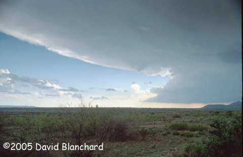
Back in Burlington, we updated our radar information and decided that we could intercept the tail end storm if we first drove east to Goodland, then south to Tribune, then back to the west. We intercepted this magnificant supercell near Towner and followed it south to near Holly.

Travelling westward from Holly we encountered squalls with intense rainfall and winds strong enough to rock the car. We had no choice but to pull off onto the shoulder and wait and hope that there was no large hail. And there wasn't. We overnighted in Lamar, Colorado.


25 May 2005
Supercell from Tremintina Creek NM

Supercell as seen from Trementina Creek area of New Mexico.

Supercell with a needle funnel

Closeup of updraft and anvil with a small needle funnel visible.

The cold front came surging south early in the morning leaving us in cool air and overcast conditions. We travelled southward to New Mexico to break out of the stable air and into a better environment. The first data stop was the library at Boise City, Oklahoma, followed by another library stop in Clayton, New Mexico.

From here, we zig-zagged south and west, south and west across a sparsely roaded region of New Mexico. The scenery was enjoyable. Eventually, storms formed over the higher terrain to our west and we were able to photograph this supercell. Note the tiny needle of a funnel descending from the mammatus.

The night was spent in Tucamcari, New Mexico -- a small city with a lot of hotel rooms.


26 May 2005
Rainbow at sunset near Socorro

Rainbow at sunset near Socorro, New Mexico.

Today was a down day. My original plan was to drive to Carlsbad Caverns. Then I got a good look at a map and realized how far away that was -- and how far out of position it would put me if I had to head back north the next day.

My next plan was to drive to White Sands. I never made it there, either. Along the way, a few small storms developed and I was more interested in both cloud and flower photography.

Eventually I made my way back towards the Interstate near Socorro where I saw one of the most fantastic rainbows I have ever seen. Because of traffic, roads, etc., I was unable to photograph it until it had faded to a faint shadow of its previous glory. Too bad.


27 May 2005
Hail producing supercell in NM

Hail producing supercell south of Romeroville, New Mexico.

Supercell south of Tecolotito

Supercell south of Tecolotito, New Mexico.

I started the day in Belen, south of Albuquerque. The best target appeared to be somewhere in north-central or northeast New Mexico. I decided the best approach was I-25 to ABQ, then east on I-40. Once in ABQ, heavy traffic forced me to stay on I-25. For a few moments, I was content to take this way but changed my mind and backtracked so that I could take I-40 east. I later learned that chasers on I-25 found themselves under a couple of hail cores with golfball-size stones. I'm glad I went east on I-40. From there, I was able to travel north on US84 to approach this storm from the south and get a good view of this supercell.


28 May 2005
High-based, low-topped storm in eastern Colorado

High-based, low-topped storm in eastern Colorado.

Sunset colors on a thunderstorm near Syracuse, Kansas.

Sunset colors on a thunderstorm near Syracuse, Kansas.

This was my last full chase day before heading home. The best target appeared to be east-central Colorado. I intercepted some high-based, low-topped storms near Cheyenne Wells, Colorado, and followed them to Sharon Springs, Kansas. A brief gust-front vortex was all this storm could muster.

Later, there was a great rainbow followed by sunset colors on the underside of the thunderstorm anvil.


29 May 2005
Hail producing thunderstorm in northeastern New Mexico

Hail producing thunderstorm in northeastern New Mexico.

Windmill and thunderstorm in northeastern New Mexico

Windmill and thunderstorm in northeastern New Mexico

Wild flowers in southeastern Colorado (Scarlet gaura)

Wild flowers in southeastern Colorado (Scarlet gaura).

A long and straight road in the plains of southeastern Colorado

A long and straight road in the plains of southeastern Colorado.

Time to drive home to Flagstaff, Arizona. There remained a chance of supercells in northern New Mexico so I held out hope that I would encounter some interesting storms as I travelled south. Shortly after crossing from Colorado into New Mexico, I was treated to a severe thunderstorm to my east. I was able to get some nice photographs as it moved across the low foothills.