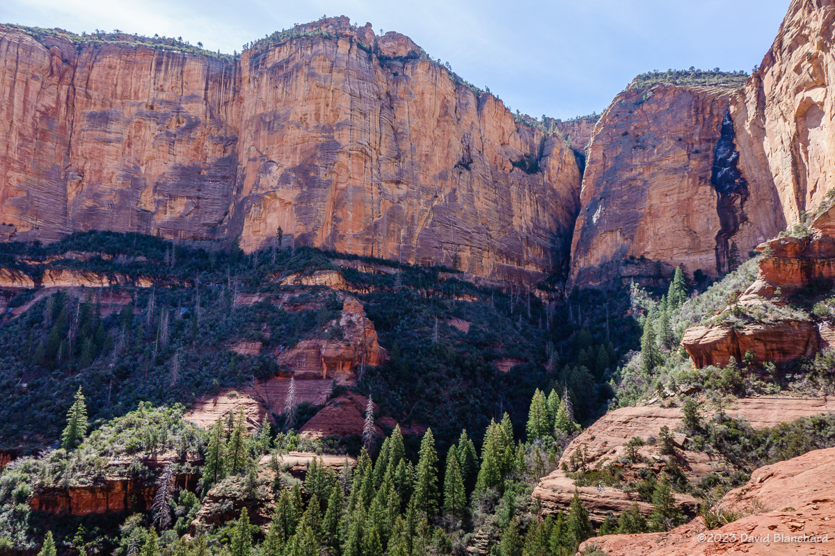
A few more images showcasing fall colors in northern Arizona. It was great while it lasted!


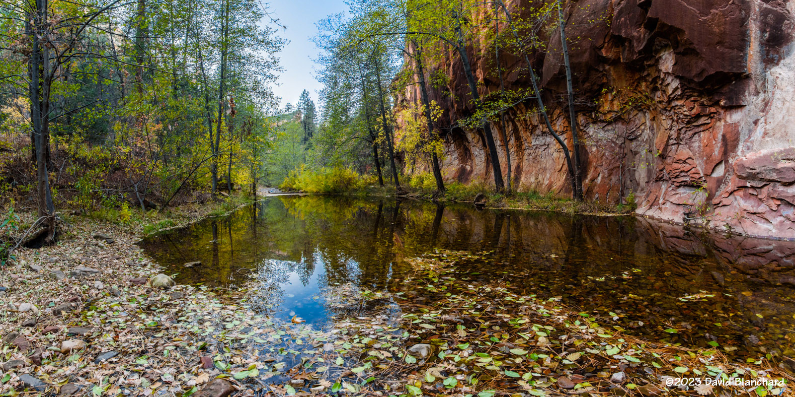
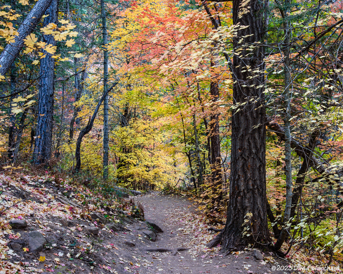


A few more images showcasing fall colors in northern Arizona. It was great while it lasted!
The upside to the epic Winter we recently experienced is the tremendous amount of snow melt that filled many of the lakes across northern Arizona. Over the past several weeks we have visited several of these by car, mountain bike, running, and hiking.

This is one of my favorites. It shows Upper Lake Mary, a portion of the spillway, and Lower Lake Mary. It’s also nice that there is a nice mirror reflection of the trees in the water. This shot is only possible when both lakes are full.
Earlier we had visitied Marshall Lake. It’s not as full as it was a few years ago but considerably better than the past several years.

We did a trail run along the Arizona Trail on top of Anderson Mesa and visited Prime Lake and Vail Lake, both with lots of water.


Here are some additional images of Lake Mary taken on various days in April.


We rode our mountain bikes up Schultz Pass Road to Schultz Tank. It has been a small puddle the past two seasons but is once again full.

Finally, we did a short hike through the upper portions of Pumphouse Wash to this set of cascades.


The snow melt is done and we are now in our dry season. Lake levels and stream flows will diminish until the summer rainy season starts in July.
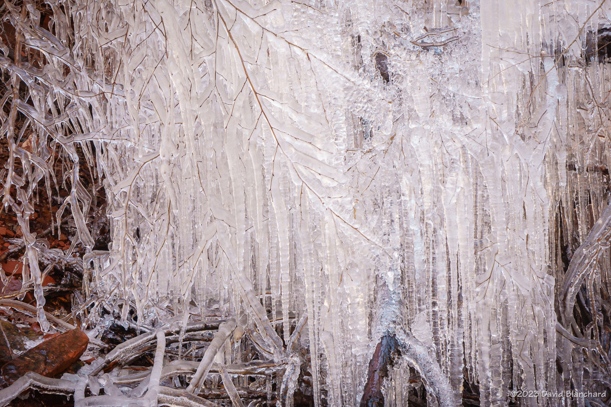
It’s been very warm the past few days but just a week ago we had several cool days and very cold nights. While hiking up the popular Boynton Canyon in the Red Rocks–Secret Mount Wilderness near Sedona we encountered this wonderful ice sculpture. It was located just a few steps off the trail–but not visibile from the trail–and under an overhang where the water dripped down and froze on the bush. I’m certain by the afternoon it had melted.

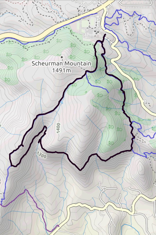
Last week we did a trail run on Scheurman Mountain using several trails to create a loop of the mountain. Along the way, the trail crosses a shallow canyon which often has running water.
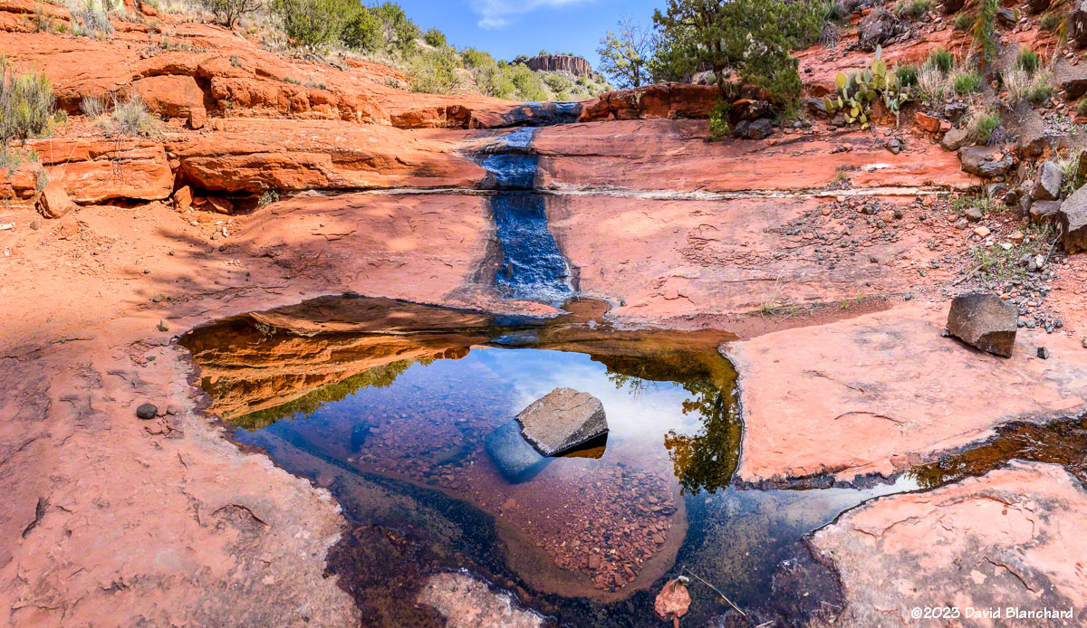
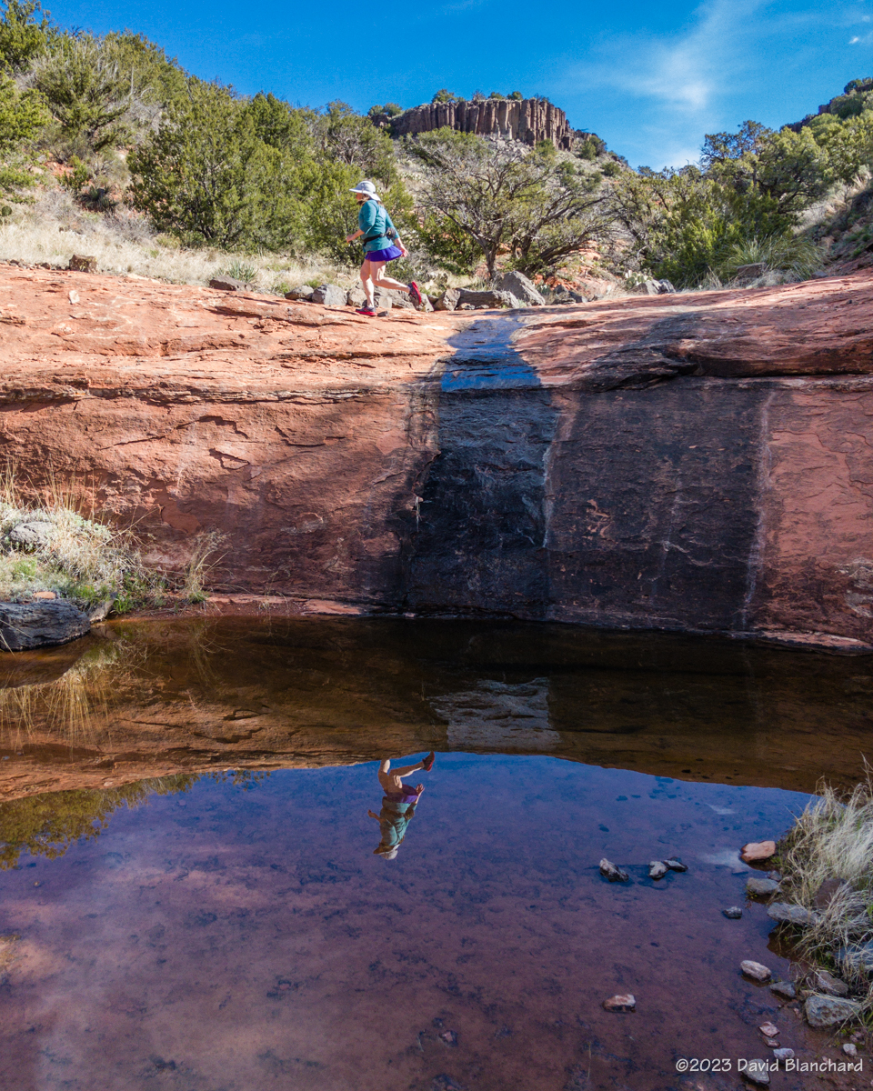
With warmer temperatures it won’t be long until this running water is only a memory.
This Winter has been relentless with snowfall now at about 200% of normal for Flagstaff. Many of these storms have made it difficult to get to various locations for shooting photos of the weather. Fortunately, the last few storms have allowed me to do some pre-dawn travel to favorite locations.
The first two photos are from the morning of 16 March 2023 when I thought there was a good chance of low clouds and fog in Grand Canyon. In fact, there was too much fog and I was only able to briefly see into the canyon while at Lipan Point. I finally moved westward to Moran Point where there was a larger break in the fog allowing sunlight to illuminate the canyon.


A week later we had a snow-turning-to-rain event that left the roads relatively easy to travel and I ventured out to Mormon Lake on the morning of 23 March 2023. The abundance of moisture over the previous few days resulted in lots of fog in low-lying basins including Lake Mary and Mormon Lake. Clear skies to the east allowed the rising sun to illuminate the San Francisco Peaks in the distance.


I was also interested in capturing images with a Glory/Brocken Spectre and fogbows. Both were faintly visible in some of the photos where I was above the fog. A better fogbow photo was shot when I was in the fog.
And here is a time-lapse video of the swirling fog in the Mormon Lake basin.
Time-lapse video of fog swirling in Mormon Lake basin.
The medium-range forecasts indicate that Winter is not yet done.