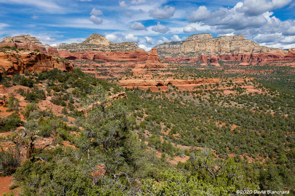
Here are a few photographs taken on some recent hikes and trail runs in Sedona.
First was a hike across the top of Mescal Mountain. There are well-defined trails that go around the mountain but only faint tracks that go up and over the top. There are even a few spots that require some basic rock climbing moves—but nothing too difficult.
View from the top of Mescal Mountain towards Long Canyon.Zoomed in view of the northern ridge of Mescal Mountain with some caves.Hiker atop Mescal Mountain.
From the top of Mescal Mountain one can see across Long Canyon into the Red Rock-Secret Mountain wilderness area. One can also see two dark openings in the middle distance. The one on the left is the so-called “birthing cave.” Note in the second image the crowd of people entering and leaving the site.
Striations and channels in the rocks in Dry Creek.Jumping at the far point of the run.
A few days earlier a small group of trail runners had done “Earl’s Loop” trail run. You won’t find this on any modern maps but you might find it on some older maps. It does not see much traffic and the trail is faint in spots but it has some great views into the Red Rock-Secret Mountain wilderness area. And, of course, the obligatory group jump— with some jumping on the count of 2 instead of 3.
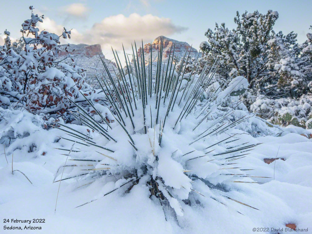
Snow in the desert is amazing. Desert plants and red rocks are covered with snow and birds are just a bit bewildered by the whole experience.
Red rocks and snow covered trees near Sedona.Snow-covered desert plants near Sedona.
A very cold storm system moved across Arizona on Tuesday and Wednesday and snow levels fell well below 4000′ feet bringing snow to the higher deserts including Sedona. I was pretty certain I was going to make the trip to Sedona for sunrise on Thursday morning.
Around 3 a.m. the snow plows came through the neighborhood pushing up a 2 foot berm of ice and snow that would need to be cleared before I could get out of the driveway. Classic—happens just about every time!
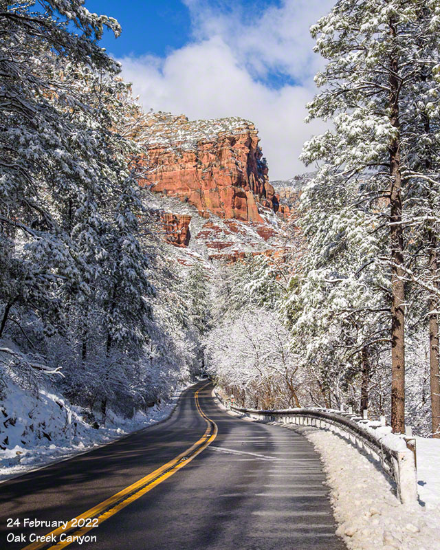
Once in Sedona I followed a trail that had not seen any human traffic since yesterday but there were coyote tracks. I never saw the critter and it was probably just as well.
New snow covers red rock and trees in Oak Creek Canyon.
The snow in Sedona will be mostly gone within a day or two.
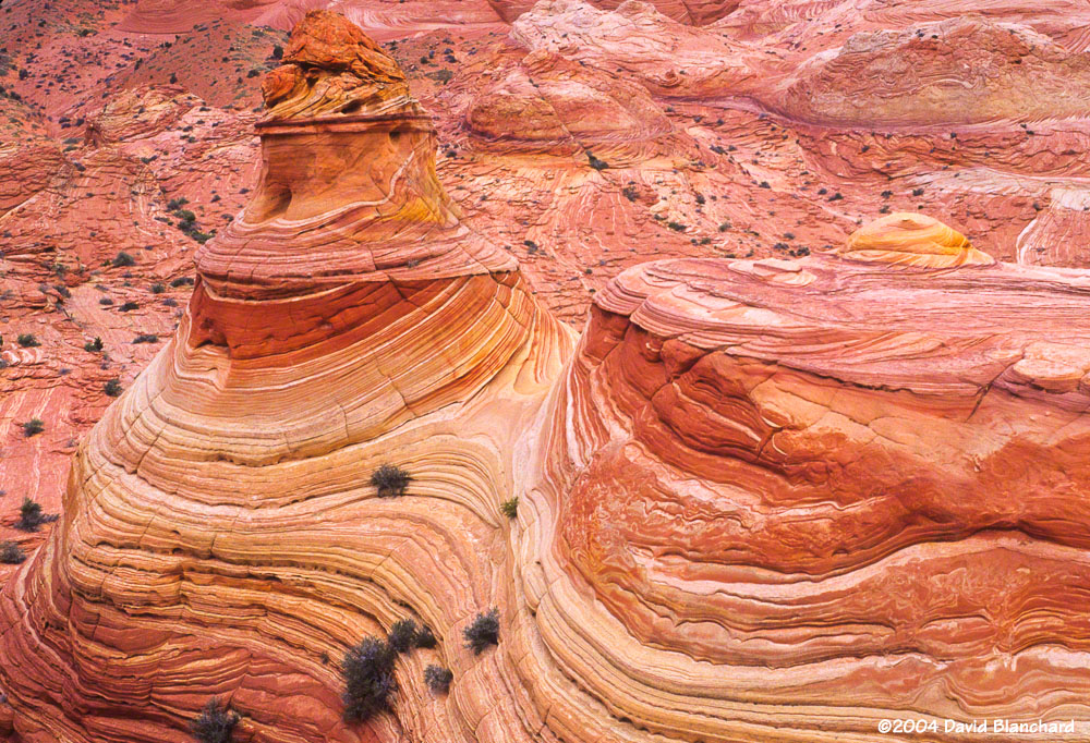
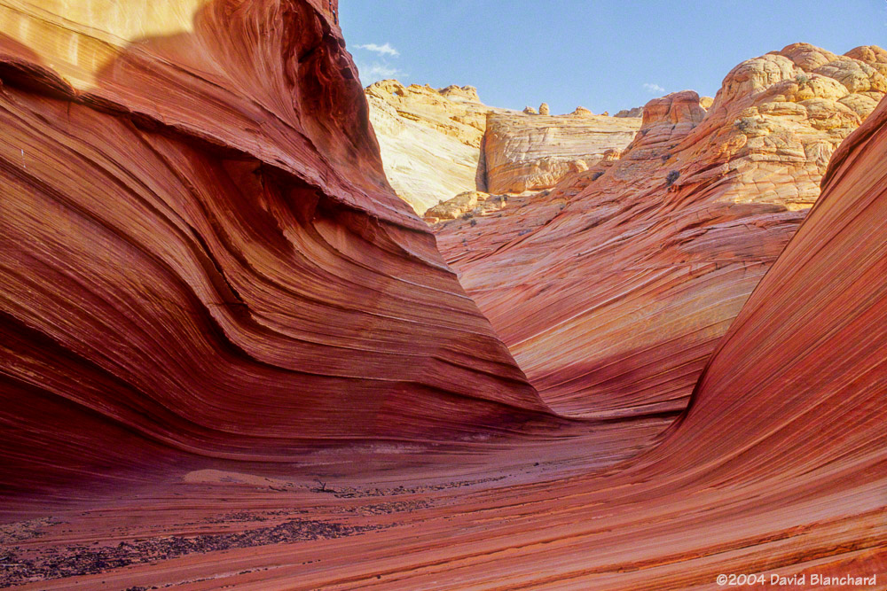
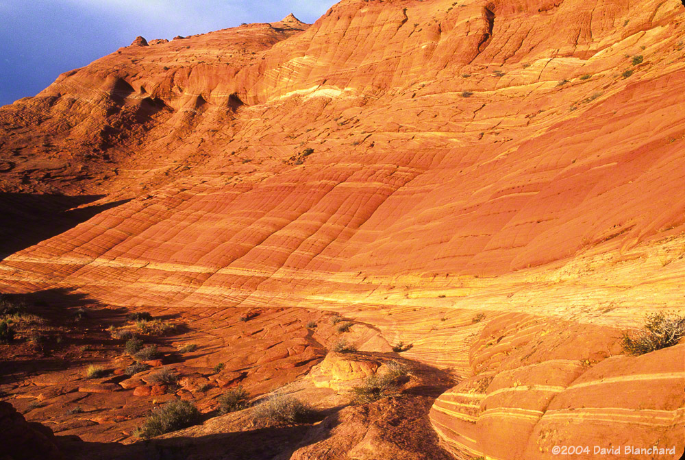
My first and only visit to Coyote Buttes and The Wave was in June 2004. A coworker had permits for two back-to-back days but was unable to use them. The BLM permit system was quite different then from what it is now. Getting multiple-day permits was not unusual. Nowadays, getting a permit at all requires a fair bit of luck and perseverance. I consider myself fortunate to have had a chance to visit this amazing location.
Coyote Buttes North.
We arrived at the trailhead in mid-day with temperatures, as I recall, in the upper ’90s. It was mid-June and the North American Monsoon and rainy season had not started. Even so, there were clouds and a few rain showers in the area.
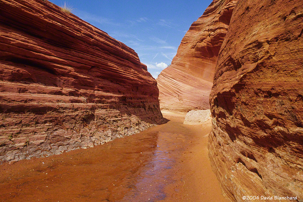
Pools of water near Coyote Buttes.Narrow passageways at Coyote Buttes.Textured landforms at Coyote Buttes.
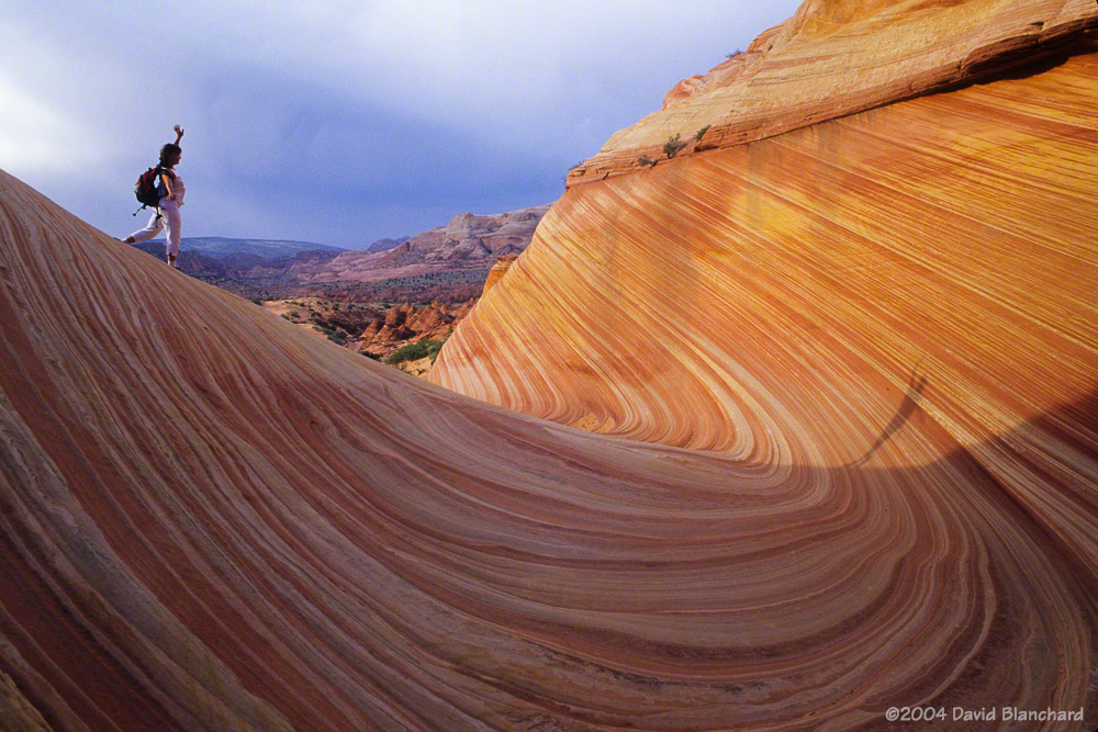
We hiked out to the rocks and made good time arriving in the late afternoon. There were a few other visitors but they left after a short time and we had the place to ourselves for the next several hours. Really—there was no one else there. Hard to believe!
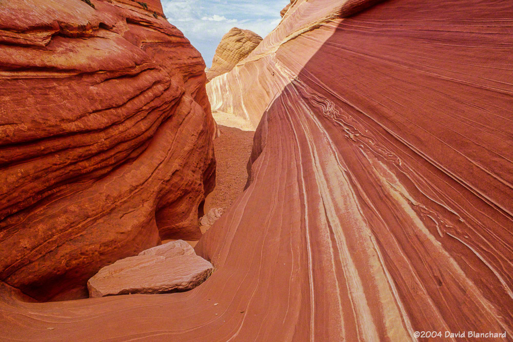
Drifted sand at Coyote Buttes.Clouds and showers develop around Coyote Buttes.
We wandered around for hours taking photographs and picnicking and enjoying the solitude. For a few brief moments, one of the rain showers produced a rainbow but I was too slow to move the camera gear and get the shot.
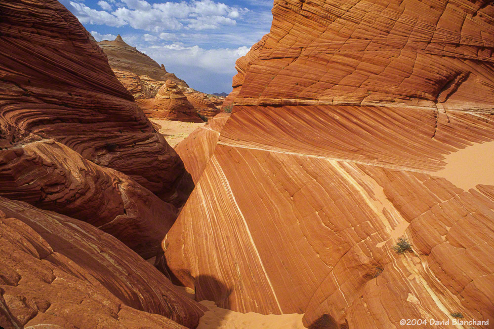
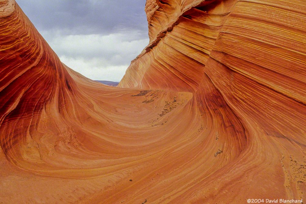
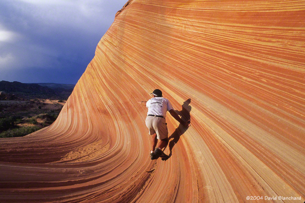
Clouds drift away and the sun returns in late afternoon at Coyote Buttes.Afternoon sun makes shadows on the walls.Surfing The Wave.
As the sun dropped in the west and temperatures began to cool we finally left and began the hike back to the car. Somewhere along the way we realized we were on a different trail—or perhaps no trail at all—but our starting point was still obvious and we continued on.
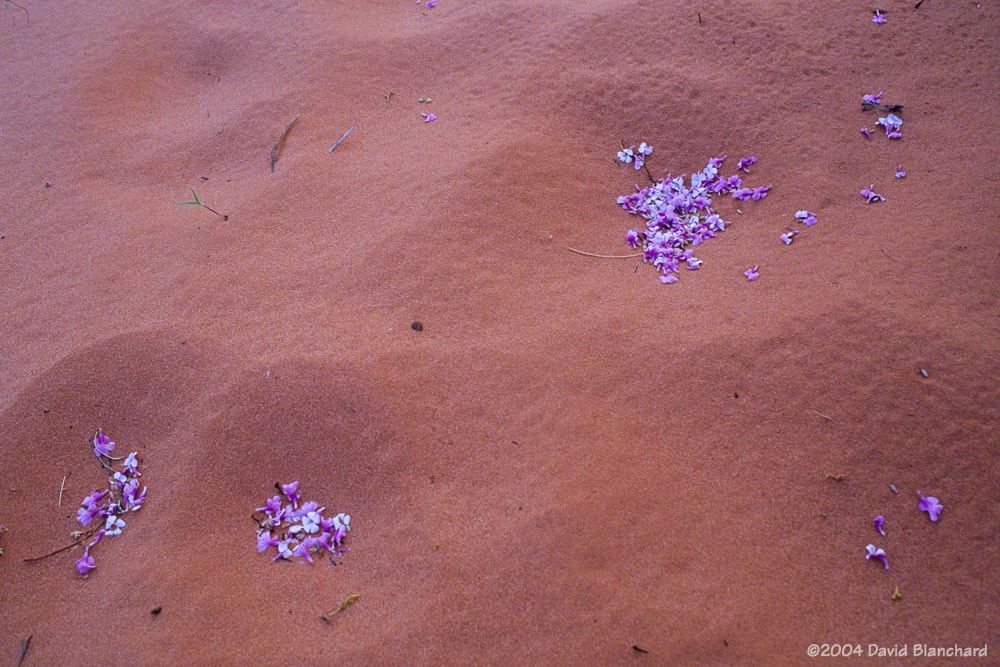
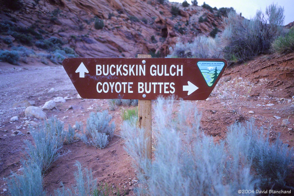
Flower petals in sand.Late afternoon light illuminates the rocks on our hike out of Coyote Buttes.The old sign showing trails to Coyote Buttes and Buckskin Gulch.
The next morning we decided we did not want or need to hike out there again so we did not use our 2nd day permit. Instead, we travelled down Buckskin Gulch—a place we had heard about but not yet had a chance to explore. It was a great hike and we did not regret our choice.
Here are photographs (shot on Fuji Provia slide film and recently scanned) from the afternoon that we spent at Coyote Buttes and The Wave.
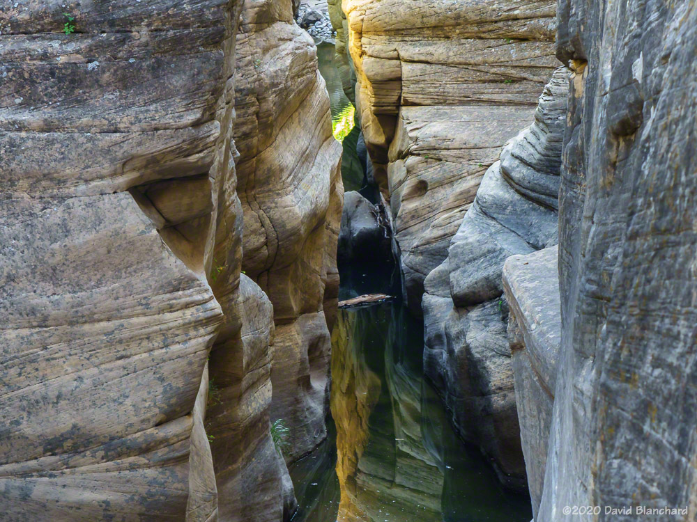
Pumphouse Wash is a canyon that is ignored by most of the people who drive past it every day. It is located in the upper reaches of Oak Creek Canyon right at the bottom of the well-known switchbacks. No matter — its best quality is that very few people hike it.
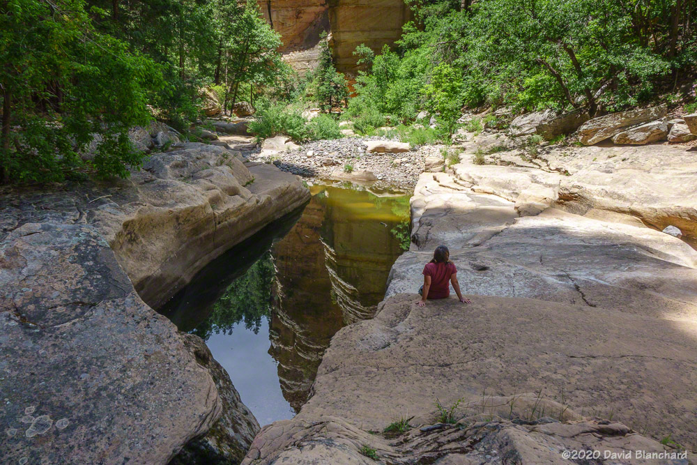
Canyon walls are reflected in a pool in Pumphouse Wash.
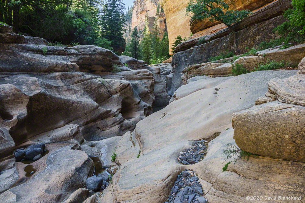
During heavy rains and snow melt there will be water flowing down the canyon. Otherwise it’s a dry wash with a series of pools. The canyon is narrow with steep walls. It’s full of boulders strewn in the stream bed that have been washed down in great floods. The plethora of boulders makes hiking in this canyon a slow, arduous process. One must hop from rock to rock for miles.
A shady location for a lunch break in Pumphouse Wash.Upper section of the narrows in Pumphouse Wash.The narrows in Pumphouse Wash.Lower section of the narrows in Pumphouse Wash.
But the rewards are worth the effort. You won’t encounter many other hikers. Maybe even none. And there are beautiful pools and narrows if you travel far enough up the canyon. Late in the spring the pools are still deep and clear and inviting enough for swimming. By early summer, however, they have warmed and filled with algae and, maybe, not so inviting. Timing is important.
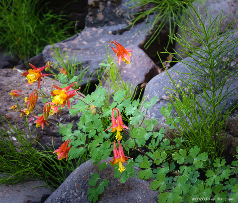
Columbines in the deep shadows of Pumphouse Wash.
So we recently hiked up from the bottom of the switchbacks up to the confluence with a small side canyon that comes in from the east. No name is given on the maps for this feature — not to be confused with James Canyon farther upcanyon. This is about 2¼ miles from the start and it took us about 2½ hours. That’s less than one mile per hour. There was no one else around — although we could hear hikers farther downstream owing to the echoes off the canyon walls. We stopped in the shade and had a leisurely lunch followed by a swim in one of the deeper pools. And then back in the shade for more lounging.
Clear, blue skies are reflected in the waters of a pool in the canyon.
But eventually it was time to go. It was now mid afternoon and the sun had moved around to the northwest leaving us in shade for most of the trip down canyon. Good thing, too, because it had been sunny and hot on the way up and we were worried about running out of drinking water. Also, with the canyon floor in the shade it was easier to take photos of the pools of water and the short section of narrows.
Light reflected from the canyon walls onto a small pool in the canyon.
And, then, there was that magical moment when the light created a perfect situation. The sun lit up a section of the canyon floor which was reflected upwards to an overhang. The reflected light on this overhang was beautiful — but this illuminated overhang was reflected in a pool of water surrounded by deep shadows. Amazing! Move a little closer and the pool and reflection did not line up. Move a little farther away — same thing. Just one spot — and it was perfect.
Most of the time when we hike West Fork Oak Creek we do it from the bottom up. Only once before have we done top-to-bottom and that was back in 1999. We were new to northern Arizona and had read Tyler Williams’ Canyoneering Arizona that this could be done in one very long, hard day. He was right about the long and hard. We have since referred to that epic day as our bootcamp hike.
The start of the hike on Woody Mountain Road.West Fork Oak Creek. You have been warned of the difficulties that lie ahead.
The passage of time can dim the memories of how hard and unpleasant things were. So here we were in 2019, twenty years later, and we wanted to do this hike again but with some modifications. We were not planning on hiking the entire length of the canyon. Instead, we would simply head down canyon and turn around when we had enough.
The first few miles feature a dry wash filled with boulders, sand, and thick vegetation. There is no trail.
It didn’t take long to realize that even this would be a challenge. There is no maintained trail—and not even much of any hint of a trail at all. The vegetation was so thick we had to bushwhack our way through it. Remember that the Slide Fire in 2014 burned through this area (mostly low intensity) and this thick vegetation may be the result of the burn and regrowth. And there was lots of poison ivy. After the first few attempts to get around it we gave up and just plowed through it.
It took us about 2 1/2 hours to reach the first set of narrows about 3 miles down canyon. Just below the narrows is the confluence with Casner Cabin Draw—which ended up being our turnaround spot. We had some commitments that evening so we did not have unlimited time for exploration. Maybe that was a good thing!
The first narrows are encounted just upcanyon of the confluence with Casner Cabin Draw.At the first narrows (2019).At the first narrows (1999).
I had just been looking at some old photographs from that 1999 hike so I remembered a few locations and took new photographs in the same spots. The tree on the right has grown substantially in 20 years.
Navigating the boulders in the dry narrows.
We did not encounter any water in the stream bed until the narrows and even then it was a small pool only a few inches deep and a few feet wide.
Wading through the cold pools (1999).
I’ve also included a photo (a scanned Kodachrome slide) from that 1999 hike showing one of the “must swim” cold pools of water.
We enjoyed the quiet and solitude of the upper canyon.