Beautiful Sunset Followed by Snow

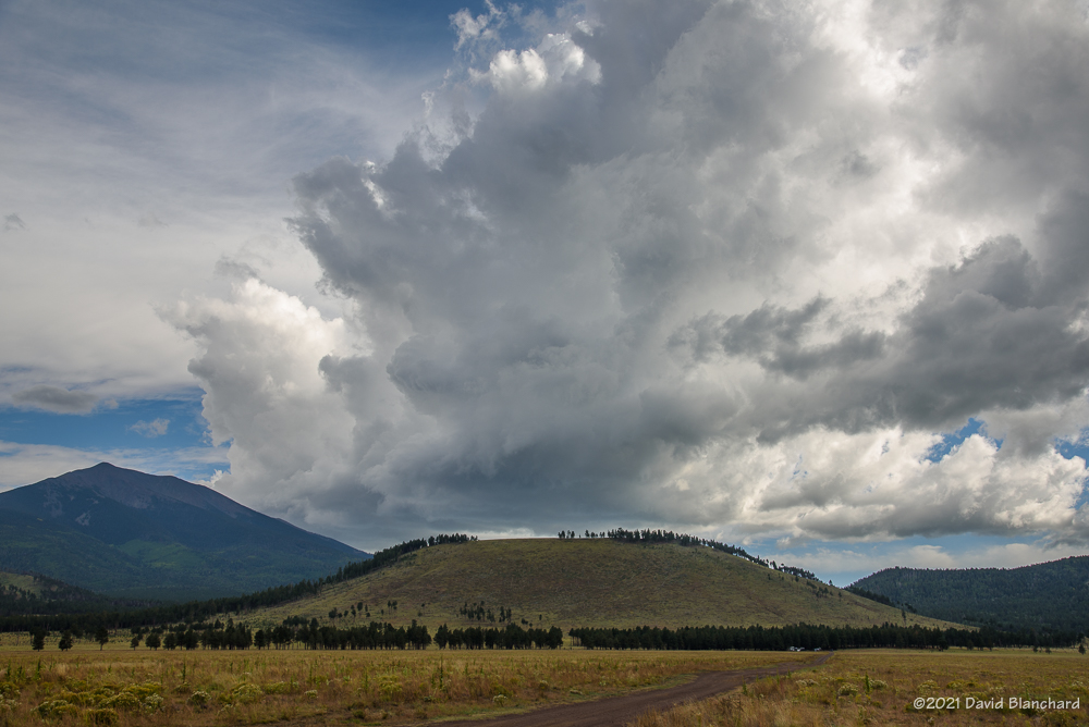
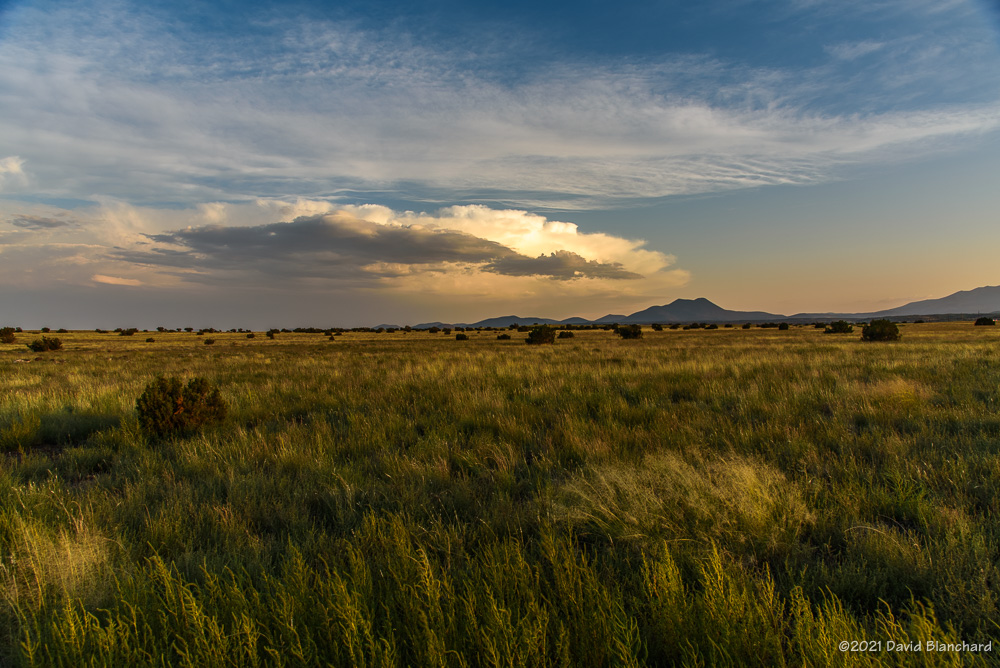
A strong storm system approached the southwest yesterday and moved through the state overnight. Ahead of the storm, clouds began to increase just before sunset and I found myself at the Mormon Lake overlook. The cumulus clouds were fairly shallow so that the sunlight hitting the tops of the clouds was scattered downward and provided some diffuse lighting and color to the cloud bases.

The setting sun faintly illuminates the meadows of Mormon Lake and provides some color to the field of cumulus clouds.
A few minutes later and the sun is now illuminating the bases of the clouds.

There was also a thin gap between the clouds and the ground allowing for just a few minutes of direct sunlight.

Here are a few photographs of the sunset and clouds along with some sunlight spilling across the currently dry lakebed of Mormon Lake.

Band of showers and thunderstorms associated with the advancing cold front.

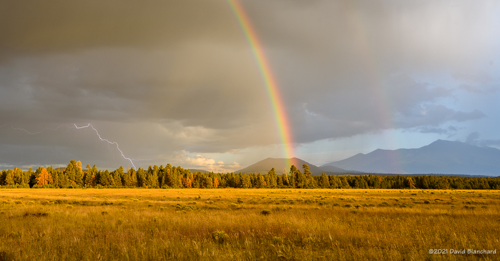
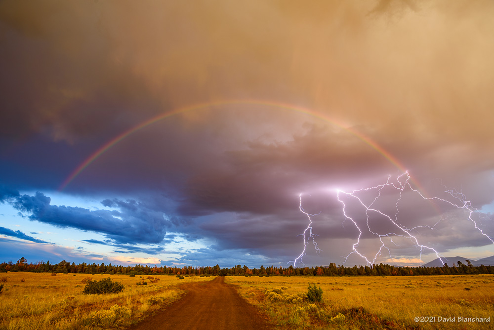
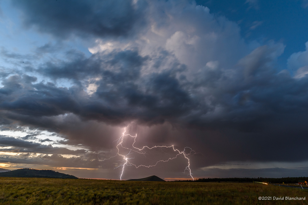
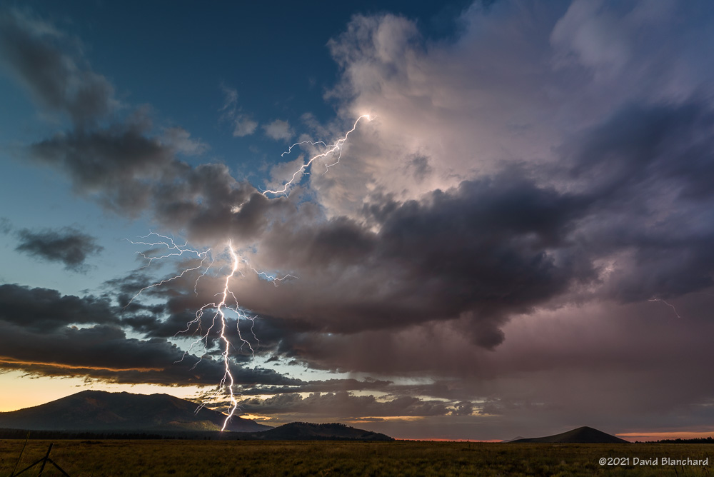
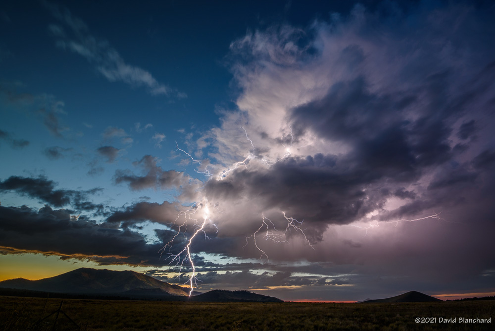
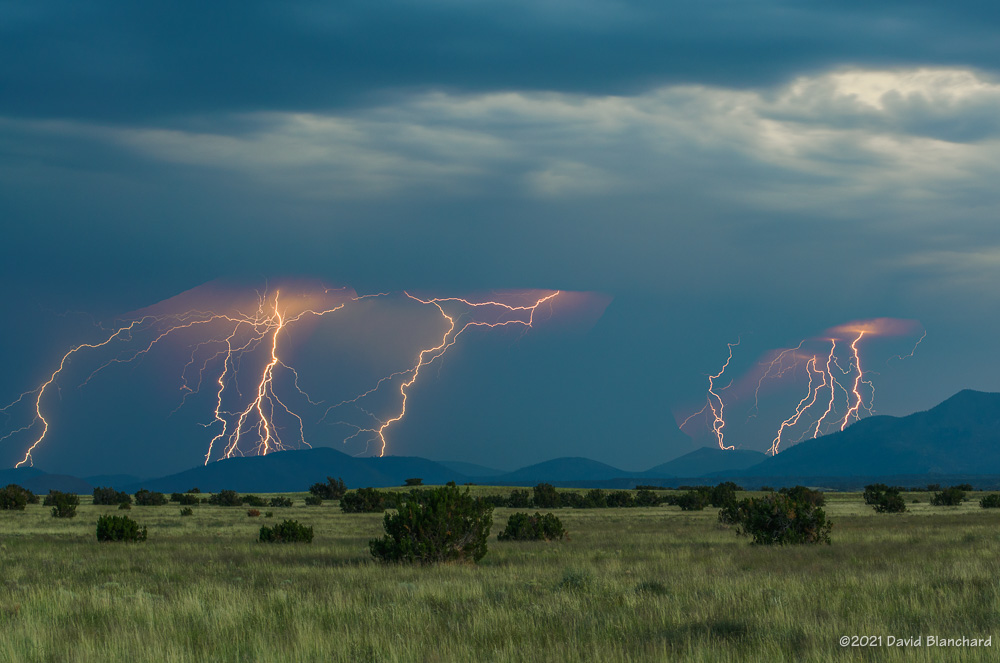
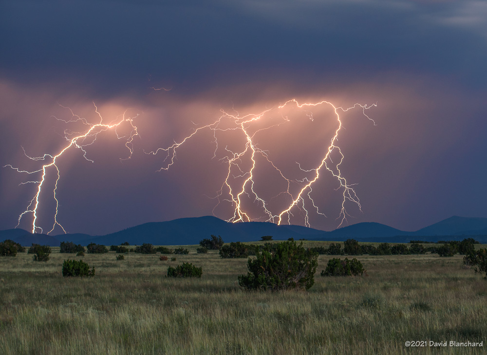
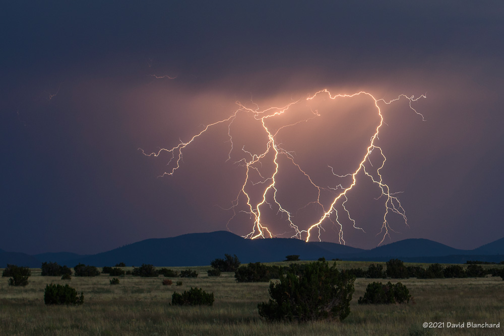
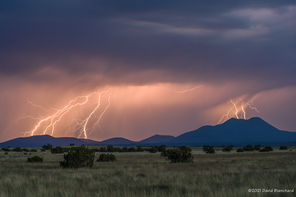
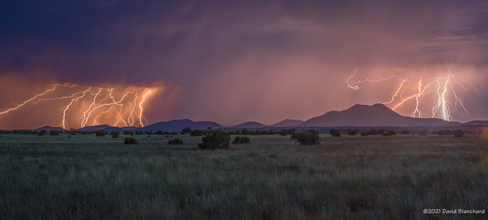
As the storm and cold front approached showers and thunderstorms quickly developed with a line of strong thunderstorms developing about an hour after sunset. There was quite a bit of lightning as the line of storms moved across the area. The sound of rain faded as it was replaced by snow falling in the wake of the front.

New-fallen snow lies on this cinquefoil plant.

In the morning there was snow covering the ground. Measurements were difficult as strong winds during the night had blown the snow such that some areas had a few inches and other areas were bare.

The snow juxtaposed with autumn colors was very pretty but my favorite photograph was the snow on this cinquefoil that still has some flowers.

Lightning and Rainbows

Twilight lightning over Kendrick Park. The north flanks of Kendrick Peak are illuminated by the bolt.

We are in the midst of the “Transition Season” where the summer monsoon pattern fades away and the mid-latitude westerlies and low pressure systems move across the area. Another of these events is in progress as a weak closed-low moves across the southwest bringing showers and thunderstorms to the area.

Thunderstorms begin to develop over the San Francisco Peaks.

Saturday afternoon we set out for the north side of the San Francisco Peaks hoping that thunderstorms would form over the higher terrain and then move northwestward across Kendrick Park. A few storms did form over the peaks and some of them were briefly photogenic but there was very little in the way of lightning. Eventually, approaching rain chased us from Kendrick Park to the northwest where we set up near Slate Mountain in a large meadow with good views of the peaks.

Distant lightning under the rainbow.
A multi-pronged lightning strike under the rainbow.
Twilight lightning over Kendrick Park.
Twilight lightning over Kendrick Park. The north flanks of Kendrick Peak are illuminated by the bolt.

These slow-moving storms continued to move towards the northwest and this time we got lightning and rainbows—and rainbows with lightning. As the sun dropped lower in the west the rainbow quickly faded and rain was again approaching our location. We retreated back to Kendrick Park—this time with the thunderstorms located to our northwest with light from the setting sun still illuminating some clouds. Lightning stikes were frequent and close enough to fill the field of view of the 17-mm focal length lens. Several of these lightning bolts struck the northern flanks of Kendrick Peak. About a half-hour after sunset it was over and the storms quickly dissipated.

Another fun day of storms and lightning.

250-mb height/winds at 0000 UTC 26 September 2021.
24-hour lightning plot with a lightning cluster near the San Francisco Peaks.

Lightning over Wupatki National Monument

Lightning at Wukoki Pueblo in Wupatki National Monument.

It was only a few days ago that I photographed an evening barrage of lightning over the San Francisco Peaks and the Cinder Hills. Those photographs were taken from Wupatki National Monument—right at the entrance pullout off of Highway 89. And, now I found myself in this same location shooting lighting from an early afternoon series of thunderstorms—except looking in the other direction across vast grasslands.

Lightning at Wupatki National Monument.

The most amazing lightning strike of the day occurred before I had set up the gear. The bolt landed miles away from the storm in a sunny area. This was a classic “bolt from the blue” and would have surprised anyone in that location. The radar image below shows the bolt landing a fair distance from the storm.

Lightning continued in this direction for more than an hour. As the storms would move to the northeast newer storms would develop north of the San Francisco Peaks and move over Wupatki National Monument.

Lightning at Wukoki Pueblo in Wupatki National Monument.
Storms move to the distant northeast at sunset.

After shooting at this location for awhile I decided to reposition to Wukoki Pueblo with hopes that lightning to the north would continue and I could get photographs with lightning and the pueblo. I was not disappointed.

24-hour lightning plot ending 1000 MST 12 September 2021.
Radar with lightning overlay for 1304 MST 11 September 2021.

Again, storms would move to the northeast and then be replaced by new storms from the southwest. This went on for several hours. The lightning plot above shows how many lightning strikes there were in this region during the afternoon.

I had hoped that thunderstorms and lightning would continue through sunset and twilight but it was not to be. Eventually, newer storms stopped developing and the other storms moved far to the northeast.

Lightning over the San Francisco Peaks

The data and models suggested there would be convection from the San Francisco Peaks northward to Grand Canyon and into far northwestern Arizona. At best, however, these would be weak storms and would probably dissipate by late afternoon. With that in mind, I headed to the south rim of Grand Canyon. And the models were right about both the location and weak character of the storms. After shooting for a short time I left well before sunset.

Sunset at Wupatki...before the lightning.
Sunset at Wupatki…before the lightning.

As I was leaving, radar data showed a strong storm well to the southeast of Flagstaff. Leaving Grand Canyon National Park, I was able to see the storm in the distance and hoped I might get a few good photos at sunset. I stopped at Wupatki National Monument to take a few photos just as the sun was dropping behind the hills to the west. A moment later, I saw a flash of lightning. Then another…and another. These flashes were almost 40 miles away but were clearly visible.

Lighting composite taken over a 3-minute period
8-second single exposure.
Lightning composite taken over a 4-minute period.
Lightning composite.

I spent the next 90 minutes shooting lightning photos from this spot. The storm was moving towards me and the lightning bolts were getting closer, larger and brighter. There were lots of cloud-to-ground strokes with multiple branches and leaders lighting up the sky. Because these lightning bolts were south of the San Francisco Peaks and the Cinder Hills, there are no photos showing the bolts in contact with the ground.

24-hour lightning map.

Above is a plot of 24-hour lightning ending the morning of 10 September 2021. There are two distinct clusters of lightning around the San Francisco Peaks. The cluster to the northwest occurred during the afternoon. Many of these were visible from the South Rim of Grand Canyon. The cluster to the southeast of the San Francisco Peaks occurred during twilight.

And what of the time spent at Grand Canyon? Yeah, this is what I saw.

Weak showers at Grand Canyon.
Some mammatus.
Some mammatus.

Glad I left early and caught the second act.

Lightning and Reflections

We have been in a “monsoon break” in northern Arizona for a week or so, but there can still be some convection during these periods. A few days ago, some isolated showers and thunderstorms developed to the north of the San Francisco Peak in the late afternoon and early evening.

Lightning reflected in the ponds of the Kachina Wetlands.

This was a good opportunity to capture images of thunderstorms and lightning with reflections in the ponds of the Kachina Wetlands.

Radar image of storms north of the San Francisco Peaks.

Above is an image showing the thunderstorms and lightning north of the peaks.

One more thing: the mosquitos were pretty intense—but it was worth it.