One morning earlier this year bright sunshine followed an overnight snowfall and created an opportunity for interesting photographs. I had been aware of this old gas station on Route 66 in Bellemont, Arizona, for several years and had been looking for the right setup for photographing it. So, shortly after sunrise with long shadows still playing across the landscape and fresh fallen snow I was able to get this image.
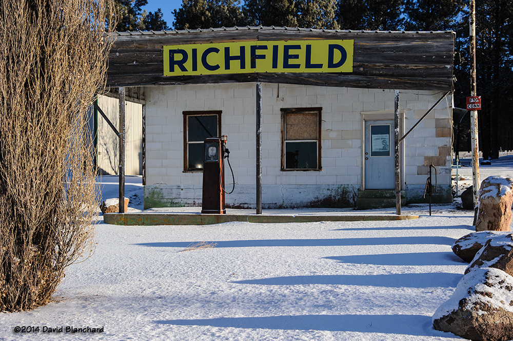
For those of you with a sharp eye and great memory, you might recognize this as the gas station that briefly appeared in the movie Easy Rider from 1969. In fact, if you look closely enough at the image, there is a poster from that movie taped to the window of the door.