Just wandering around on East Pocket above Oak Creek Canyon

A few days ago we decided to spend the day wandering around the East Pocket area. This location overlooks the Red Rocks-Secret Mountain Wilderness on one side and Oak Creek Canyon on the other. It is a relatively flat area surrounded by steep cliffs and deep canyons. Back in the fall of 2005 we explored this area for the first time and decided that we needed to return to see more. Well, it took a few years…

To get to this location you drive south on FR231 — also known as Woody Mtn Road. From the end of the pavement it is about 28 miles to the East Pocket. The dirt road is pretty good for the first half — and not too bad over the second half.
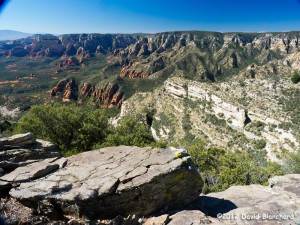
Looking west from the East Pocket area into the Red Rock - Secret Mountain Wilderness near Sedona, Arizona.
Looking west from the East Pocket area into the Red Rock – Secret Mountain Wilderness near Sedona, Arizona.

There are no trails on the East Pocket but there are old, abandoned forest roads that are disappearing into the forest. We set off towards the south to see if we could reach the southern point and then find a way across the canyons and climb back to the flats farther south. For an idea of what the terrain looks like, follow this link to Google Maps.
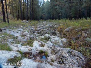
Upper reaches of the West Fork of Oak Creek Canyon near FR231.
We were not successful in getting across the canyon because there were some steep rock downclimbs and we were not prepared to attempt this without ropes and other climbing gear. I guess we’ll just have to return once again. The walk out to the edge was interesting and we had this fabulous view to the west of the Secret Wilderness area and the cliffs marking the edge of the Mogollon Rim.
Cautionary sign upon entering upper reaches of the West Fork of Oak Creek Canyon.

On the way home, we stopped at the bridge that crosses the extreme upper reaches of the West Fork of Oak Creek Canyon. At this point, there is no water and it consists of a rock strewn stream bed in a mountain forest of pine, spruce, and fir. There is a cautionary sign informing hikers of the difficult hiking to be found while heading downstream. We did this canyon from the upper end to the lower end about 10 years ago. It was a very challenging, but ultimately rewarding, 13-hour hike (and swim).

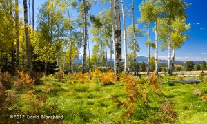
Mountain biking in the Inner Basin of the San Francisco Peaks

It’s fall and the leaves are starting to show their autumn colors in the high country. One of the many great places to view the aspen is the Inner Basin of the San Francisco Peaks. In previous years, we would ride our mountain bikes from Schultz Tank up the Waterline Road and into the Inner Basin. But the Waterline Road is still undergoing reconstruction for the immense damage it incurred as a result of the Schultz Fire and subsequent flooding.

An alternative route is to drive to Lockett Meadow. The road to the meadow has been under construction this summer but just reopened earlier in September. So we grabbed the mountain bikes and drove to the Lockett Meadow trailhead. Because of the surrounding Kachina Peaks Wilderness, the Waterline Road and Lockett Meadow are the only routes into the Inner Basin for bicycles. Hikers have more options.

Pump station located in the Inner Basin of the San Francisco Peaks.

A few years ago the upper portions of the Inner Basin trail underwent some re-routing and the trail now twists and turns through a near surreal stand of aspen as it ascends from the meadow to the Waterline Road and then into the Inner Basin. The landscape has been described as a Monet-like scene when the leaves turn colors in the fall.

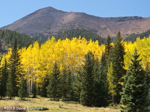
Inner Basin of the San Francisco Peaks with Humphreys Peak in the distance.

Once in the Inner Basin — and that’s no easy task as the trail and access road are steep — the view opens up and you are surrounded by the many summits of the San Francisco Peaks. And still higher we went up the access roads to Flagstaff Springs. The last quarter-mile of this road is rocky and steep and — we walked. This is one of the many springs in the basin that are tapped by the City of Flagstaff and piped downhill as part of the city’s drinking water.

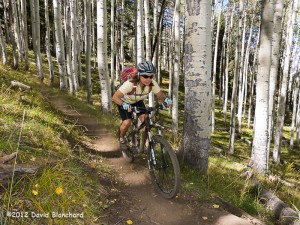
Descending the Inner Basin trail in the aspen forest.

The season for this route is short because in the summer it rains most days and can be a bit chilly. And the winter both comes early and stays late at these elevations. So, this is the season: mid-September through mid-October. Enjoy it while you can.

Missile contrails across the morning sky

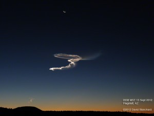
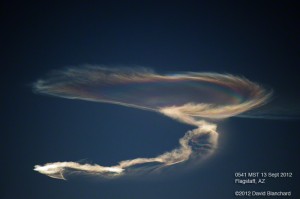
A few mornings ago the White Sands Missile Range in New Mexico conducted a test of the Patriot interceptor, producing iridescent rocket exhaust visible across the early morning sky of northern Arizona.

Exhaust trails from rockets launched in New Mexico as part of a test.

From the SpaceWeather.com web site: “…The test proceeded as follows: A Juno rocket was launched from Fort Wingate in Gallup, New Mexico. This served as the target for another missile, the Patriot Advanced Capability 3 interceptor, launched shortly thereafter from White Sands. A press release from White Sands confirmed the test and stated that “the Juno performed as expected…”

Iridescence in the exhaust trails from a rocket launch over New Mexico.

It’s not often that you get to see a missile launch from Arizona.

Monsoon thunderstorms and lightning over the Grand Canyon in Arizona

The North American Monsoon was going strong in late August and I decided to take a day trip up to the south rim of the Grand Canyon. My goal was to photograph lightning — both during the daytime and in the twilight hours — over and in the canyon.

I wasn’t disappointed. There were only a few thunderstorms around and that makes for better chances since there are fewer intervening storms and there is a better chance of catching some of the sky.

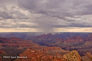
The first two images are of fairly weak thunderstorms producing only a few flashes as they traversed the canyon from south to north.

Early afternoon lightning over the Grand Canyon.
Afternoon lightning over the Grand Canyon from Grandview Point.

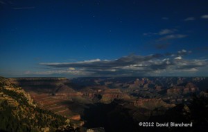
Later in the evening there was thunderstorm activity over the Kaibab Plateau and the north rim. This image captures the small thunderstorm as well as the stars overhead and the lights of the North Rim buildings.

Evening lightning over the Grand Canyon from Grandview Point.

The last image was taken as the storms ended leaving only a thin layer of clouds with the stars shining brightly and the inner canyon illuminated by the light of the full moon.

Full moon light shining down into Grand Canyon.

A few notes of interest. While taking lightning photos using my lightning trigger, a group of four photographers showed up at the same viewpoint — all with the same lightning trigger. And later, during the twilight hours, another group of lightning photographers arrived at the same viewpoint. Turns out these were folks from News9.com (an Oklahoma City television station). It’s not clear to me how lightning over the Grand Canyon is part of the news team coverage for Oklahoma City.