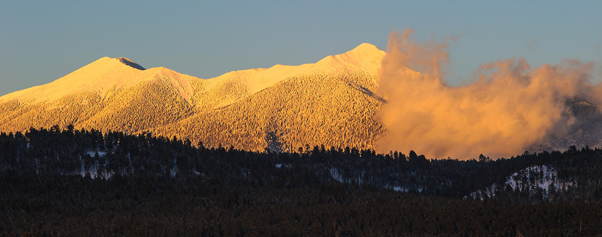
Last week we had a cold front race across the state that was generating showers and a few thunderstorms along the leading edge of the frontal boundary. As this front passed through Flagstaff we had some thunder and lightning while it was snowing. Thundersnow is not uncommon around here and we typically see a couple occurrences each year.
KFSX radar image.
The radar image clearly shows a leading line of strong convection with thunderstorms, followed by a transition zone of low reflectivity, and then a broad area of stratiform precipitation towards the west, or rear, of the system. This closely matches the “Leading convection–Trailing stratiform” model for mesoscale convective systems.
What was interesting was the mammatus that was present. This photograph was taken after the snowfall had ended (about 1.5″ fell on grassy areas) that clearly shows both the mammatus and the snow.
Cumulonimbus Mammatus clouds following Thundersnow.
The past week has been bountiful for photographing objects in the night sky. These objects include Mercury, Venus, Mars, the Moon, and the Zodiacal Light.
In mid-March the planet Venus was an evening object but was dropping closer to the horizon each evening. At the same time, Mercury was rising higher each day. On 18 March 2017, they were roughly side by side and presented an interesting spectacle in the evening twilight.
Venus and Mercury in the evening twilight above the Kachina Wetlands. Venus can be seen just to the right of center of the image; Mercury is left of center.
The following night I returned to Kachina Wetlands but later in the evening to capture the Zodiacal Light. The Zodiacal Light is a faint, roughly triangular, diffuse white glow seen in the night sky that appears to extend up from the vicinity of the Sun along the ecliptic or zodiac.
Zodiacal Light (28mm focal length).
A week later I attempted the same photograph except using an ultra-wide angle lens (i.e., 16mm focal length) to capture the Zodiacal Light as well as the constellation Pleiades in the upper portion of the cone of light.
Zodiacal Light (16 mm focal length).
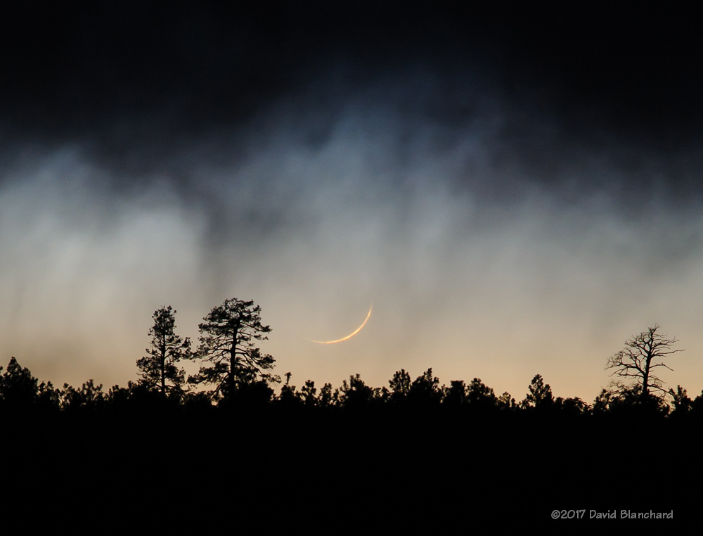
A few days later, the moon had reappeared in the evening sky. With just 1.4% of the disk illuminated it can be difficult to see. Making it much harder was the showery weather and abundance of clouds. But just before the moon set behind the trees it was visible in the gap below the clouds and the horizon.
A bonus was the very nice sunset colors reflected in the waters of Lake Mary while waiting for the moon to make an appearance.
Sunset colors reflected in Lake Mary.Crescent Moon.
One day later, I tried again. This time the skies were clear and it was possible to capture an image with the 3M’s: Mercury, Mars, and the Moon. While waiting for the sky to darken enough for the planets to become visible I was able to capture an image of the moon with sunset colors still visible.
Crescent Moon above Lake Mary.
As twilight faded away Mercury and Mars became visible and the triplet made a triangle in the western sky.
Mercury, Moon, and Mars in the evening sky. Mercury is located at the “4 o’clock” position relative to the Moon; Mars in at the “12:30 position.”Mercury, Moon, and Mars in the evening sky.
An active weather pattern is in place across the southwest at this time and it may be several days before the skies become clear again.
My first visit to Death Valley National Park was in January 2014. At that time, I noted that “…I would like to return–soon–and visit many of the other wonderful locations in Death Valley National Park…” Well, it turned out “soon” was more than three years later but we finally made a return visit.
With the significant amount of rain that has occurred across the American Southwest this winter I was hopeful that there would be another wildflower “super bloom” comparable to that which occurred in 2016. But either we were too early or it just doesn’t happen two years in a row. So we were disappointed with the scarcity of wildflowers.
Dante’s View of Panamint Range and Badwater Basin.
Still, it’s hard to be disappointed for long when visiting Death Valley National Park. So much to see—and usually not enough time to see it all. On this trip we visited a few of the sites that we saw in 2014 but we also visited places we had not been to before.
Our first stop as we entered the Park was Dante’s View. The view from this high point is expansive and includes the Panamint Range and the Badwater Basin regions—where the lowest elevation in the United States occurs (–282 feet; –86 m).
Our next destination was supposed to be Badwater Basin but we got sidetracked along the way and ended up at Desolation Canyon. We hiked here then continued on our way to Badwater Basin, arriving—barely—in time for sunset.
Textured landforms of Zabriskie Point.The Narrows of Desolation Canyon.Desolation Canyon.
Because of the rains this winter Badwater Basin was wet and the famous polygonal shapes in the crust were not present. Instead, it was more like a giant basin of slushy salt. As the sun was setting, the wave clouds over the Panamint Range took on a variety of colors that made for interesting photographs.
Badwater Basin at sunset.
The following morning we made a trip to Mesquite Sand Dunes for sunrise. The rising sun and shapes of the dunes can make for amazing photographs—especially if you can find a place without footprints. The longer it has been since the last windy period the harder it is to find pristine sand. In some locations the polygon-cracked clay of an ancient lakebed forms the floor and makes for an interesting contrast with the dunes. Regardless of the conditions it’s hard to go wrong in this location.
Mesquite Sand Dunes.Sand dunes and polygon-cracked clay deposits.Sunlight and shadow draped across the Mesquite Sand Dunes.
After a late breakfast we struck out for the west side of the park with a destination of Darwin Falls. It’s always amazing to see running water—and waterfalls—in a desert environment. We spent a long time in this lush and green environment.
Running water in Death Valley.Darwin Falls, Death Valley National Park.Standing water in Panamint Valley.
On the way back to Stovepipe Wells Village we found ourselves driving up Emigrant Canyon Road and out to the Eureka Mine and Aguereberry Point. The NPS guide says a high clearance vehicle is needed because of rock outcrops and a rocky section in the final 1/2 mile. I’m glad I didn’t read that in advance or I would never have bothered. It turns out the road is in great shape (March 2017) and any passenger vehicle can make the journey. I guess they must have done some recent road improvements. Lucky for us!
Eureka Mine, Death Valley National Park.Badwater Basin from Aguereberry Point.
The next morning we attempted the sunrise over the sand dunes again. We had learned from yesterdays visit where we might find dunes without footprints–or, at least, not many footprints. Indeed, some of the most interesting footprints we did find were from the nocturnal animals that wander the dunes at night.
Mesquite Sand Dunes illuminated by moonlight.Mesquite Sand Dunes at sunrise.Mesquite Sand Dunes at sunrise.Animal tracks on the sand dunes.
Later we traveled north towards Ubehebe Crater. Along the way, we crossed over Grapevine Canyon Wash which had a devastating flood in October 2015. As a result, the road up Grapevine Canyon as well as Scotty’s Castle remain closed until repairs can be made. The debris field that is still evident from the main road is very impressive. At the crater we were motivated to hike down into the crater itself. Even going down was tough because of the loose cinders. Going up? Yeah, that was work.
Ubehebe Crater panoramic composite.Wildflowers on the road to Beatty, Nevada.
As we left the park via the road to Beatty, Nevada, we saw our second wildflower of the trip. Yep, two wildflowers in four days. Not much of a season yet. Hopefully it will get better.
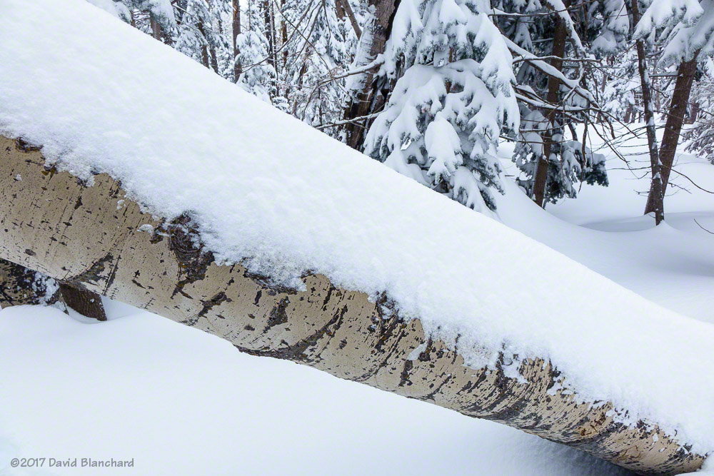
The last major snow event around here was a multi-day storm from January 19–25 that put down about 36″ of snow in town. The Kachina Peaks received anywhere from 5 to 7 FEET of snow. Since then, the weather has been pretty quiet with no storms. The snow in town had melted away and the snowpack in the mountains had melted/sublimated substantially.
Finally, however, another snow storm moved across the area earlier this week bringing about 16″ in two days to Flagstaff and about 18–24″ across the peaks. Time to hit the slopes.
New snow on a toppled aspen tree.
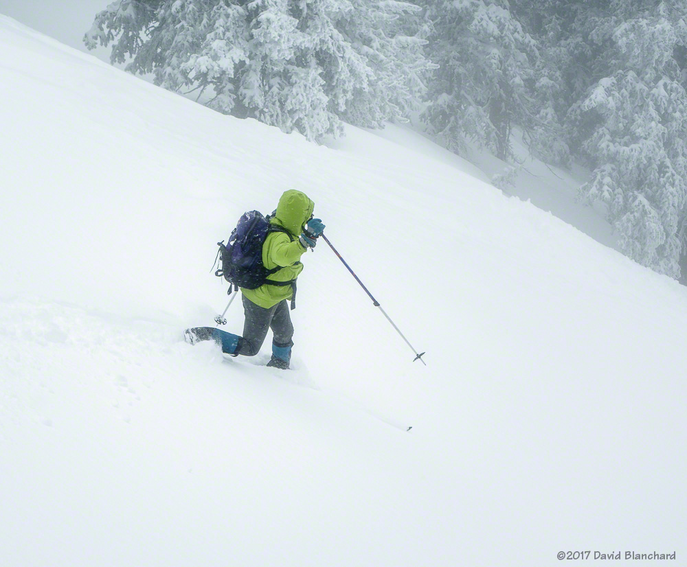
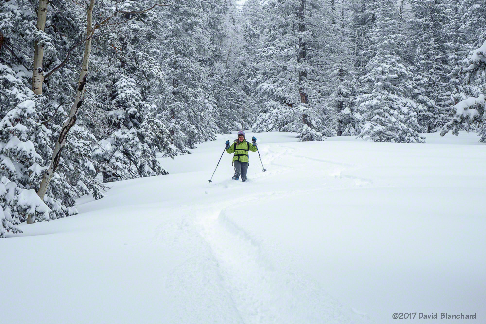
Our original destination was the area known as Allison Clay but that idea was abandoned because of the amount of trail breaking required to get there. Instead, we went for the nearer destination known as Flying Dutchman. A few skiers had already broken a trail to the top of the area so we had an easy climb. Thanks, guys!
Here are a few images from the downhill runs.
At the top of Flying Dutchman.Lower glades before hitting the Humphreys Trail.
Will this be the last chance for good skiing? Or will we see another big event in March?
Earlier this month we spent an evening in Moab, Utah while on our way from Flagstaff to Leadville, Colorado. The purpose of our trip was a multi-day ski trip to the Uncle Bud’s Hut which is part of the 10th Mountain Division Hut System.
We arrived in Moab in late afternoon and did a quick check in at our hotel. Then we left for some sunset and twilight photography in Arches National Park. The sun was already low in the sky and I decided to stop at the first interesting spot. From here we were able to watch the sunset colors on Balanced Rock as well as the moon rise behind it.
Moonrise behind Balanced Rock, Arches National Park.Sunset colors behind a rock pillar.
I would have preferred to be farther away from the rock so that the moon would appear larger compared to the rock but I’m not too disappointed with the images that I did get.