Thunderstorms and lightning have returned to northern Arizona

The North American Monsoon (NAM) got off to a slow start across northern Arizona this year despite a few predictions that it would start early and strong. It did in some locations but northern Arizona was not one of them. But after a few false starts, the rainy season is in full swing here. We’ve had a couple of days with substantial rainfall and that has — finally — put an end to the extreme fire danger.

Cloud-to-ground lightning from a distant thunderstorm at twilight.

And, with all the thunderstorms, comes another chance to photograph lightning. Yesterday (15 July 2012) turned out to be a very good day for lightning. By late afternoon, storms were weakening across northern Arizona but there remained a chance that there would be another round in the evening. And there was. At one point in time, I was observing lightning in all directions — none of it close however.
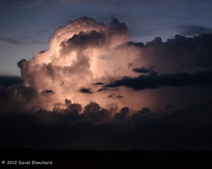
Thunderstorm lit from within by lightning during twilight hours.

I found myself in Wupatki National Monument during the evening. I stopped at one of the many pullouts along the road that afforded me a view in multiple directions and set up to photograph. Initially, the best storms were to my north but since they were moving to the north they eventually were too far away. At the same time, a cluster of storms was moving northward across central Arizona. I could see only the tops of these storms but they still managed to light up the sky. Because they did not fill the sky yet there were plenty of stars visible as well. I was happy with the results: bright stars overhead, distant thunderstorms lit from the inside by lightning, and wonderful colors and light reflecting off the clouds in all directions.

Stars shine overhead as a cluster of distant thunderstorms light up the far horizon.

It was amazingly quiet in the Monument. Only a few cars drove by at that time of the evening and the storms were distant so that the thunder was inaudible. It was so quiet I could hear the bats flitting around.

An amazing evening.
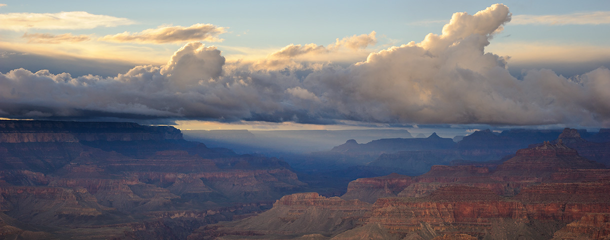
Buckskin Gulch sans water and mud

Three of us recently did a day hike in Buckskin Gulch. This is a well-known slot canyon on the Utah side of the Utah/Arizona border. The canyon is about 13 miles long making it one of the longest slot canyons in the southwest — and possibly the world.

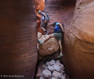
A climbing move is required to bypass this boulder in Wire Pass -- a tributary of Buckskin Gulch. The pile of boulders at the bottom helps.
A climbing move is required to bypass this boulder in Wire Pass — a tributary of Buckskin Gulch. The pile of boulders at the bottom helps.

In normal years rainfall during the summer, fall, and winter leaves ankle- to knee-deep pools of cold water in the canyon. Hiking through here under these conditions is tricky since the pools are often scoured by the rushing water which may result in one side being deep and the other shallow as the sand or rocks build up. With muddy water it is impossible to see under the surface of the water and a walking pole is used to probe carefully before placing each step. A mis-step can result in going from knee-deep water to chest-deep water in one quick step!

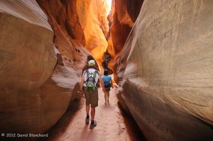
Dry and sandy narrows through Buckskin Gulch.

Some years, however, the fall and winter months are dry and the canyon floor is dry in the spring. That was the case this year. After a wet fall, a dry winter and spring followed and this allowed the canyon floor to be water free — at least in the first few miles that we traveled.

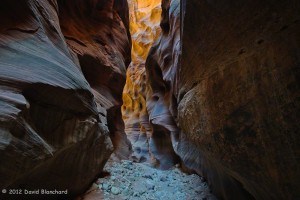
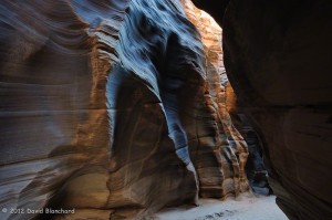
Reflected light illuminates a far wall deep within Buckskin Gulch.

The first time we did this hike (2004) it was dry and we mistakenly assumed this was normal. Returning to hike in 2005, 2006, and 2007, we were greeted each time with water. So it was a pleasant surprise to return after a few years absence and find it dry.

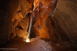
A narrow beam of light penetrates deep into the narrows of Buckskin Gulch and gently illuminates the side walls of the canyon.

What was less pleasant was seeing how visitors to this amazing place have left graffiti along the canyon walls. There was no graffiti the first three times we visited and only one defacement the last time. This time there was graffiti in many locations in the first few miles of the canyon. It is truly saddening that people would do such a thing in a beautiful place.

Exquisitely textured walls found within Buckskin Gulch.

Still, we had a great time walking a few miles down canyon, eating our lunch in the cool and quiet narrows of the slot, and enjoying our brief visit to this remarkable place.

Hiking over land and through water in Wet Beaver Creek

Wet Beaver Creek is a popular destination for hikers — especially in the hotter months. Along the stream are many trees providing shade and cooler temperatures. But the biggest draw is the swimming hole locally known as “The Crack” located about three and one-half miles upstream from the trail head. On a hot and sunny weekend there might be a few dozen visitors swimming and relaxing by the stream. Even on a cold weekday you might find visitors because even though it is too cold to swim it is still magnificent to see. (Well, maybe not too cold. I’ve seen trail runners jump in during the winter!)

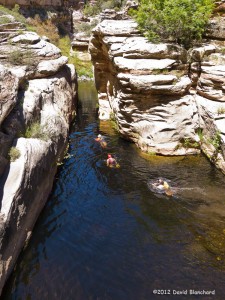
One of the many narrows in Wet Beaver Creek. The shallow water deepens and turns into a swim to get beyond the far wall.

But go beyond The Crack and the crowds thin out quickly. There is no trail other than a faint footpath that wanders from one bank to the other. There are sections that require wading in the water. And then there are the required swims (“aqua-hiking”) in which the canyon sides close in and the water deepens.

Another set of narrows and deep water in Wet Beaver Creek requiring a swim. But the water is warm and the day is hot -- so no complaints!
Another set of narrows and deep water in Wet Beaver Creek requiring a swim. But the water is warm and the day is hot — so no complaints!


These are best done in the hottest months otherwise the hypothermia factor must be considered. Finally, these are not easy miles so it takes far longer to travel than one might anticipate.

Stereo Pair of Moonrise above Cathedral Rock in Sedona, Arizona

The full moon occurred on 04 June and there was an early morning partial eclipse — but I slept through it. The two evenings prior to the full moon, however, provided an opportunity to photograph the rising moon as the sun still cast light and color on the red rocks.

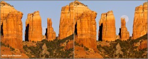
Stereo pair of Cathedral Rock, Sedona, Arizona.

Using The Photographers Ephemeris (TPE) I was able to pre-determine where to set up to photograph the moon as it traversed above the towers that make up Cathedral Rock. As the moon rose up and to the right I moved my position to the left to keep the moon in the larger gap. The unintended consequence of this movement is that I was able to get these similar — but slightly different — images about five minutes and 50 meters apart. Putting them together side-by-side makes a good stereo pair using the cross-eyed viewing method — that is, as long as you don’t object to having two moons in the 3-D image.

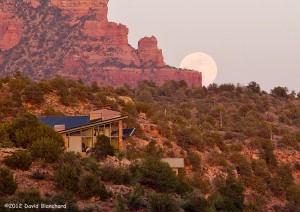
Moonrise over Oak Creek, Sedona, Arizona.

The following night I set up in a different location and was able to capture the moon as it rose from behind these cliffs with this large home in the foreground.

Venus Transit of the the Sun

The transit of Venus across the face of the Sun on 05-06 June 2012 UTC was an amazing sight. Even more amazing is the rarity of this event. Transits of Venus occur in pairs approximately eight years apart then not repeated again for over one hundred years. Since this was the second transit of the pair the next will not occur until the year 2117. So, if you wanted to see a transit, this was your last best chance!

NASA has compiled some stunning video and images of the transit. The SpaceWeather site also has information and a user gallery of images.

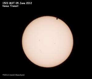
Venus transiting the sun at 1523 MST (2223 UTC). The full disk of the planet is visible at this time.

I was able to capture several images of the transit including first contact at ~2206 UTC and when the full disk first became completely visible in front of the sun.

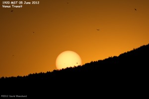
Venus transiting the sun as the sun sets behind the low mountains west of Flagstaff. Image shot using a ND3 filter.

As the sun began to set behind the mountains west of Flagstaff I was able to capture this image with the lower portion of the sun already behind the trees.

Composite image of (1) filtered image of the sun and Venus in transit and (2) the darkening sky a few minutes after sunset.

This image is a composite of a filtered image of the sun followed a few minutes later by a standard exposure showing the colors in the evening sky as well as numerous birds.

(Edit: Fixed typo in year of next transit.)