Snow in April

Snow in April! Actually, it isn’t rare for snow in April in Flagstaff. In fact, it is more likely that there is snow in April than no snow. Over the course of record for Flagstaff (1898–2025), there has been measurable snow in 107 of those years. Only 21 years had no snow or only a Trace of snow.

The snowfall this April, however, has been well above average. To date, there has been 13.5″ of snow (average for the entire month is 7.3″), falling in two events: April 2–3 (4.3″) and April 18–19 (9.0″).

This is good news as we had a dry winter. Our snow season total (July 1–present) stands at 60.3″ compared to an average of 87.6″. It is unlikely that we will catch up to normal as the chances for significant snow decrease rapidly going forward. However, this late influx of moisture (both March and April) has been good in bringing the fire danger down to LOW across the Coconino and Kaibab National Forests.

Here are some photographs from both of these events.

Layers of clouds are draped across the San Francisco Peaks near Flagstaff, Arizona, in the wake of a winter storm (04 April 2025).
The rising sun illuminates clouds draped across Mormon Mountain in northern Arizona in the wake of a winter storm (04 April 2025).

Time-lapse video of clouds over the San Francisco Peaks and Mormon Mountain in northern Arizona.

Streamers of fog and low clouds move below the red rocks of Sedona, Arizona (19 April 2025).
Fog and low clouds move below the red rocks of Sedona, Arizona (19 April 2025).
Fog and low clouds drape across the red rock spires of Sedona, Arizona (19 April 2025).
The rising Sun illuminates mist and fog swirling around the red rocks of the Munds Mountain Wilderness (19 April 2025).
Mist and fog swirls around the red rock cliffs and is reflected in a small pool in Munds Mountain Wilderness (19 April 2025).
The setup for the previous photograph.
Dewdrops adorn this small lupine in Sedona (19 April 2025).
Snow adorns the blossoms of this flowering fruit tree in Flagstaff (19 April 2025).
Snow on a flowering forsythia bush in Flagstaff (18 April 2025).
Snow on a flowering crab apple tree (18 April 2025).
Snow and daffodil, Flagstaff (18 April 2025).
Snow in the upper reaches of Oak Creek Canyon with the switchbacks of SR-89A below.

A Foggy Morning in Sedona

A sea of fog surrounds Cathedral Rock in Sedona, Arizona.

It’s been a quiet winter with very few storms so when we finally got a storm  I wanted to try and get some morning sunrise fog shots. I awoke early to check radar and satellite data. I was both surprised and disappointed that my favorite locations appeared to be cloud and fog free. On the other hand, satellite data showed an extensive area of fog and low clouds near Sedona and into the Verde Valley. I quickly headed down Oak Creek Canyon to a location in Sedona that has a great view for these types of events.

A wide-angle shot with Cathedral Rock in the distance. A few minutes later the fog surged northward.
Fog begins to wrap around red rock buttresses in Sedona.

At first the fog was fairly distant to the south and visibility was very good in all directions. I was able to see Cathedral Rock poking through the fog. But over the next few minutes the fog surged northward and soon I was in the thick of it with low visibility.

Fog and mist partially obscure the red rock buttresses in Sedona, Arizona.
A zoomed-in shot of the fog obscuring the red rock in Sedona, Arizona.

I headed to another viewpoint hoping there would be some sun shining through the fog. For a few minutes it did. And then the fog thickened again.

Overall I was pretty happy with the fog and photo session–especially since I haven’t had many chances this winter. And the weather forecast looks warm and dry. Boring.

Monsoon–September 2023

As mentioned in an earlier post the monsoon had a late start this year–and ended about the middle of September which is fairly typical.

02 September 2023

Lightning bridges the clouds above and fog below in Grand Canyon.
Lightning strikes the walls of Grand Canyon near Desert View Tower.

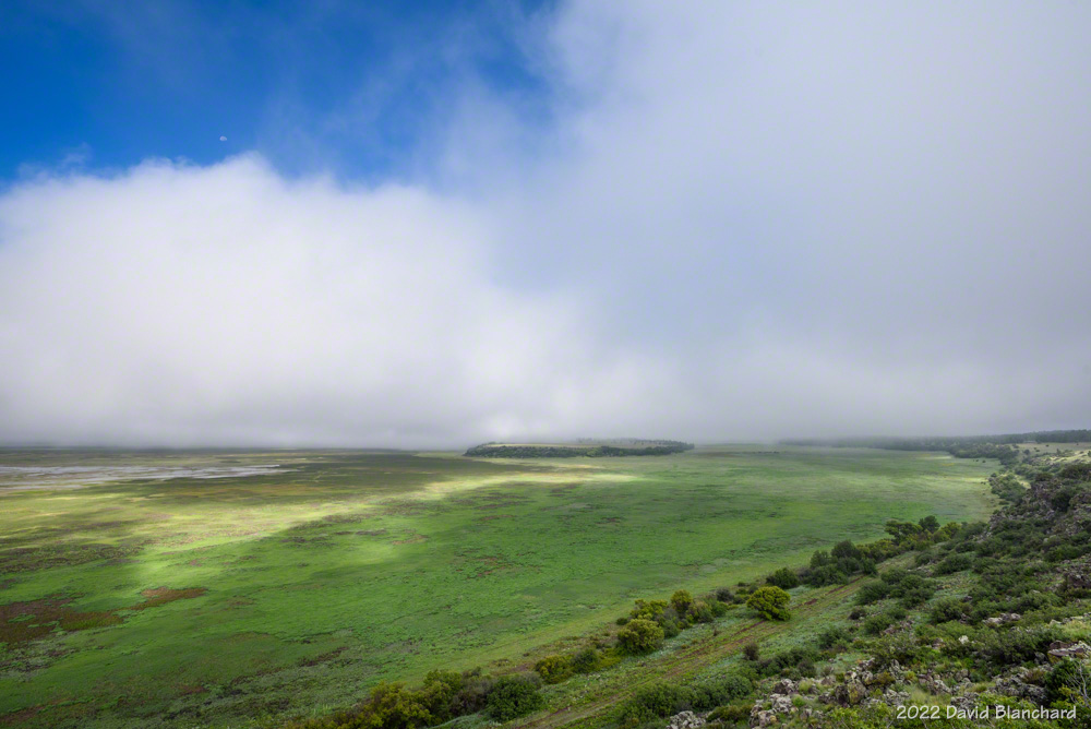
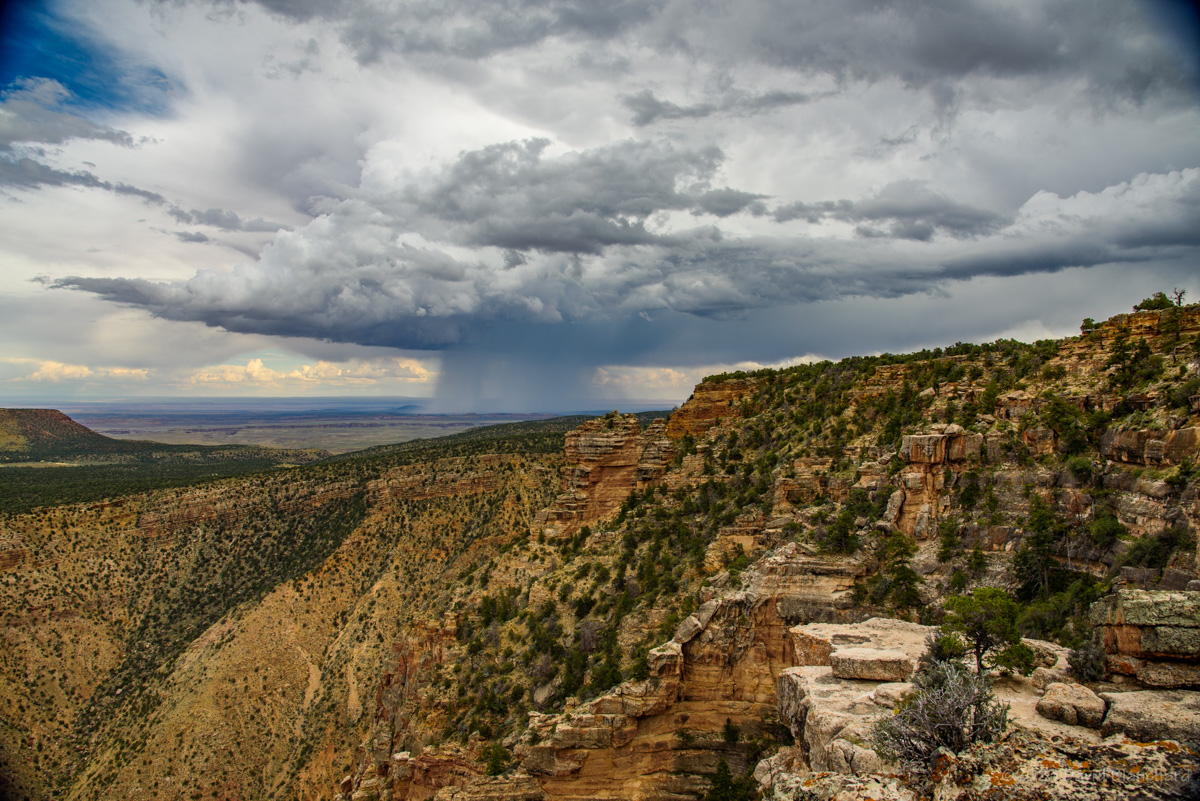
I went to Grand Canyon early and was photographing storms shortly before 3 P.M. It was interesting and unusual because fog rapidly developed deep inside the canyon as the storms approached from the south. For a moment I wasn’t certain I would see anything in the reduced visibility. But close lightning bolts dropped from the cloud base above, through the clear air, and then disappeared in the fog in the inner canyon. It was really spectacular to see this.

Another storm dropped a lightning bolt into the canyon near Desert View Tower with multiple contact points. Wow!

A double rainbow over Palisades of the Canyon and Desert View Tower in Grand Canyon.
A rainbow moments before sunset spans the canyon.

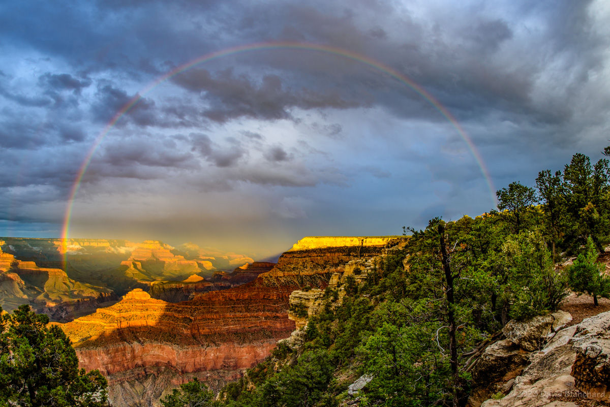
And then the rainbows arrived with some brilliant and colorful arcs of light over Desert View point. Finally, just moments before sunset, another rainbow stretched from the North Rim to the South Rim.

It was an amazing day.

12 September 2023

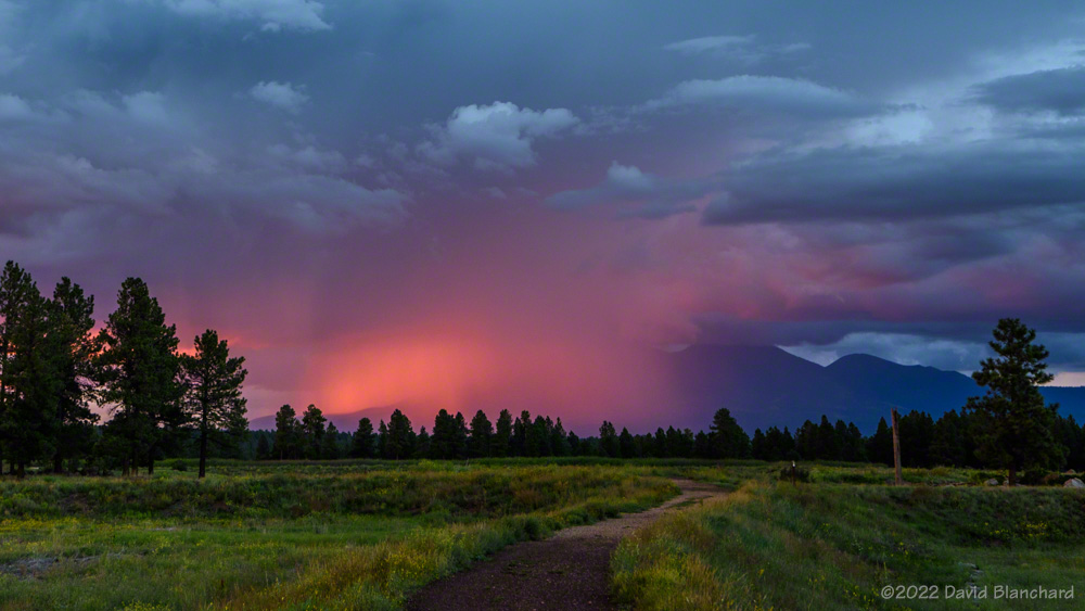
An early evening storm produced a lot of in-cloud lightning that lit up the thunderstorm at the same time that the setting Sun was illuminating it from the West. And all of this was reflected in the waters of Mormon Lake.

Thunderstorm after sunset near Mormon Lake.

13 September 2023

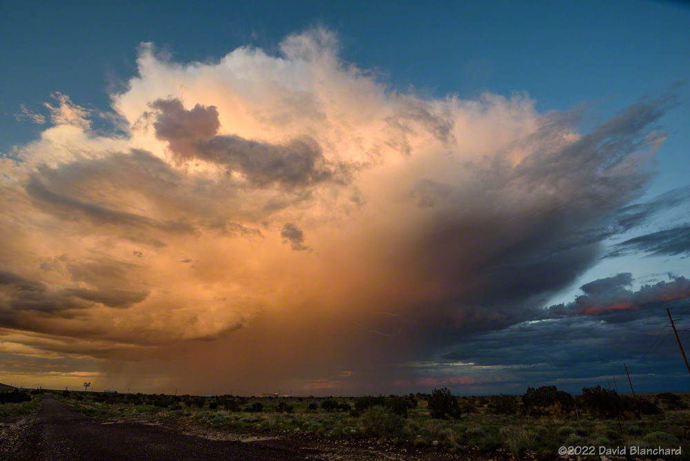
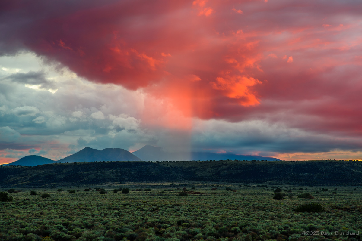
Storms were more isolated this day allowing for nice views of the convection. I was able to get several photographs of the storms over the Little Colorado River (LCR) valley as I was heading towards Grand Canyon. Late in the afternoon a short segment of a rainbow appeared over the LCR.

An early afternoon thunderstorm over the Little Colorado River valley east of Grand Canyon.
Thunderstorm over the eastern portions of Grand Canyon.
A short segment of a rainbow with Desert View Tower.

14 September 2023

I spent the late afternoon and early evening in Wupatki National Monument and was able to get some really great sunset photographs. There was lightning after dark but most of it was too far away for interesting structure and branching.

A burst of color on a rain shaft at sunset over Wupatki National Monument.
Fading sunset colors over Wupatki National Monument.

15 September 2023

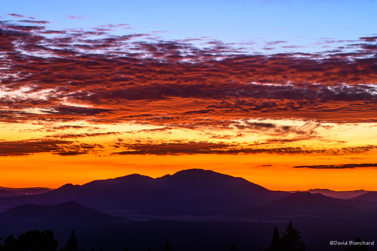
Late afternoon and early evening storms were present to the west of Mormon Lake. I kept hoping for some dramatic lightning with sunset color–but only got the latter. It was still pretty good!

The setting sun illuminates a rain shaft over Mormon Mountain and Mormon Lake.

17 September 2023

I was actually trying to photograph Comet C/2023 P1 Nishimura but these clouds were in the way. This was taken well after sunset and the color was pretty remarkable.

Sunset colors on a mid-level deck of clouds.

So after a late start the monsoon season produced many photogenic opportunities for clouds, sunsets, fog, and lightning.  And now the long wait until next season.

Previous posts on the 2023 North American Monsoon:

A Very Foggy Morning

Fog at sunrise in the Mormon Lake Basin.

A few days ago we had a cold front move across the area and overnight temperatures fell below freezing for a few hours in the higher terrain. It turns out that October is a good month for fog formation from these first frontal incursions. Area lakes still have relatively warm water from the recently ended summer. The passage of the cold air over the warm water allows for increased moisture flux from the warm water into the colder air that increases the dewpoint (and relative humidity) and can result in fog. Also, the shorter days–and longer nights–allows radiation fog to develop in the valleys.

Fog in the Mormon Lake basin with a colorful but diffuse glory.
A small sailboat lies at anchor on a foggy morning at Upper Lake Mary.
Fog and Upper Lake Mary.

With that in mind, I found myself driving past Lake Mary to Mormon Lake before sunrise on Tuesday morning. As I approached Lake Mary visibility dropped quickly to 1/4 mile, then 1/8 mile, and then 1/16 mile. Visibility improved once I passed both Lower and Upper Lake Mary. At Mormon Lake, there was fog swirling in the basin and the rising Sun was just starting to illuminate the summits of the San Francisco Peaks.

Fogbow over Upper Lake Mary.

After the fog dissipated in Mormon Lake, I returned to Lake Mary where the fog was still present and I was able to capture fogbows plus a nice photo of a sailboat anchored in the lake.

Time-lapse video of the swirling fog in the Mormon Lake basin.

Time-lapse video of the swirling fog and glory in the Mormon Lake basin.

The time-lapse videos show remarkable motion of the swirling for over Mormon Lake as well as the colorful but diffuse glory that was present.

A very fun morning.


Fog definitions from Weather.gov:

(1) Steam fog (arctic sea smoke). Steam fog forms when water vapor is added to air that is much colder, then condenses into fog. It is commonly seen as wisps of vapor emanating from the surface of water. This fog is most common in middle latitudes near lakes and rivers during autumn and early winter, when waters are still warm and colder air masses prevail.

(2) Radiation fog (ground or valley fog). Radiational cooling produces this type of fog. Under stable nighttime conditions, long-wave radiation is emitted by the ground; this cools the ground, which causes a temperature inversion. In turn, moist air near the ground cools to its dew point. Depending upon ground moisture content, moisture may evaporate into the air, raising the dew point of this stable layer, accelerating radiation fog formation.

Fog in Northern Arizona

This Winter has been relentless with snowfall now at about 200% of normal for Flagstaff. Many of these storms have made it difficult to get to various locations for shooting photos of the weather. Fortunately, the last few storms have allowed me to do some pre-dawn travel to favorite locations.

The first two photos are from the morning of 16 March 2023 when I thought there was a good chance of low clouds and fog in Grand Canyon. In fact, there was too much fog and I was only able to briefly see into the canyon while at Lipan Point. I finally moved westward to Moran Point where there was a larger break in the fog allowing sunlight to illuminate the canyon.

Early morning fog in Grand Canyon from Lipan Point.
Early morning fog in Grand Canyon from Moran Point.

A week later we had a snow-turning-to-rain event that left the roads relatively easy to travel and I ventured out to Mormon Lake on the morning of 23 March 2023. The abundance of moisture over the previous few days resulted in lots of fog in low-lying basins including Lake Mary and Mormon Lake. Clear skies to the east allowed the rising sun to illuminate the San Francisco Peaks in the distance.

The distant San Francisco Peaks rise above fog filling Mormon Lake basin.
Fog fills Mormon Lake Basin. A faint Glory is seen left of center while a short segment of a fogbow is right of center.
A fogbow along Upper Lake Mary.

I was also interested in capturing images with a Glory/Brocken Spectre and fogbows. Both were faintly visible in some of the photos where I was above the fog. A better fogbow photo was shot when I was in the fog.

And here is a time-lapse video of the swirling fog in the Mormon Lake basin.

Time-lapse video of fog swirling in Mormon Lake basin.

The medium-range forecasts indicate that Winter is not yet done.