A previous post displayed photographs of storms and weather that occurred during July of this year’s North American Monsoon. Here are photographs from August (plus the first day of September).
Cumulus and Cumulonimbus
A search for wildflowers and thunderstorms brought me to Rogers Lake west of Flagstaff. It’s a lake only ephemerally during springs with heavy snow runoff. But it makes a grand place for photographs when a wide-open vista is desired. Earlier convective storms were pushing an outflow boundary southward with new convection developing on the boundary.
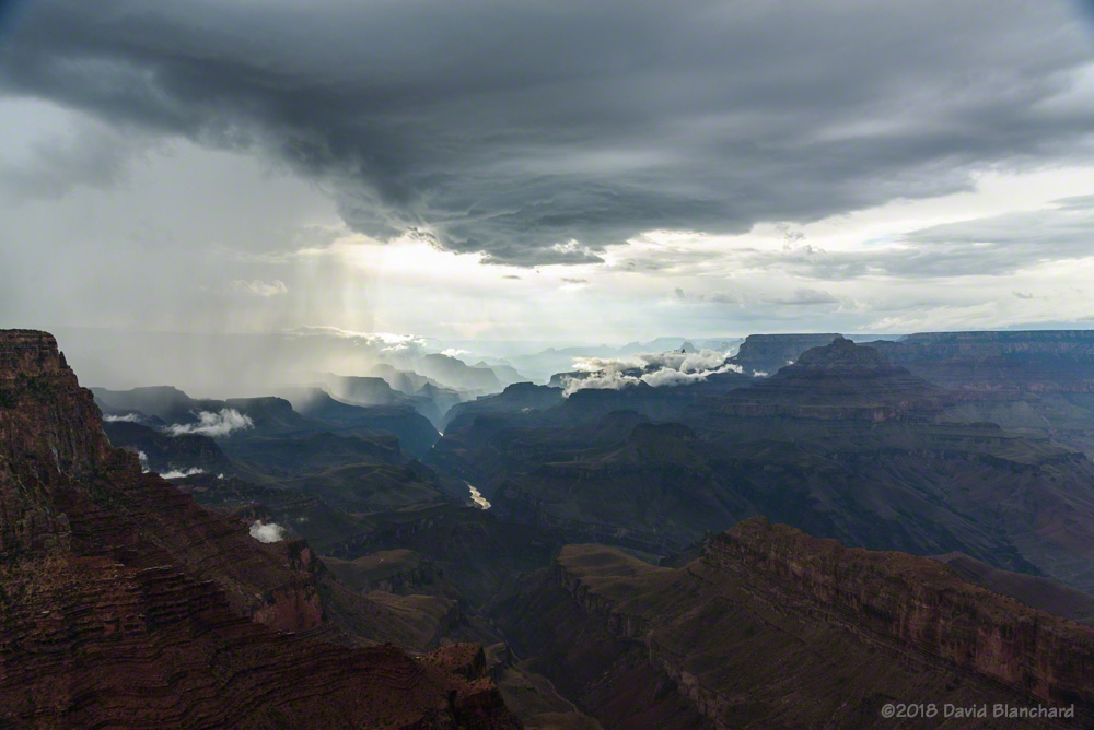
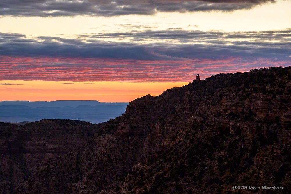
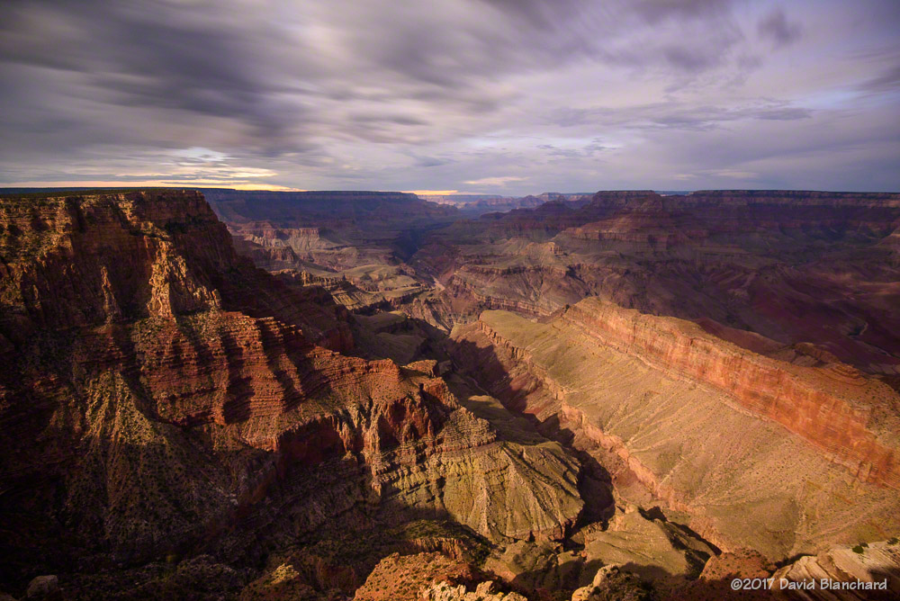
Outflow boundary and convection over Rogers Lake with the San Francisco Peaks in the distance.A distant cumulonimbus can be seen from the Doney Mountain Picnic Area near Wupatki National Monument.Thunderstorms move across Grand Canyon with low clouds clinging to the higher points and buttes.
There was just enough vertical wind shear on this day to allow some storms to briefly exhibit supercell characteristics and deviate to the right—which brought this thunderstorm near the edge of the North Rim of Grand Canyon.
A strong thunderstorm over the North Rim of Grand Canyon is reflected in a small pool of water.A weak, late afternoon thunderstorm is backlit by the setting sun.
Fog and Smoke
Sometimes the unexpected can be magical. When fog forms in Grand Canyon the visitors may be disappointed but there is the potential for amazing photographs.
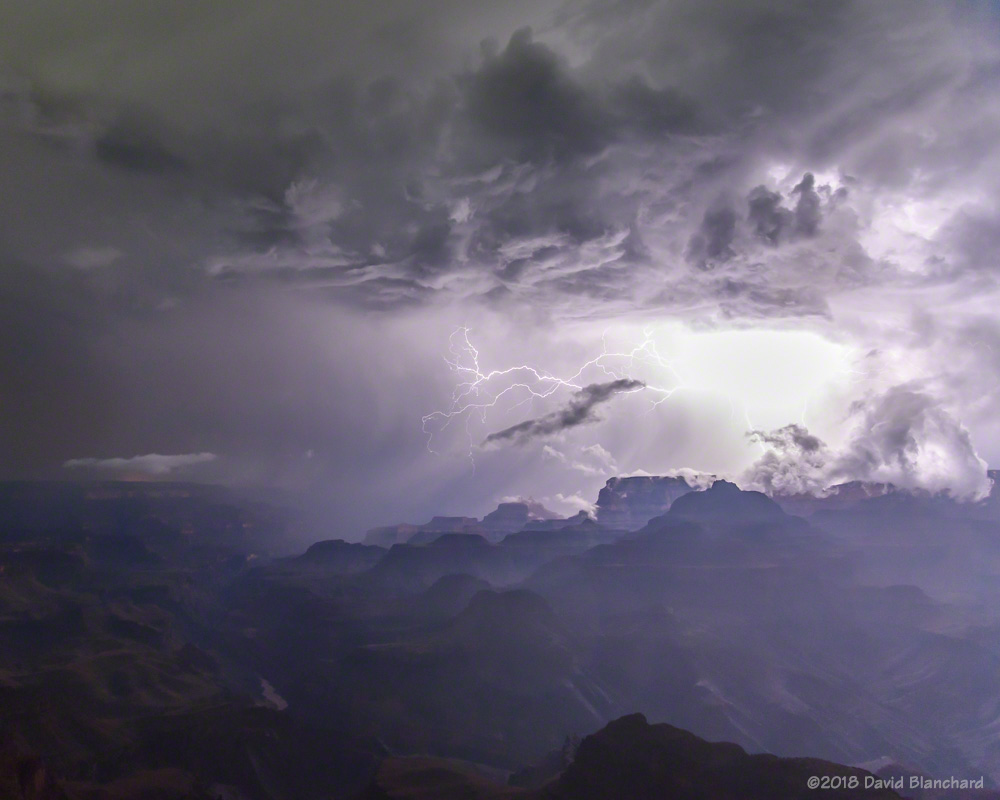
A long-lived cluster of thunderstorms east of Grand Canyon pushed a cool, moist outflow into the canyon producing areas of fog near the South Rim.More fog in Grand Canyon.
Smoke from the Obi Fire on the North Rim creates a colorful sunset.Smoke from the Obi Fire fills Grand Canyon and reduces visibility.
Sunset and Full Moon
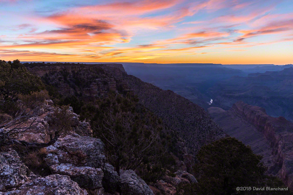
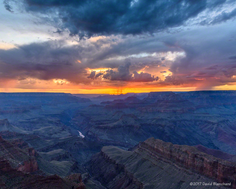
Sunset after the storms can be amazing. And if there is a nearly full moon, things can get very interersting.
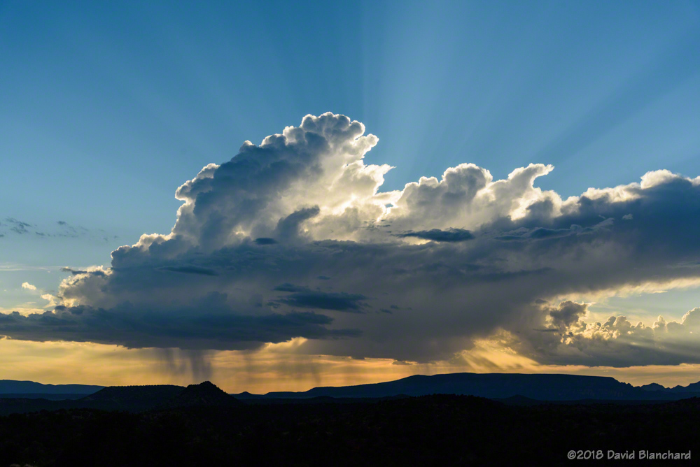
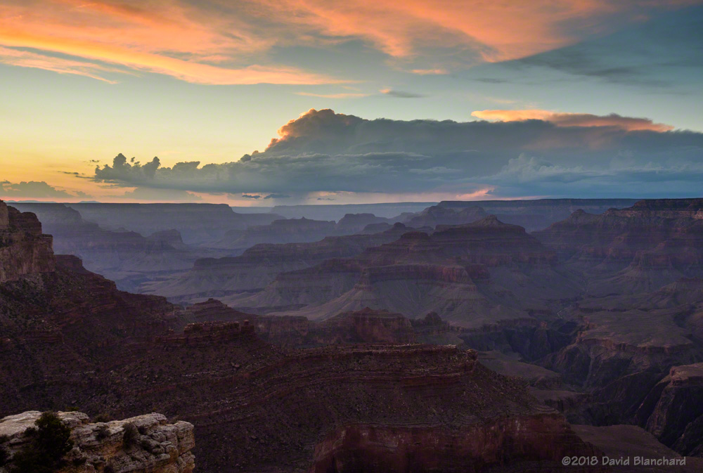
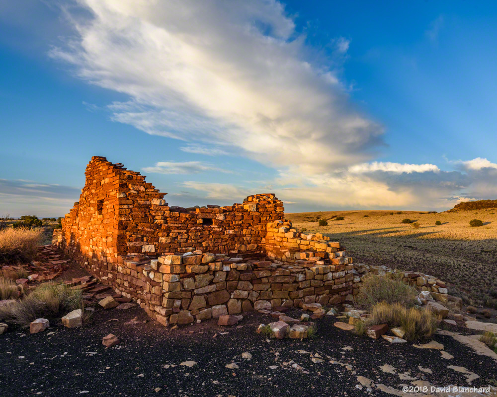
A backlit thunderstorm at sunset over Grand Canyon.Post-sunset colors illuminate the underside of a dissipating shower.Dissipating cumulus clouds at sunset with O’Leary Peak in the distance.Dissipating showers are backlit by the setting sun.The nearly full moon illuminates the inner canyon as twilight fades behind a distant thunderstorm.A dissipating thunderstorm anvil cloud is seen above pueblo ruins in Wupatki National Monument at sunset.
Rainbows
A double rainbow above Cathedral Rock in Sedona.A rainbow, dissipating anvil, thunderstorm, and towering cumulus.
Lightning
And lightning…
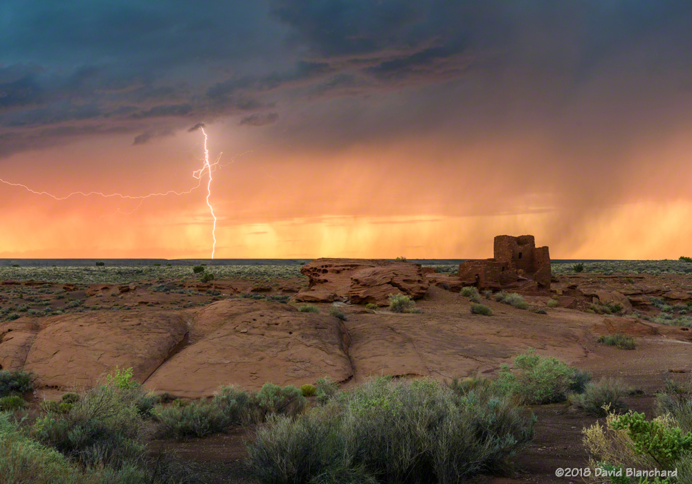
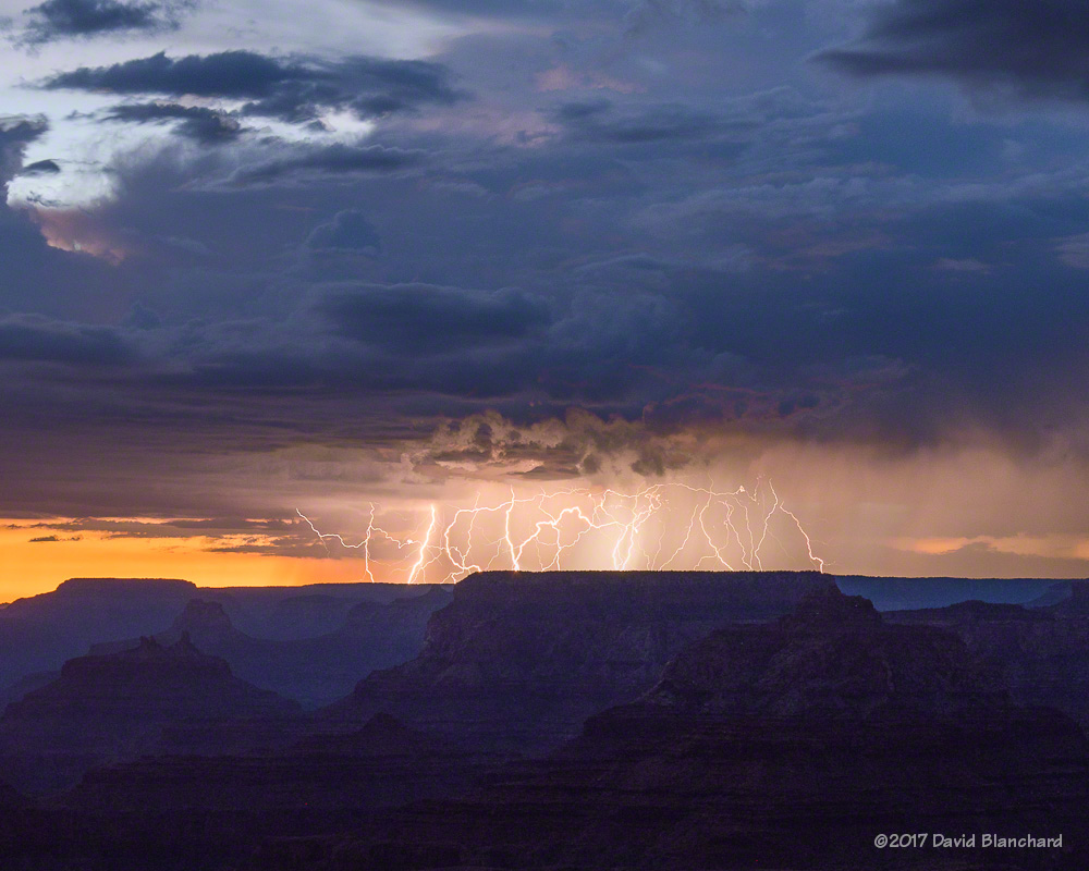
An amazing anvil bolt…and too close!Lightning west of Sedona, Arizona.Anvil bolt over Cathedral Rock. (It’s out of focus–you try focusing in the dark!)Lightning illuminates Grand Canyon at night.Lightning strikes the Moenkopi Plateau (composite image).Several bolts strike behind Wukoki Pueblo in Wupatki National Monument.The setting sun lights up rain curtains as a brilliant lightning bolt strikes behind Wukoki Pueblo in Wupatki National Monument.
It’s early September and the summer monsoon pattern is beginning to fade away. Soon it will be time to start thinking about autumn colors on the peaks.
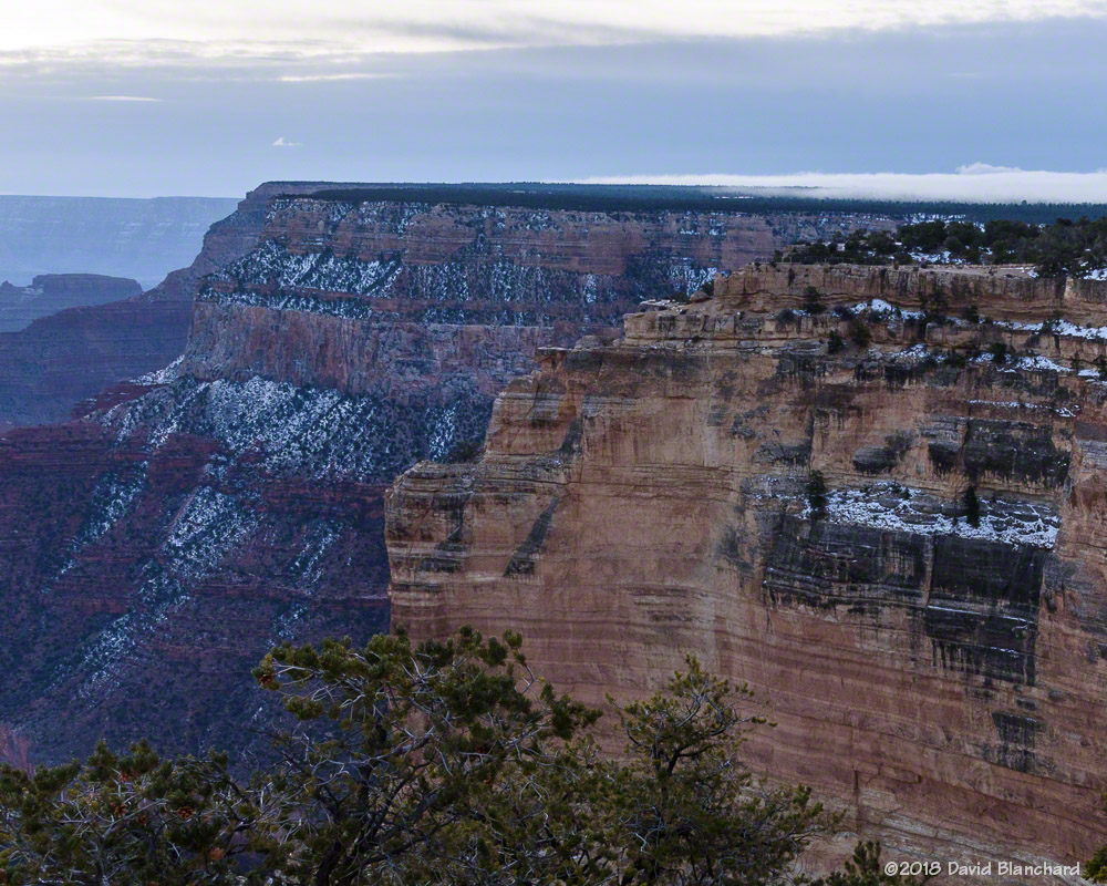
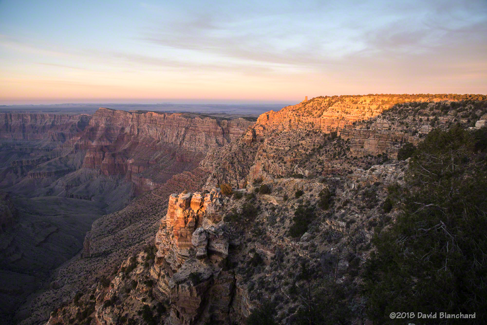
I have traveled up to the South Rim of Grand Canyon several times in the past few weeks to get interesting weather and cloud photographs.
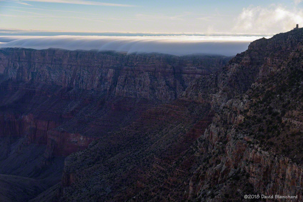
Fog begins to spill over the rim of Grand Canyon.
Two weeks ago, we spent two nights at the South Rim waiting for a winter storm to arrive and drop some snow on the higher elevations of the canyon. The storm went too far south and Grand Canyon got nothing but some clouds and a bit of fog. Flagstaff, on the other hand, got about 8″ on snow—which we had to clear from our driveway when we returned.
A thin layer of fog on the South Rim of Grand Canyon.A zoomed-in view of the fog on the canyon rim.As the sun rose higher it illuminated the canyon below Hopi Point.
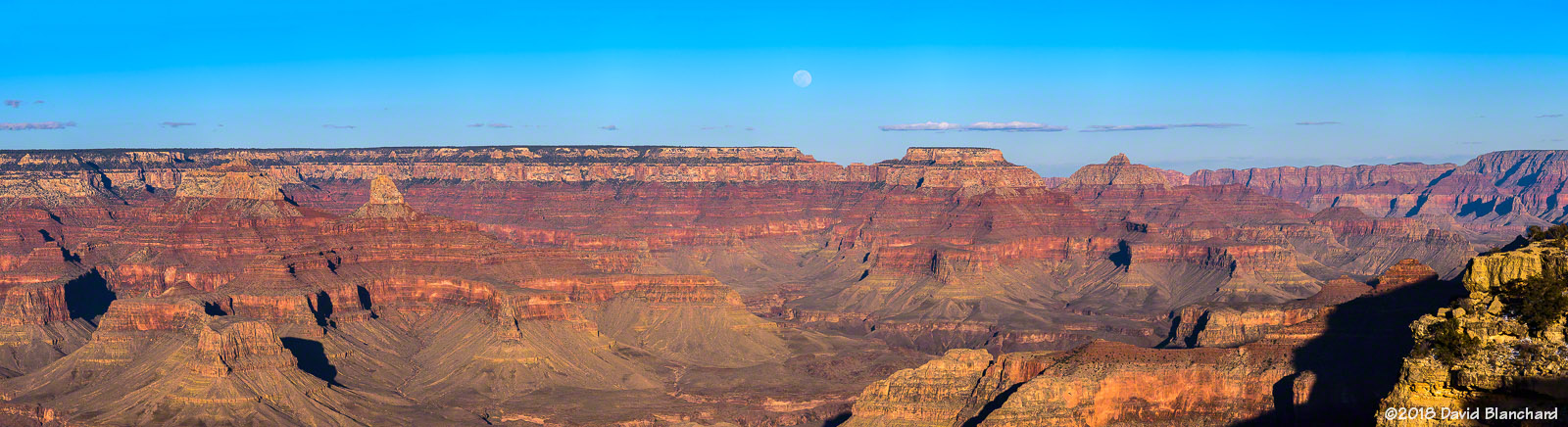
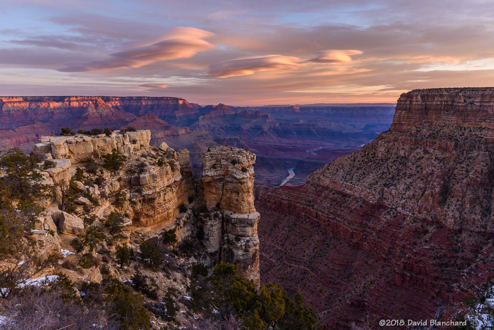
The other goal on that trip was to catch the rising nearly-full moon as it climbed above Cape Royal on the North Rim. That worked out well as the clouds had dissipated by late afternoon. This image was shot as a 12-frame panorama (6 across, 2 rows) resulting in an image of ~200 megapixels. There is a lot of detail in the full-resolution image!
Moonrise above Cape Royal, Grand Canyon National Park.
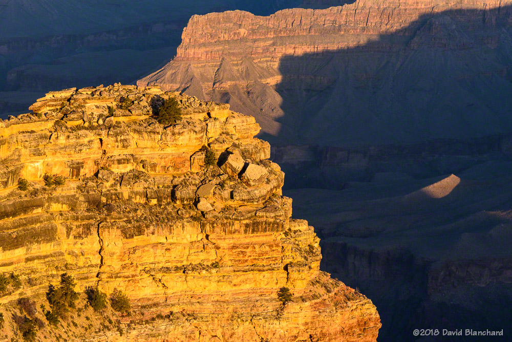
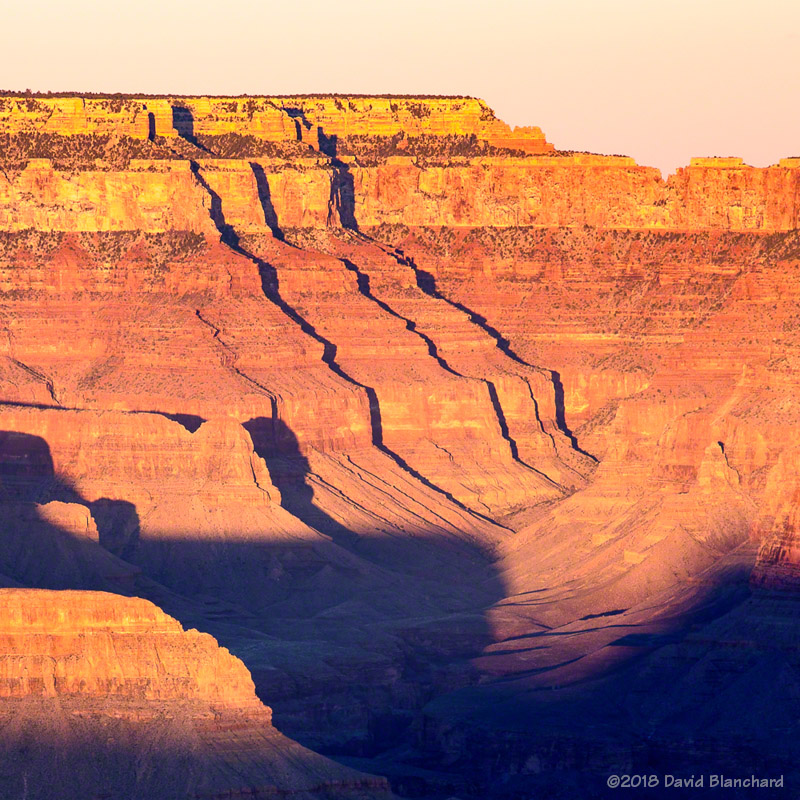
As the sun fell lower in the sky, shadows raced across the canyon bottom while some of the higher towers and buttes remained in the sun—resulting in some interesting lighting and abstract patterns.
Late afternoon sun in Grand Canyon.Light and shadow create abstract forms on Cape Royal.
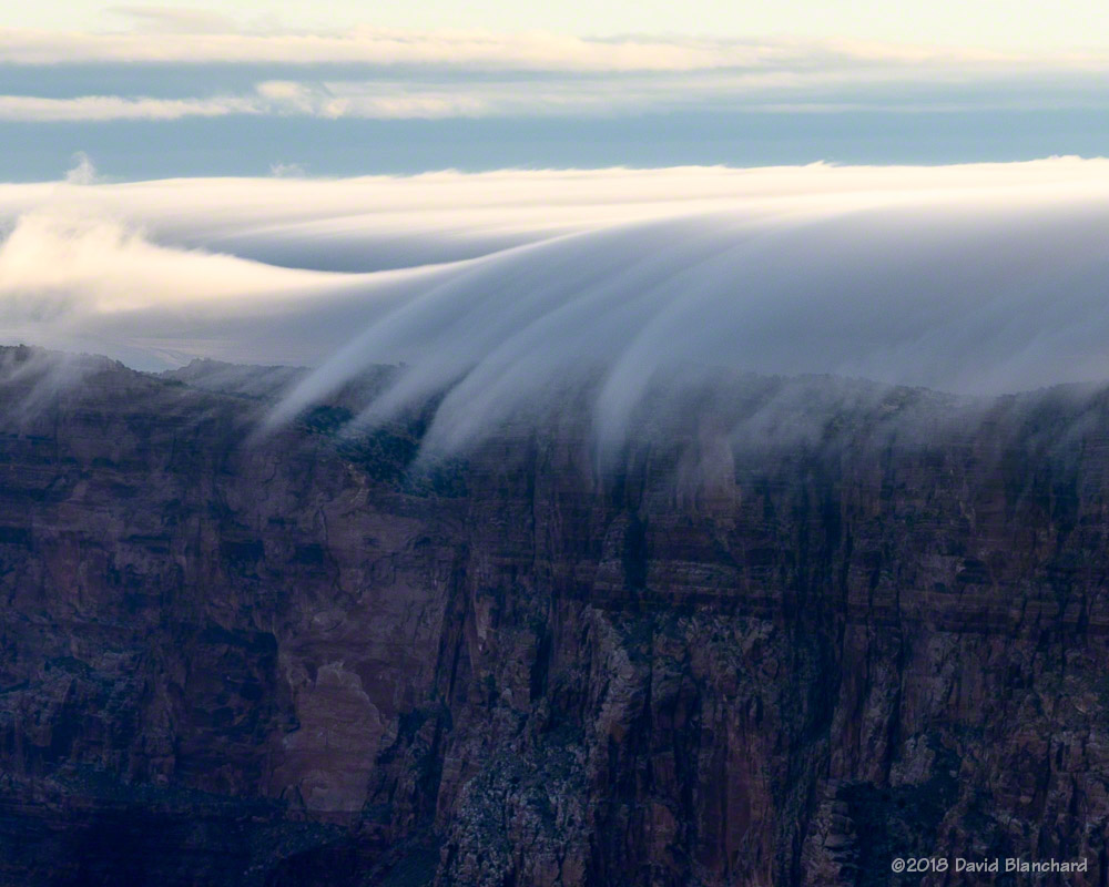
Our final morning had some wave clouds forming downwind of the Kaibab Plateau and being lit by the rising sun.
Wave clouds illuminated by the rising sun.
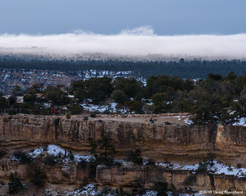
A few days ago we had a widespread rain event—even though rainfall amounts were not particularly large. Most importantly, measurable rain fell in Winslow. This meant that there was a possibility of fog forming in the Little Colorado River (LCR) Valley and drifting into the eastern reaches of Grand Canyon. I arrived at Lipan Point on the South Rim before sunrise and could see some low-lying fog in the LCR well east of the canyon. As the sun rose and the land began to warm, the fog began to lift and move towards the canyon. Eventually, it reached the Palisades north and east of Desert View Overlook. And, then, it began to spill over the sides evaporating only a short distance below the rim.
A shallow fog layer lies to the east of Grand Canyon at sunrise.Fog spills over the rim into Grand Canyon.
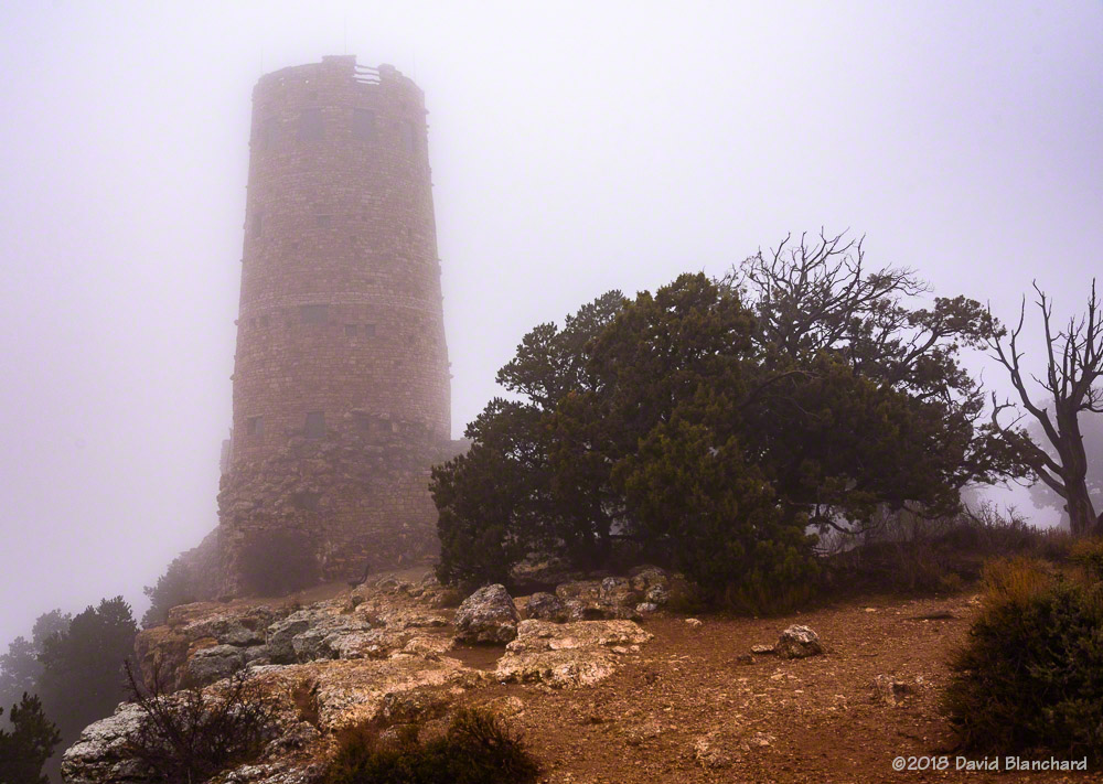
The fog soon swept across Desert View Overlook. I headed over to Desert View to shoot photos of Desert View Watchtower in the fog—but the fog was so thick I had to get very close to even see it.
Fog swirls around Desert Watchtower.And—for just a moment—there was great color in the sky behind Desert Watchtower.
I went back to Grand Canyon again the next morning but there were clouds along with some drizzle and light rain. However, there was a 2–3 minute period in which some clouds had a bit of sunlight color. Yes—that’s a pretty long round-trip drive for 2–3 minutes of good photography. Nobody ever said it was easy…
A few days ago the Moon and Venus were very close together in the evening twilight sky. At sunset on Friday, the two objects were about 3° apart—about six moon diameters—with the Moon located up and to the left of Venus.
Crescent Moon and Venus in evening twilight.
To view this I wanted a location with a very low western horizon. I chose to visit Navajo Point on the South Rim of Grand Canyon National Park. From this location, the rim to my southwest was actually slightly lower than my position giving me an unobstructed view.
There was a nice sunset to start off the evening. The clouds were lit up and there was still enough light to fill in the lower canyon.
Sunset at Navajo Point, Grand Canyon.Twilight at Grand Canyon.
The moon was only one day past New Moon and was about 1.4% illuminated although there was a bit of Earthshine helping to illuminate the entire disk.
Setting moon over the South Rim of Grand Canyon.
As the Moon approached the horizon, atmospheric effects resulted in the lower limb of the Moon being distorted. The final image is a composite taken over several minutes prior to moonset. In this composite it is easy to see the distortion of the lower limb.
The North American Monsoon continues across the Southwest bringing thunderstorms almost every day to northern Arizona. Rainfall amounts across much of the state have been well above average with Flagstaff receiving 4.5″ compared to a normal of 2.6″ in the month of July,
Of course, all this storminess brings opportunities for photographing interesting skies, lightning, and sunsets.
I was heading towards the South Rim of Grand Canyon when I decided that Wupatki National Monument might be more interesting. Although there wasn’t much in the way of lightning there was a nice sunset with a thunderstorm in the distance.
Sunset at Citadel Pueblo in Wupatki National Monument.
Another day brought a great sunset with beams of light illuminating the inner canyon.
Sunset from Lipan Point, Grand Canyon National Park.
I found myself in Sedona a few nights later hoping for lightning at sunset. The lightning was there but clouds to the west blocked the light of the setting sun. This spectacular bolt of anvil lightning traveled horizontally for a great distance before terminating above Cathedral Rock.
Lightning over Cathedral Rock, Sedona, Arizona.
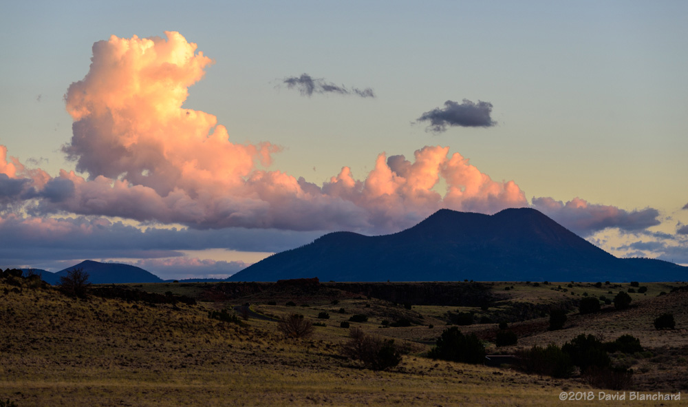
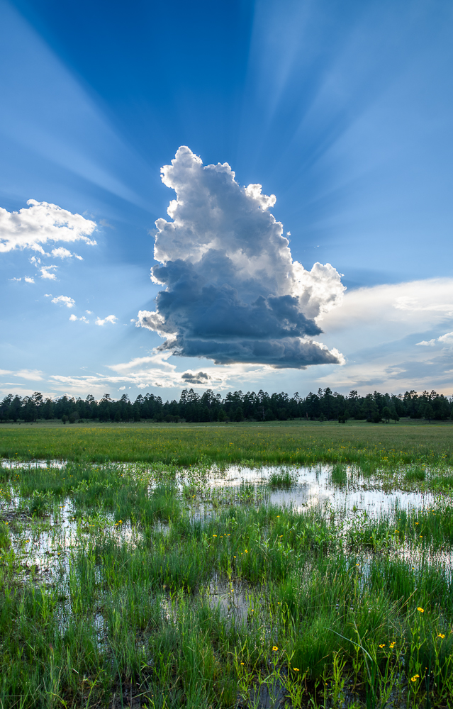
Early afternoon cumulus development near Marshall Lake on Anderson Mesa resulted in this small cumulus cloud producing a very photogenic shadow.
Cumulus cloud over Marshall Lake.
And, later that afternoon, we found ourselves at Lower Lake Mary watching another cumulus cloud develop to our east and reflected in the water.
Cumulus cloud reflected in Lower Lake Mary.
I’ve been trying to capture evening thunderstorms and lightning (image) over Grand Canyon with a crescent moon illuminating the interior the canyon. Not very easy to do. I was able to get the moonlit canyon. And there was lightning but it was over 100 km away and resulted in teeny, tiny bolts in the phots. Well, I’ll just keep trying.
A crescent moon illuminated the interior of Grand Canyon. (120 second exposure, f/4, ISO 200, 16mm)
The other day provided a good opportunity to photograph both lightning from thunderstorms and sunset at Grand Canyon. Satellite imagery from the new GOES-16 satellite indicated that skies remained clear across western Arizona as well as southern Nevada and California. This would allow the setting sun to appear below the cloud deck from the thunderstorms and—maybe—create a great sunset with the clouds glowing from below as the sun approached the horizon.
GOES-16 visible satellite imagery.
Close, but it didn’t quite happen that way. The clouds never took on that beautiful glow. On the other hand, an abundance of monsoon moisture in the lower atmosphere allowed the sun to create beams of light and shadow through the depths of the canyon. This was at its best when the sun was briefly obscured by some mid-level clouds creating some shadows at my location—but with sunlight streaming into the canyon below.
Beams of light and shadow play across Grand Canyon.
After the sun had dropped below the horizon the beams were gone, of course, but there was still color in the western sky.
Twilight colors at Grand Canyon.
The earlier thunderstorms over the area had dissipated but new storms developed about 50 km to my west. This distance meant the visible bolts were fairly small. I wanted big bolts dropping into the canyon near me. What we want and what we get…well, you know.
The radar image shows my location (circle) and the storms to the northwest.
Twilight thunderstorms and lightning over Grand Canyon.Evening thunderstorms and lightning over Grand Canyon.
The lightning images are composites of multiple photographs taken over a period of several minutes. The shutter was left open for 15s for each photograph. Some had multiple lightning bolts while others were dark. Even though it was almost 90 minutes after sunset the photographs were still able to pick up twilight colors on the western horizon.
All in all, an illuminating evening (bad pun intended).