An early-season trough of low pressure moved across the west on Wednesday and Thursday disrupting the winds associated with the North American Monsoon. As the trough moved across the area, copious amounts of sub-tropical moisture surged northward across Arizona and surrounding areas. Widespread rain with embedded thunderstorms occurred across the area with areas of heavy rainfall and localized flash flooding.


But now the trough has moved northeastward across the Rocky Mountains and into the northern Plains states. The moisture across the southwest has been swept away. This can be seen in the water vapor satellite image. The warm colors are associated with a drier air mass and this has overspread the southwest.
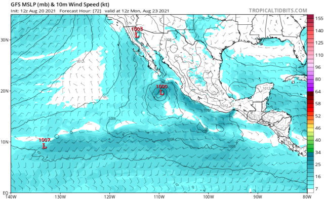
Medium range models such as the GFS (Global Forecast System) suggest that moisture and showers will not return to the area before the end of the month leaving us with an extended break in rainfall.


But there are always some features that can result in different outcomes. For example, Hurricane Grace is moving westward across the Gulf of Mexico and is expected to make landfall in Mexico. The remnants of this tropical cyclone will continue to move to the west and may emerge in the Pacific south of the Gulf of California. If this happens, there might be a surge of moisture moving northward toward Arizona that could bring a return of showers and thunderstorms sooner than models currently suggest.