Moonrise above the snow-covered San Francisco Peaks

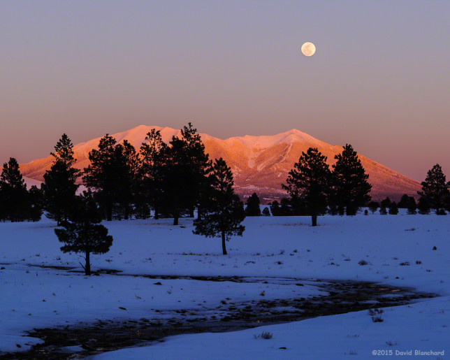
Here are a few recent images of the nearly-full moon rising above the San Francisco Peaks in northern Arizona. The day before the full moon is often the most photogenic time as the landscape is still bathed in sunset light while the moon has already climbed well above the horizon.

But if only it was that easy! Earlier in the day I had used The Photographers Ephemeris (TPE) to find a location. I decided that a position on SR64 north of Williams, Arizona, would work and at that distance the moon would appear quite large juxtaposed against the mountains. Unfortunately, when I arrived at my predetermined spot I was not able to see the mountains. Numerous cinder cones and small hills completely blocked my view. I wish TPE was more intelligent than this photographer and would let me know of obstructions.

With less than 15 minutes until moonrise and one-half hour until the moon would be above the peaks, I had to find a new location quickly. I backtracked south on SR64 and then east along Route 66 but hills and trees continued to block my view. When I did finally get a clear view I was too far south and the moon would rise south (right) of the peaks. I stayed around for a few minutes to get a few consolation images of the moonrise then headed east again. Arriving in Parks, Arizona, I turned north and kept looking for a location with the moon above the peaks and a clear view. Finally, I found this location.

20150304_1822_DBP_5619 20150304_1823_DBP_5620

Although these were not the images I thought I was going to get I’m still happy with the result.

Note: No speed limits were broken while trying to reposition!

A foggy night in northern Arizona

It’s still the rainy season but this is silly. The amount of rain that has fallen in Bellemont, Arizona, in August is quickly approaching eight inches. Meanwhile, a few miles away at the Flagstaff airport, a more reasonable two and one-half inches has fallen this month. Most of that rain in Bellemont has fallen in the past few days. As a result, the ground is fairly saturated and there is plenty of standing water. This produces good conditions for nighttime fog in the area.

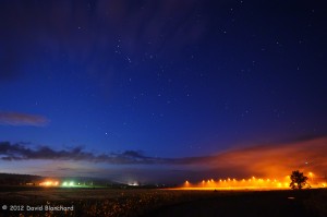
Fog during the pre-dawn morning hours.

The first image was taken well before sunrise with plenty of stars visible. More striking, however, is the patch of fog and low clouds on the right — nicely illuminated by the lights.

Early morning fog creeping down the hillside.

The next image was taken shortly after sunrise and shows the fog lurking on the hills above the flats of Bellemont. The trees poke out through the top and the light poles add some foreground texture to the image.

Desert View Watchtower at Grand Canyon National Park

Recently some friends visited northern Arizona and we gave them the quick, one-day tour of Grand Canyon National Park. We visited many of the easily accessible overlooks as well as a few that required some hiking which gave us some moments of solitude. The canyon is spectacular, but on this day I was more intrigued with photographing the interior of the Desert View Watchtower.

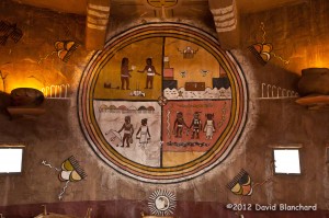
Mural on the wall of the Desert View Tower at Grand Canyon National Park.

The Desert View Watchtower was the last of the series of Mary Colter-designed visitor concession structures at Grand Canyon National Park and was designed to resemble the Ancient Pueblo Peoples watchtowers found at Hovenweep National Monument and Mesa Verde National Monument. From the tower there are majestic views of the North Rim, South Rim, and East Rim as well as some of the better views of the Colorado River below as it turns westward.

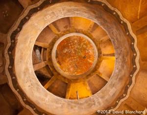
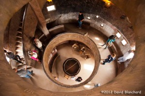
Looking up through the grand staircase at Desert View Tower.

The tower rises as an open shaft lined by circular balconies overlooking the central space and the interior walls contain many murals, including this one by Fred Kabotie. Many other petroglyph-style decorations art adorn the walls.

...And looking down on the visitors...
…And looking down on the visitors…

Looking up…and down…gives a grand sense of the structure.

Spring snowfall at Slide Rock State Park in Oak Creek Canyon

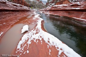
A late season storm brought snow to the high country of Flagstaff where almost a foot of snow fell over the weekend. But snow also occurred in the lower elevations including Oak Creek Canyon. Here was a final opportunity of the season to photograph new-fallen snow on the red rocks of Slide Rock State Park.

New snow on the red rocks of Slide Rock State Park in Oak Creek Canyon.

Unlike my previous snow photo shoot here back in early December temperatures were considerably warmer. (On that cold morning it was below zero in Flagstaff and only in the upper teens at Slide Rock State Park.) In fact, the temperatures remained above freezing overnight in this part of Oak Creek Canyon. This meant that the snow had been melting all night long leaving only patches on the ground. On the other hand, the relative warmth also meant that the rocks were only wet rather that covered in ice as in that previous session. So this made walking around substantially safer.

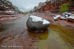
Snow covered boulder sits in Oak Creek in Slide Rock State Park.

Low clouds hung over northern Arizona that morning and the light was dull and flat as a result. Consequently the photographs don’t have the *pop* they might otherwise have if there was sunrise light reflecting off the high cliffs above the creek. Still, the juxtaposition of snow on the red rock is always worth a chance.

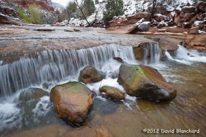
Boulders in Oak Creek in Slide Rock State Park.

Afterwards, a trip to the Indian Gardens Oak Creek Market was in order. Having a hot cup of coffee after a chilly morning of shooting is always welcome. And their bakery items are pretty good, too.

Grand Staircase-Escalante National Monument in Winter

With the winter holidays presenting a few days off from work we decided to do a bit of close-to-home travel. Our destination was Page, Arizona, and from there we could visit some photographically-interesting sites as well as do some canyon hiking.

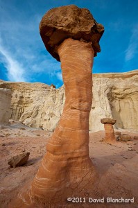
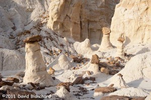
We arrived mid afternoon and headed for the Toadstools (also known as the Paria Rimrocks or the Rimrock Hoodoos), an otherworldly site that is part of the Grand Staircase-Escalante National Monument.

Located between Page, Arizona, and Kanab, Utah, it is easy to miss as there is only a small roadside sign and dirt parking lot as you travel on US Route 89. The trail is a short and easy hike of less than a mile.

Rimrock Hoodoos ("Toadstools") in the Grand Staircase-Escalante National Monument.
Rimrock Hoodoos (“Toadstools”) in the Grand Staircase-Escalante National Monument.

From the interpretive sign at the start of the trail: “What is a Toadstool? A toadstool is a spire-like feature with a boulder perched atop a pedestal rock, like a mushroom, or ‘toadstool’. It forms when softer rock erodes away, leaving a column sheltered from the wind and water.”

Such a mundane description for what are amazing pieces of natural rock art.

Rimrock Hoodoos ("Toadstools") in the Grand Staircase-Escalante National Monument.
Rimrock Hoodoos (“Toadstools”) in the Grand Staircase-Escalante National Monument.

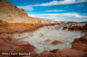
With afternoon light beginning to fade the colors were amazing. The downside was that it’s late December and even in the desert southwest it can get pretty chilly in the late afternoon. Finally, the sun set and the sky darkened ending an enjoyable afternoon of exploration and photography.

Late afternoon lighting across the Toadstools region.

The next day was spent at the better known Antelope Canyon — a part of the Navajo Nation Parks.

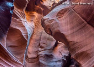
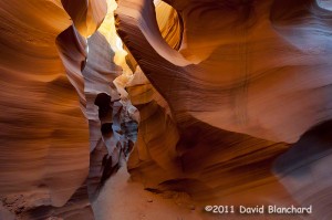
Lower Antelope Canyon, Navajo Nation Parks, near Page, Arizona. (HDR image).

We’ve been here a few times over the years but never get tired of viewing the fantastic sculpturing of the soft sandstone within the confines of this slot canyon.

Lower Antelope Canyon, Navajo Nation Parks, near Page, Arizona.

There are two distinct areas to visit: Upper Antelope Canyon and Lower Antelope Canyon. The upper canyon is much easier to walk as it has a smooth and generally flat sandy floor and is wide enough for people to move around. It is the recommended choice for those with limited hiking abilities or those that are uncomfortable in confined spaces. Lower Antelope Canyon requires moving through exceptionally narrow confines and climbing up and down steep ladders.

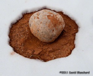
Snow melt pattern around a boulder in Catstair Canyon, Utah.

Lastly, we traveled back west towards Houserock Valley and did a short hike in Catstair Canyon. If you look carefully you will find some ancient petroglyphs on the sandstone walls of this short canyon. Far more interesting to us, however, was the snow melt pattern around this volleyball-sized boulder.