Walking Through Zion Narrows

Zion Narrows: It’s a trip we have thought about for several years. So when a friend indicated she wanted to do the Narrows this spring, we agreed to join her and plan a trip.

There are two different ways to hike Zion Narrows. The easiest and the one done by probably 99%+ of visitors to Zion National Park is to walk upstream from the Temple of Sinawava—the last stop on the summer shuttle bus. The other is much harder and is a full-day commitment. It requires a long drive to the upper end of the canyon followed by a 16-mile hike down through the canyon. Wading through water is required most of the way—and a few swims are also possible.

The full-day trip requires a permit. We decided that early June would be the best time because water levels have diminished from the high water of spring, water temperatures have slowly increased, days are long and hot, and the summer thunderstorm season has not started. This last point is an important one because this is not a good place to be if it begins to rain hard. Flash floods are possible and there are sections of the walk where no high ground is possible.

So we obtained a reservation for our permit—to be picked up the day before the hike.

But something strange happened to the weather this spring. Instead of the normally hot and dry months of May and June, we had rain and cool temperatures. And then there were the unseasonably strong and early hurricanes in the eastern Pacific this year. Hurricane Blanca, in particular, caused problems because it sent a substantial surge of tropical moisture northward. So what should have been a warm and dry June became a cool and wet June.

A Flash Flood Watch was issued for several days across southwestern Utah because conditions suggested that floods were possible. We declined the permit. Instead, we went hiking and did the Observation Point Trail.

The many switchbacks of Observation Point Trail.
Looking down on Angels Landing from Observation Point.
Near the top of Observation Point.
Slot canyon along the Observation Point Trail.

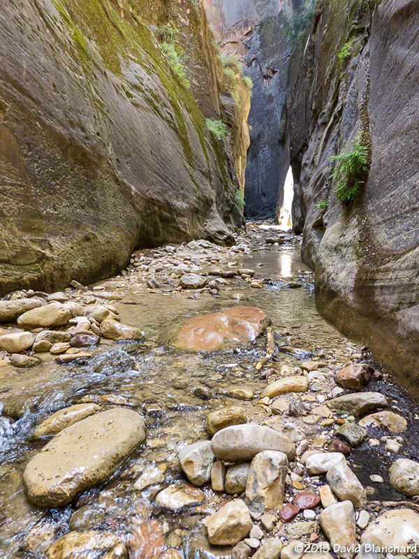
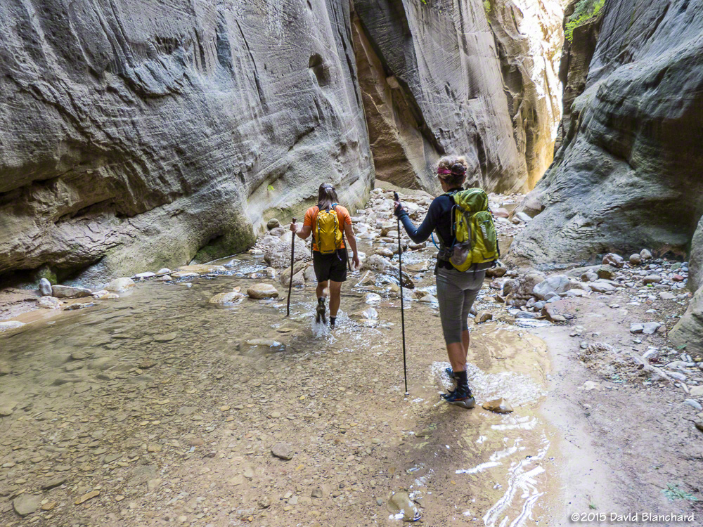
The next day, we decided to do the out-and-back version of Zion Narrows since this required far less time and commitment and provided some safety escape routes. At the beginning of the trail the Park Service had posted a sign indicating that a Flash Flood Watch was in effect and that flooding was possible. This didn’t seem to deter the folks intent on hiking up the river. I wonder how many of these visitors actually understood the situation? I certainly did. We would minimize the risk by starting and ending early before thunderstorms developed and we would minimize how far upstream we would travel so that we could stay in the wider and—hopefully—safer stretches of the canyon.

The beginning of the Zion river walk.
The walls close in on the river...
The walls close in on the river…
...and a small rock and sand beach appears alongside the river.
…and a small rock and sand beach appears alongside the river.
Deeper into the canyon...
Deeper into the canyon…

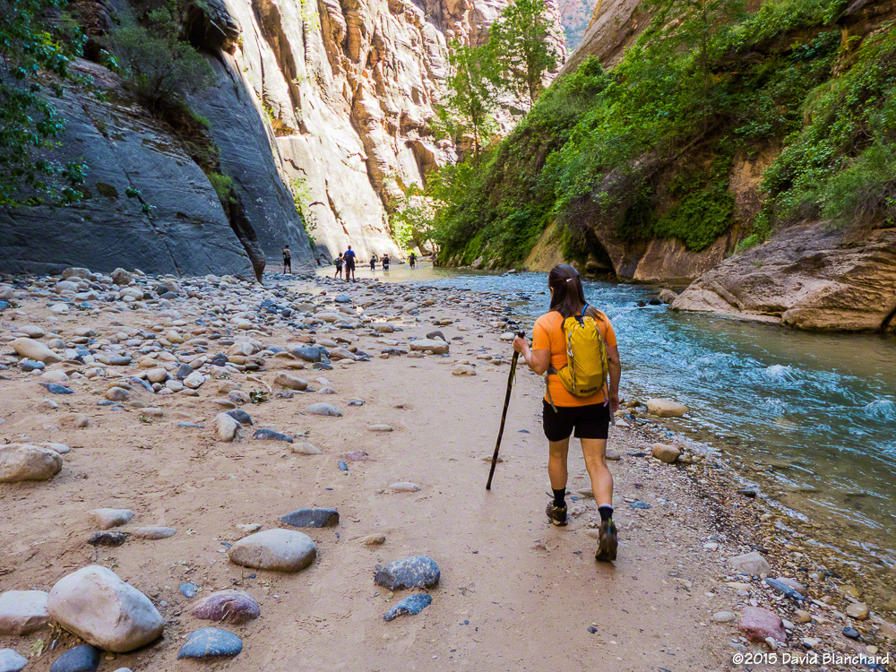
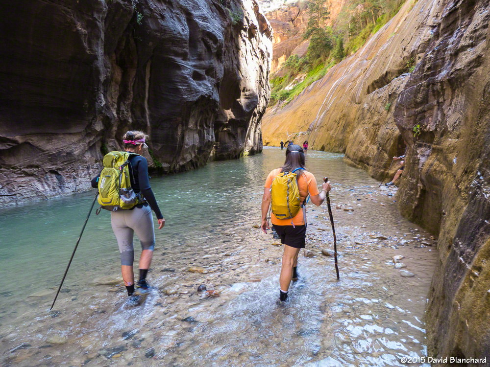
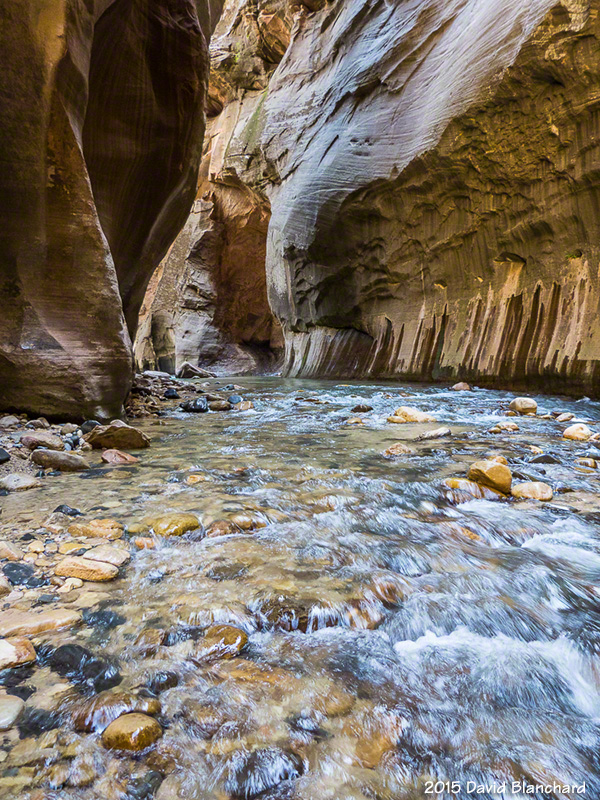
And so we set off under mostly sunny skies and warm temperatures. The water was cool but we had brought along neoprene socks and these did a fine job keeping our feet warm. After a few miles, we reached Orderville Canyon, a fine side canyon to explore. The water was shallower here with far less current making for easier travel. Until, that is, we reached some of the deep pools that required some swimming. So—we swam. Not too much farther upstream we were blocked from easy travel. We might have been able to bypass the rocks and logs at this point but with the weather situation looming we were content to let this be our turn-around point.

The beginning stretch of Orderville Canyon.
Around this bend was our first deep water and swim.
The return trip down Orderville Canyon.

And, sure enough, on the way back, it began to rain. Not much, not long, but enough to be glad we were heading back downstream.

Flood gage for the Paria River.

Oh, one more thing. While no flash floods occurred in Zion National Park that day, a large flash flood did occur not too far away along the Paria River, another popular canyon hike. Water levels rose from 8 cubic feet per second (cfs) to over 1000 cfs in less than an hour.

A couple of rafts floating down the river

While returning to Flagstaff from a quick trip the other day, we stopped for a few minutes at the Navajo bridge across the Colorado River near Lee’s Ferry. Lee’s Ferry is the launch location for boat trips down the Colorado River through Marble Canyon and Grand Canyon. These rafts had probably launched within the hour and were beginning a multi-day trip down the river.

20150612_1303_DBP_6723

20150612_1304_DBP_6724

Heavy rains in recent days had deposited a large load of silt into the Paria River—which empties into the Colorado River just below the boat launch site. Stream flow increased from a baseline of about 8 cfs (cubic feet per second) to around 1000 cfs.

Stream flow on the Paria River near Lee's Ferry.
Stream flow on the Paria River near Lee’s Ferry.

These boaters may have been hoping for clear water for the initial portion of their river trip—but did not get it.


Buckskin Gulch sans water and mud

Three of us recently did a day hike in Buckskin Gulch. This is a well-known slot canyon on the Utah side of the Utah/Arizona border. The canyon is about 13 miles long making it one of the longest slot canyons in the southwest — and possibly the world.

A climbing move is required to bypass this boulder in Wire Pass -- a tributary of Buckskin Gulch. The pile of boulders at the bottom helps.
A climbing move is required to bypass this boulder in Wire Pass — a tributary of Buckskin Gulch. The pile of boulders at the bottom helps.

In normal years rainfall during the summer, fall, and winter leaves ankle- to knee-deep pools of cold water in the canyon. Hiking through here under these conditions is tricky since the pools are often scoured by the rushing water which may result in one side being deep and the other shallow as the sand or rocks build up. With muddy water it is impossible to see under the surface of the water and a walking pole is used to probe carefully before placing each step. A mis-step can result in going from knee-deep water to chest-deep water in one quick step!

Dry and sandy narrows through Buckskin Gulch.

Some years, however, the fall and winter months are dry and the canyon floor is dry in the spring. That was the case this year. After a wet fall, a dry winter and spring followed and this allowed the canyon floor to be water free — at least in the first few miles that we traveled.

Reflected light illuminates a far wall deep within Buckskin Gulch.

The first time we did this hike (2004) it was dry and we mistakenly assumed this was normal. Returning to hike in 2005, 2006, and 2007, we were greeted each time with water. So it was a pleasant surprise to return after a few years absence and find it dry.

A narrow beam of light penetrates deep into the narrows of Buckskin Gulch and gently illuminates the side walls of the canyon.

What was less pleasant was seeing how visitors to this amazing place have left graffiti along the canyon walls. There was no graffiti the first three times we visited and only one defacement the last time. This time there was graffiti in many locations in the first few miles of the canyon. It is truly saddening that people would do such a thing in a beautiful place.

Exquisitely textured walls found within Buckskin Gulch.

Still, we had a great time walking a few miles down canyon, eating our lunch in the cool and quiet narrows of the slot, and enjoying our brief visit to this remarkable place.