Clouds at Sunset at Rogers Lake

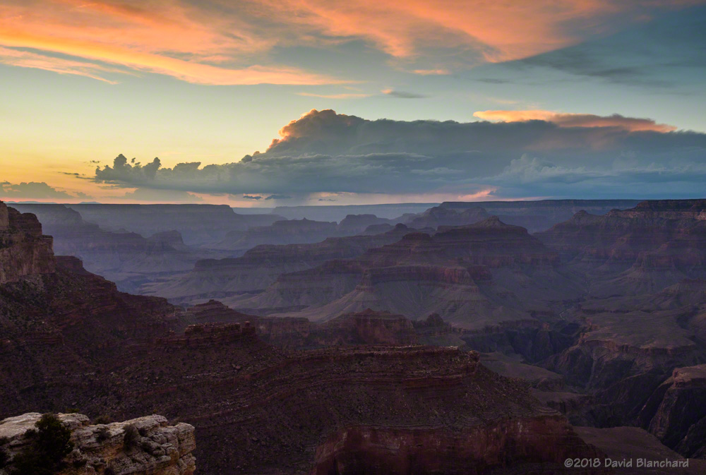
The past week has featured dry conditions with mostly cloudless skies. That changed on Wednesday as a weak disturbance moved across the Southwest and brought a bit of moisture to the area. By afternoon it was evident that there would be some interesting clouds at sunset so we headed to Rogers Lake County Natural Area, located a few miles southwest of Flagstaff.

A view of the San Francisco Peaks reflected in the shallow waters of Rogers Lake.

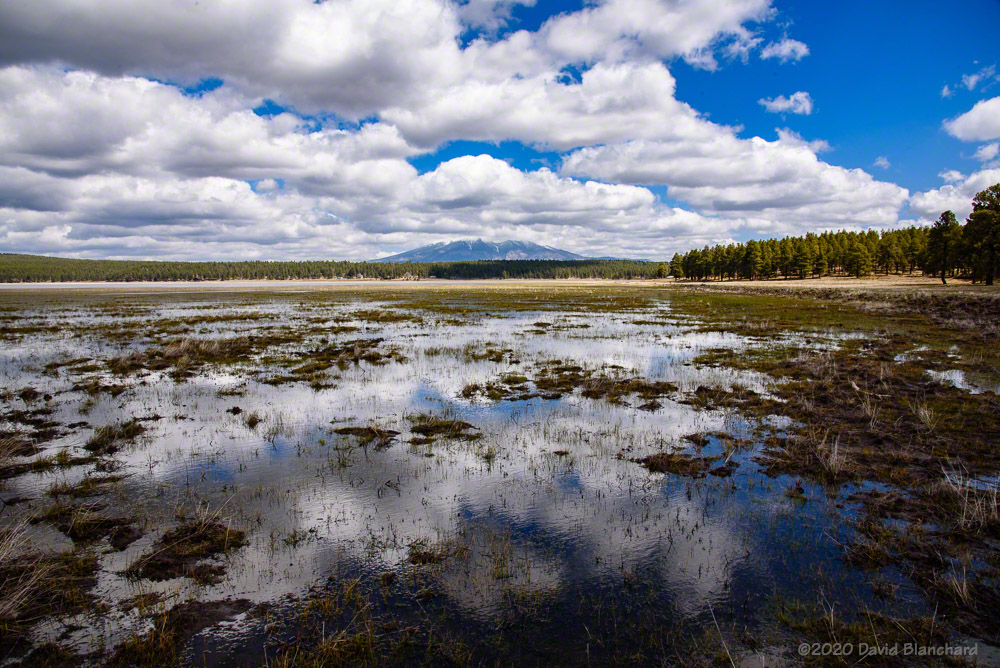
Our first stop was at the southern end of the lake which allowed us to take photographs over the water looking towards the San Francisco Peaks. The winds began to calm as the sun lowered in the west providing interesting reflections of the peaks in the smooth water. Note: lots of bugs but they weren’t annoying.

Sunset over Rogers lake from the northern viewing area. Wetland grasses are already growing tall in the shallow waters of the lake.
A zoomed-in view of the wetland grasses and sunset reflections on the waters of Rogers Lake.

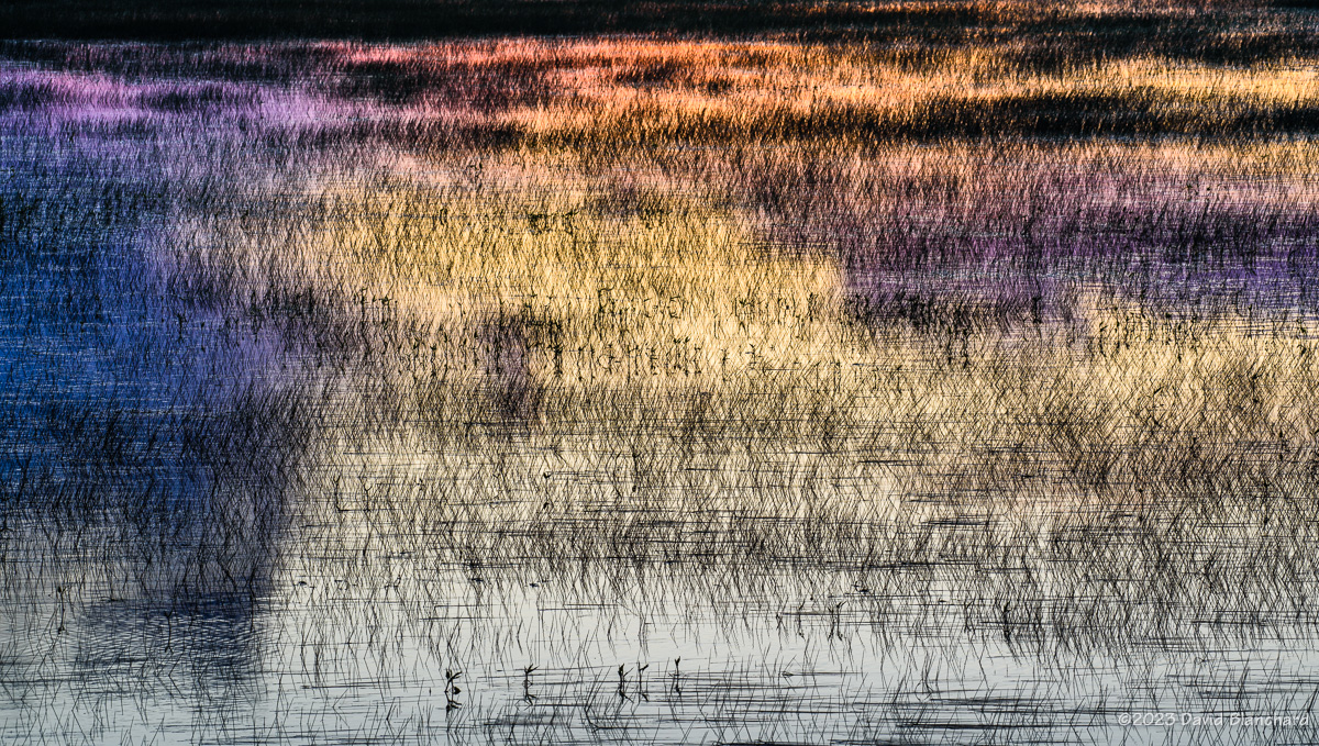
We then moved to the northern viewing area to shoot photos across the lake and towards a band of shallow convective clouds and the sun. There was a period of a few minutes in which the colors were greatly enhanced. I was using a 24–120mm lens for most of the early photographs but switched to a 200–500mm lens for some closeup photographs of the water. The wetland grasses were growing out of the shallow water and created an interesting abstract photo, especially with the sunset colors reflected on the water.

Panoramic view of Rogers Lake at sunset.

The panoramic image was shot using an iPhone.

The forecast calls for several more days with clouds and showers so there may be additional opportunities.

Water—Spring 2020

Here are a few recent water photographs in northern Arizona.

Dry Beaver Creek and Jacks Canyon Creek confluence.

This photograph was taken in mid-April after a spring storm brought snow to the Mogollon Rim and rain to the lower elevations. The runoff was sufficient to swell the flow in Dry Beaver Creek from a light trickle back to a noisy roar. This is the confluence of the smaller Jacks Canyon Creek with Dry Beaver Creek. While the flowing water is in late-afternoon shadow, the trees and distant hills remain in sunlight.

Rogers Lake.
Rogers Lake.

A day later I was at Rogers Lake southwest of Flagstaff. The reflections of the clouds in the shallow water is interesting. Getting this shot required walking out into the mud. I was glad I had thought to bring a spare pair of shoes for the drive home.

Headwaters of Sycamore Canyon.

A week later I did a morning run along the Sycamore Rim Trail. When finished, I returned to a few spots that would make interesting water photographs. This is typical of the upper sections of the canyon with ponds of slow moving water and grassy edges.

Dry Beaver Creek.
Dry Beaver Creek.

This image was taken on a different location on Dry Beaver Creek about two weeks after the top photograph. Water levels have dropped substantially. A few large pools remain but water flow is down to a trickle.

We are now entering our dry season and the water in these locations will quickly disappear.

Arizona Monsoon Clouds — August 2018

The setting sun lights up rain curtains as a brilliant lightning bolt strikes behind Wukoki Pueblo in Wupatki National Monument.

A previous post displayed photographs of storms and weather that occurred during July of this year’s North American Monsoon. Here are photographs from August (plus the first day of September).

Cumulus and Cumulonimbus

A search for wildflowers and thunderstorms brought me to Rogers Lake west of Flagstaff. It’s a lake only ephemerally during springs with heavy snow runoff. But it makes a grand place for photographs when a wide-open vista is desired. Earlier convective storms were pushing an outflow boundary southward with new convection developing on the boundary.

Outflow boundary and convection over Rogers Lake with the San Francisco Peaks in the distance.
A distant cumulonimbus can be seen from the Doney Mountain Picnic Area near Wupatki National Monument.
Thunderstorms move across Grand Canyon with low clouds clinging to the higher points and buttes.

There was just enough vertical wind shear on this day to allow some storms to briefly exhibit supercell characteristics and deviate to the right—which brought this thunderstorm near the edge of the North Rim of Grand Canyon.

A strong thunderstorm over the North Rim of Grand Canyon is reflected in a small pool of water.
A weak, late afternoon thunderstorm is backlit by the setting sun.

Fog and Smoke

Sometimes the unexpected can be magical. When fog forms in Grand Canyon the visitors may be disappointed but there is the potential for amazing photographs.

A long-lived cluster of thunderstorms east of Grand Canyon pushed a cool, moist outflow into the canyon producing areas of fog near the South Rim.
More fog in Grand Canyon.

Smoke from the Obi Fire on the North Rim produced both amazing and dull conditions.

Smoke from the Obi Fire on the North Rim creates a colorful sunset.
Smoke from the Obi Fire fills Grand Canyon and reduces visibility.

Sunset and Full Moon

Sunset after the storms can be amazing. And if there is a nearly full moon, things can get very interersting.

A backlit thunderstorm at sunset over Grand Canyon.
Post-sunset colors illuminate the underside of a dissipating shower.
Dissipating cumulus clouds at sunset with O'Leary Peak in the distance.
Dissipating cumulus clouds at sunset with O’Leary Peak in the distance.
Dissipating showers are backlit by the setting sun.
The nearly full moon illuminates the inner canyon as twilight fades behind a distant thunderstorm.
A dissipating thunderstorm anvil cloud is seen above pueblo ruins in Wupatki National Monument at sunset.

Rainbows

A double rainbow above Cathedral Rock in Sedona.
A rainbow, dissipating anvil, thunderstorm, and towering cumulus.

Lightning

And lightning…

An amazing anvil bolt...and too close!
An amazing anvil bolt…and too close!
Lightning west of Sedona, Arizona.
Anvil bolt over Cathedral Rock. (It's out of focus--<u>you</u> try focusing in the dark!)
Anvil bolt over Cathedral Rock. (It’s out of focus–you try focusing in the dark!)
Lightning illuminates Grand Canyon at night.
Lightning strikes the Moenkopi Plateau (composite image).
Several bolts strike behind Wukoki Pueblo in Wupatki National Monument.
The setting sun lights up rain curtains as a brilliant lightning bolt strikes behind Wukoki Pueblo in Wupatki National Monument.

It’s early September and the summer monsoon pattern is beginning to fade away. Soon it will be time to start thinking about autumn colors on the peaks.