A visit to West Fork Oak Creek after the Slide Fire

The Slide Fire started on May 20, 2014, and was fully contained 16 days later. In the aftermath of the fire, Coconino National Forest closed much of Oak Creek Canyon for safety reasons. Four months later, on October 1, the restrictions were lifted and recreational activities resumed.

We wondered how much—or how little—of West Fork Oak Creek (WFOC) had burned. There had been some information during and just after the fire indicating that in the lower section of the canyon there was only light to moderate burn severity and only over a small percentage of the canyon. Farther up in the headwaters there had been widespread low intensity burns.
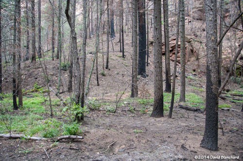
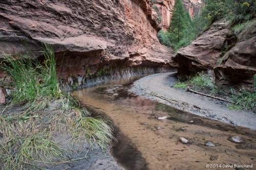
Typical burn scar seen in the lower reaches of West Fork.

So, finally, we hiked up WFOC to see for ourselves. The information was essentially correct and only small portions had burned and at low intensity. The canyon had survived. But there was still significant damage. Because of the burned areas farther up canyon, heavy rains this summer caused a lot of soil and ash to wash into the creek and flow downstream.

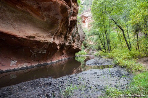
The creek channel was filled with silt and black ash. Where once the creek bottom had been smooth sandstone it now had several feet of silt and ash with deep channels carved through the silt.

This will slowly evolve back to its original state as winter rains and summer thunderstorms over the coming years flush out the silt and ash.

On a brighter note, we did see a late crop of ripening berries along the creek. Tasty!

A late season crop of ripening blackberries along West Fork.

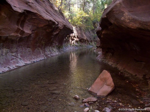
One of the most significant changes occurred at the end of the West Fork Trail. The trail ends around 3.3 miles from the trail head where the canyon narrows and deep water is found from edge to edge. To travel farther upstream requires wading through water that is thigh deep in places. Most hikers turn back at this point; a few hardy hikers accept the challenge of water and no trail and continue upstream for many miles.
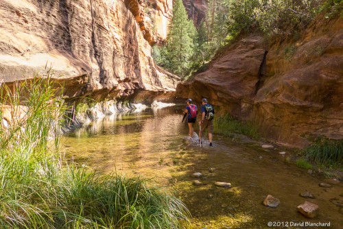
End of West Fork Trail in 2012 with water-filled channel.
End of West Fork Trail in 2008 with water-filled channel.
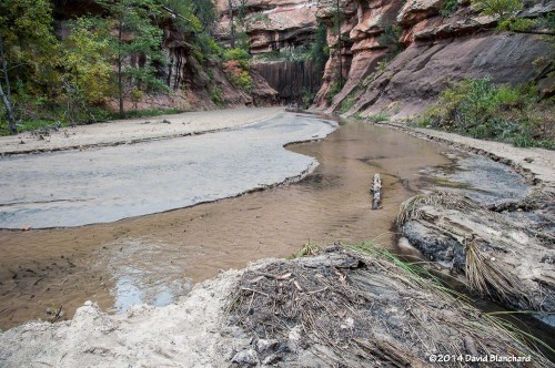
End of West Fork Trail in 2014 with silt-filled channel.

That has changed now as silt fills the slot canyon and a firm trail now exists where it once was only water.

Here are additional before and after images of West Fork Oak Creek.
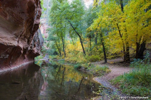
This is the first large pool most hikers see as they travel up West Fork Trail (2011).
This is the same pool in 2014. Ash and mud line the banks.

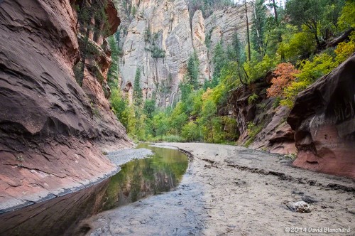
Several miles up the canyon the walls of the canyon close in again and water is found from edge to edge.
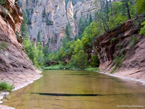
A wide and shallow pool stretches from wall to wall in this section of West Fork (2009).
The same section is now filled with silt and ash with a narrow channel carved in the debris.
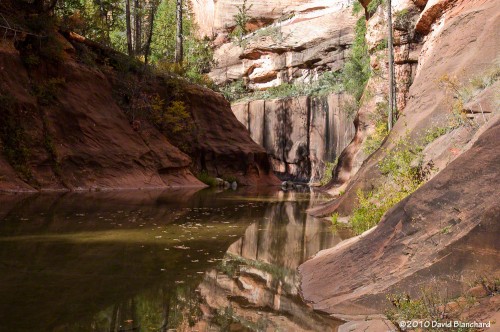
This is the same pool as above but viewed from downstream (2010).
The once-sparkling pool of water is now filled with silt and ash (2014).

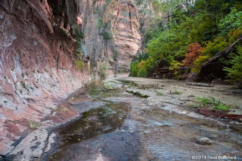
Just upstream and around the corner from this pool likes another narrow portion of the canyon with this large and smooth sandstone wall with trees. The sandstone floor of the creek bed has been filled with silt but the trees remain safe above the water and silt.
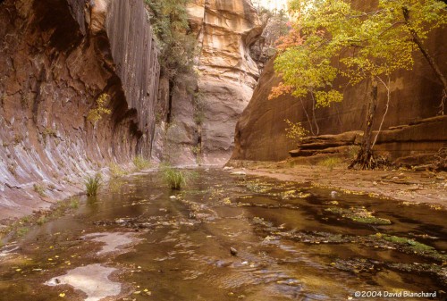
Narrow "slot canyon" with trees (2004).
Narrow “slot canyon” with trees (2004).
Silt and ash now cover the creek bed (2014).

Fire is an essential part of the ecosystem in northern Arizona and the Slide Fire may have done more good than harm since much of the burn severity was low or moderate. The fire removed a lot of fuels on the forest floor and have provided nutrients for the future of the forest. In the short term the silt and ash have filled many pools and covered the sandstone floor of the creek bed but these are not long-term harms. In time, the canyon will return to what it was before.


Rainbows and lightning in the Arizona Desert

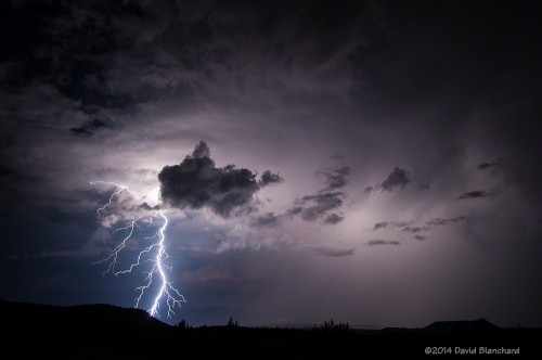
Over the weekend tropical moisture and an area of low pressure interacted to produce showers and thunderstorms—and even a few severe thunderstorms—across northern Arizona. A quick look at satellite and radar data convinced me it was worthwhile to drive down the hill from Flagstaff to Sedona to capture some lightning photos.

A rainbow arcs across the skies of Sedona and in front of Cathedral Rock.

Light rain began to fall as I approached my first photo location and a horizon-to-horizon rainbow appeared. As I arrived, the southern end was quickly fading while overhead and to the north the rainbow remained brilliant. And, then, for just a brief moment, the southern end brightened again and a swath of color painted itself across Cathedral Rock. In another moment it was gone. Note, also, that there is a supernumerary rainbow visible in a portion of the bow. Supernumeraries are the closely spaced greenish purple arcs on the inner side of the primary bow.

Lightning and sunset colors over the Verde Valley.

As these storms moved to the northwest it was time to reposition and hope for some lightning. The first image shows a thunderstorm moving across the Verde Valley and the storm is lit up from below by the lights in the town of Cottonwood. Sunset colors are still faintly visible in the west and stars can also be seen. This was followed by a bolt with numerous downward stepped leaders and a brilliant return stroke.

Lightning bolt with numerous branches.

Not too bad!

Sedona sunset and lightning

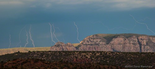
It’s the middle of July and the North American Monsoon is in full swing now with near-daily thunderstorms across northern Arizona. It was time for another photo shoot in Sedona in hopes of getting great lightning shots with Sedona’s famous redrocks as a background. A few nice sunset photos wouldn’t be too bad, either.

After a quiet afternoon in Flagstaff with little in the way of thunderstorm activity, clouds finally began to develop in the late afternoon. A quick check of the radar data using RadarScope showed that thunderstorms were developing over the higher terrain of the Mogollon Rim and were moving slowly to the south-southwest. This would put some of these storms near or over Sedona in an hour or two. Time to jump in the car and head south.

Lightning over the Mogollon Rim.
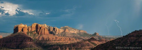
Lightning near Courthouse Butte.

It began to rain as I drove down the switchbacks into Oak Creek Canyon. This was the site of the Slide Fire in May and the threat of flash flooding exists whenever moderate-to-heavy rain falls in the area. Luckily, rainfall remained light and there was no threat.

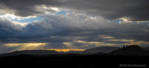
Setting sun in Sedona, Arizona.
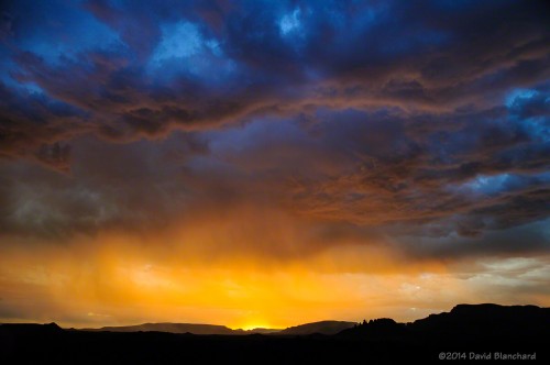
A blaze of color as the sun sets in Sedona, Arizona.

My first location was on Upper Red Rock Loop Road with a view to the east so that I could capture lightning along with some of Sedona’s famous rocks — Courthouse Butte and Cathedral Rock. No luck today — but I did get some good images the previous day from this same location. Still, I was able to get several lightning strokes over the cliffs and create a composite image.

Lightning ("anvil crawlers")  after sunset.
Lightning (“anvil crawlers”) after sunset.

As the sun began to set, the activity shifted and it was time for another location and I headed to the Sedona Cultural Park. The sunset colors just got better…and better…and…well, you get the idea. And there was also plenty of lightning to shoot as twilight unfolded.

All-in-all, a very successful photo shoot.

Moon rise behind Cathedral Rock in Sedona: Part II

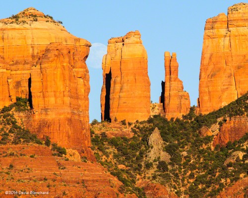
Here are another set of images of the moon rise behind Cathedral Rock in Sedona, Arizona. I had two locations preselected for the shots on this day. The first was located about one and one-half miles west of the rocks so that the moon’s disk would appear larger than the gaps between the rocks. We were on the eastern slopes of Pyramid Peak (the eastern summit of Scheurman Mountain). This setup worked as planned but since it was still early in the evening the sky was too bright and the moon appeared washed out. I did get the result I was seeking, however, which was the moon larger than the opening between the different rock columns.

Moon rise behind Cathedral Rock---1st location.
Moon rise behind Cathedral Rock—1st location.
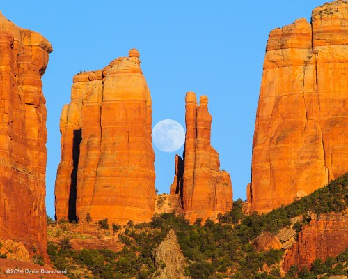
Moon rise behind Cathedral Rock---2nd location.
Moon rise behind Cathedral Rock—2nd location.

We moved to our second location—closer to Cathedral Rock which was now only one mile away—at the Red Rock Crossing/Crescent Moon picnic area. Many other photographers were assembled here but were scattered over a large area so that it wasn’t hard to secure a good spot for the next series of images. This time, the sky was darker and the moon was perfectly framed between the rock columns. I admit that I did not know, in advance, that it would work out this well. The Photographers Ephemeris can tell you the times and geometry of the setup but it can’t reveal how the size of the moon will compare with the rocks.

Lots of planning—and a little bit of good luck.

Moon Rise Behind Cathedral Rock in Sedona

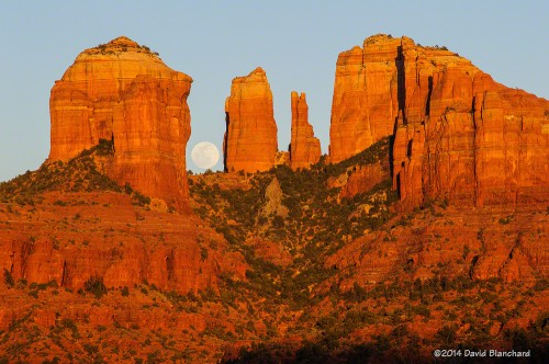
It’s spring and this is the time of the year when the moon rise behind the sunset-lit spires of Cathedral Rock in Sedona, Arizona, can be breathtaking.

Two years ago, I took a 1-day workshop from Southwest Perspectives called “Sedona Full Moon Hunt.” We were taught not just how to use the camera for capturing the image but, more importantly, how to know when and where to position ourselves for these types of images.

There are several applications available for smart phones, tablets, and computers that provide this information. My program of choice is The Photographer’s Ephemeris. With this information in hand, one can position themselves in the right spot and wait for the moon to rise. The waiting part, however, can be tough as you wonder if you are in the “right” place. It’s a moment of relief, then, when the moon rises right where you expected it in the gap.

Moonrise behind Cathedral Rock.

As the calendar marches forward into spring and early summer the location of the moon moves south relative to the rocks; it then moves north in the cooler season. It’s during the warmer months that it lines up best with the gaps between the spires.

Moonrise behind Cathedral Rock.

If you get too close to the rocks the moon will appear small compared to the spires. Get farther away and the relative size of the moon appears much larger in comparison. But it’s never that easy. Some shooting locations are effortless to get to— drive, park, set up, done. Others require a bit of walking or hiking.

Getting in the right place is at least part of the enjoyment of capturing these images.