It’s great that one can do all three of these in the winter. Ski in Flagstaff; run and mountain bike in the deserts. We have done all three this winter with the emphasis on running. Here are a collection of photos from this winter.
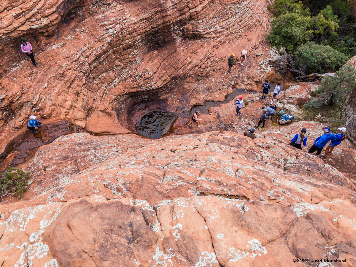
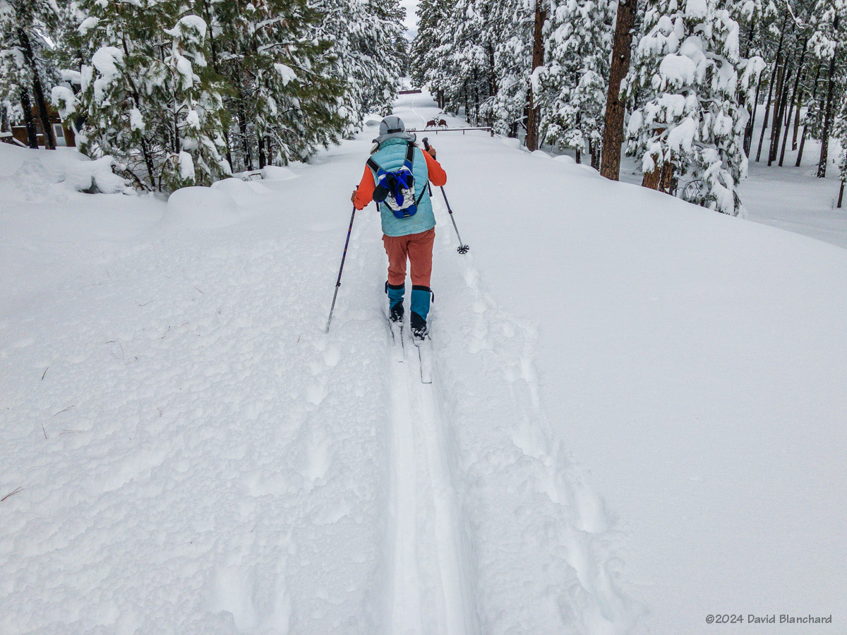
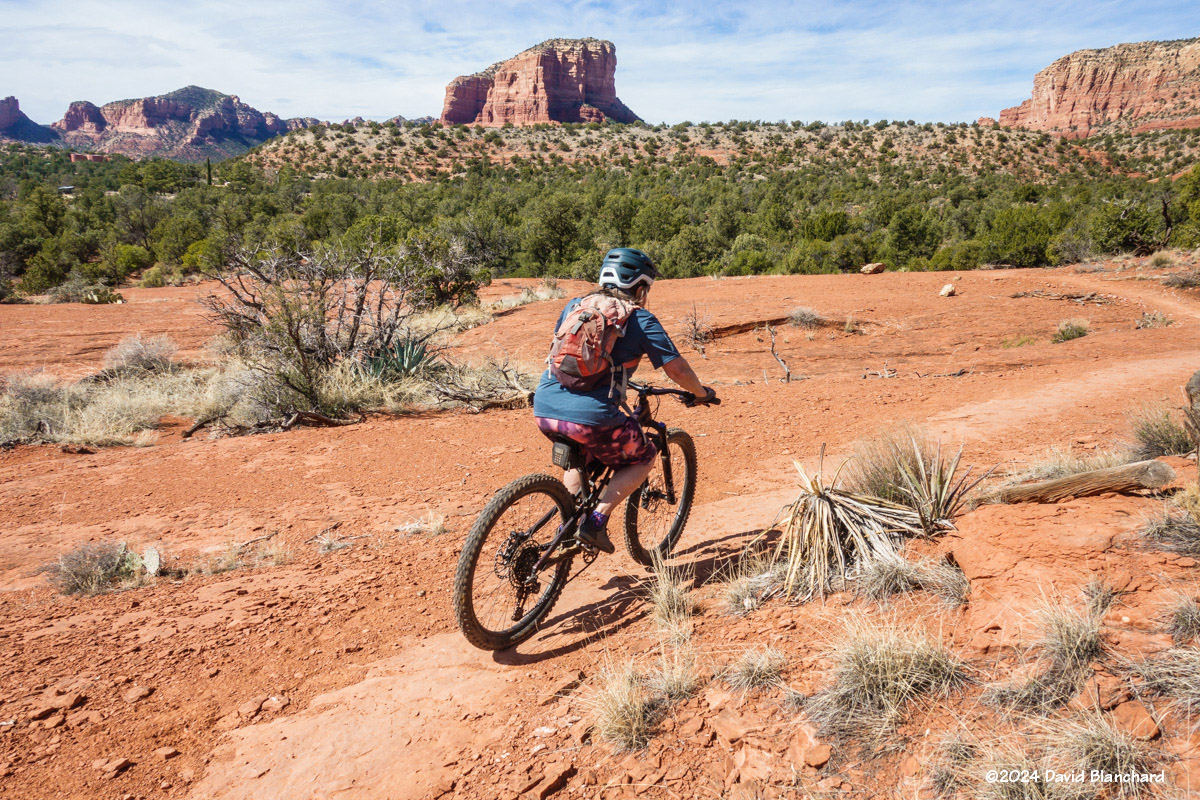
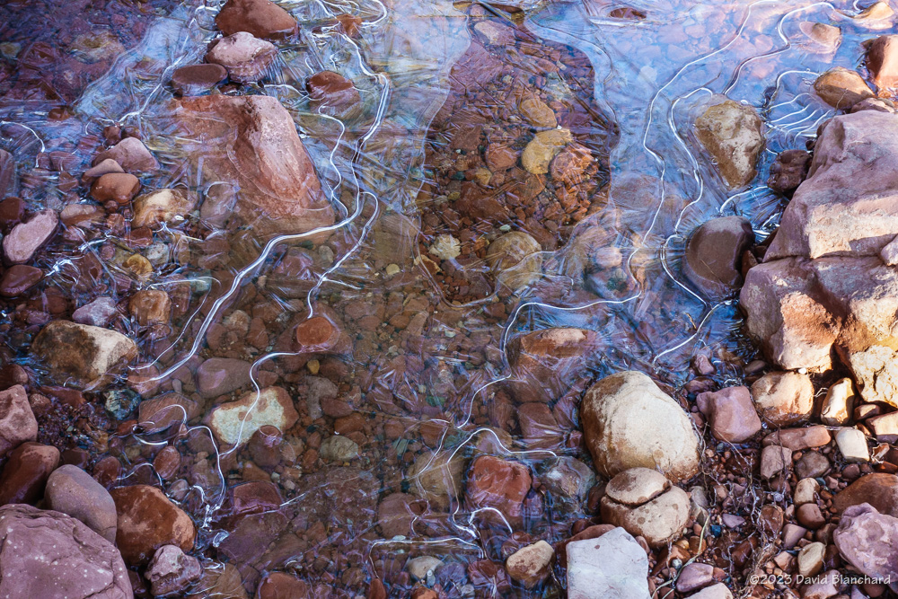
Group of runners stand around pools of water (01/20/2024).X-C skiing at Fort Tuthill (02/09/2024).X-C skiing at Fort Tuthill (02/09/2024).Trail run on Sketch Trail, Sedona (02/13/2024).Snowy run on Schultz Pass Road (02/15/2024).Trail run on Margs Draw, Sedona (02/17/2024).Mountain biking on Little Rock Trail, Sedona (02/20/2024).Trail run on Lower Chimney Trail, Flagstaff (02/22/2024).Trail run on Woods Canyon Trail, Sedona (03/02/2024).Trail run on Woods Canyon Trail, Sedona (03/02/2024).
Bonus photo from last year’s epic winter. Yeah, untracked powder!
Preparing to descend Flying Dutchman chute, Mt. Humphreys (01/18/2023).
In a previous post I wrote how the North American Monsoon (NAM) was very late getting started in July. Fortunately, once started, it resulted in normal precipitation amounts for the month of August. Here are photographs and discussion of some of the events during the month.
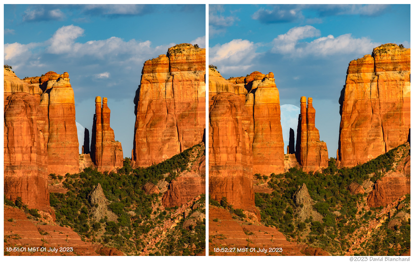
It is the season for capturing the nearly-full Moon as it rises behind Cathedral Rock in Sedona, Arizona. The best time to capture this is a day (or two) before the actual full Moon so that late afternoon sunlight still illuminates Cathedral Rock. The Photographers Ephemeris (TPE) was used to determine the best location to shoot this as it became visible between the towers.
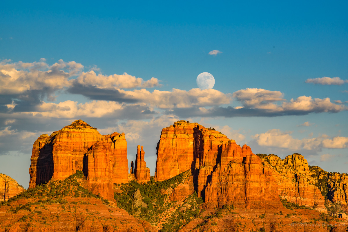
The nearly-full Moon rises behind Cathedral Rock in Sedona, Arizona.
The Moon rose into the gap between the north buttress and the spires about 45 minutes before sunset. Here are two shots of the Moon taken ~90 seconds apart as the Moon rose higher. I particularly like the spire that is in shadow because of the illusion that the spires are casting a shadow on the Moon.
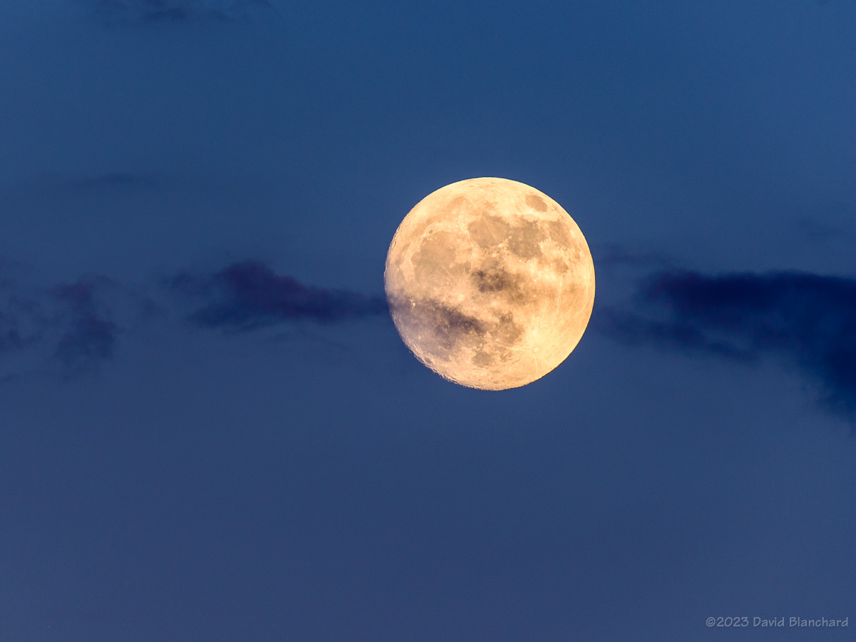
The Moon rises above the clouds at Cathedral Rock in Sedona, Arizona (1909 MST).A nearly-full Moon during twilight (1943 MST).
As the Moon rose higher it was obscured by clouds and then made a reappearance above the clouds.
January has been a very snowy month in Flagstaff. So far, 2023 is the third snowiest January–and only a few inches from being second snowiest. So we have been taking advantage of the lower elevations of Sedona and doing all of our trail runs there.
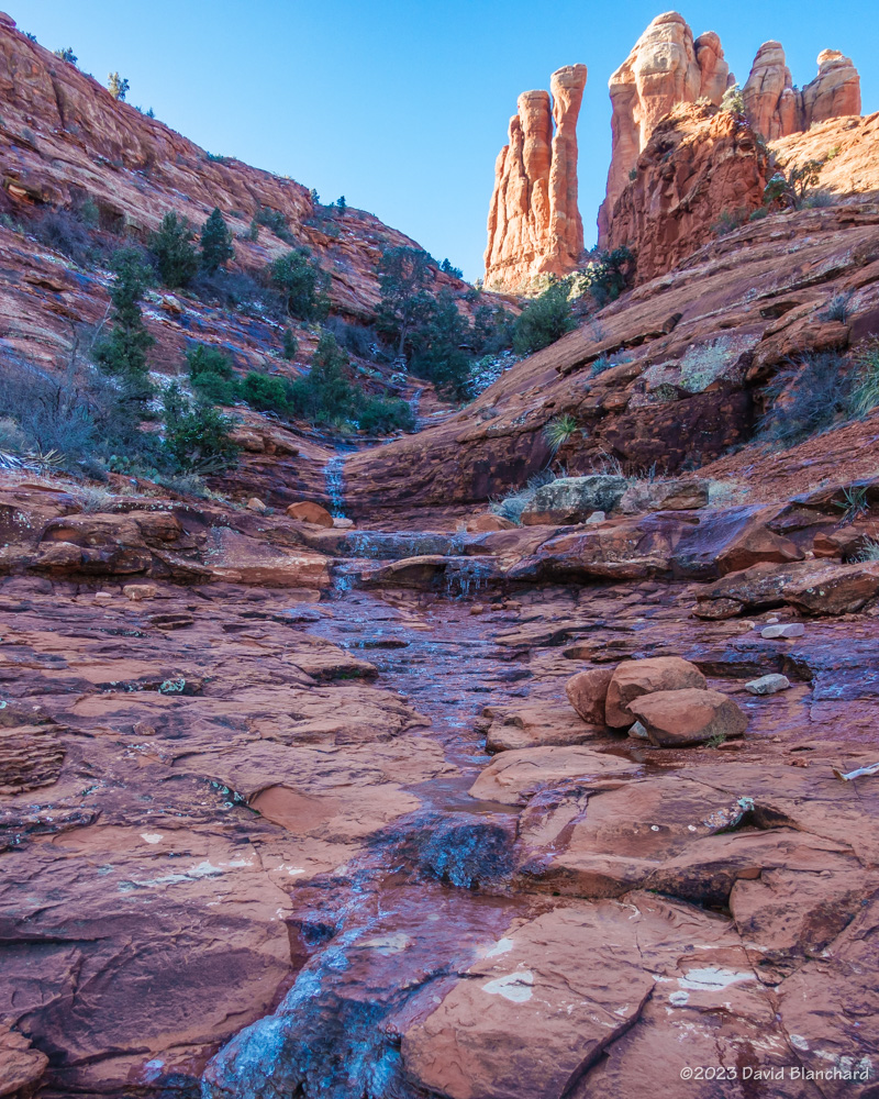
Cathedral Rock from Templeton Trail in Sedona.One of the many icy flows along the Templeton Trail in Sedona.Thin ice along the Easy Breezy Trail in Sedona.
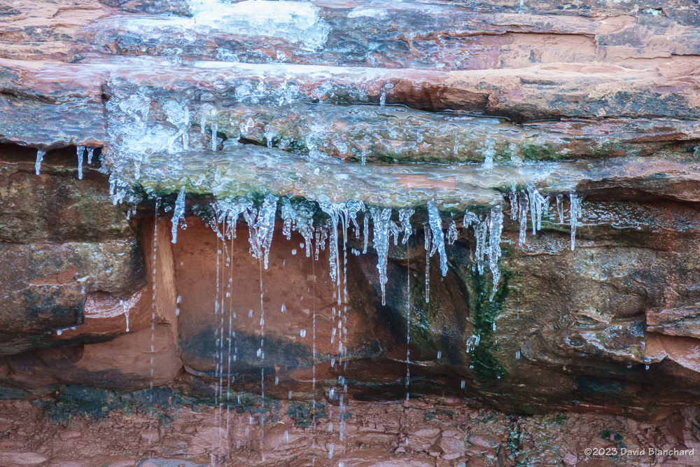
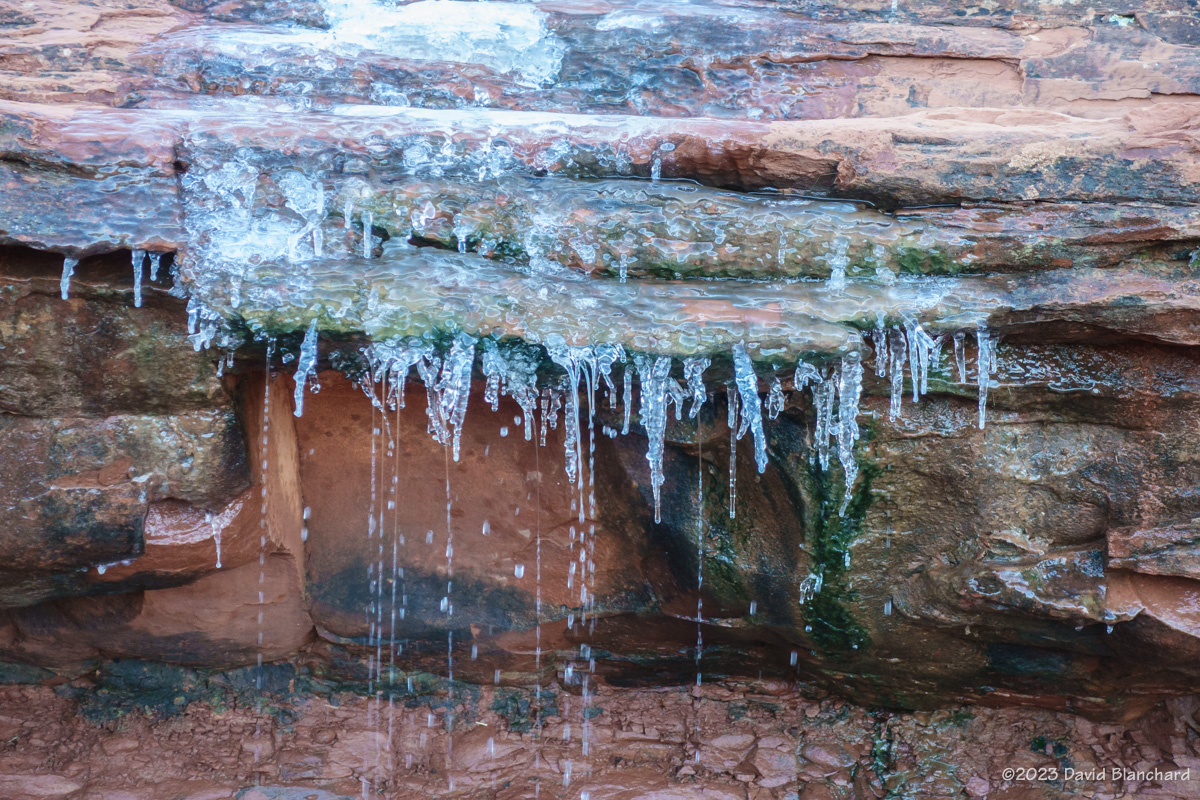
This run took us along the Baldwin, Templeton, HT, and Easy Breezy Trails. Recent rains and some snow resulted in rivulets of water running across the slickrock–except that the nights had been cold enough to freeze the water and create icy patches. Although it made for some tricky running it also produced some very photogenic scenes.
It’s always fun to combine a trail run with a bit of photography.
A few days ago we ventured down to Sedona for a morning trail run with Northern Arizona Trail Running Association (NATRA.org). Recent rain/snow and cold temperatures resulted in slippery conditions on the sandstone slickrock with rivulets of water and ice crossing the trail. Although treacherous–and many of us took a spill or two–it was also very beautiful so see patches of snow and ice on these trails.
A frozen stream cascades down Cathedral Rock in Sedona.One of many frozen streams along the Templeton Trail in Sedona.Delicate ice structures in the stream alongside the Easy Breezy Trail in Sedona.