Coyote Buttes and The Wave

My first and only visit to Coyote Buttes and The Wave was in June 2004. A coworker had permits for two back-to-back days but was unable to use them. The BLM permit system was quite different then from what it is now. Getting multiple-day permits was not unusual. Nowadays, getting a permit at all requires a fair bit of luck and perseverance.  I consider myself fortunate to have had a chance to visit this amazing location.

Coyote Buttes North.

We arrived at the trailhead in mid-day with temperatures, as I recall, in the upper ’90s. It was mid-June and the North American Monsoon and rainy season had not started. Even so, there were clouds and a few rain showers in the area.

Pools of water near Coyote Buttes.
Narrow passageways at Coyote Buttes.
Textured landforms at Coyote Buttes.

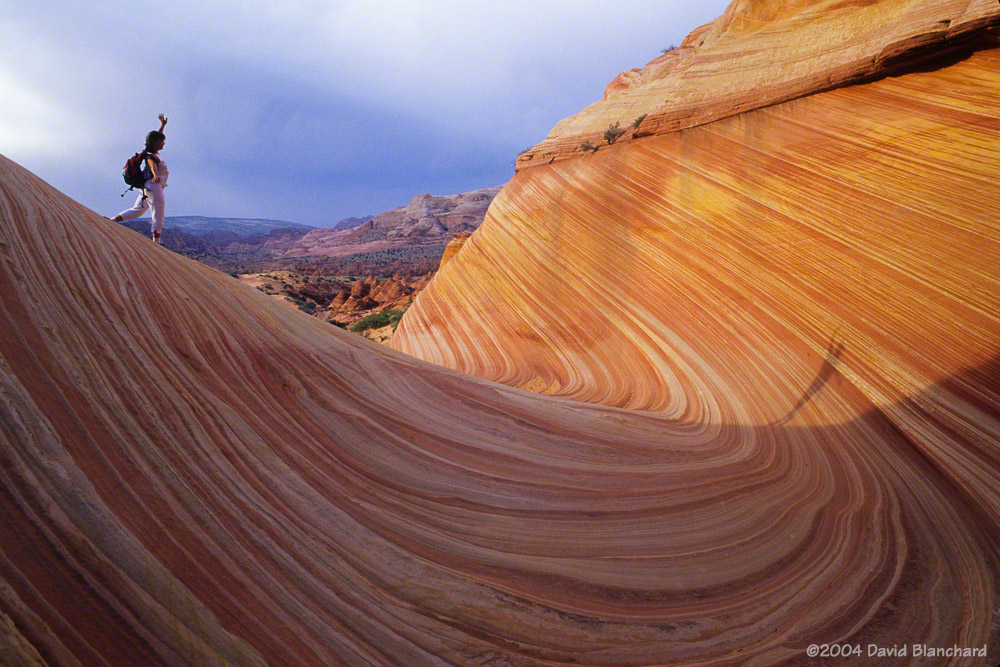
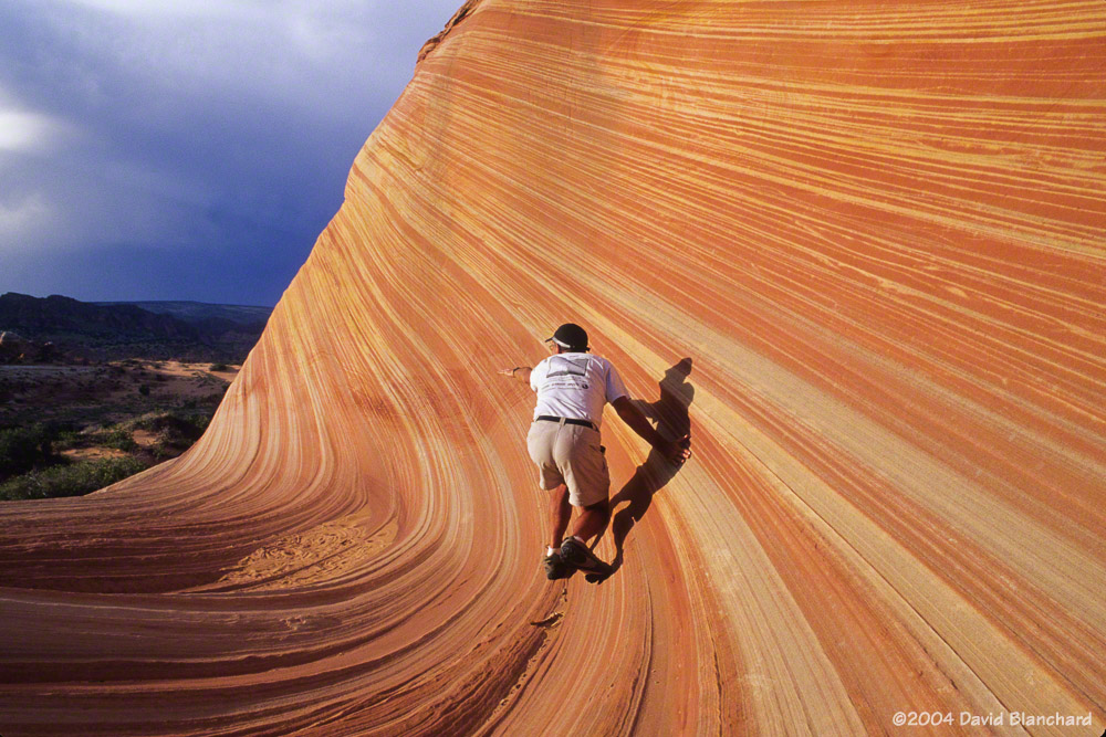
We hiked out to the rocks and made good time arriving in the late afternoon. There were a few other visitors but they left after a short time and we had the place to ourselves for the next several hours. Really—there was no one else there. Hard to believe!

Drifted sand at Coyote Buttes.
Clouds and showers develop around Coyote Buttes.

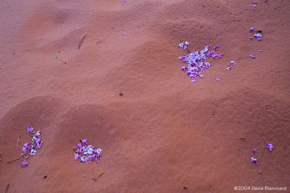
We wandered around for hours taking photographs and picnicking and enjoying the solitude. For a few brief moments, one of the rain showers produced a rainbow but I was too slow to move the camera gear and get the shot.

Clouds drift away and the sun returns in late afternoon at Coyote Buttes.
Afternoon sun makes shadows on the walls.
Surfing The Wave.
Surfing The Wave.

As the sun dropped in the west and temperatures began to cool we finally left and began the hike back to the car. Somewhere along the way we realized we were on a different trail—or perhaps no trail at all—but our starting point was still obvious and we continued on.

Flower petals in sand.
Late afternoon light illuminates the rocks on our hike out of Coyote Buttes.
The old sign showing trails to Coyote Buttes and Buckskin Gulch.

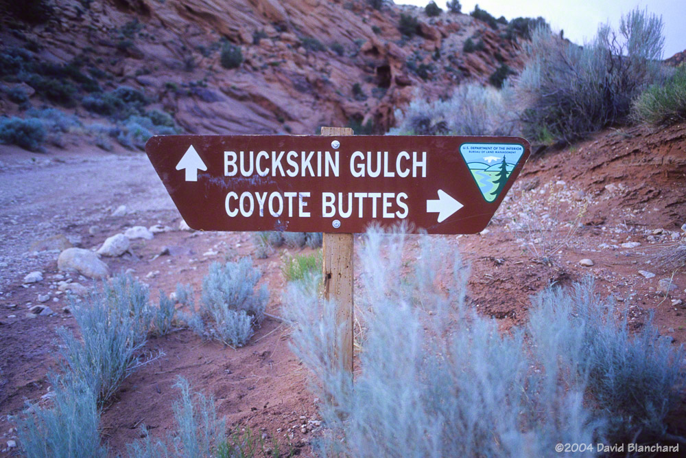
The next morning we decided we did not want or need to hike out there again so we did not use our 2nd day permit. Instead, we travelled down Buckskin Gulch—a place we had heard about but not yet had a chance to explore. It was a great hike and we did not regret our choice.

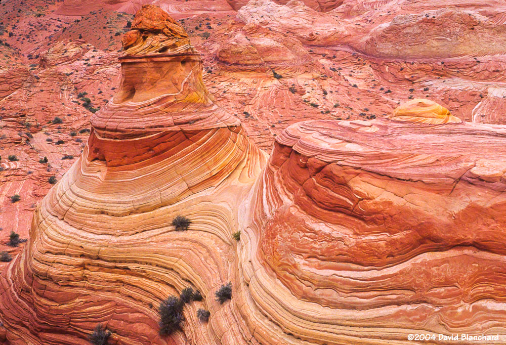
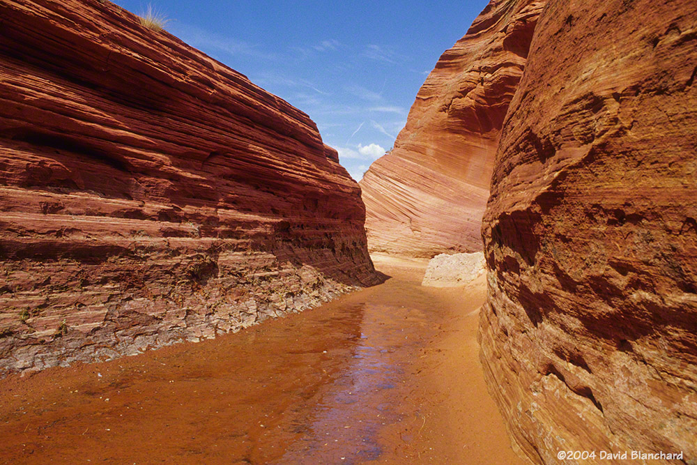
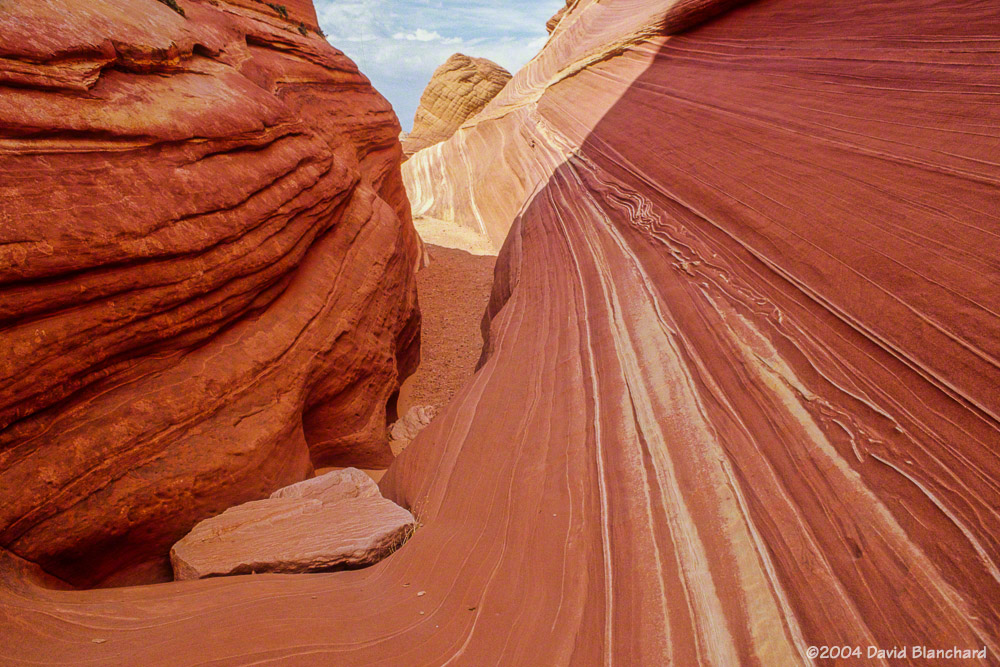
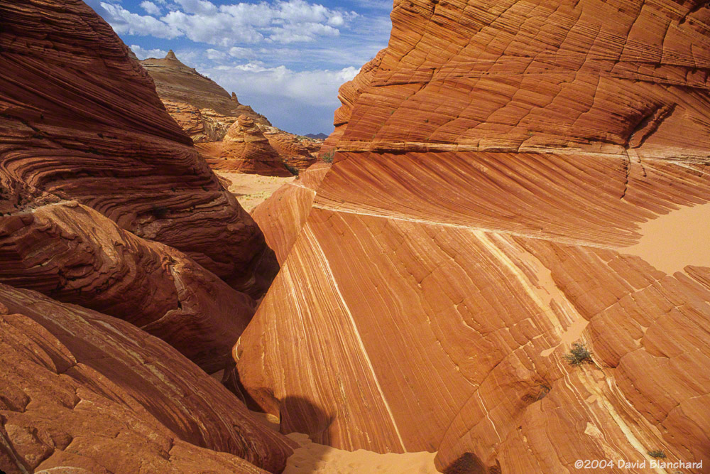
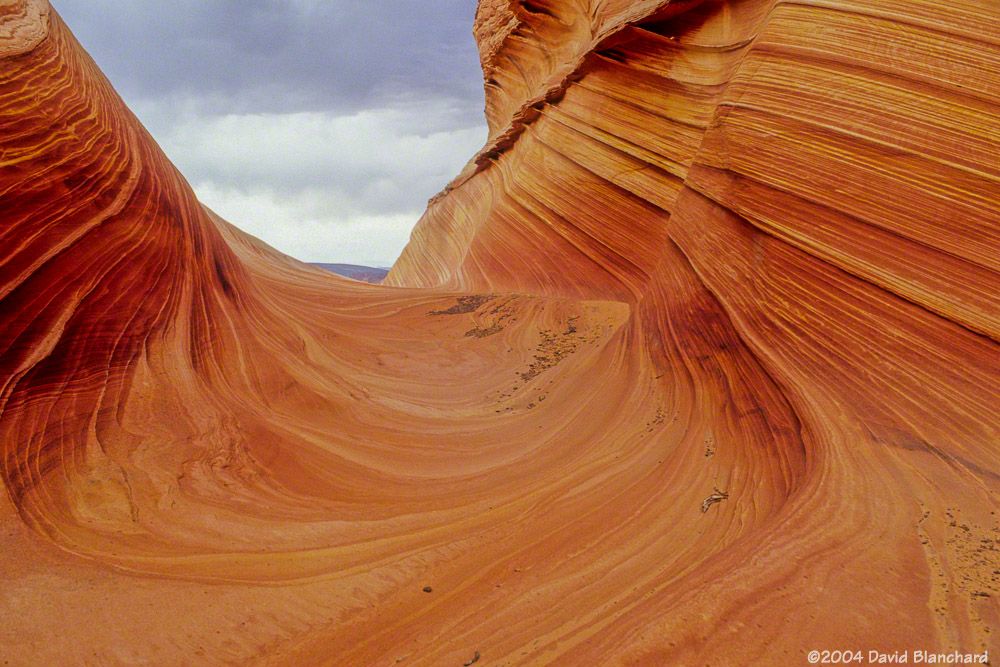
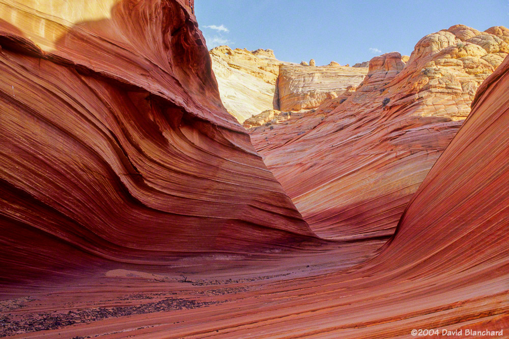
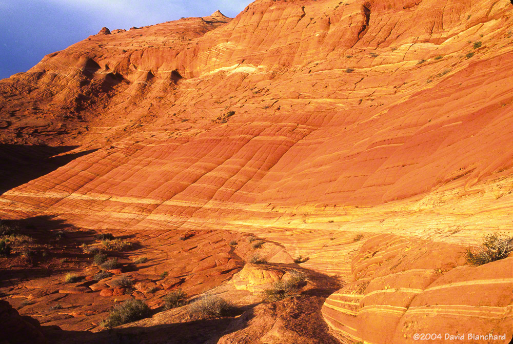
Here are photographs (shot on Fuji Provia slide film and recently scanned) from the afternoon that we spent at Coyote Buttes and The Wave.

Vermillion Cliffs National Monument: An otherworldly place

Massive cliffs. Deep slot canyons. Unimaginably contorted rock formations. Vivid colors. Otherworldly. Amazing. Beautiful.

All these and more describe — yet fail to describe — the Vermillion Cliffs National Monument and the Paria Plateau.

The VCNM was established in November 2000 by a Presidential proclamation from existing public lands already under the management of the Bureau of Land Management (BLM). At that time, the beauty of this place was known mostly to locals, ranchers, explorers, and a few photographers. Since then, however, it has become famous world wide. Years ago I was surprised to see a poster advertising a lecture and slide show with a picture from the VCNM posted to a kiosk in Europe. At that time, some of the best information on this place could be found on European web sites. Apparently, Americans hadn’t yet discovered it.

Deep within the confines of Buckskin Gulch, Vermillion Cliffs National Monument.

A friend worked for the BLM in this area some years ago and would tell me about these amazing places but was hesitant to give directions how to get there for fear that increased crowds would damage the area. He was right, of course, but in todays Internet world and digital cameras it’s become challenging to keep a “secret spot” secret.

Lollipop Rock, White Pocket, Vermillion Cliffs National Monument.

Over the years we have visited Buckskin Gulch a couple of times traveling slowly down canyon while taking photographs but have yet to complete the entire trek to Paria Canyon. Perhaps if I travel without the camera I might make better time.

Sunset at White Pocket, Vermillion Cliffs National Monument.

We’ve also visited Coyote Buttes North and seen the Wave back in the day when permits were relatively easy to obtain. At least it was for us because a friend gave us his permits which he could not use. But we haven’t been to Coyote Buttes South yet.

Sunset and reflection at White Pocket, Vermillion Cliffs National Monument.

And, just recently, we finally made it to White Pocket. Travel to this location requires an adequate vehicle with appropriate driving skills. I have neither. So we chose to hire a guide and outfitter to take us there for the day. Sure, it cost a bit of money but it’s cheaper than getting stuck!

Deep and narrow: Buckskin Gulch, Vermillion Cliffs National Monument.

We encountered about a dozen other people there that day. I guess that’s a large crowd for this location. But the crowds are certain to increase with time and a permit system seems inevitable. Best to visit sooner — rather than later.