Lightning and Rainbows

Twilight lightning over Kendrick Park. The north flanks of Kendrick Peak are illuminated by the bolt.

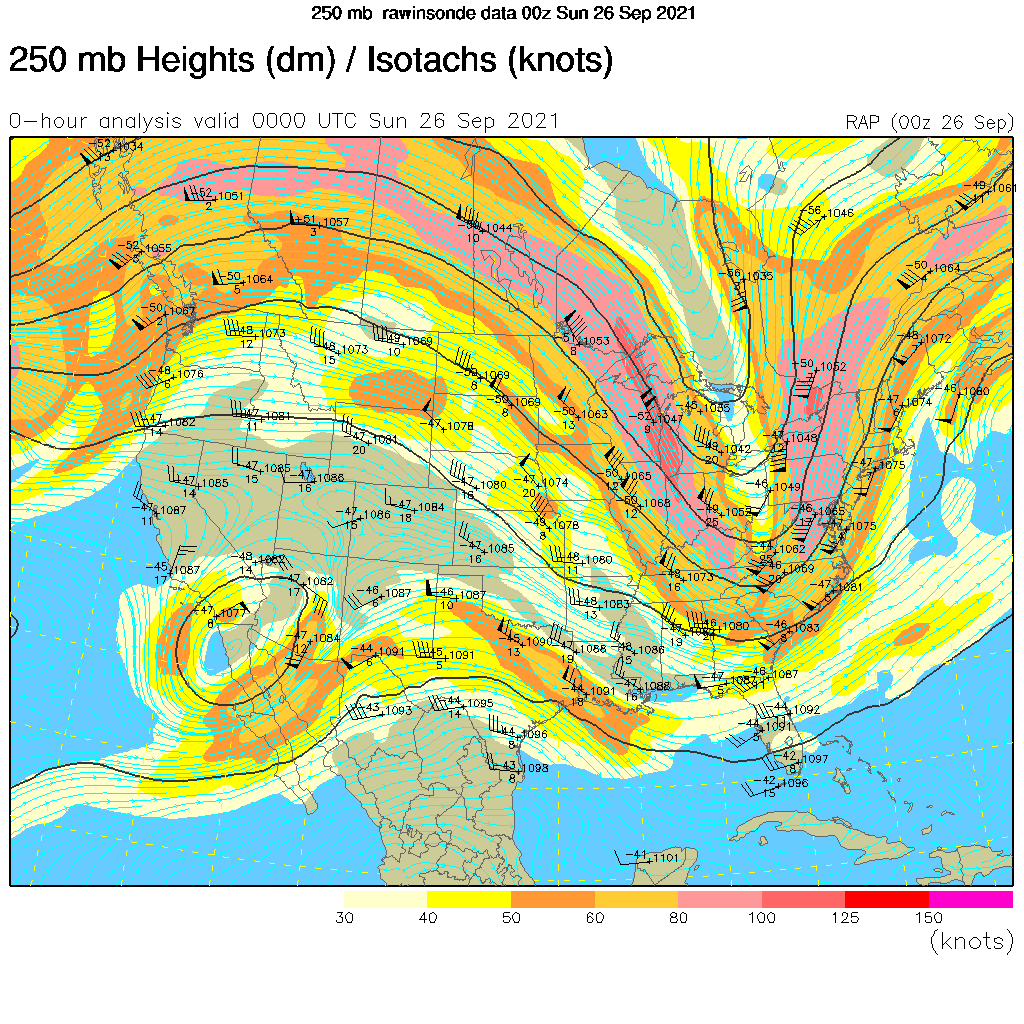
We are in the midst of the “Transition Season” where the summer monsoon pattern fades away and the mid-latitude westerlies and low pressure systems move across the area. Another of these events is in progress as a weak closed-low moves across the southwest bringing showers and thunderstorms to the area.

Thunderstorms begin to develop over the San Francisco Peaks.

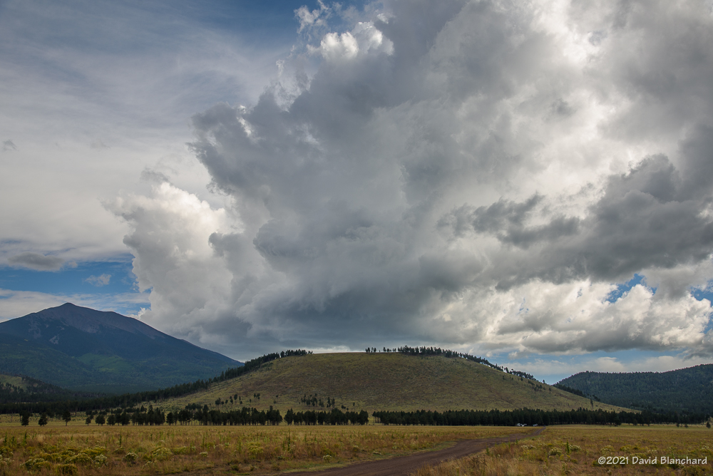
Saturday afternoon we set out for the north side of the San Francisco Peaks hoping that thunderstorms would form over the higher terrain and then move northwestward across Kendrick Park. A few storms did form over the peaks and some of them were briefly photogenic but there was very little in the way of lightning. Eventually, approaching rain chased us from Kendrick Park to the northwest where we set up near Slate Mountain in a large meadow with good views of the peaks.

Distant lightning under the rainbow.
A multi-pronged lightning strike under the rainbow.
Twilight lightning over Kendrick Park.
Twilight lightning over Kendrick Park. The north flanks of Kendrick Peak are illuminated by the bolt.

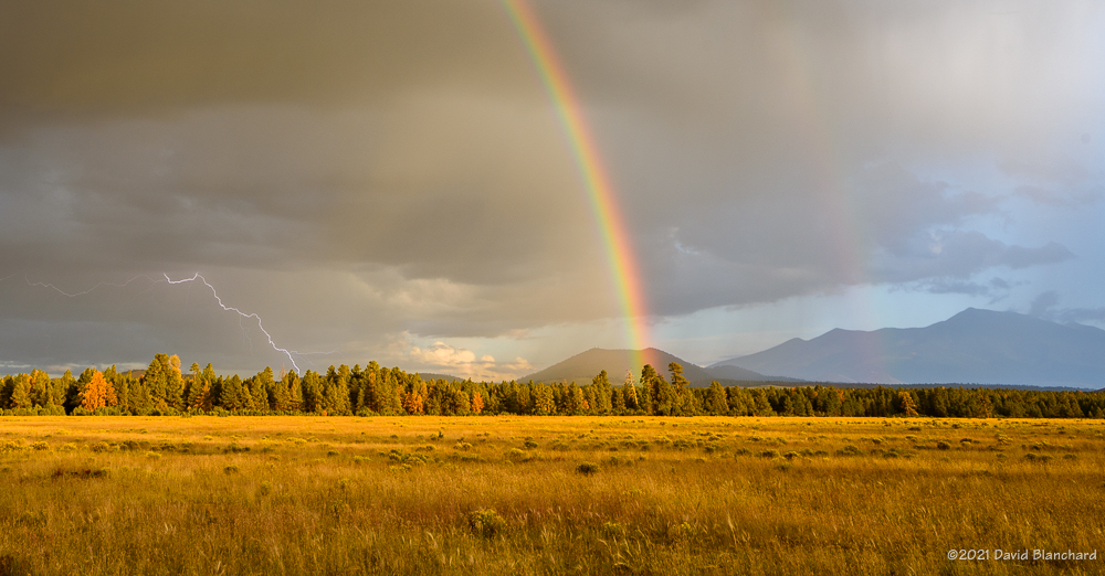
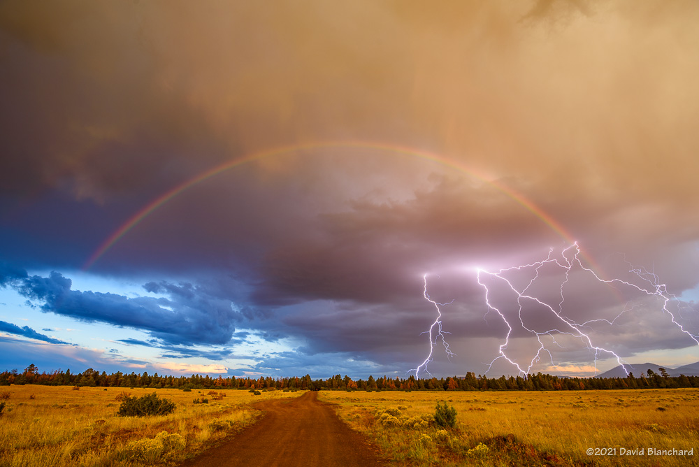
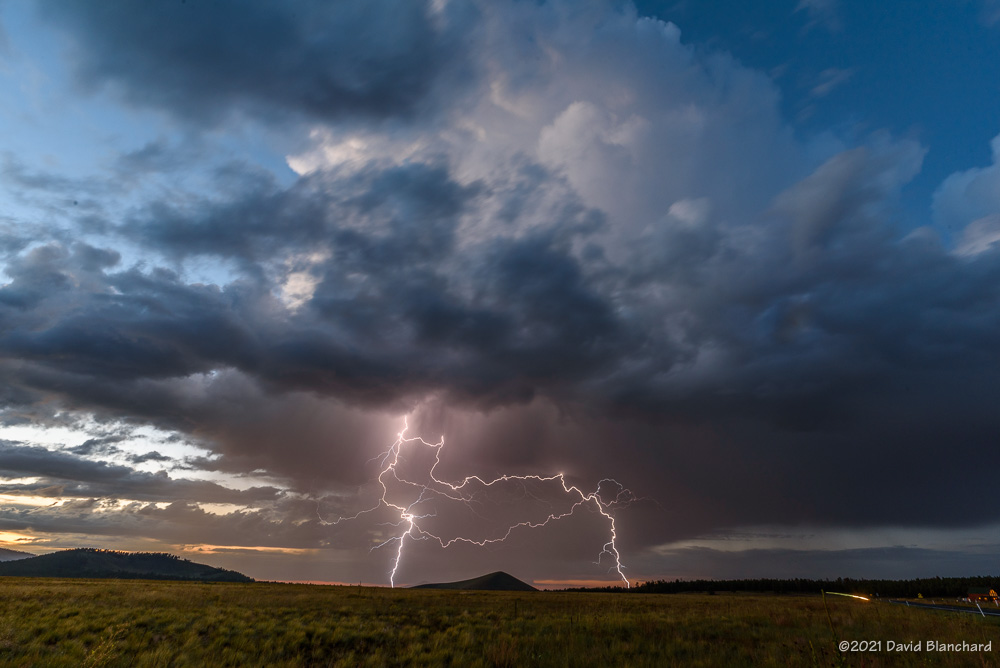
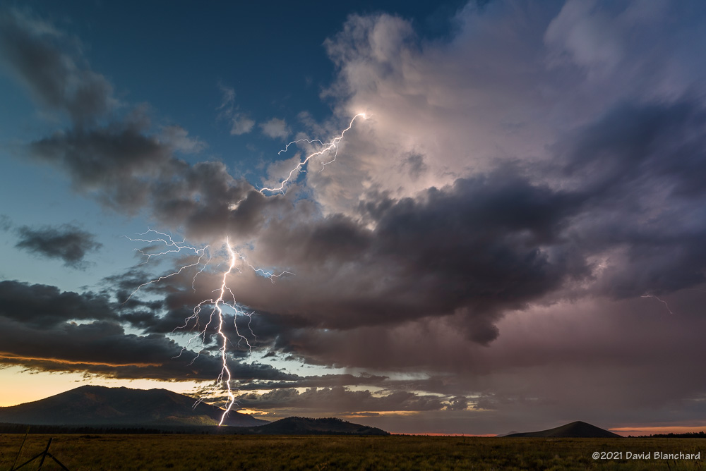
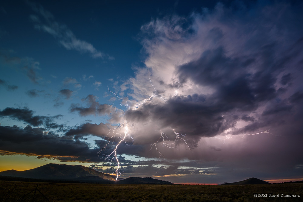
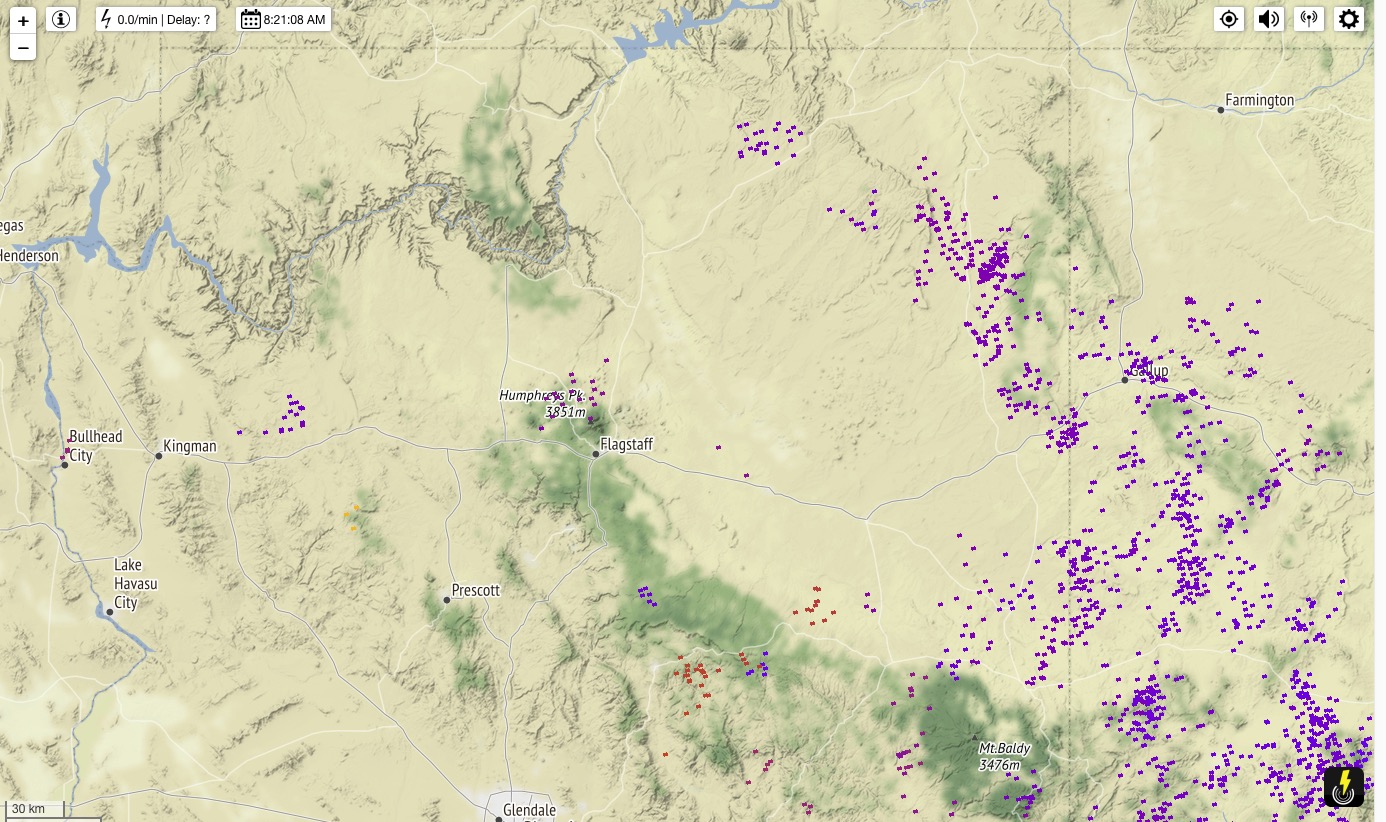
These slow-moving storms continued to move towards the northwest and this time we got lightning and rainbows—and rainbows with lightning. As the sun dropped lower in the west the rainbow quickly faded and rain was again approaching our location. We retreated back to Kendrick Park—this time with the thunderstorms located to our northwest with light from the setting sun still illuminating some clouds. Lightning stikes were frequent and close enough to fill the field of view of the 17-mm focal length lens. Several of these lightning bolts struck the northern flanks of Kendrick Peak. About a half-hour after sunset it was over and the storms quickly dissipated.

Another fun day of storms and lightning.

250-mb height/winds at 0000 UTC 26 September 2021.
24-hour lightning plot with a lightning cluster near the San Francisco Peaks.

Monsoon Transition Season Is Here

It is now September and we are in the so-called “transition season” as the North American Monsoon weakens and stronger baroclinic weather systems begin to traverse the southwestern states. From a paper presented at the 23rd Severe Local Storms Conference (2006):

Outbreaks of severe thunderstorms in northern Arizona are most likely to occur during the transition between the moist, tropical environment of the warm-season North American Monsoon regime and the first incursions of mid-latitude baroclinic systems in September. The presence of copious tropical moisture, combined with increased convective instability and deep-layer shear, is supportive of long-lived supercells which are responsible for most of the severe weather.

Supercells are more common during the transition season than other times of the year in northern Arizona. Tornadoes—especially long-lived, damaging tornadoes—are more likely to occur during this brief period. This is from a paper presented at the 24th Severe Local Storms Conference (2008):

The results show that more than half of the tornado days occurred during the approach of a closed low from the eastern Pacific with northern Arizona located in the warm sector of the northeast quadrant of the low. The closed lows produced environments with deep-layer shear and low-level shear comparable to the 3rd and 4th quartiles of tornadic environments discussed by Rasmussen and Blanchard (1998) while instability was small and was comparable to or less than their 1st quartile. These interesting results suggest that shear may be the more important factor and that instability need only be sufficient to initiate and maintain convection long enough for the shear to act upon the updrafts.

While tornadoes in northern Arizona are more likely to occur during the transition season they are still uncommon (a notable exception was the October 2010 outbreak) and several years may pass without any tornado events. Supercells, on the other hand, are more common and at least a few can be expected each year during the transition.

Below are composite means of 500-mb geopotential height, 700-mb v-wind component, and surface Lifted Index for the tornado events.

Composite 500-mb height field for the 19 tornado event days.
Composite 700-mb v-component of the wind field.
Composite surface-based Lifted Index field.

Will we have a closed-low, transition-season type of event this year?

References

Blanchard, D. O., 2006: A cool season severe weather episode in northern Arizona. Preprints, 23rd Conference on Severe Local Storms, St. Louis, MO., Amer. Meteor. Soc.

Blanchard, D. O., 2008: Synoptic environments associated with tornadoes in northern Arizona. Preprints, 24th Conference on Severe Local Storms, Savannah, GA., Amer. Meteor. Soc.

Blanchard, D. O. 2013: Comparison of wind speed and forest damage associated with tornadoes in northern Arizona. Wea. Forecasting, 28, 408–417.