Desert mountain biking in southwest Utah

Longer days and warmer weather combined to send us off to southwest Utah for a couple days of mountain biking. We made our first mountain biking trip to this area last fall and had a blast riding the trails—so it was time for a return trip.

View of Zion National Park from the trailhead on Gooseberry Mesa.

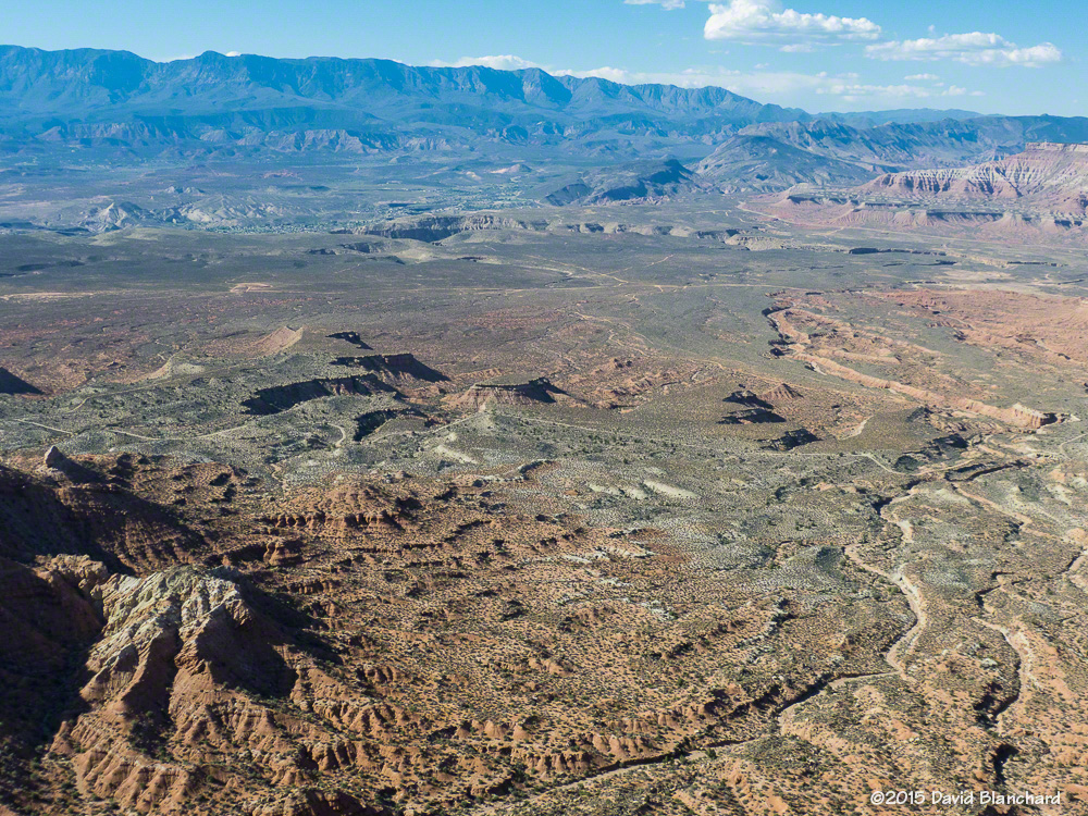
We left Flagstaff on a Monday morning and arrived at Gooseberry Mesa by early afternoon. After a quick lunch at the trailhead we started off on Windmill Trail. A short distance brings you to the north edge of the mesa with amazing views to the north—and down.

View from the edge of Windmill Trail.

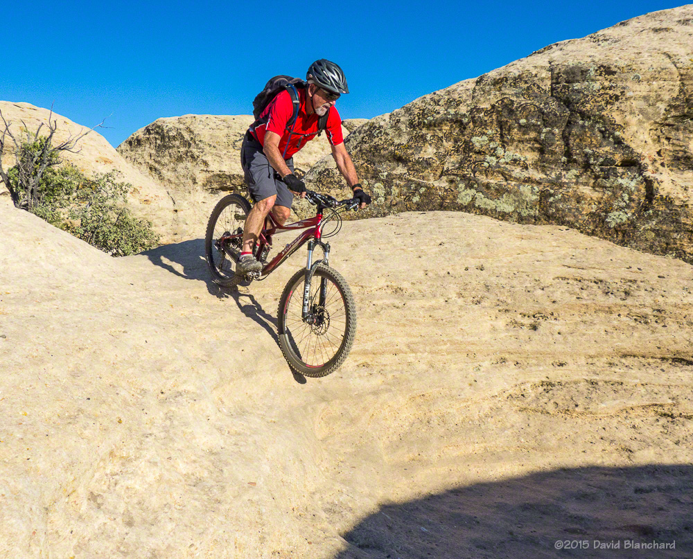
It doesn’t take long before the trail veers away from the edge and takes you through ramps, chutes, small hills, and steps on a high-traction surface. (The geologic name for this rock is Shinarump Conglomerate.) There are no long uphills here—but many short and quick ascents and descents.

Descending one of the numerous "rollers."
Descending one of the numerous “rollers.”
Rolling into a sandstone bowl.

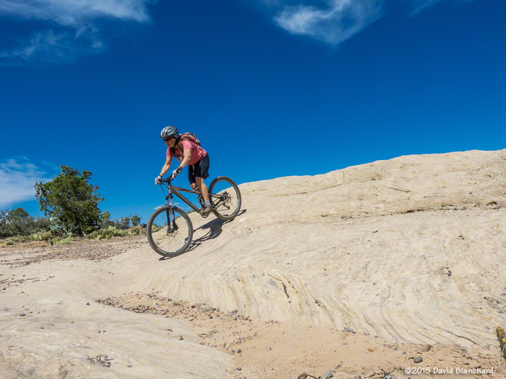
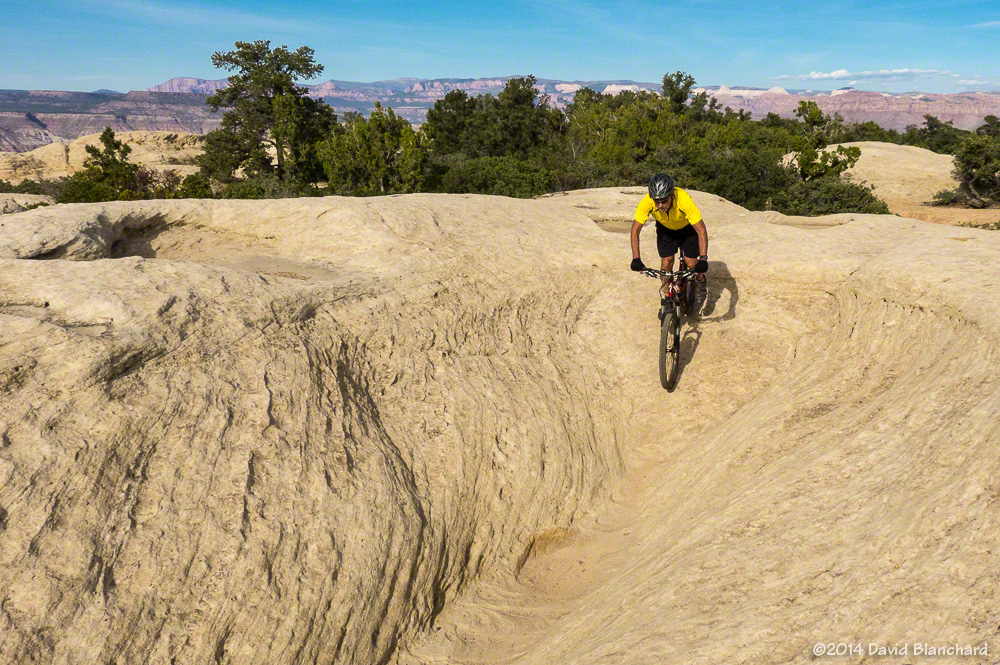
Finding the route through here is as easy as following the painted dots on the rock.

Follow those dots!
Follow those dots!
More bowls.
More bowls.

The trail ends on the west end of the mesa at The Point which provides a magnificent view of the Virgin River valley as well as the Hurricane Cliffs trail system.

View from Gooseberry Mesa Point.

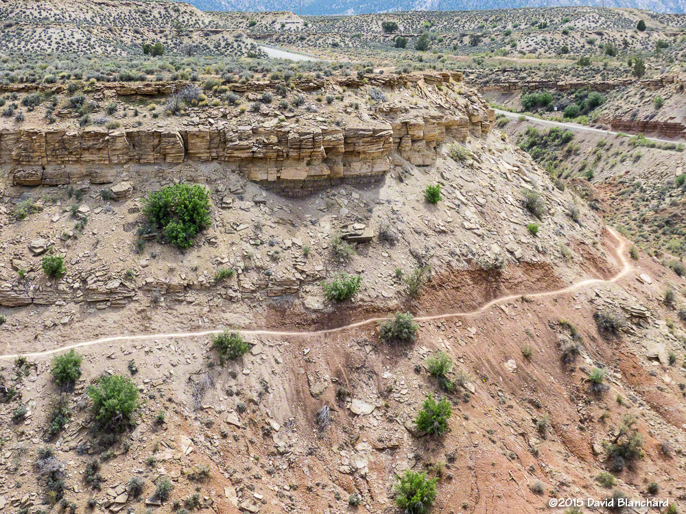
On Tuesday we headed for the Hurricane Cliffs Trail System. These trails are at a lower elevation than Gooseberry Mesa and it was a bit warmer—although still comfortable. We headed up JEM Trail, connected to Crytobiotic, and then on the newer Dead Ringer. This would take us to the top of the mesa where we could connect with the More Cowbells trails.

Hurricane Cliffs trail system: Jem Trail.

Although Dead Ringer never gets very steep, it is perched on the side of a hill with moderate slope.

Dead Ringer Trail as seen from the mesa top and More Cowbells Trail.

More Cowbells is rated Easy and is a great trail for beginner riders. It is most easily accessed from the Upper JEM Trailhead on the mesa top rather than riding up from the bottom. We returned down Dead Ringer and connected to the Goosebumps—a trail with lots of quick ups-and-downs—and then back to JEM for the fast downhill run back to the car.

The next day we returned to Gooseberry Mesa to try the non-system trail known as Gander. This is an intermediate trail with big mileage if done out and back. It’s best done as a shuttle. Or, in our case,  we did a shorter version of the out and back as we were running out of time.

Riding the rim of Gooseberry Mesa on Gander Trail.

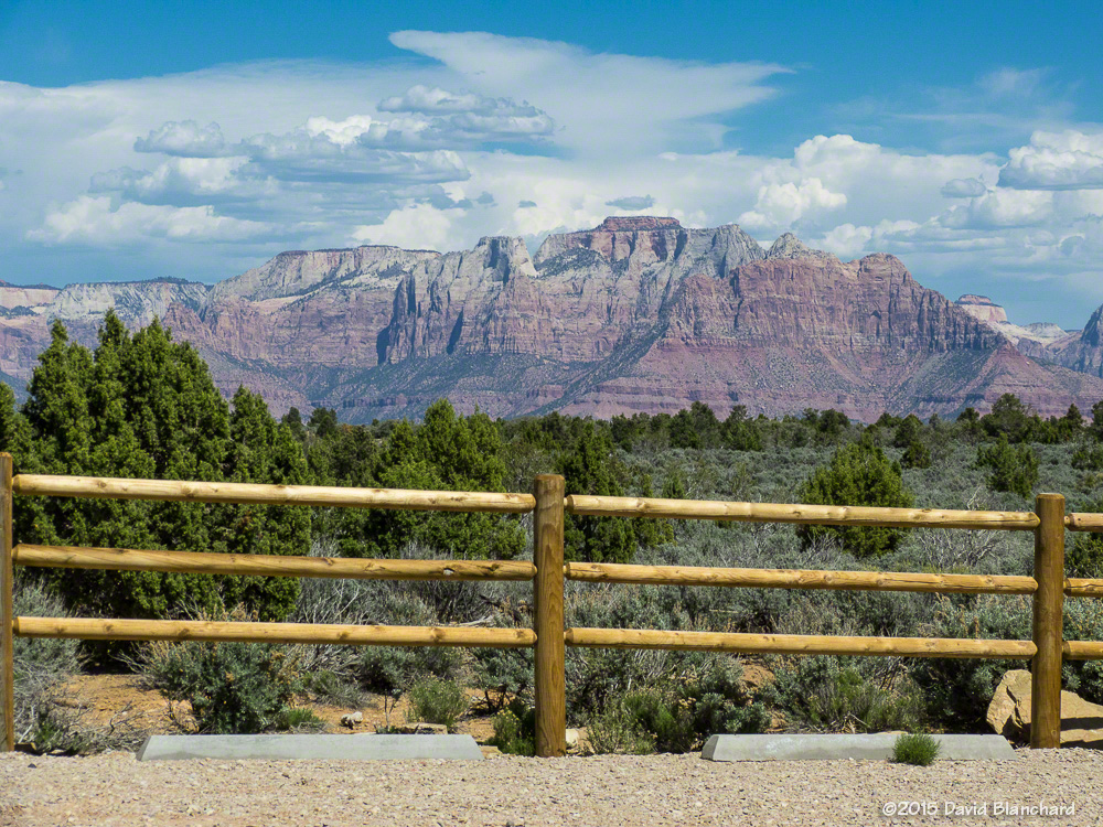
It was getting late and time to go. From Gooseberry Mesa, we drove north towards Rockville. The road was pretty good—until it suddenly wasn’t. For a brief stretch, it was steep, narrow, and rocky and I wondered if I was getting into something I might regret. It was over in about a mile and smoother roads returned. We took the scenic route home through Zion National Park and were back in Flagstaff late Wednesday evening.

Some photographs from the early years: Part II

I”m still in the long process of scanning slide file from the pre-digital era. This week, I scanned some images from a trip to Utah in the spring of 1988. On our first travel day, we stopped at Fisher Towers to spend the night. While eating dinner the sun slowly sank in the western sky. And, then, for just a few minutes the colors on the towers was intense. Quick! Find the camera and fire off a few shots. It didn’t hurt that the moon was in the image to lend some balance.

Fisher Towers at sunset.

Winter in Moab, Utah

On a recent trip to Colorado we made a stop in Moab, Utah. This is a place that hosts a large number of tourists each year, including visitors to Arches and Canyonlands National Parks, which are located close by. The town also hosts large numbers of mountain bikers and off-roaders. At least that’s the case during the warmer months of spring, summer, and fall.

The Windows area of Arches National Park at sunset during the winter.

In the winter there are fewer visitors and the trails are mostly empty. It’s a great time of year to visit if you don’t mind the cooler temperatures, shorter days, and occasional snow and ice on the trails and roads.

Frozen streamside in Negro Bill Canyon near Moab, Utah.

We took advantage of the low-crowd season to hike a few trails in the area, including Negro Bill Canyon and Corona Arch. On both trails we saw only a few other people. With so few people, it’s easy to set up a tripod and get some great photographs and not worry about hikers, bikers, jeeps, or other distractions finding their way into your images!