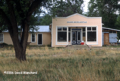
General Mercantile in Miami, New Mexico.
|
2006 Storm Chase Summary and Photographs
David Blanchard Flagstaff Arizona |
|---|
| All photographs were shot on Fuji Provia 100f film. Camera equipment included a Nikon FM with three AI Nikkor lenses: 28mm f/2.8; 50mm f/1.8, and 80-200mm f/4.0-5.6. All slides were scanned with a Nikon LS-2000. |
|---|
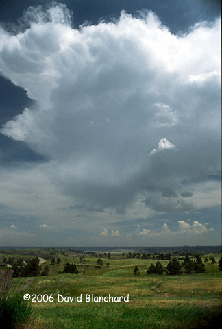
| Much of the 2006 severe weather season was characterized by a deep trough across the eastern portion of the country and a large ridge across the central and western portions. This ridge resulted in less than optimal shear and instability for supercells in most locations. The only places that were able to produce thunderstorms with at least a chance of supercells were the High Plains of eastern Colorado, Wyoming, and Montana, with storms moving eastward into South Dakota and Nebraska. As in 2005, my previously scheduled period for storm chasing fell during this period of atmospheric ridging. Despite suboptimal conditions, I still managed to see some interesting storms and to get some great photographs. |
|---|
| 01 June 2006 | |
|---|---|
|
General Mercantile in Miami, New Mexico.
|
I left Flagstaff early this morning so that I had at least some chance of reaching northern New Mexico in the afternoon and in time for some convection. My 5 a.m. MST start was good since I arrived at the target area in early afternoon. Unfortunately, convection did not inspire. Numerous weak cells were noted but nothing held together. Over the mountains, it was a different story. One cell had a distinct bowl-shaped lowering but its location made it all but impossible to intercept. I checked in at the library in Springer for updated weather data to see if there was something I was missing. Nope. So I turned it into a sight-seeing afternoon. Driving west from Springer took me through Miami and then to Philmont Scout Ranch. I spent the night in Raton, New Mexico, at the same motel I stayed in last year. They still had my information on record, including my credit card number. Now, that's a little disturbing. |
| 02 June 2006 | |
|---|---|
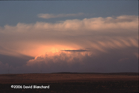
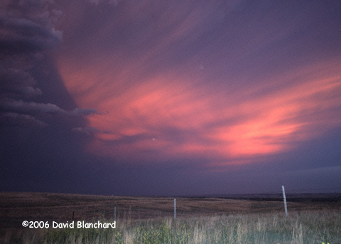
 LP supercell at sunset in Nebraska.
Distant supercell at sunset in Nebraska.
LP supercell at sunset in Nebraska.
|
My initial target area was eastern Colorado. The model data was unable
to help me pin down a more specific location other than both northeast
Colorado and southeast Colorado had good chances of interesting
convection. Since I wanted to be north of my current location at the
end of the day, I aimed for the northeast. Early convection in
southeast Colorado was a distraction but I held onto my original
target. After driving to LaJunta, I went north to Limon where some high
based Cu were struggling. Keep on going. After arriving in Sterling, I
could see a cell to my northeast so I went that way. I finally
intercepted this storm about 10 miles west of Oshkosh, Nebraska. It was
a slow-moving, high-based, LP supercell. As the sun got lower and the
boundary layer began to cool, the cloud base became more laminar until
it began to resemble the classic upside-down wedding cake. With the low
sun angle, the colors on the storm--as well as the local hills--was
quite nice and I shot a large number of photographs.
|
| 03 June 2006 | |
|---|---|
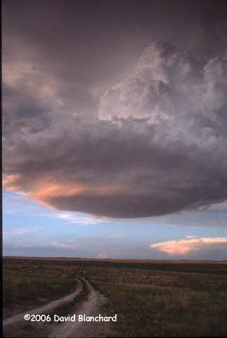
 Sunset colors on supercell anvil in Nebraska.
|
Started the day in Ogallala, Nebraska. Overall, the data and models
suggested it was not a good setup for supercells but there was at least
a chance. Initial target was Valentine, Nebraska. After arriving in
Valentine, I began to suspect I was too far north. A call to other chasers
confirmed that there were some small Cu farther south near Thedford,
where I had been about an hour earlier. I drove back south and found
the few clouds. I followed these to the southeast but as they moved
into more stable air they vanished. Dinner and lodging was in North Platte, Nebraska. |
| 04 June 2006 | |
|---|---|
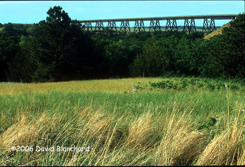
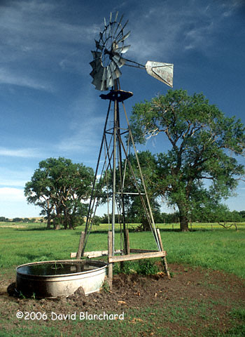 Windmill in Cherry County, Nebraska.
Bridge over the Niobrara River.
|
A few thunderstorms formed late in the evening and pushed southeastward
overnight and became a small MCS. Outflow from this system pushed some
better moisture westward and turned the winds more to the east. Best
instability was along the CO/KS border but shear profiles were better
elsewhere. After monitoring the data from the hotel lobby for a few
hours, I decided today was a down day and I would spend the rest of it
traveling through the Sand Hills and taking photographs. This is a
difficult place to chase because of all the hills and lack of views in
all directions as well as being a land of few roads. On the other hand,
if you are not chasing, it is a delightful place to visit and stop and
admire. There are many rivers and streams, as well as ponds and lakes,
scattered throughout the hills. All with abundant wildlife. The evening was spent in Valentine and I took a sunset walk out to the old railroad bridge across the Niobrara River. The bridge is now part of the Cowboy Trail, a "Rails To Trails" project. |
| 05 June 2006 | |
|---|---|
 Developing supercell in southwest Nebraska.
Intense rainshaft in southwest Nebraska.
Cumulonimbus Mammatus near McCook, Nebraska.
|
Model data over the past few days had been reasonably consistent with
portraying a severe weather play in eastern Nebraska and South Dakata.
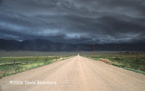
That's why I spent the night in Valentine. Unfortunately, evening convection in Wyoming continued overnight and became a large MCS that moved across southern Nebraska during the night and well into the next day. This resulted in convectively overturned air, a depletion of low level moisture, and a disruption of the winds at most levels. Although there was still a chance of severe in the east, it was going to be harder to develop, and possibly harder to chase. The convection had pushed a significant outflow boundary in all directions and to the west it was already pushing into Colorado. If other ingredients are already in place, a surge of moist easterlies can produce severe weather in the high plains. I chose to go west. By the time I got to Ogallala, convection was developing all around me. Without radar guidance, it was difficult to choose a target so I chose the nearest best storm. Until it dissipated. Then I chose another. As this storm was approaching Imperial, I drove southwestwards towards it to peer into the darkness of the rain but could see nothing. I turned around and drove east to stay ahead of the storm. A few minutes later, an impressive updraft/shelf cloud appeared to my left, moving almost as fast as I was driving. This may have been a left mover from a split. I watched this for some time and it produced some very dramatic rainshafts. Photogenic even. Eventually, all of this became a line and was outflow dominant with a large cold pool and the threat of severe thunderstorms was rapidly diminishing. I drove westward back to McCook and shot some photos of very dramatic CbMam with fabulous sunset colors. All from the Wal-Mart parking lot. Finally, I drove back to North Platte for the night. |
| 06 June 2006 | |
|---|---|
 Towering cumulus in western Nebraska.
Towering cumulus dissipatis in western Nebraska.
|
Not much of a severe play today. There was a slight chance of a DCVZ setting up so I decided that I might as well head towards Colorado. By the time I arrived, the easterlies had pushed all the way to the foothills and there was no circulation and very little convection over the plains. Plenty of convection over the mountains, however. I drove northward to Cheyenne and spent the night in hopes of an eastern Wyoming setup for tomorrow. |
| 07 June 2006 | |
|---|---|
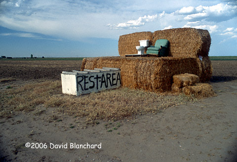 Nebraska Rest Stop.
Carhenge. Alliance, Nebraska.
Carhenge. Alliance, Nebraska.
|
Models had been suggesting that the northeast corner of Wyoming and
the surrounding area could see ingredients come together for
supercells. This would allow me to get near Devils Tower and, possibly,
get that perfect photograph with a thunderstorm, rainbow, and the
Tower. Unfortunately, by mid morning, the surface front had already surged south of this region. I revised my strategy and planned to drive north until I encountered the northeast winds then turn east. This occurred in Lusk, Wyoming. Traveling east, I could see some small Cu forming to my south and I stopped a few times to take some photographs. With harsh afternoon light, I don't think they are going to be particularly great. I could see stronger storms farther east but these were too far away to catch. Instead, I drifted south with the front, finally overtaking it near Alliance. Stopped at Carhenge and an amusing Nebraska "rest stop" for some fun photos. Numerous locations in Nebraska and Wyoming set record high temperatures this afternoon with many temperatures exceeding 100°F. With dewpoints only in the low 50s, that results in a T/Td spread well in excess of 40°F and approaching 50°F. Since published results suggest that spreads greater than 20°F can be detrimental to tornadogenesis, it's no surprise that there were none. In fact, with spreads this large, about all that can occur will be very high-based storms. I drove back to Cheyenne and stayed at the same motel as the previous night. And ate at the same Chinese restaurant. Both were good. |
| 08 June 2006 | |
|---|---|
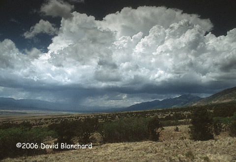
 Convection over the Sangre de Cristo mountains.
|
After determining that today would be essentially the same as yesterday
except possibly farther north--and that tomorrow wasn't all that great
either--I left Cheyenne for the Colorado mountains. I ended up
visiting the San Luis Valley and the Sangre de Cristo mountains for
some rest and relaxation and to re-think my chase strategy. That's
assuming I have a strategy. Some thunderstorms formed early in the afternoon on the west side of the San Luis Valley. These storms sent out a strong and cold outflow that rushed eastward across the valley and then up against the west flank of the Sangre de Cristo mountains. The clouds that resulted were very photogenic with multiple layers appearing above the foothills of the mountains. |
| 09 June 2006 | |
|---|---|
 Convection in the San Luis Valley.
|
Convection again developed early in the afternoon over the San Luis
Valley and I watched with some hope that maybe there would be some
non-supercell tornadoes with these storms. But, no, just ordinary
thunderstorms. By late afternoon I have to decide whether to "cut my losses" and drive home to Flagstaff or take one last shot at chasing. Models suggest there might be a play for the Nebraska and Colorado border region so I drove back out onto the plains and spent the night in Limon. |
| 10 June 2006 | |
|---|---|
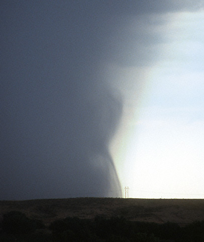
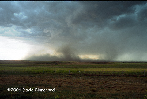 Gust-front vortex on an outflow boundary in the Nebraska panhandle.
Arcus clouds approaching a ranch in northeastern Colorado.
|
Models all pointed to the Nebraska panhandle and northeastern Colorado
as the best locations for storms today. After digging as deep into the
data as I could, I decided that far northeastern Colorada had the best
combination of shear, surface winds, and instability. I left Limon and
drove northward through the Pawnee Grasslands to Kimball, Nebraska, so
that I could move east and south ahead of the developing storms and end
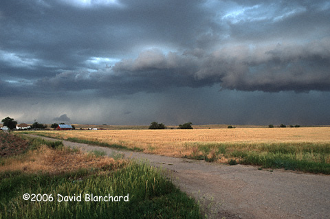
up in my forecast hot spot. Unfortunately, the early short wave was too strong and convection erupted rapidly over a large area. This resulted in a strong cold pool developing and very soon the entire system became outflow dominant. I observed very impressive arcus and gust front clouds as well as massive walls of dust plus a few gust-front vortices as the outflow and cold pool spread to the east and south. There may even have been a few tornadoes during the earliest stages of development but I was unable to ever get east of the main system. I was always on the southeast and south end of the outflow. Because of intervening cloud cover, I was unable to see that an isolated storm had developed east of Denver and was moving into my forecast target zone. Dewpoints were quite low in this region (generally mid/upper 40s) so it's not likely that this developed a tornado. On the other hand, the radar signature was very impressive and I would have enjoyed seeing this isolated supercell. Hope someone else did. [In fact, quite a few chasers saw this storm and reported that it was visually striking.] Spent the night in Fort Morgan, Colorado. |
| 11 June 2006 | |
|---|---|
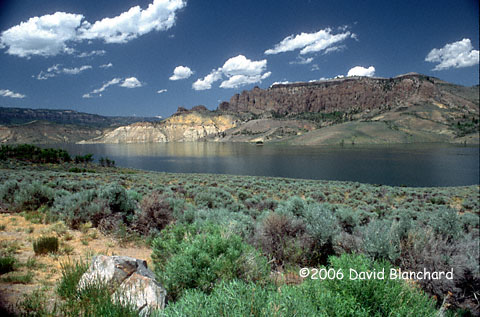 Blue Mesa Reservoir.
|
Analysis of the data indicated that the best chances for convection and
supercells would take me north into the Nebraska panhandle. Since I
have to be back in Flagstaff by tomorrow evening, I decided that this
potential setup would take me too far in the wrong direction and would
not be playable. Instead, I started the drive home so that I could do
it in two leisurely days instead of one day of hard driving. I made it
as far as the San Juan mountains in Colorado. I found a Wi-Fi hot spot after dinner and checked the weather to see if my decision had been a good one. Although there were some very impressive severe thunderstorms, it was located in far western Nebraska where I had determined the best chances existed. I rested comfortably that night knowing I had made a good choice. |
| 12 June 2006 | |
|---|---|
| As I drove through the Four Corners region and into Arizona, I could see smoke from a couple of different fires. One was burning on Navajo Mountain on the Navajo Reservation; another was burning on the Kaibab Plateau. Fire season had arrived in Arizona. | |