We had a very wet period from late afternoon Thursday through early evening Friday (12/23-12/24) as an atmospheric river (AR) moved across the southwest and Arizona. From the Wikipedia site:
An atmospheric river (AR) is a narrow corridor or filament of concentrated moisture in the atmosphere. Other names for this phenomenon are tropical plume, tropical connection, moisture plume, water vapor surge, and cloud band.

An approaching trough of low pressure was able to tap into tropical moisture and move it across the southwest into Arizona overnight. Interestingly, the moisture plume aloft initially moved above a drier layer of air. Precipitation falling into this drier air experienced strong wet bulbing and evaporative cooling which lowered snow levels to ~6500 feet—putting Flagstaff into the snow. As the plume continued, these cooling effects diminished and the snow turned into rain. So we had about 4-6″ of snow followed by day-long rain. What a mess.
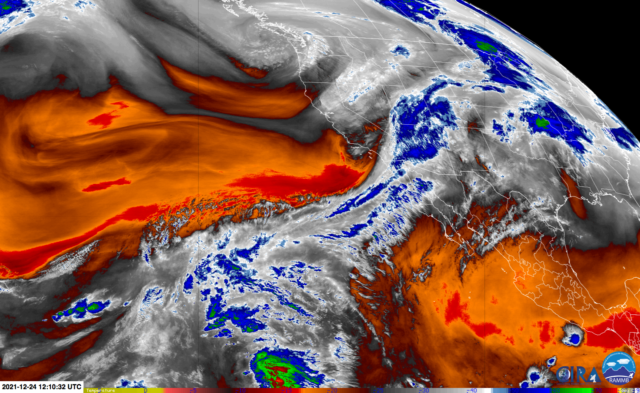
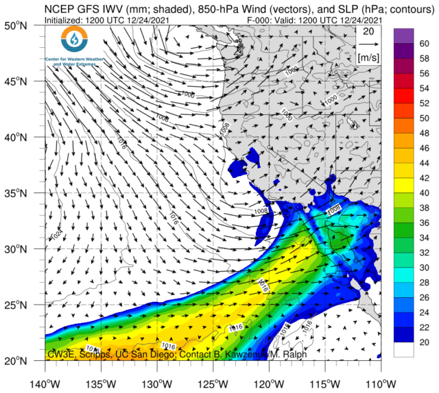
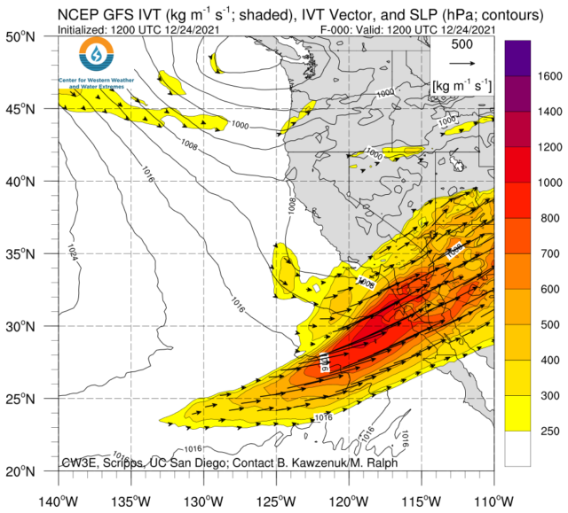
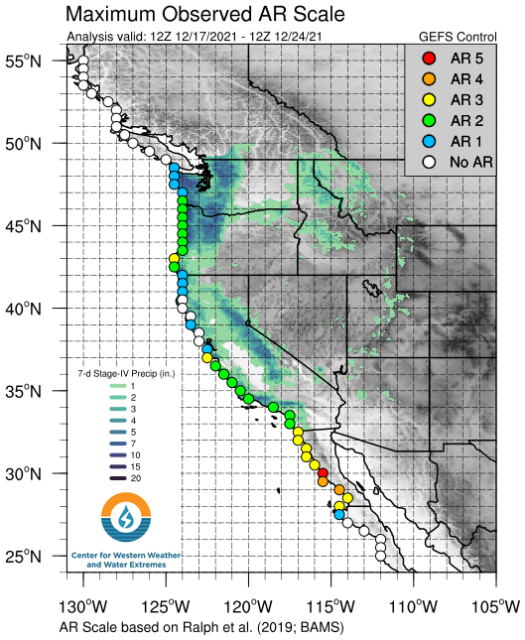
The Center for Western Weather and Water Extremes provides forecasts for ARs moving into the West. Below are some of the products valid at 5 A.M. Friday (12/24/2021) that clearly show the plume of moisture.


It’s great to get all this moisture although it would have been much better if had been either all rain or all snow. Mixed precipitation is always a mess.