Monsoon Transition Season Is Here

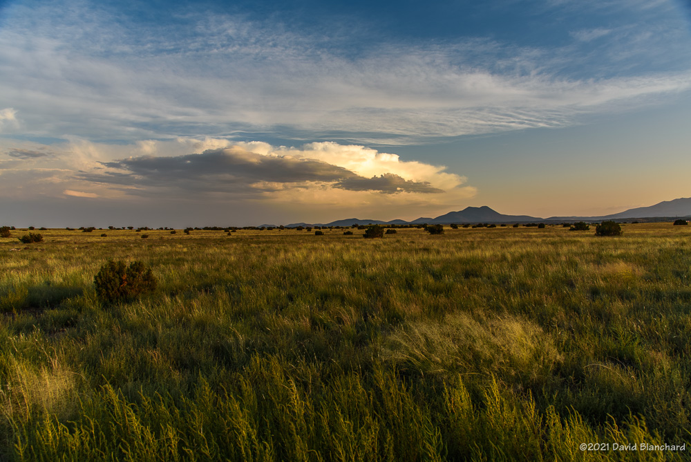
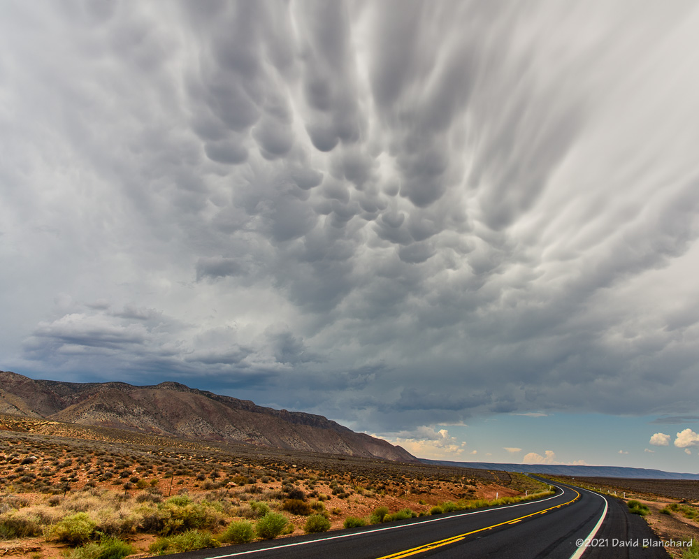
It is now September and we are in the so-called “transition season” as the North American Monsoon weakens and stronger baroclinic weather systems begin to traverse the southwestern states. From a paper presented at the 23rd Severe Local Storms Conference (2006):

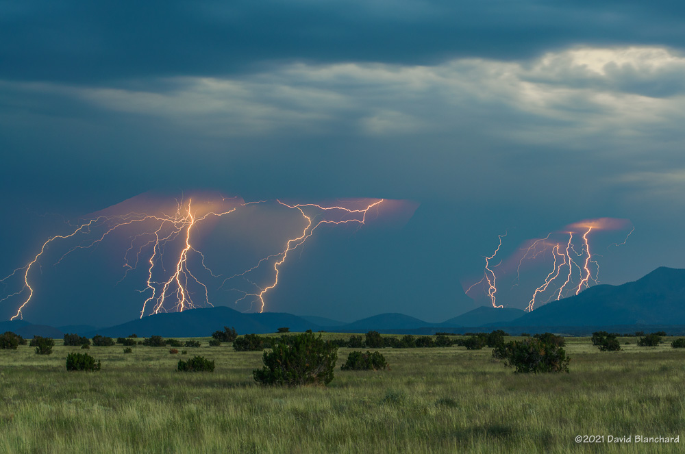
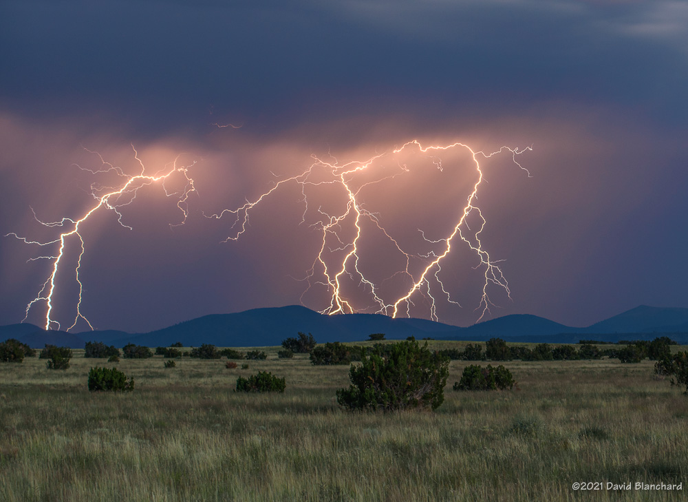
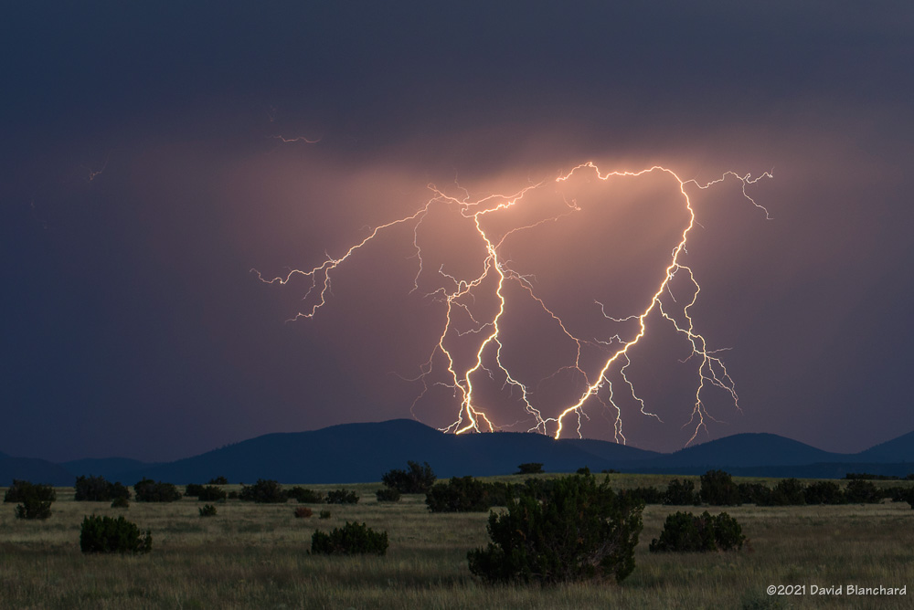
Outbreaks of severe thunderstorms in northern Arizona are most likely to occur during the transition between the moist, tropical environment of the warm-season North American Monsoon regime and the first incursions of mid-latitude baroclinic systems in September. The presence of copious tropical moisture, combined with increased convective instability and deep-layer shear, is supportive of long-lived supercells which are responsible for most of the severe weather.

Supercells are more common during the transition season than other times of the year in northern Arizona. Tornadoes—especially long-lived, damaging tornadoes—are more likely to occur during this brief period. This is from a paper presented at the 24th Severe Local Storms Conference (2008):

The results show that more than half of the tornado days occurred during the approach of a closed low from the eastern Pacific with northern Arizona located in the warm sector of the northeast quadrant of the low. The closed lows produced environments with deep-layer shear and low-level shear comparable to the 3rd and 4th quartiles of tornadic environments discussed by Rasmussen and Blanchard (1998) while instability was small and was comparable to or less than their 1st quartile. These interesting results suggest that shear may be the more important factor and that instability need only be sufficient to initiate and maintain convection long enough for the shear to act upon the updrafts.

While tornadoes in northern Arizona are more likely to occur during the transition season they are still uncommon (a notable exception was the October 2010 outbreak) and several years may pass without any tornado events. Supercells, on the other hand, are more common and at least a few can be expected each year during the transition.

Below are composite means of 500-mb geopotential height, 700-mb v-wind component, and surface Lifted Index for the tornado events.

Composite 500-mb height field for the 19 tornado event days.
Composite 700-mb v-component of the wind field.
Composite surface-based Lifted Index field.

Will we have a closed-low, transition-season type of event this year?

References

Blanchard, D. O., 2006: A cool season severe weather episode in northern Arizona. Preprints, 23rd Conference on Severe Local Storms, St. Louis, MO., Amer. Meteor. Soc.

Blanchard, D. O., 2008: Synoptic environments associated with tornadoes in northern Arizona. Preprints, 24th Conference on Severe Local Storms, Savannah, GA., Amer. Meteor. Soc.

Blanchard, D. O. 2013: Comparison of wind speed and forest damage associated with tornadoes in northern Arizona. Wea. Forecasting, 28, 408–417.

Lightning over Wupatki National Monument

Lightning at Wukoki Pueblo in Wupatki National Monument.

It was only a few days ago that I photographed an evening barrage of lightning over the San Francisco Peaks and the Cinder Hills. Those photographs were taken from Wupatki National Monument—right at the entrance pullout off of Highway 89. And, now I found myself in this same location shooting lighting from an early afternoon series of thunderstorms—except looking in the other direction across vast grasslands.

Lightning at Wupatki National Monument.

The most amazing lightning strike of the day occurred before I had set up the gear. The bolt landed miles away from the storm in a sunny area. This was a classic “bolt from the blue” and would have surprised anyone in that location. The radar image below shows the bolt landing a fair distance from the storm.

Lightning continued in this direction for more than an hour. As the storms would move to the northeast newer storms would develop north of the San Francisco Peaks and move over Wupatki National Monument.

Lightning at Wukoki Pueblo in Wupatki National Monument.
Storms move to the distant northeast at sunset.

After shooting at this location for awhile I decided to reposition to Wukoki Pueblo with hopes that lightning to the north would continue and I could get photographs with lightning and the pueblo. I was not disappointed.

24-hour lightning plot ending 1000 MST 12 September 2021.
Radar with lightning overlay for 1304 MST 11 September 2021.

Again, storms would move to the northeast and then be replaced by new storms from the southwest. This went on for several hours. The lightning plot above shows how many lightning strikes there were in this region during the afternoon.

I had hoped that thunderstorms and lightning would continue through sunset and twilight but it was not to be. Eventually, newer storms stopped developing and the other storms moved far to the northeast.

Lightning over the San Francisco Peaks

The data and models suggested there would be convection from the San Francisco Peaks northward to Grand Canyon and into far northwestern Arizona. At best, however, these would be weak storms and would probably dissipate by late afternoon. With that in mind, I headed to the south rim of Grand Canyon. And the models were right about both the location and weak character of the storms. After shooting for a short time I left well before sunset.

Sunset at Wupatki...before the lightning.
Sunset at Wupatki…before the lightning.

As I was leaving, radar data showed a strong storm well to the southeast of Flagstaff. Leaving Grand Canyon National Park, I was able to see the storm in the distance and hoped I might get a few good photos at sunset. I stopped at Wupatki National Monument to take a few photos just as the sun was dropping behind the hills to the west. A moment later, I saw a flash of lightning. Then another…and another. These flashes were almost 40 miles away but were clearly visible.

Lighting composite taken over a 3-minute period
8-second single exposure.
Lightning composite taken over a 4-minute period.
Lightning composite.

I spent the next 90 minutes shooting lightning photos from this spot. The storm was moving towards me and the lightning bolts were getting closer, larger and brighter. There were lots of cloud-to-ground strokes with multiple branches and leaders lighting up the sky. Because these lightning bolts were south of the San Francisco Peaks and the Cinder Hills, there are no photos showing the bolts in contact with the ground.

24-hour lightning map.

Above is a plot of 24-hour lightning ending the morning of 10 September 2021. There are two distinct clusters of lightning around the San Francisco Peaks. The cluster to the northwest occurred during the afternoon. Many of these were visible from the South Rim of Grand Canyon. The cluster to the southeast of the San Francisco Peaks occurred during twilight.

And what of the time spent at Grand Canyon? Yeah, this is what I saw.

Weak showers at Grand Canyon.
Some mammatus.
Some mammatus.

Glad I left early and caught the second act.

Morning Fog at Mormon Lake

A few days of tropical moisture—remnants of Tropical Depression Nora—brought widespread rainfall to much of northern Arizona. As the moisture was replaced by drier air in the middle- and upper-levels but was unchanged in the near-surface layer, we were left with a situation in which fog might form in the early morning hours.


So, up before dawn to drive out to Mormon Lake and the surrounding basin. And there was fog—at least in one corner of the basin. Here is a 30-minute time lapse compressed down to 17 seconds showing the movement of the fog as it sloshes back and forth.

Sunrise through morning fog.

As this was taking place, the sun rose through a shallow layer of fog.

Sunset at Grand Canyon.

Bonus: on the previous evening the sun was setting through layers of smoke from the western wildfires.

Edit: updated image.

Lightning and Reflections

We have been in a “monsoon break” in northern Arizona for a week or so, but there can still be some convection during these periods. A few days ago, some isolated showers and thunderstorms developed to the north of the San Francisco Peak in the late afternoon and early evening.

Lightning reflected in the ponds of the Kachina Wetlands.

This was a good opportunity to capture images of thunderstorms and lightning with reflections in the ponds of the Kachina Wetlands.

Radar image of storms north of the San Francisco Peaks.

Above is an image showing the thunderstorms and lightning north of the peaks.

One more thing: the mosquitos were pretty intense—but it was worth it.