Iridium Flares and NOSS satellite pairs

With storm systems and cold fronts moving across the region last night the opportunity to do any sky watching seemed remote. And, yet, for a brief period, clear skies revealed the stars, moon, and satellites above northern Arizona.

First up was the X-37B at ~1805 MST. I watched — but did not photograph — this USAF spacecraft. I wish that I had because for a few seconds after it had passed maximum altitude it flared brightly – possibly rivalling Jupiter in brightness.
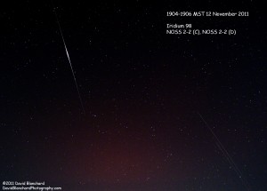
Iridium 98 satellite flaring along with the NOSS 2-2 (C) and NOSS 2-2 (D) satellite pair.

Next up was an Iridium 98 flare that was forecast to brighten to magnitude -6.5. This was easily captured by the camera but I was also able to capture two additional satellites travelling close together. A bit of investigation revealed that these were likely NOSS 2-2 (C) and NOSS 2-2 (D). NOSS is the Naval Ocean Surveillance System and these spacecraft travel in pairs and triplets.

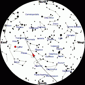
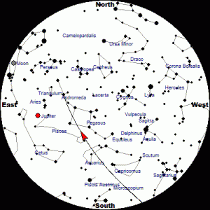
I often use the information available at the Heavens-Above web site for satellite tracks and times. Below are the tracks for the Iridium98, NOSS 2-2(C), and NOSS 2-2(D) spacecraft.
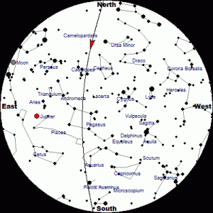
Track of Iridium 98 for 12 November 2011.
Track of NOSS 2-2(C) for 12 November 2011.
Track of NOSS 2-2(D) for 12 November 2011.

There are hundreds of active satellites and thousands of objects (live satellites, dead satellites, and pieces of space debris) orbiting the earth. So it’s pretty easy to look up and see one of these moving across the sky. But it also makes it difficult to photograph the stars, planets, and other celestial bodies without getting a satellite track across the image.

Another Space Station in the Sky

We all know about the International Space Station (ISS). Many people have watched as it flies overhead as a brilliant point of light moving across the sky.

But now it is no longer the only space station in the sky. On 29 September 2011 China launched its own space station known as Tiangong (“Heavenly Palace”). It’s not as bright as the ISS and thus less noticeable to most observers.

Tiangong and Shenzou spacecraft moving across the pre-dawn sky.

Then, on 01 November 2011, China launched the Shenzhou-8, an unmanned spacecraft designed to dock with Tiangong. And early on the morning of 02 November 2011, both spacecraft passed overhead cutting through the constellation Orion. Just a few hours later, Shenzou-8 successfully docked with Tiangong.

The dual spacecraft flyby is reminiscent of the ISS-Shuttle flybys.

Night hiking in the Grand Canyon

We recently took a “day” hike in the Grand Canyon — except that much of the hike was in the dark. We left Flagstaff around midnight and arrived at the South Kaibab Trailhead at 1:30 a.m. and began our descent in the dark.

The moon was already past 3rd quarter and had not yet risen. But the skies were exceptionally clear and the stars were brilliant. There was almost enough light from the stars to hike down. Almost, but not quite.

So we did the safe thing and used our headlamps to light the trail.

Normally, the South Kaibab Trail is quite busy with hikers. The constant low hum of people talking to each other mixes with the normal daytime sounds of birds and of aircraft flying high overhead (or, sometimes, not so high overhead).

But there was none of that. Just the gentle sighing of the wind and even that began to diminish as we descended from the rim.

The Orionids meteor shower was nearing its peak (still a day away) but we saw plenty of meteor action during the pre-dawn hours. There would be extended lulls followed by a brief flurry of streaks across the sky. We spent so much time looking up that we made only slow progress going down.

At Tip Off Point, we turned onto the Tonto Trail and slowly made our way westward as the first hints of twilight began to appear in the eastern sky. With first light, I began to shoot some photographs of the cliffs of both the South and North Rims and of the side canyons.

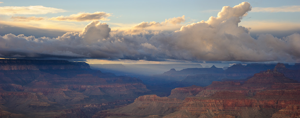
Early morning light on the South Rim of the Grand Canyon.

As we reached the Bright Angel Trail near Indian Garden, the sun had risen and people were out and about on the trail heading both up from Phantom Ranch and down from the Rim. The low hum of many conversations permeated the air and the heavenly silence we had experienced over the past few hours came to an end.

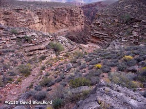
Pipe Spring Canyon - a side canyon of Grand Canyon.
Pipe Spring Canyon – a side canyon of Grand Canyon.

After a short jaunt out to Tonto Point — where we once again had silence — we finished our “day” hike by ascending the Bright Angel Trail.

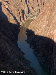
The Inner Gorge of Grand Canyon as seen from Tonto Point.

Autumn in the High Country of Northern Arizona

It’s that special time of year in northern Arizona. The thunderstorms and cloudy days of the summer rainy season are history and have been replaced with day after day of perfect weather. Warm days. Cool nights. Cloudless skies. Light winds.

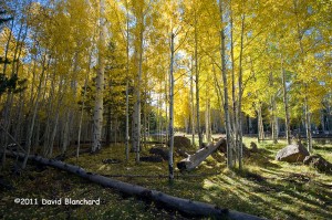
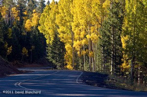
Fall colors near Aspen Corner on Snowbowl Road.

And, of course, the leaves are changing colors.

The view along the road is spectacular.

It’s mid-October and the colors have hit their peak at the higher elevations of the Kachina Peaks. Lower down, the colors are quickly approaching their peak. But it won’t last long. All it takes is one windy day or another hard freeze and it will be over for this year.

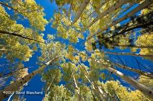
Everyone has an aspen image that looks like this!.You should have one, too!

I took some time early this morning wandering around the aspen along Snowbowl Road and found some groves in full color. Interestingly, a few groves were still green and a few others were already done. But most were hitting that perfect peak.

Yet another tornado for Northern Arizona

Last week another tornado moved across northern Arizona. The damage produced by this tornado was confined to a small area and was nothing like the tornado outbreak of 06 October 2010.

What makes this tornado interesting is where it occurred. The tornado formed just west of the San Francisco Peaks and then moved up the west flank of Humphreys Peak. Damage was isolated along the early portion of the path at around 9000 feet. As it moved up the mountain, damage increased in intensity and coverage with the peak damage occurring near 9800 feet. Farther up the mountain isolated damage continued until the tornado dissipated near 10500 feet.

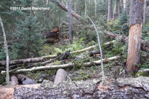
The worst damage occurred as the tornado crossed the Humphreys Trail just a short distance from the trail register. In the first few days after the event travel along this section of the trail can best be characterized as challenging. Climbing over and under downed trees — and around others — certainly slows the hiking pace.

Somewhere under all those trees is the Humphreys Trail.

This is not the highest elevation tornado of record. That belongs to a tornado that occurred in the Sierra Nevada mountains a few years ago with evidence of damage at elevations above 12000 feet.

The  limited damage inflicted upon the mountain might never have been noticed if it had not passed over a heavily used hiking trail. Now that’s serendipity. Or bad luck.

Nobody saw the tornado so all we have to go on is the radar data. And according to that information the event occurred between 5:25 and 5:35 pm on 14 September 2011.