The North American Monsoon is in full swing and is producing daily thunderstorms and heavy rains across the southwest. Lightning is always a favorite subject for me this time of year and I have tried a few times to get interesting photos. Today was a good day.
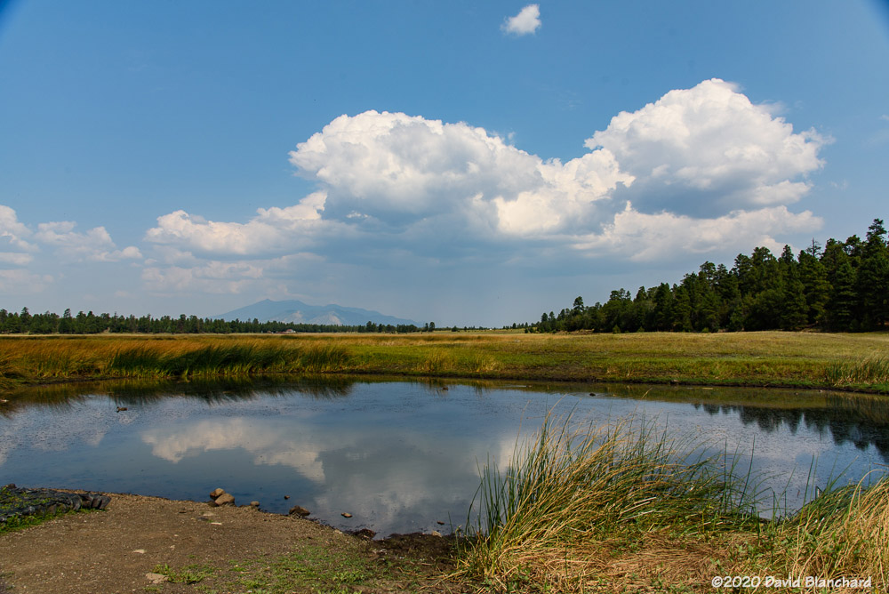
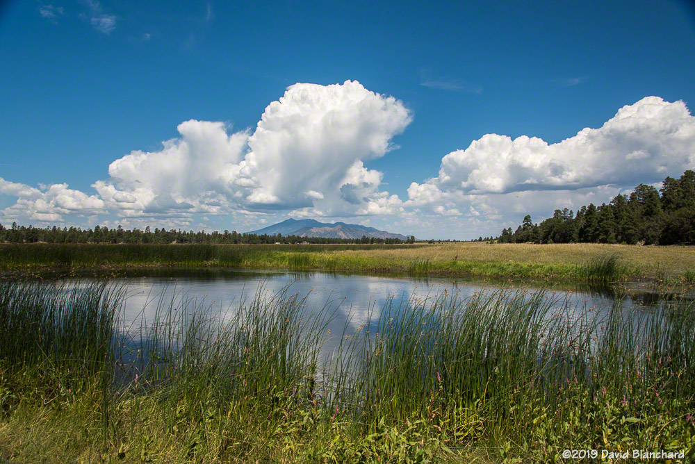
Rain falling at Wupatki National Monument.
I stopped briefly at Wupatki National Monument and photographed an interesting rain shaft over the grasslands of the park — but no lightning.
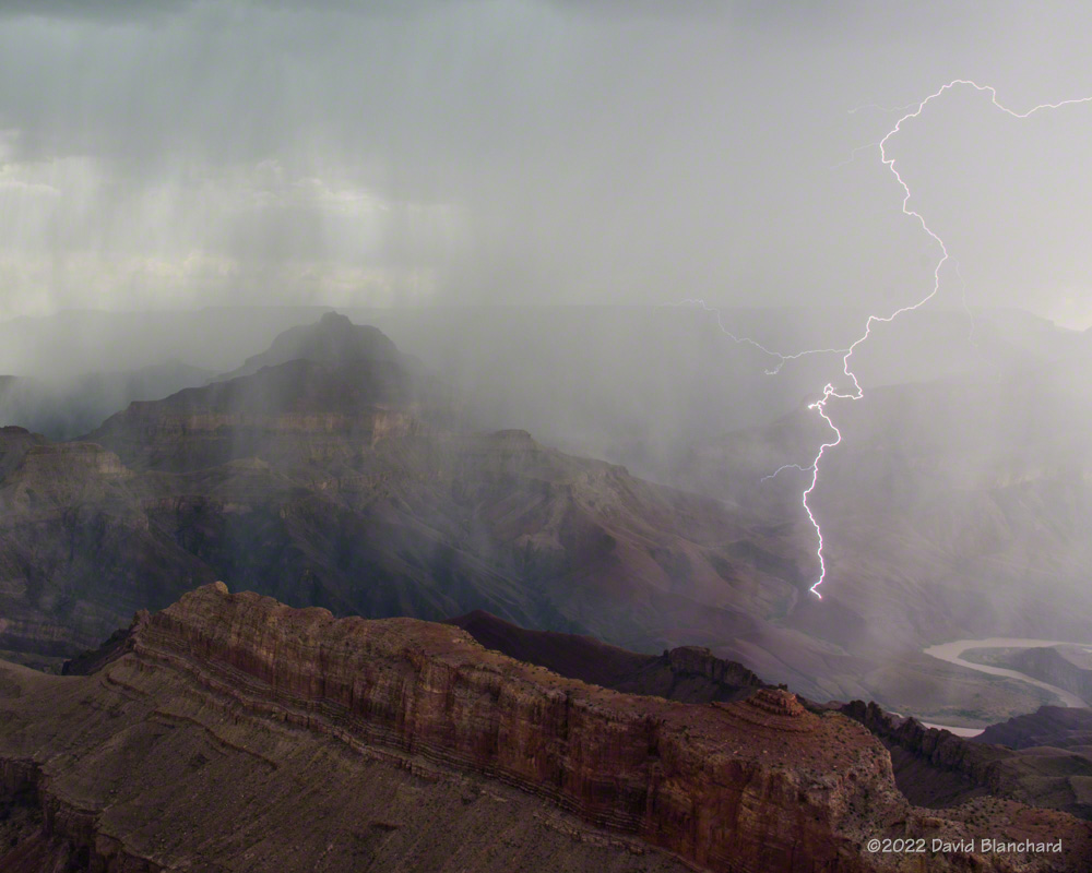
Lightning near the Little Colorado River canyon.
I moved on towards Grand Canyon but made a stop at one of the Little Colorado River overlooks along the way and was able to get a few good bolts.
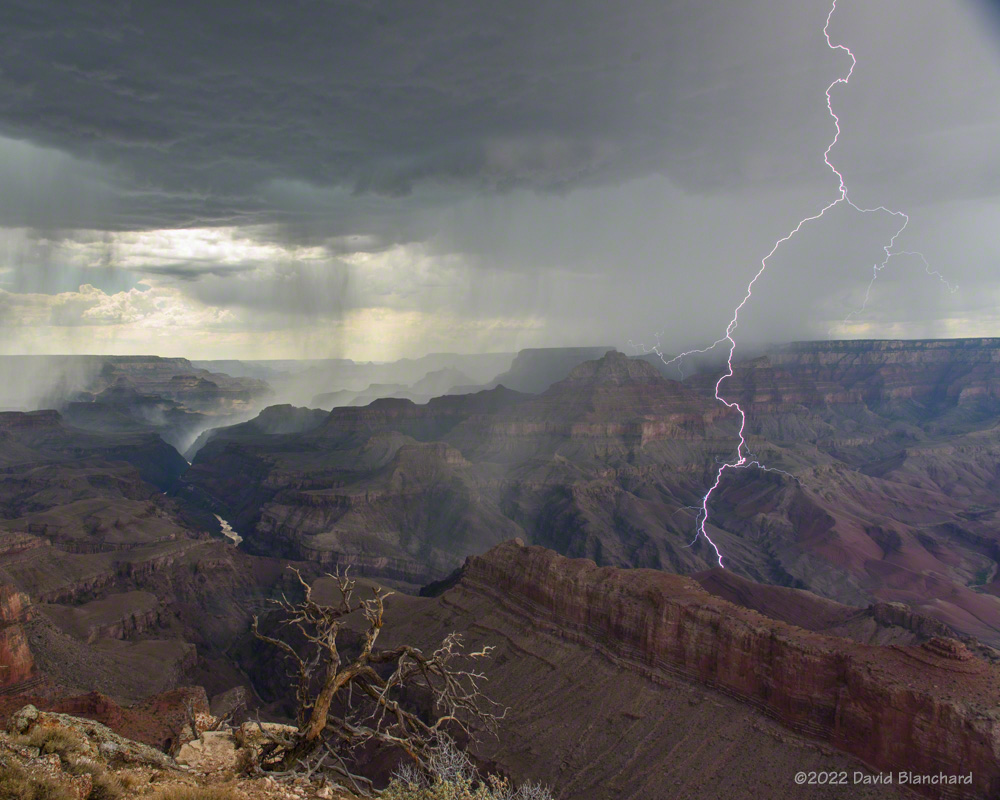
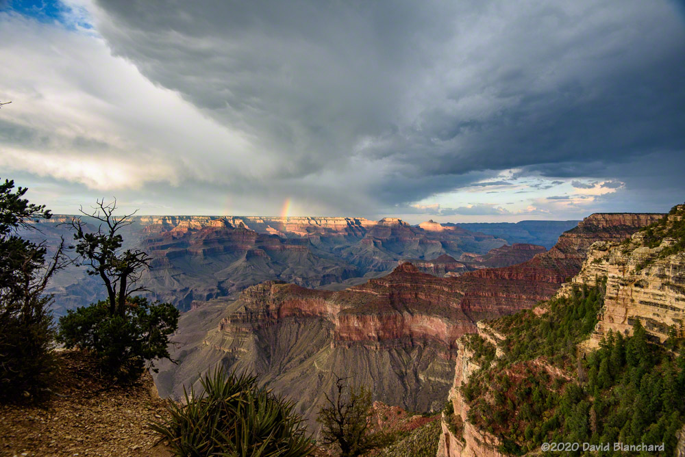
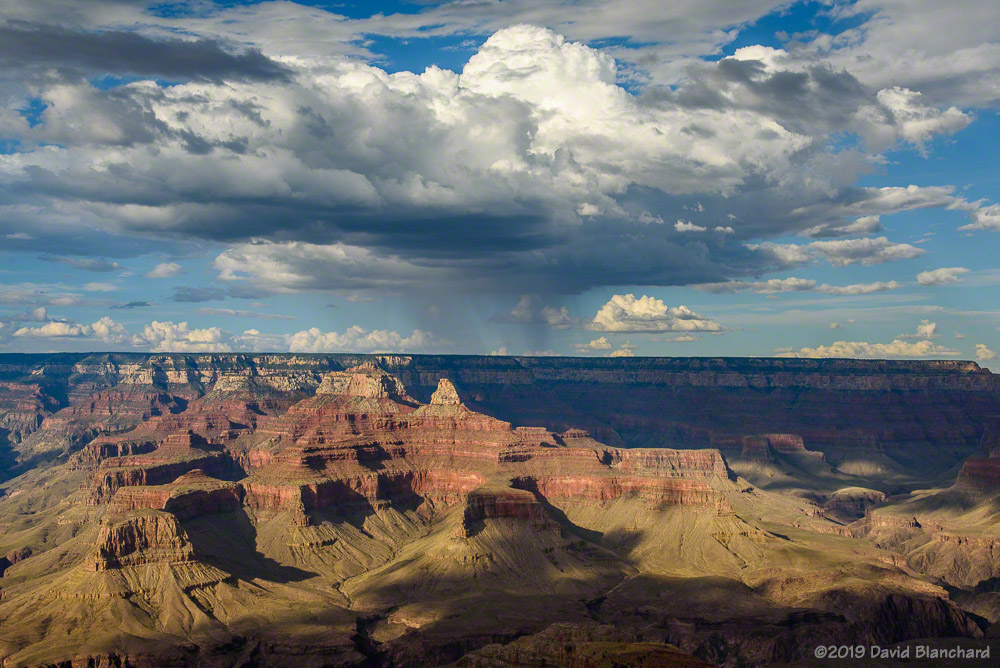
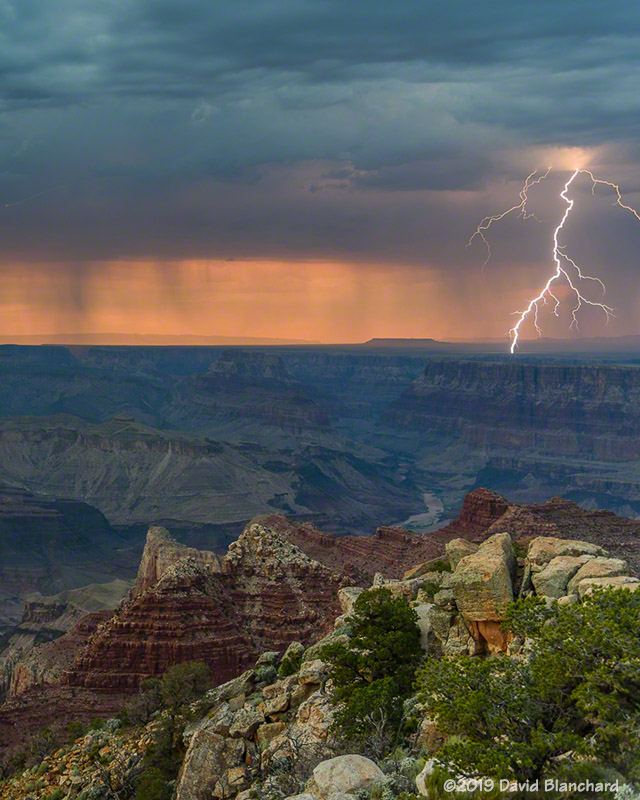
Lightning at Grand Canyon.Rain falling into Grand Canyon.
I arrived in time to watch new thunderstorms develop south of the canyon and then move across the canyon to the North Rim. Capturing bolts landing below the rim is always interesting and I managed to get a few. But the best and closest lightning bolts occurred while it was raining and I was safely watching from the inside of my vehicle.
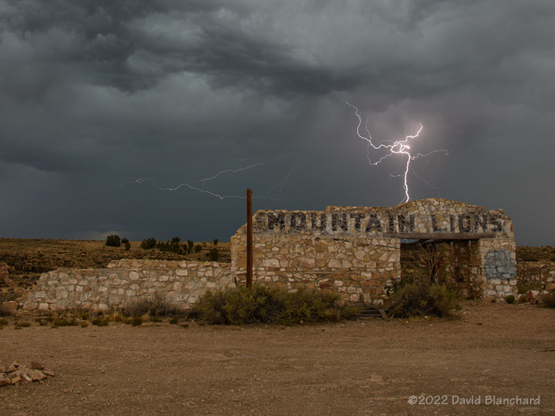
Lightning behind the ruins at Two Guns, Arizona.Solstice sunset.
A few days earlier I was able to catch this bolt of lighting at the Two Guns ruins near I-40. And a few days before that I caught this great sunset from Mormon Lake.
It is now September and we are in the so-called “transition season” as the North American Monsoon weakens and stronger baroclinic weather systems begin to traverse the southwestern states. From a paper presented at the 23rd Severe Local Storms Conference (2006):
Outbreaks of severe thunderstorms in northern Arizona are most likely to occur during the transition between the moist, tropical environment of the warm-season North American Monsoon regime and the first incursions of mid-latitude baroclinic systems in September. The presence of copious tropical moisture, combined with increased convective instability and deep-layer shear, is supportive of long-lived supercells which are responsible for most of the severe weather.
Supercells are more common during the transition season than other times of the year in northern Arizona. Tornadoes—especially long-lived, damaging tornadoes—are more likely to occur during this brief period. This is from a paper presented at the 24th Severe Local Storms Conference (2008):
The results show that more than half of the tornado days occurred during the approach of a closed low from the eastern Pacific with northern Arizona located in the warm sector of the northeast quadrant of the low. The closed lows produced environments with deep-layer shear and low-level shear comparable to the 3rd and 4th quartiles of tornadic environments discussed by Rasmussen and Blanchard (1998) while instability was small and was comparable to or less than their 1st quartile. These interesting results suggest that shear may be the more important factor and that instability need only be sufficient to initiate and maintain convection long enough for the shear to act upon the updrafts.
While tornadoes in northern Arizona are more likely to occur during the transition season they are still uncommon (a notable exception was the October 2010 outbreak) and several years may pass without any tornado events. Supercells, on the other hand, are more common and at least a few can be expected each year during the transition.
Below are composite means of 500-mb geopotential height, 700-mb v-wind component, and surface Lifted Index for the tornado events.
Composite 500-mb height field for the 19 tornado event days.Composite 700-mb v-component of the wind field.Composite surface-based Lifted Index field.
Will we have a closed-low, transition-season type of event this year?
The North American Monsoon has been sputtering—for lack of a better term—the past week or two. We get a few days of storms followed by a hot and dry period. Finally, however, moisture is beginning to increase and we are seeing more storms. I have tried several times this year to get great photographs of storms and lightning but my success rate has been pretty low.
Here are a few photographs from the past week.
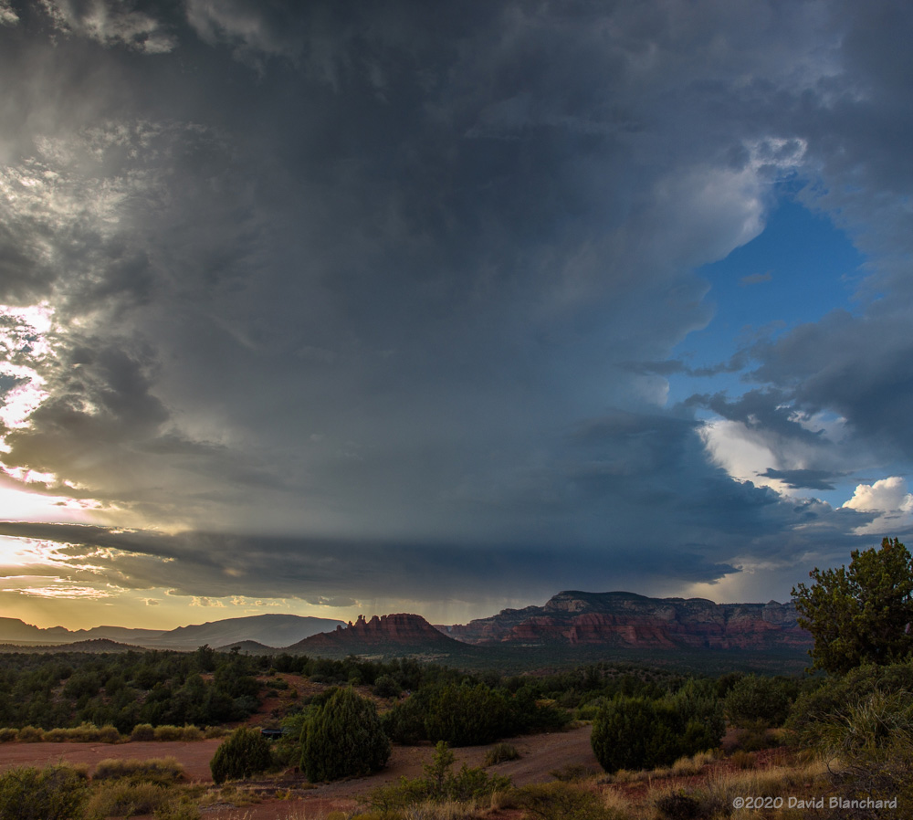
Clouds develop across the whole sky in Sedona.An outflow boundary arrives and thunderstorms develop within a few minutes.A distant thunderstorm seen from Wupatki National Monument.Mid-afternoon lightning near Mormon Lake.
And, finally we have a time lapse of the same storm that produced the lightning above. The video is 200x real time; from the motion it can be seen that the storm has some slow rotation. This storm moved off the higher terrain and became severe as it neared the Camp Verde area.
The weather models have been consistent with forecasting a significant increase in storm activity next week.
This is the second year in a row in which the North American Monsoon has failed to deliver its normal weather to Arizona. The monsoon had a late start in July with only a few isolated rain events early in the month and the main event starting around the third week of July. But even that faltered after a week and the final week of July was dry.
August was even worse with no measurable precipitation until after mid-month and even then the amounts were light. The National Weather Service in Flagstaff has posted some climate data for the area for August. It was the hottest August and the 2nd driest on record in Flagstaff and most of the west experienced similar conditions (Figure 1; Figure 2;Figure 3).
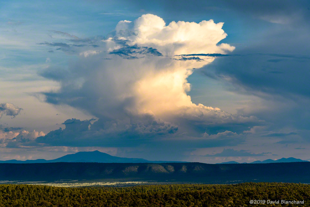
Photographing summer monsoon storms has been a challenge this year because there were so many dry periods. Even so, there are always interesting weather events and clouds that make it worthwhile. So here is a collection of the most interesting weather photographs from this summer.
Convection
Early stages of convection over the San Francisco Peaks as viewed from Marshall Lake.
A time-lapse movie shows that the ducks are more interesting than the convection.
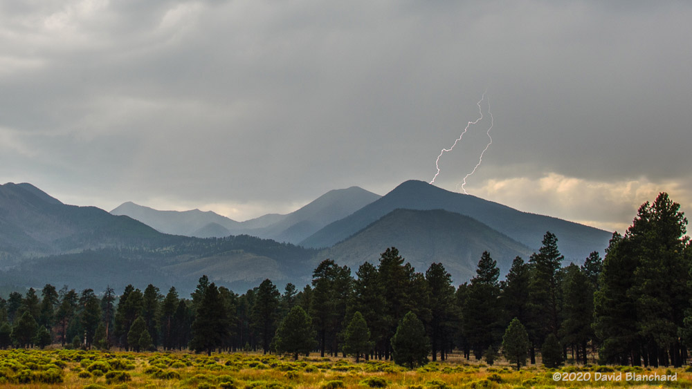
Developing Cb’s over the San Francisco Peaks.Small cumulus clouds over the Painted Desert.A weak thunderstorm near Two Guns, Arizona.A well-developed thunderstorm over the Mogollon Rim viewed from Sedona.
Rainbows
Full rainbows eluded me this year butI did manage to photograph a rainbow segment.
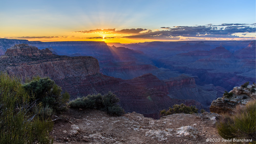
Rainbow segment over the North Rim of Grand Canyon.
Lightning
As with rainbows, lightning was elusive this year. It was typically a case of being in the wrong place on the wrong day and at the wrong time. But I did get lucky with the following image.
Lightning illuminates the interior of Grand Canyon.In-cloud lightning illuminates a small Cb near the Grand Canyon. I was trying to photograph the comet so I got lucky with this storm.Lightning at sunset over the Mogollon Rim viewed from Sedona.Weak storms over the San Francisco Peaks produced these two bolts of lightning.In-cloud lightning partially illuminates Grand Canyon while the nearly-full Moon provides additional illumination.
Sunsets
And when there is no lightning and no rainbow, one can be content with the sunset.
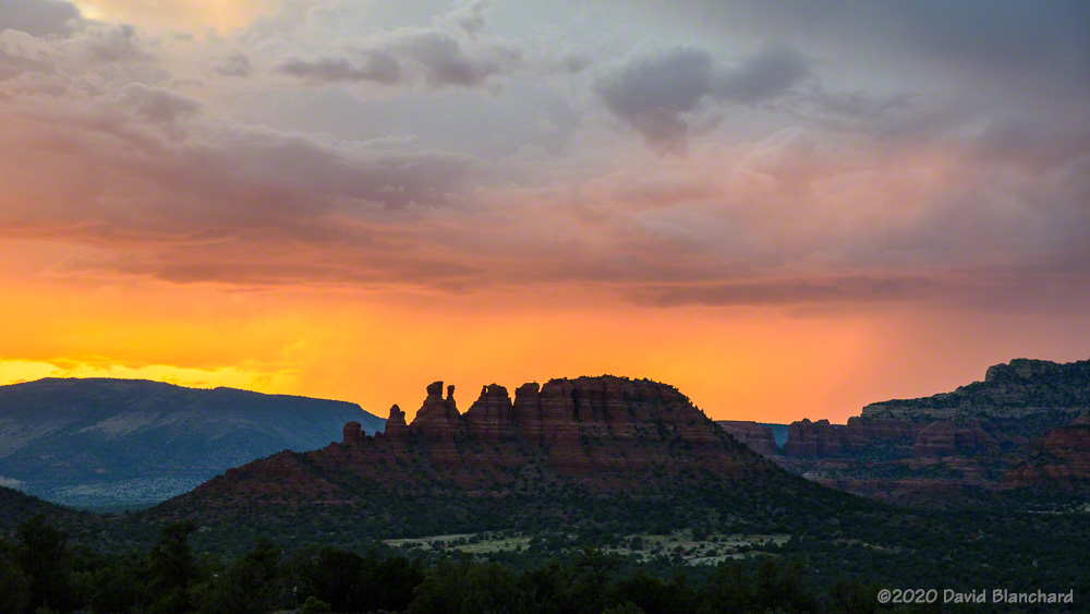
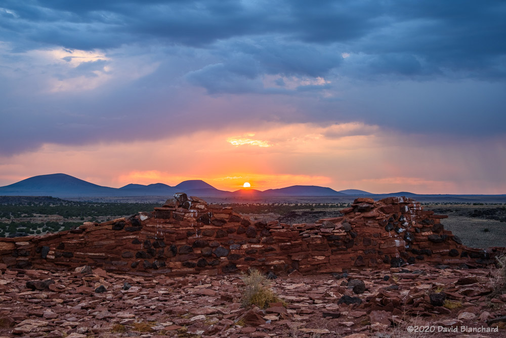
A small rain shaft is illuminated by the setting sun.Distant rain catches the last light of the sun and provides backlighting for the Cockscomb.A thin band of clouds partially blocks the sun and creates an array of crepuscular rays of light.The sun sets over ruins in Wupatki National Monument.The setting sun illuminates both Cathedral Rock and the clouds above.
Miscellaneous
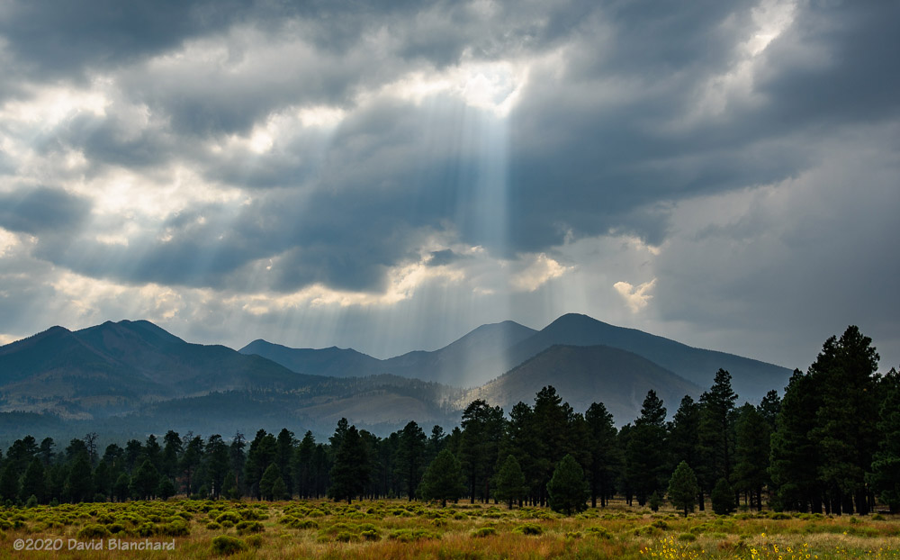
Crepuscalar Rays—Wupatki National Monument.Crepuscalar Rays—San Francisco Peaks.Even thought it is supposed to be the wet and rainy season, we still managed to get cap clouds on the high peaks with stars above.
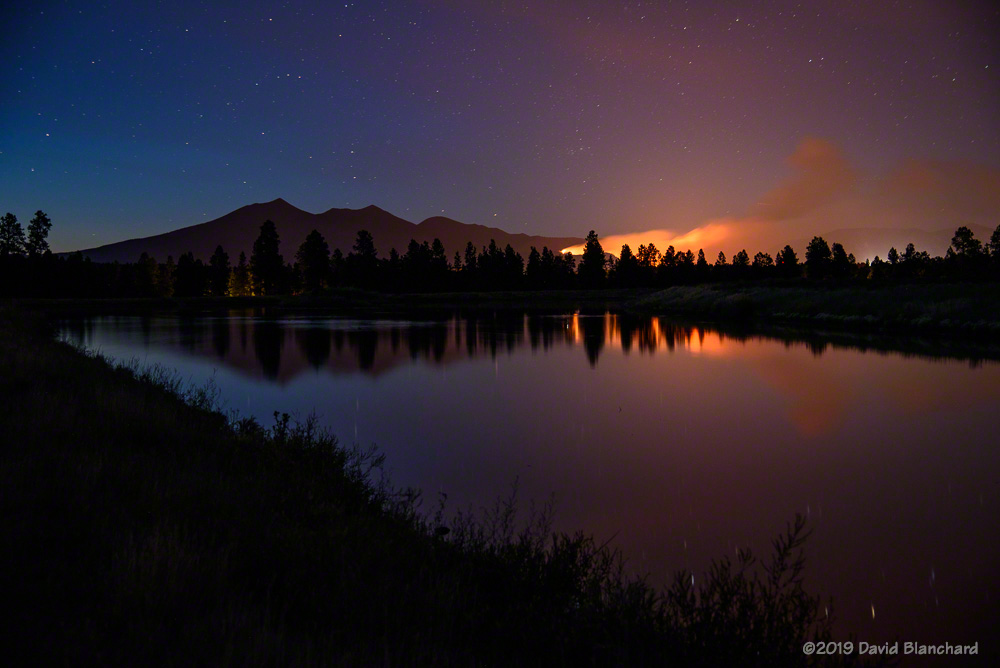
It’s been an unusual monsoon season across Arizona this year. After both a wet winter and wet spring—with above normal precipitation amounts all the way into the month of May—things went dry. The North American Monsoon started late this year with the first significant rainfall not arriving until the second half of July. This was unfortunate as the dryness partially contributed to a very damaging wildfire (Museum Fire) burning across portions of the San Francisco Peaks.
Just a few days later, the rains finally arrived. And, then, they stopped again. And it has been that way much of this monsoon season. A few days of rain, then a week or more of dry weather. A normal pattern would have rain falling perhaps four days out of seven for a two-month period. Folks around here have dubbed this monsoon the “nonsoon”.
And, of course, with the lack of moisture and thunderstorms opportunities for photographing storms, heavy rain, lightning, and sunsets has been a challenge. But it only takes one great photograph to make it a successful season. I’m still trying to get that photograph.
Here are some of the more interesting photographs from this “nonsoon monsoon” season.
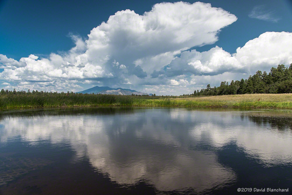
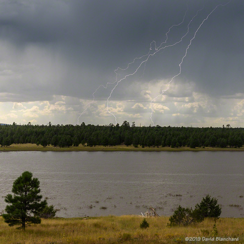
The Museum Fire burns in the San Francisco Peaks near Flagstaff.A thunderstorm develops above the San Francisco Peaks as seen from the South Rim of Grand Canyon.Convection develops over the North Rim of Grand Canyon.Convection is reflected in the waters of Marshall Lake.A growing thunderstorm is reflected in Marshall Lake.The sun sets over Wupatki National Monument.Beams of light from the setting sun illuminate the landscape near Sedona.Lightning strikes in the distance behind Upper Lake Mary.Lightning on the North Rim of Grand Canyon.Twilight lightning in Wupatki National Monument.Lightning strikes near the confluence of Grand Canyon and Little Colorado River.