In a previous post I wrote how the North American Monsoon (NAM) was very late getting started in July. Fortunately, once started, it resulted in normal precipitation amounts for the month of August. Here are photographs and discussion of some of the events during the month.
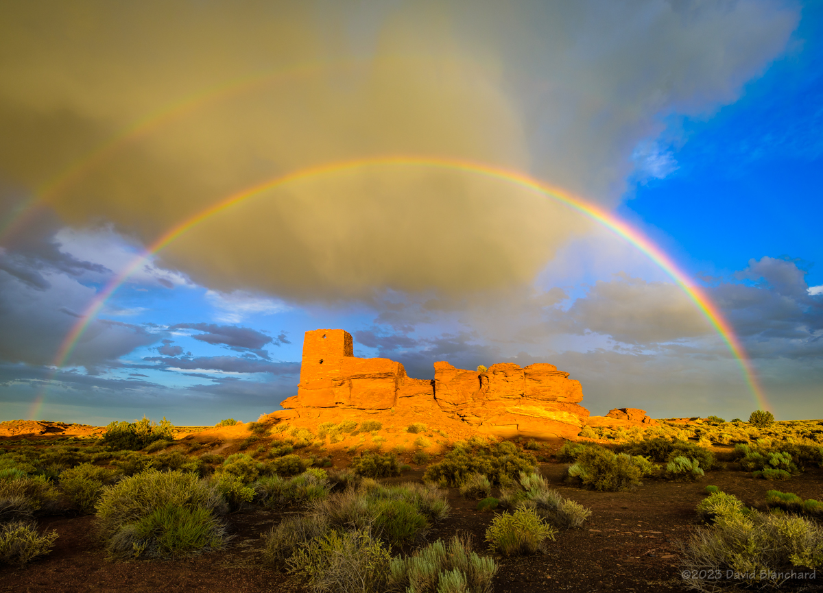
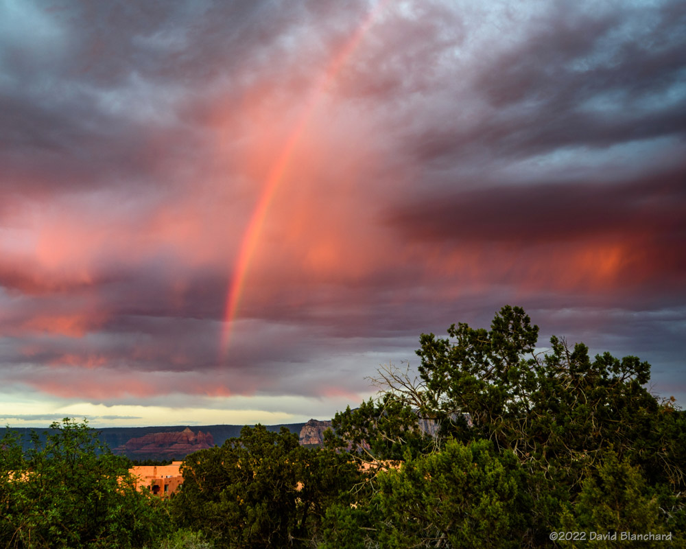
A double rainbow arches above Wukoki Pueblo in Wupatki National Monument.
The North American Monsoon (NAM) has been slow to get started this year. A general rule of thumb is it gets going around the 4th of July and is considered late (but still normal) by mid-July. Likewise an early start can occur as early as mid June–as it did last year.
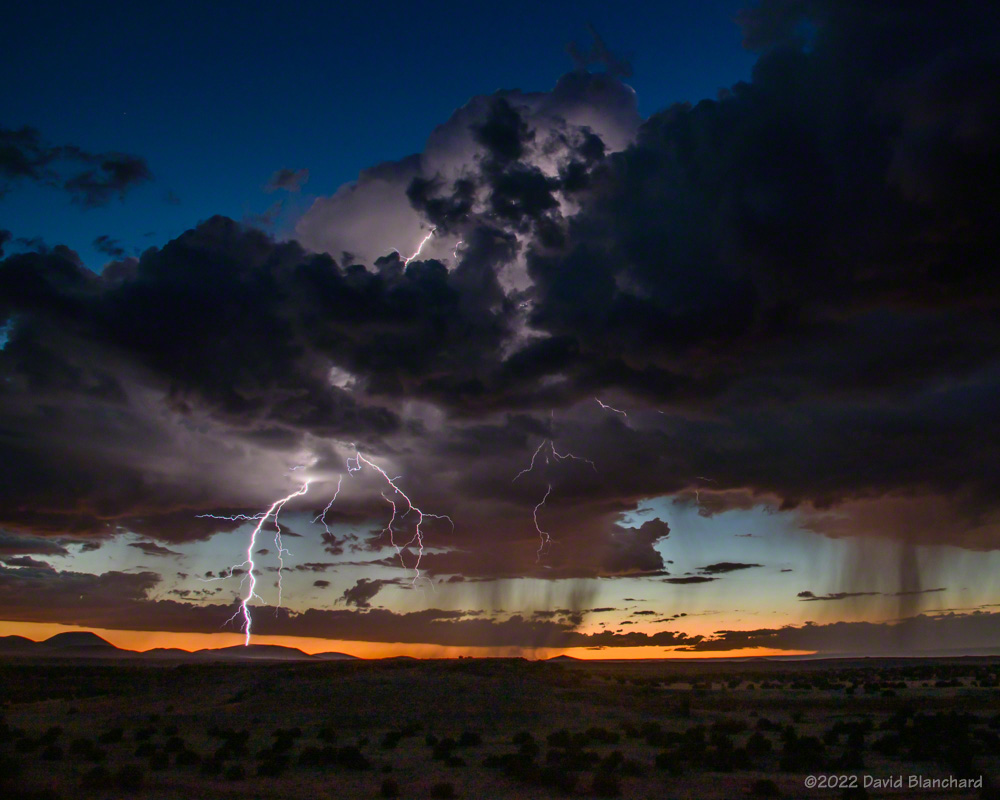
Composite image of late afternoon lightning strikes over the grasslands of Wupatki National Monument.A segment of a rainbow over Wukoki Pueblo in Wupatki National Monument.Several lightning clusters that occurred during twilight at Wupatki National Monument.
During the month of July the GFS weather forecast model consistently showed the NAM getting started “Real Soon Now.” But the target was always several days away. Finally, late in the month the rains arrived as an inverted trough (IVT; def. 2) moved across Arizona.
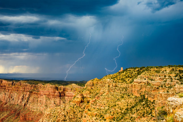
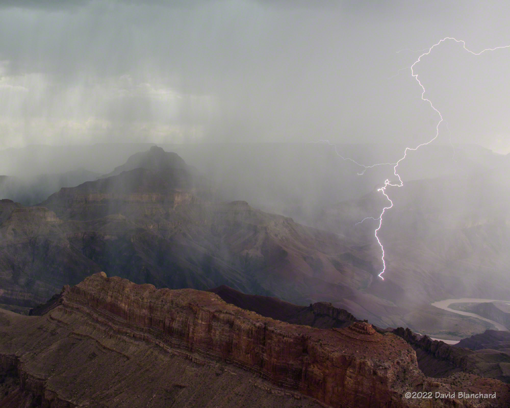
Lightning over the San Francisco Peaks with Marshall Lake in the foreground.Lightning touches down deep in Grand Canyon.
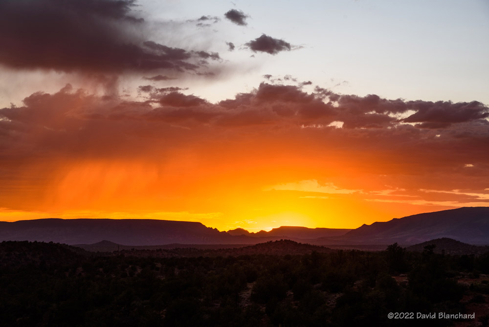
There have been some photogenic storms. A little over a week ago I traveled to the South Rim of Grand Canyon hoping to get some lightning. Although there were some flashes they were far away. On the other hand, the sunset was pretty good. A band of clouds just above the horizon effectively blocked the Sun at my location while beams of light were getting under the clouds and into the canyon farther to the west. The alternating beams of light and shadow were pretty nice.
Beams of light and shadow filter deep into Grand Canyon.Beams of light and shadow filter deep into Grand Canyon.
The following day I went to Wupatki National Monument in hopes of lightning and rainbows. There was a late afternoon storm that moved towards the Monument and produced a lot of lightning. As it got closer it weakened but was still dropping rain and a short time later a beautiful, full double rainbow appeared. All I needed to do was position myself so that I could get the rainbow arch to frame Wukoki Pueblo.
Time lapse of convection developing over the San Francisco Peaks with Marshall Lake in the foreground.
A new storm formed to my southeast as twilight came on and began to produce a lot of lightning. This was the 3rd act of the day and it was a good one.
Later in the week I took a short drive to Marshall Lake near Flagstaff to time lapse the early stages of convection over the San Francisco Peaks–and with some reflections in the waters of the lake. A few lightning bolts landed near the peaks adding to the show.
A few more trips to Grand Canyon rounded out the month.
As noted in a previous post we had an early start to the North American Monsoon which brought thunderstorms and rain to northern Arizona in the second half of June. This was most welcome as it had been a very dry spring. Then we went into a down period for the first third of July with very little activity. That was completely reversed as we entered a period of very strong monsoon activity which brought frequent heavy rains and flash flooding.
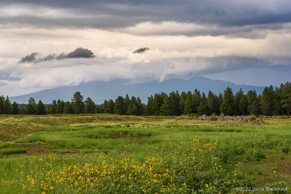
So the first part of July had few targets. The remainder of July had above normal amounts of total precipitable water and very high surface dewpoints which produced an environment with mostly cloudy skies and very low cloud bases. None of this is particularly conducive to photographing storms with beautiful light (i.e., golden hour, blue hour). Nonetheless, if you head out often enough you will get some good photographs.
A cluster of late afternoon storms that lingered into twilight produced some beautiful lightning over the San Francisco Volcanic Field.
An isolated thunderstorm produced lightning at sunset over the San Francisco Volcanic Field.An isolated thunderstorm produced lightning at sunset over the San Francisco Volcanic Field.
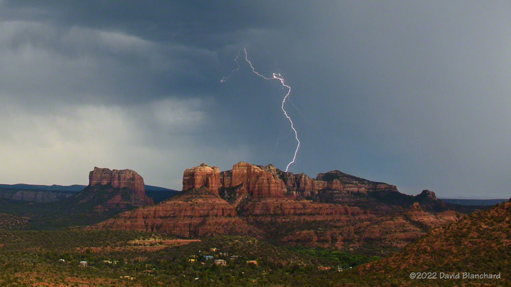
This day in Sedona produced very little lightning but did get a nice sunset and a partial rainbow.
Lightning beyond Cathedral Rock in Sedona, Arizona.A brilliant and colorful sunset in Sedona, Arizona.As the sun set, a partial rainbow formed.
Convection often starts early over the elevated terrain of the San Francisco Peaks. These storms eventually produced flash flooding over recent wildfire burn scars.
Convection starts early over the peaks.
Convective towers mix with laminar wave clouds over the San Francisco Peaks. Shot from Marshall Lake–now just a dry grassland.
Morning convection and wave clouds over the San Francisco Peaks.A cloud-to-cloud lightning flash over Mormon Lake, Arizona.
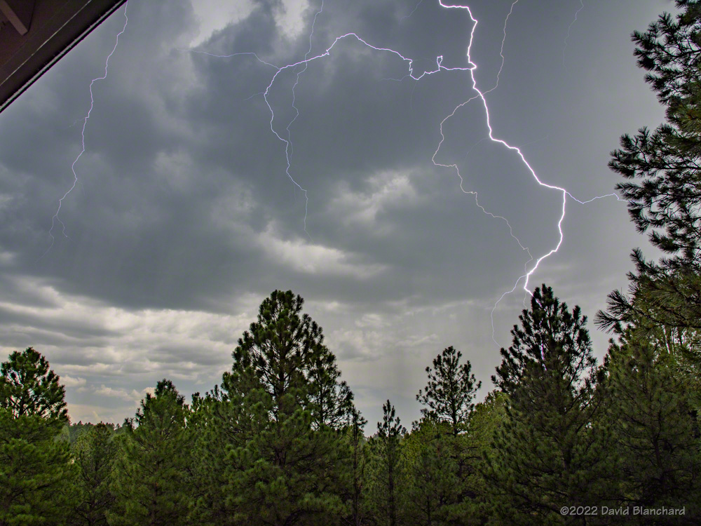
Sometimes you don’t have to travel any farther than your back porch to see lightning.
Lightning from my back porch.
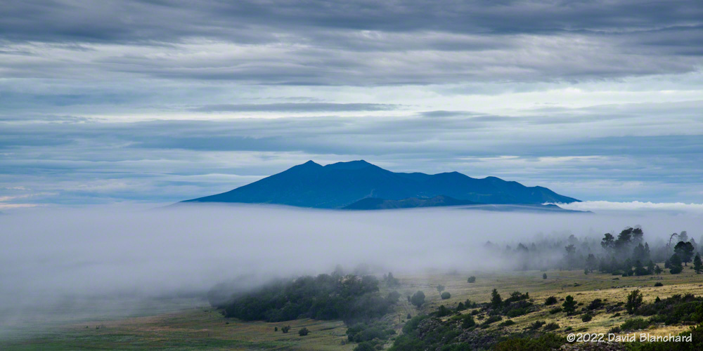
After several days of heavy rain and high dewpoints fog would form in the shallow basins. But getting photos of fog at sunrise in July means a very early start!
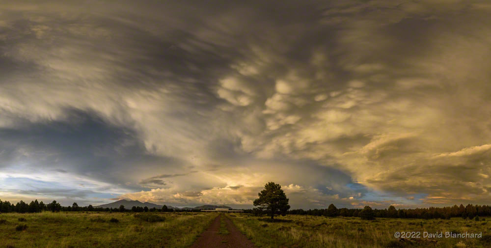
Morning fog with the San Francisco Peaks in the distance.Morning fog with the San Francisco Peaks in the distance.An example of what happens with too much moisture: overcast skies and low cloud bases.Sunset panoramic image from Flagstaff.
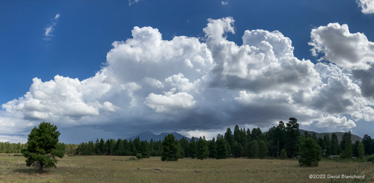
Maybe August will be better. The photo above is a sunset panorama (10 images stitched together) taken on the first day of August.
The North American Monsoon is in full swing and is producing daily thunderstorms and heavy rains across the southwest. Lightning is always a favorite subject for me this time of year and I have tried a few times to get interesting photos. Today was a good day.
Rain falling at Wupatki National Monument.
I stopped briefly at Wupatki National Monument and photographed an interesting rain shaft over the grasslands of the park — but no lightning.
Lightning near the Little Colorado River canyon.
I moved on towards Grand Canyon but made a stop at one of the Little Colorado River overlooks along the way and was able to get a few good bolts.
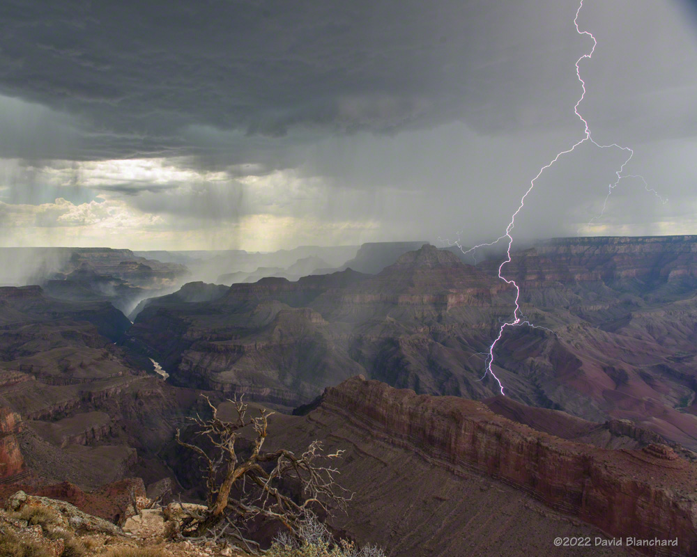
Lightning at Grand Canyon.Rain falling into Grand Canyon.
I arrived in time to watch new thunderstorms develop south of the canyon and then move across the canyon to the North Rim. Capturing bolts landing below the rim is always interesting and I managed to get a few. But the best and closest lightning bolts occurred while it was raining and I was safely watching from the inside of my vehicle.
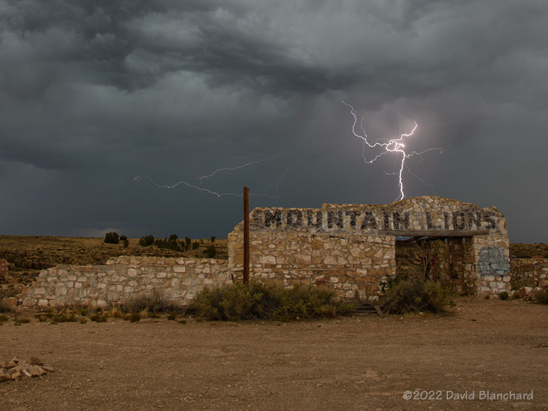
Lightning behind the ruins at Two Guns, Arizona.Solstice sunset.
A few days earlier I was able to catch this bolt of lighting at the Two Guns ruins near I-40. And a few days before that I caught this great sunset from Mormon Lake.
It is now September and we are in the so-called “transition season” as the North American Monsoon weakens and stronger baroclinic weather systems begin to traverse the southwestern states. From a paper presented at the 23rd Severe Local Storms Conference (2006):
Outbreaks of severe thunderstorms in northern Arizona are most likely to occur during the transition between the moist, tropical environment of the warm-season North American Monsoon regime and the first incursions of mid-latitude baroclinic systems in September. The presence of copious tropical moisture, combined with increased convective instability and deep-layer shear, is supportive of long-lived supercells which are responsible for most of the severe weather.
Supercells are more common during the transition season than other times of the year in northern Arizona. Tornadoes—especially long-lived, damaging tornadoes—are more likely to occur during this brief period. This is from a paper presented at the 24th Severe Local Storms Conference (2008):
The results show that more than half of the tornado days occurred during the approach of a closed low from the eastern Pacific with northern Arizona located in the warm sector of the northeast quadrant of the low. The closed lows produced environments with deep-layer shear and low-level shear comparable to the 3rd and 4th quartiles of tornadic environments discussed by Rasmussen and Blanchard (1998) while instability was small and was comparable to or less than their 1st quartile. These interesting results suggest that shear may be the more important factor and that instability need only be sufficient to initiate and maintain convection long enough for the shear to act upon the updrafts.
While tornadoes in northern Arizona are more likely to occur during the transition season they are still uncommon (a notable exception was the October 2010 outbreak) and several years may pass without any tornado events. Supercells, on the other hand, are more common and at least a few can be expected each year during the transition.
Below are composite means of 500-mb geopotential height, 700-mb v-wind component, and surface Lifted Index for the tornado events.
Composite 500-mb height field for the 19 tornado event days.Composite 700-mb v-component of the wind field.Composite surface-based Lifted Index field.
Will we have a closed-low, transition-season type of event this year?