March Snow in northern Arizona

Another winter storm moved across northern Arizona on Friday and Saturday dropping several inches of snow. Clouds began to clear Sunday morning just before sunrise setting up the possibility of a great sunrise. Well—it was a great sunrise at my location but a small patch of low clouds blocked the sun from shining on the San Francisco Peaks.
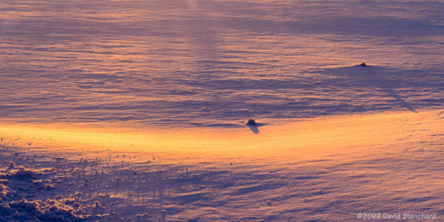
First light illuminates freshly-fallen snow.

Time to shoot photos of something else. Here is an image as the first sunlight hits the snow in front of me. The sun angle is so low that the slightest undulations in snow create long shadows.
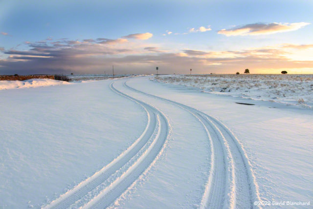
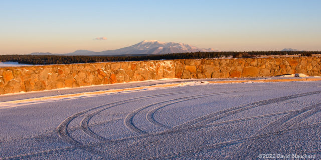
Tire tracks in the snow.

Tire tracks in snow are interesting, aren’t they? Taken just a few minutes later as a bit of cloudiness moved in front of the sun.
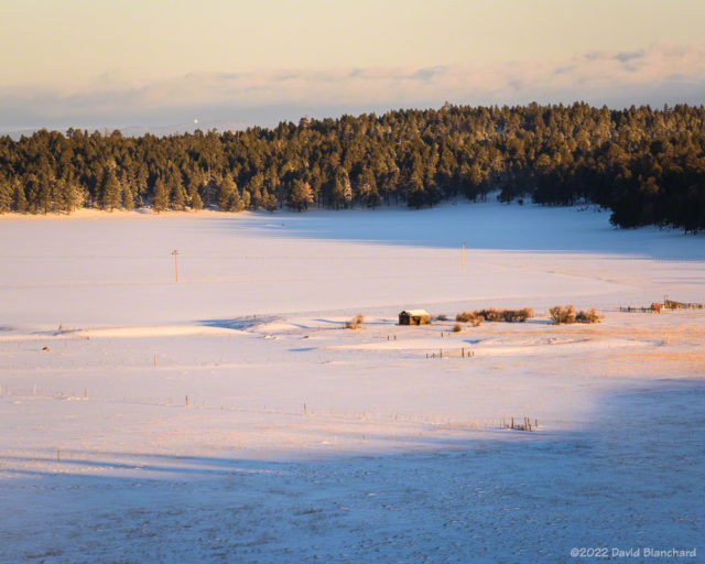
Old ranch buildings near Mormon Lake.

There are a couple of old buildings in the meadow near Mormon Lake and the sun and clouds provide a natural spotlight on the old ranch.
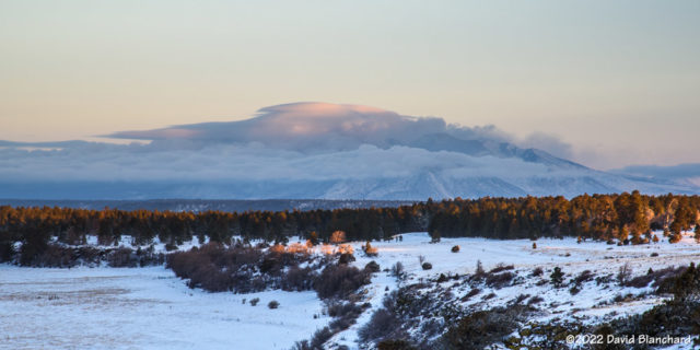
Clouds blow across the top of the San Francisco Peaks in the wake of a departing storm.

Here is an image of the San Francisco Peaks with just a bit of light striking the highest clouds.

Finally, a short time lapse video of the peaks and clouds. Note the sinking motion along the eastern edge of the peaks as well as the hydraulic jump farther downstream.

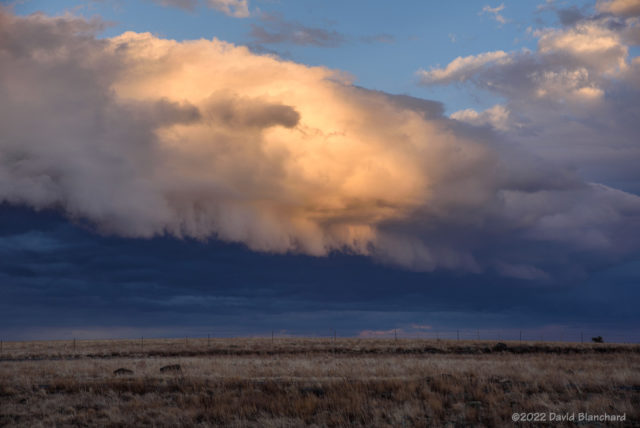
Sunset Over the San Francisco Peaks

Bands of snow showers moving across the San Francisco Peaks. In its wake, sunlight illuminates both clouds and some of the snow still falling.

Tuesday afternoon brought the passage of a weak cold front across northern Arizona. It was mostly clear much of the day but by late afternoon clouds were increasing and spreading southward. Because there was a distinct west edge to the clouds it was likely that the setting sun would be able to illuminate the overhead clouds.

As the band of convective snow showers progressed southward it took on the characteristics of an outflow boundary and even developed a bit of a shelf cloud on the leading edge.

Convective cloud band with a small shelf cloud beginning to develop.
The setting sun illuminates the convective cloud band.

As the sun dropped lower in the western sky this cloud band briefly took on the colors of sunset.

Time lapse video showing the southward progression of the convective snow showers.

And, then, a few minutes later the light was gone.

Sunrise on the San Francisco Peaks

It’s always fun to head out at the tail end of a winter storm and capture photographs of the sunrise with the new snow. This winter has had only a few periods with real winter weather—the most notable was the last 10 days of December. Since then storms and snow have been infrequent.

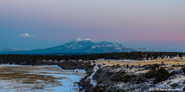
Pre-sunrise sky over the San Francisco Peaks( 0724 MST 23 January 2022).
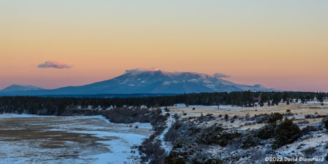
First light strikes the San Francisco Peaks (0735 MST 23 January 2022).

Of course I was interested in taking advantage of our latest weather event—even though it was fairly weak and delivered only a skiff of snow. A quick check of satellite imagery before sunrise showed that skies were mostly clear and that there was a cap cloud on top of the San Francisco Peaks.

I arrived a bit before sunrise at the Mormon Lake overlook and started taking both photographs and video. The clouds were already dissipating over the peaks resulting in much less of a cap cloud than I hoped.

No matter—it’s always fun to out there before sunrise shooting photos. Here are a few photos from before sunrise and just after as the sun began to illuminate the peaks.

Below is a time-lapse video showing the movement of the clouds over the summits of the San Francisco Peaks.

Time lapse video (50x) of the sunrise over the San Francisco Peaks.

I was also intrigued by the tire tracks left in the snow of the parking area.

Tire tracks in the new snow at Mormon Lake overlook.

Finally—here is a sunrise photo from New Years Day—the last day in which we had significant snow here.

Sunrise over the San Francisco Peaks on New Years Day.

Comet C/2021 A1 (Leonard)—II

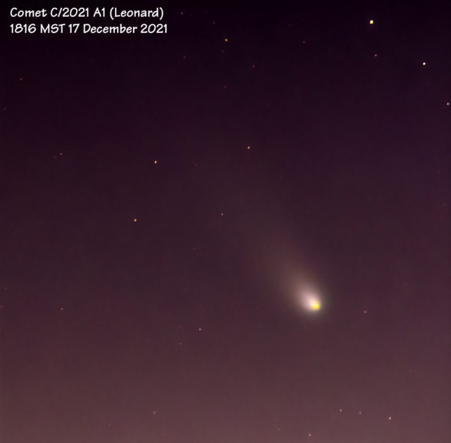
Comet C/2021 A1 (Leonard) is currently visible in the southwest evening sky for a short period after sunset. Evening twilight makes it difficult to see the comet with the unaided eye. Even in binoculars it is a faint object. On the other hand, a short exposure on a camera will reveal the comet and its tail.

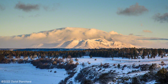
A nearly-full Moon illuminates the snow-covered San Francisco Peaks as the comet sets in the evening twilight.
Telephoto view of the comet and tail. (Stack of 13x15seconds, 300 mm, f/8, ISO 400.)
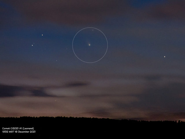
Comet peaking out between the clouds.

Finally, here is a time-lapse of the comet on 17 December 2021 from 18:16:48–18:21:08 MST. It moves quite a bit in just a few minutes.

Time lapse of the comet.

The comet will reach its highest elevation above the horizon this week and then begin to slowly drop towards the horizon again.

Late September Storms in Flagstaff and Sedona

Late September provided a chance to photograph storms associated with the passage of an upper-level trough crossing the southwest. Ahead of the trough would be moderate-to-strong upper level winds along with deep-layer shear. So there was a possibility of a few strong thunderstorms that might develop supercellular characteristics. As well, there would likely be a line of storms that formed on the surface cold front pushing southeastward across the state.

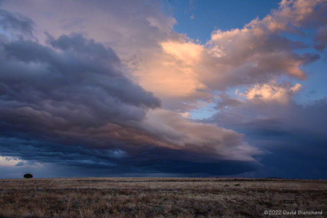
Shelf cloud associated with an outflow boundary from a cluster of thunderstorms moving over the San Francisco Peaks.

The plan was to head north to Cameron, Arizona, then slowly work back to the south as the line of storms moved across the area. I went to Cameron but the storms to the west and northwest were already weakening while storms farther to the southwest were strengthening. So — back south I went with stops at Wupatki NM and Sunset Crater NM while watching the storms. A cluster of storms developed north of the San Francisco Peaks and eventually pushed a strong outflow across the mountains. The leading edge of this outflow had an interesting cloud structure and was briefly very photogenic.

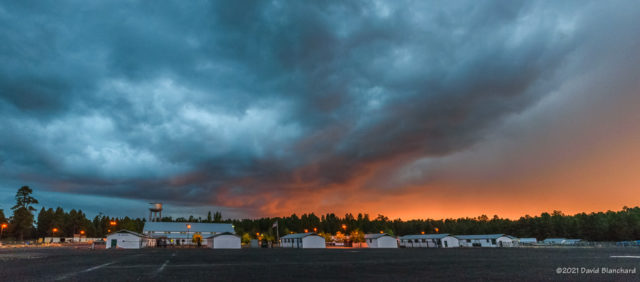
Sunset colors on the clouds at Fort Tuthill County Park.

After a few photos, I continued moving across Flagstaff on my way home. Suddenly, the sun dropped low enough to get below the clouds and for a few minutes there was great sunset light on the bottom of the clouds. I shot a few photos at Fort Tuthill County Park with the undersides of the clouds full of sunset colors. And, then just a few minutes later it was over and the light was gone.

So I could have just stayed at home and gone out shooting at the last minute of daylight.

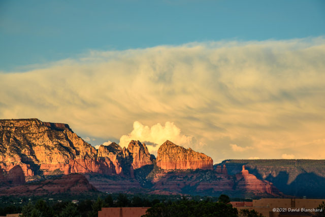
Late afternoon sun lights up a distant thunderstorm and the Red Rocks of Sedona.
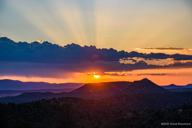
The setting sun and crepuscular rays.

The next day showed potential for a few interesting storms south of Flagstaff. I headed to Sedona and spent a few hours photographing storms.

The setting sun with crepuscalur rays was pretty nice.

Edit: corrected typo in photo caption.