Trail Running in Northern Arizona

Running—especially trail running—is a big part of our lives and we try to run in interesting places. That could be running up mountains, alongside streams, through forests, and in canyons. And I try to take a camera with me when we run. As a minimum, the camera will be a phone but I prefer to take along my Sony RX100 V, a small camera with a 24-70mm  zoom lens. The camera is actually smaller than my phone (smaller length x width, but thicker) so it fits well in my water bottle waist pack.

Here is a collection of photographs taken on the trails we have run this spring in northern Arizona.

The rising sun illuminates the red rocks of Sedona as we prepare to start the run.
Sometimes Dry Creek has water.
A great swimming hole at the turn around point on Wet Beaver Creek.
Group run through Carroll Canyon.
Spring blossoms along the Elden Springs Trail.
Overhanging rock on Hardline Trail.
Blooming agave plant on Hangover Trail.
Spring-fed ponds along the Sycamore Canyon Rim Trail.
Sycamore Canyon Rim Trail overlook.
Cluster of oak trees on Apollo Trail in the Mount Elden Dry Lakes (MEDL) trail system.
View of the San Francisco Peaks on the high point of Space Walk Trail, a part of the MEDL system.
Tree with carved bench at the top of Space Walk Trail.
Rock art along a trail in the Red Rock—Secret Mountain Wilderness.
Rocky Mountain Iris along the Arizona Trail.
Picturesque stand of aspen along the Arizona Trail.
Running on the Oldham Trail at the base of Mount Elden.

It’s not just about the running—it’s also about the beautiful places running can take us.

Edit: fixed typo in title.


Snow in April

Snow in April! Actually, it isn’t rare for snow in April in Flagstaff. In fact, it is more likely that there is snow in April than no snow. Over the course of record for Flagstaff (1898–2025), there has been measurable snow in 107 of those years. Only 21 years had no snow or only a Trace of snow.

The snowfall this April, however, has been well above average. To date, there has been 13.5″ of snow (average for the entire month is 7.3″), falling in two events: April 2–3 (4.3″) and April 18–19 (9.0″).

This is good news as we had a dry winter. Our snow season total (July 1–present) stands at 60.3″ compared to an average of 87.6″. It is unlikely that we will catch up to normal as the chances for significant snow decrease rapidly going forward. However, this late influx of moisture (both March and April) has been good in bringing the fire danger down to LOW across the Coconino and Kaibab National Forests.

Here are some photographs from both of these events.

Layers of clouds are draped across the San Francisco Peaks near Flagstaff, Arizona, in the wake of a winter storm (04 April 2025).
The rising sun illuminates clouds draped across Mormon Mountain in northern Arizona in the wake of a winter storm (04 April 2025).

Time-lapse video of clouds over the San Francisco Peaks and Mormon Mountain in northern Arizona.

Streamers of fog and low clouds move below the red rocks of Sedona, Arizona (19 April 2025).
Fog and low clouds move below the red rocks of Sedona, Arizona (19 April 2025).
Fog and low clouds drape across the red rock spires of Sedona, Arizona (19 April 2025).
The rising Sun illuminates mist and fog swirling around the red rocks of the Munds Mountain Wilderness (19 April 2025).
Mist and fog swirls around the red rock cliffs and is reflected in a small pool in Munds Mountain Wilderness (19 April 2025).
The setup for the previous photograph.
Dewdrops adorn this small lupine in Sedona (19 April 2025).
Snow adorns the blossoms of this flowering fruit tree in Flagstaff (19 April 2025).
Snow on a flowering forsythia bush in Flagstaff (18 April 2025).
Snow on a flowering crab apple tree (18 April 2025).
Snow and daffodil, Flagstaff (18 April 2025).
Snow in the upper reaches of Oak Creek Canyon with the switchbacks of SR-89A below.

March was a Snowy Month

As noted elsewhere on these pages this winter has been very dry and warm. That changed in March as a series of storms moved across the southwest. By the time it was over we had accumulated 2.47″ of SWE (snow water equivalent) and 35.6″ of snow. It was greatly appreciated because we are now heading into our dry and windy season (“wildfire season”) and anything that helps to moisten the landscape is appreciated.

Here is a collection of photographs taken during this extended period of snow.

08 March 2025

Clouds cap the San Francisco Peaks just before sunrise (08 March 2025).
Cross country skiing at Fort Tuthill Park in Flagstaff (08 March 2025).
Grasses poke through the snow at Fort Tuthill Park (08 March 2025).

14 March 2025

Low clouds race across the Mormon Lake area (14 March 2025).
Snow covers the tables and benches at a picnic area at Upper Lake Mary near Flagstaff, Arizona (14 March 2025).

15 March 2025

The clouds departed but winds increased resulting in plumes of blowing snow over the San Francisco Peaks (15 March 2025).

Then it got warm and everything melted. But the forecast indicates that snow is likely this week so time to get some more photographs.

Mountain Biking on the Waterline Road

A view into the Inner Basin from above shows colorful aspens.

The Waterline Road in the San Francisco Peaks reopened in October. It had been closed for more than two years in the aftermath of the Pipeline Fire. That fire occurred in the same area as the Schultz Fire (2010) and managed to burn what had been spared by the earlier fire. After two years of work, the Waterline Road was safe for the general public to use again.

View of the burned mountainside along Waterline Road in the San Francisco Peaks. New growth is already sprouting.
Riding on Waterline Road in the San Francisco Peaks. We've finally left the burn scar and have entered the aspen groves.
Riding on Waterline Road in the San Francisco Peaks. We’ve finally left the burn scar and have entered the aspen groves.
Aspen trees starting to show autumn colors along Waterline Road.
One of the few gaps in trees along the road allows a view down into Lockett Meadow. The hill on the far right was burned by the Pipeline Fire but is beginning to recover.

We rode our mountain bikes up the road and were saddened–but not surprised–by the destruction of the fire. There had been a lot of new growth after the 2010 fire–especially with new aspen trees already attaining heights of 10 to 20 feet. All this burned in 2022. Once again, new growth is taking place but most of it is still quite small.

A view into the Inner Basin from above shows colorful aspens.
A stand of aspen along Waterline Road with the high peaks surrounding the Inner Basin visible in the distance.
Biking back down the Waterline Road. It's about 9 miles of downhill. Easy!
Biking back down the Waterline Road. It’s about 9 miles of downhill. Easy!

The Inner Basin, however, was mostly spared by the 2022 fire and here were many aspen trees in full autumn colors. Along the road there are a few locations where you can get a wider view of the trees and the mountains but mostly the only view along the road…is the road.

Winter Sunrise

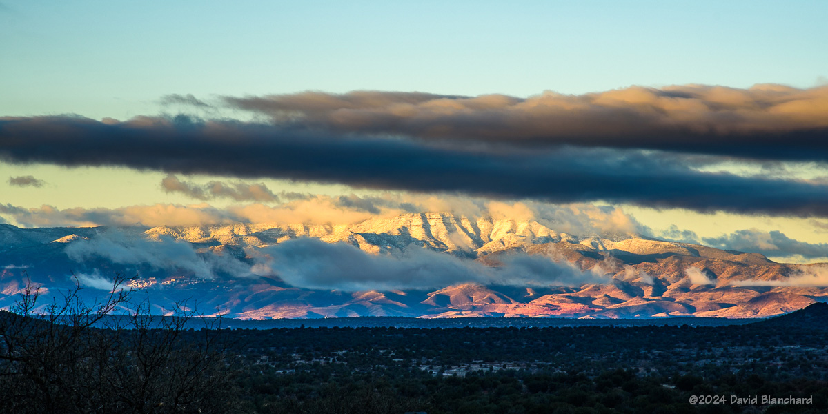
The sunrise after a winter storm often results in beautiful scenery and colors. Low-lying areas may have shallow fog. Mountains may have multiple layers of clouds. All of this is enhanced by the low sun angle as it first rises above the horizon.

Low clouds and fog partially obscure the San Francisco Peaks as the sun rises (24 Jan 2024).

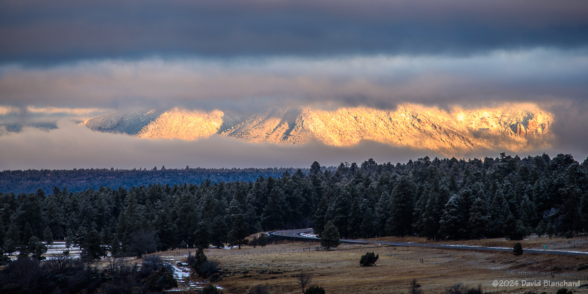
On the other hand, getting up before sunrise, driving on snow-packed roads, and standing around shooting photos with cold temperatures is a challenge. But the results are often worth the effort. Here are a few sunrise photographs.

Wispy clouds cap the San Francisco Peaks (08 Jan 2024).
First light on some old ranching structures near Mormon Lake (08 Jan 2024).
Earth's shadow can be seen behind the San Francisco Peaks in this pre-sunrise image (26 Jan 2024).
Earth’s shadow can be seen behind the San Francisco Peaks in this pre-sunrise image (26 Jan 2024).
Telephoto image of snow and clouds on the San Francisco Peaks (26 Jan 2024).
Layers of clouds are draped across Mingus Mountain (03 Feb 2024).

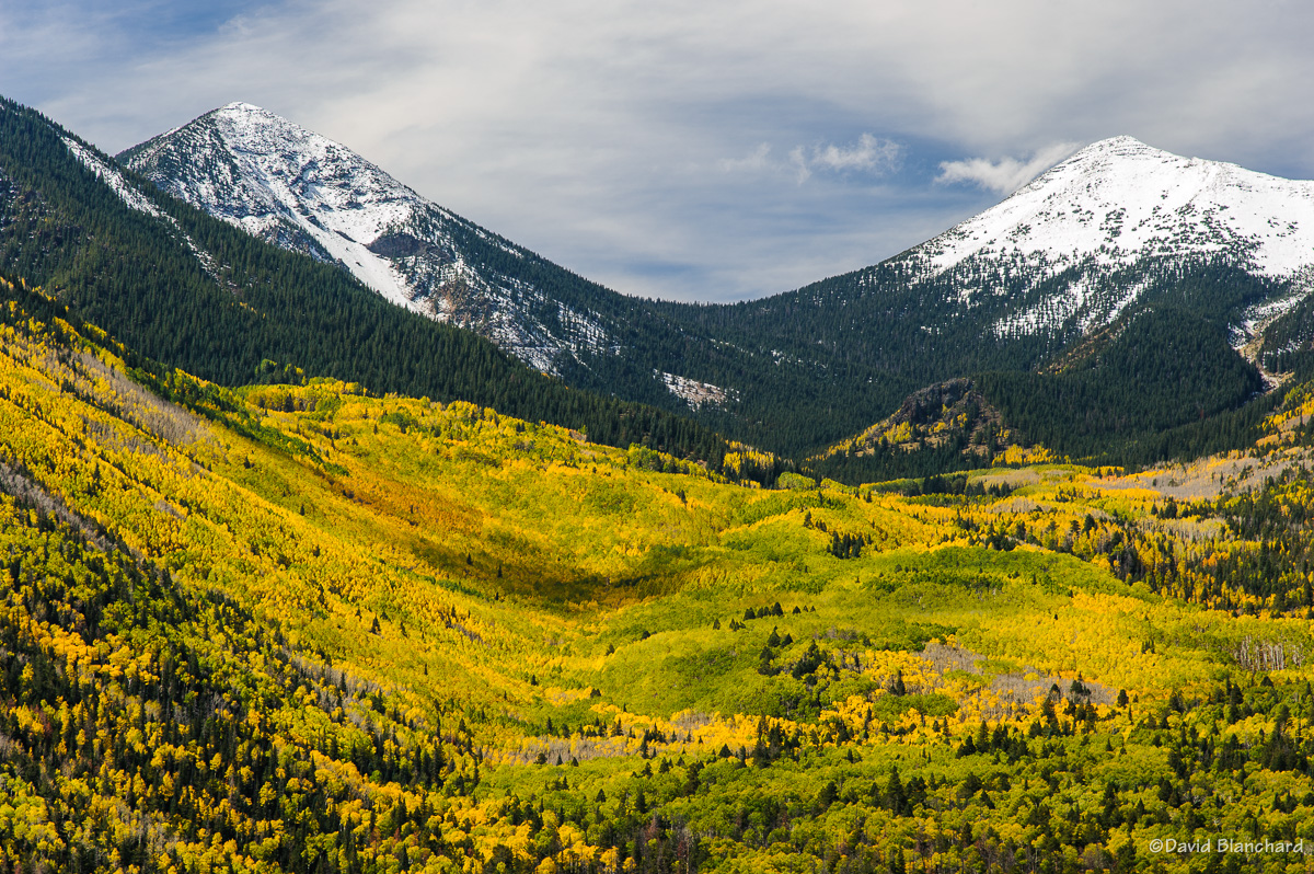
This week should bring lots of snow to northern Arizona. I hope to get some interesting photographs.